
Bamberg district
| coat of arms | Germany map |
|---|---|

|

Coordinates: 49 ° 53 ' N , 10 ° 53' E |
| Basic data | |
| State : | Bavaria |
| Administrative region : | Upper Franconia |
| Administrative headquarters : | Bamberg |
| Area : | 1,167.83 km 2 |
| Residents: | 147,163 (Dec 31, 2019) |
| Population density : | 126 inhabitants per km 2 |
| License plate : | BA |
| Circle key : | 09 4 71 |
| NUTS : | DE245 |
| Circle structure: | 36 municipalities |
| Address of the district administration: |
Ludwigstrasse 23 96045 Bamberg |
| Website : | |
| District Administrator : | Johann Kalb ( CSU ) |
| Location of the Bamberg district in Bavaria | |
 .svg) |
|
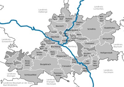
The district of Bamberg is the westernmost district of the administrative district of Upper Franconia in Bavaria. In the west and south it borders on the districts of Lower and Middle Franconia . The independent city of Bamberg is completely surrounded by the district.
It also includes two closely spaced enclaves from the municipality of Pommersfelden in the south. The Limbacher Weiher and the Steinersee are in the larger one. The area is completely surrounded by the district of Erlangen-Höchstadt and is about one kilometer from the rest of the district, but administratively belongs to the district of Bamberg. The district is a member of the Nuremberg Metropolitan Region .
geography
location
In the Bamberg district there are (partly) three nature parks , the Steigerwald in the west, the Franconian Switzerland in the east and the Haßberge in the north. The Regnitz flows through the district and flows into the Main north of Bamberg .
At 585 m, the Geisberg is the highest mountain in the district. It is located 10 km east of Bamberg between Melkendorf (municipality of Litzendorf ) and Geisfeld (municipality of Strullendorf ) in the west and Lindach and Teuchatz (both Markt Heiligenstadt ) in the east. A few kilometers north of the Stockenberg ( 562.7 m ) and the Stammberg ( 559.5 m ) and 3 km south of the Katzenberg with 558.5 m are almost the same height . All four peaks belong to the north-western part of the Franconian Switzerland Nature Park .
Neighboring areas
The district borders clockwise in the north, beginning with the districts of Coburg , Lichtenfels , Bayreuth , Forchheim , Erlangen-Höchstadt , Neustadt an der Aisch-Bad Windsheim , Kitzingen , Schweinfurt and Haßberge .
history
When the area around Bamberg became Bavarian, it already had eight hundred years of history under the Bamberg Monastery. Regarding church rule, symbolized by the crook , it was said that it was good to live under the crooked staff:
- " Having a crooked place is good to have an apartment ".
Almost the entire church property fell victim to the Reichsdeputationshauptschluss of February 25, 1803. The Bavarian Elector Max Joseph IV wrote to the last Prince-Bishop Franz von Buseck on August 23, 1802 that he would occupy Bamberg, Kronach and Forchheim. The prince-bishop expressed his deep regret, but also assured that no resistance would be offered. Bavarian troops marched into the Bamberg area on November 3rd, 1802, which was declared Bavarian on November 22nd.
Regional courts
District courts replaced the previous episcopal offices. The municipalities of Memmelsdorf , Hallstadt and Scheßlitz came to the Bamberg district court on the right bank of the Regnitz , as well as the places around Altendorf , Buttenheim and Hirschaid . The Bamberg district court on the left bank of the Regnitz reunited Schlüsselau , Burgebrach and parts of Hallstadt. In 1810, Ebrach finally became Bavarian in the course of border regulation with the Grand Duchy of Würzburg .
The parish edict of 1818 partially restored local self-government and enabled the formation of district parishes as temporary special-purpose associations. The revolution of 1848 abolished the rule of aristocratic families over the communities. The patrimonial courts of Reichmannsdorf , Lisberg , Trabelsdorf , Trunstadt , Walsdorf , Sassanfahrt , Buttenheim , Kirchschletten , Grasmannsdorf , Aschbach , Staffelbach and Burglesau were affected .
A kind of administrative district has only existed in Bavaria since 1852. At that time, the district communities, the forerunners of today's administrative districts, were established in Bavaria on the right bank of the Rhine. However, these were under state supervision and required the approval of the state resource authority for important decisions. Real self-government was only introduced in 1919.
District Offices
In 1862 district offices were established as state administrative authorities. The district offices of Bamberg I and Bamberg II were established in the Bamberg area. Bamberg I comprised the regional courts of the older order of Bamberg on the right bank of the Regnitz and Scheßlitz, established in 1804, and Bamberg II comprised the regional courts of Bamberg on the left bank of the Regnitz and Burgebrach, which were also established in 1804. The new regional courts were designated Bamberg I and Bamberg II. The city of Bamberg did not belong to any district office because it had been a district direct since 1809.
In 1879 the regional courts Bamberg I and II were combined to form the Bamberg II district court, but a distinction was still made between two sub-districts, Bamberg II district court, first part (eastern half) and Bamberg II district court, second part (western half). The city of Bamberg, which is in direct proximity to the district, formed the Bamberg I District Court from 1879 onwards. In 1903, both district courts were combined to form the Bamberg District Court.
On October 1, 1929, the Bamberg I District Office, established in 1862, was dissolved and its communities were incorporated into the Bamberg II District Office, which from then on was only called the Bamberg District Office. In 1932 the district courts of Burgebrach and Scheßlitz were abolished and their communities were mainly assigned to the district court of Bamberg.
Bamberg district 1939 to 1972
On January 1, 1939, the uniform designation Landkreis was introduced in the German Reich . Thus the district office became the district of Bamberg. He belonged to the administrative district of Upper Franconia . The district had one city and 141 parishes. The largest places in the district were Scheßlitz and Hirschaid .
Cities and communes:
|
Municipalities Seat of the association municipality *
|
|
Regional reform in Bavaria in 1972
During the regional reform in Bavaria , which came into force on July 1, 1972, the Bamberg district in its current form emerged as one of 71 new districts in Bavaria. At that time, the previous district of Bamberg, the Markt Heiligenstadt in Upper Franconia and the municipality of Königsfeld in the dissolved district of Ebermannstadt , parts of the district of Ebern and individual communities in the districts of Staffelstein and Höchstadt an der Aisch were added; In return, he had to transfer the municipalities of Bug, Gaustadt , Wildensorg, the district of Bughof of the municipality of Strullendorf and the district of Hirschknock of the municipality of Gundelsheim to the urban district of Bamberg, Eckersbach and Untermelsendorf to the district of Erlangen-Höchstadt, Koppenwind to the district of Haßberge and Unterstürmig and Trailsdorf to the district of Forchheim. Bamberg continued to be the seat of the now enlarged district of Bamberg.
The oldest places in the Bamberg district are Hallstadt , Königsfeld , Lisberg , Rattelsdorf , Scheßlitz and Trunstadt .
Bamberg district after 1972
On January 1, 1978, the district of Kitzingen was enlarged to include the community of Ilmenau in the district of Bamberg, which was incorporated into Geiselwind . The district of Bamberg, for its part, was expanded to include the town of Schlüsselfeld in the district of Erlangen-Höchstadt, which now also includes Eckersbach and Untermelsendorf, which were given up in 1972 by the district of Bamberg.
politics
District council
The district council consists of 60 district councilors and the district administrator. The district council elections on March 15, 2020 led to the following distribution of seats in Kreitag:
| CSU | Green 1 | SPD | FW 2 | BBL 3 | FDP | ödp 4 | REP | Left 5 | AfD | total | |
| 2020 | 23 | 8th | 8th | 2 | 5 | 7th | 1 | n / A | 1 | 5 | 60 |
1 Green / alternative list 2 Free voters / non-partisan voter community 3 Citizens' bloc 4 ödp / party-free 5 Left / open list
The district elections in 2014, 2008 and 2002 resulted in the following allocation of seats:
| CSU | SPD | BBL | FDP | Green | ÜWG * | ödp | REP | total | |
| 2014 | 27 | 10 | 7th | 1 | 5 | 8th | 2 | n / A | 60 |
| CSU | SPD | BBL | FDP | Green | ÜWG | ödp | REP | total | |
| 2008 | 27 | 11 | 8th | 2 | 4th | 5 | 1 | 2 | 60 |
| CSU | SPD | BBL | FDP | Green | ÜWG | ödp | REP | total | |
| 2002 | 33 | 11 | 7th | 1 | 3 | 3 | 1 | 1 | 60 |
* Started in 2014 as a free voter / ÜWG
District Administrator
The following district administrators have been at the head of the Bamberg district since 1938:
- 1938–1942: Felix Beigel
- 1942–1945: Emil Schick
- 1945–1946: Thomas Dehler ( FDP )
- 1946–1948: Heinrich Grimm
- 1948–1964: Georg Hart ( CSU )
- 1964–1965: Emil Kemmer (CSU)
- 1966–1996: Otto Neukum (CSU)
- 1996-2014: Günther Denzler (CSU)
- since 2014: Johann Kalb (CSU)
coat of arms
|
|
Blazon : “In gold, side by side, a left-facing, red-armored black lion covered with a silver sloping left-hand bar and a rising, resisting, red-tongued black boar, who holds a continuous, inclined silver abbot's staff with a silver sweat in its frail (mouth) and with the left Front hammer (leg) supports. " |
|
Justification of the coat of arms: The coat of arms of the Bamberg district dates from 1962 and combines the symbols of the Ebrach monastery (the boar ) and the Bamberg monastery (the lion ).
The district council decided in 1972 to adopt the coat of arms of the old district of Bamberg unchanged, since it also reflects the history of the new district area. The Cistercian Abbey of Ebrach held an extensive rulership complex in the western part of the district. |
Economy and Infrastructure
In the Future Atlas 2016 , the district of Bamberg was ranked 92nd out of 402 districts, municipal associations and independent cities in Germany, making it one of the places with "future opportunities".
Road traffic
The following motorways run through the Bamberg district:
|
|
|
|
|
|
The following federal highways also run through the district:
| Bad Bramstedt - Nuremberg | |
| Kitzingen - Bamberg - Bayreuth - Cham | |
| Riedstadt - Bamberg (to be downgraded soon) | |
| Eichenzell - Breitengüßbach | |
|
|
Rail transport
The Kingdom of Bavaria built a state railway from Nuremberg to Bamberg as early as 1844, which was continued up the Main to Lichtenfels in 1846 under the name Ludwig-Süd-Nord-Bahn .
After the Ludwigs-West-Bahn went into operation down the Main in 1852 , Bamberg had become a railway junction, from which - only 40–50 years later - almost half a dozen local railways radiated into the area:
- 1895: (Bamberg–) Breitengüßbach – Ebern
- 1899: (Bamberg–) Strullendorf – Frensdorf – Steppach – Pommersfelden and further
- 1900 to Schlüsselfeld with the branch line
- 1904: Frensdorf – Burgebrach – Ebrach
- 1908: Bamberg – Scheßlitz
- 1913: Breitengüßbach – Dietersdorf
The small community of Heiligenstadt in Franconian Switzerland received a rail connection from Ebermannstadt in 1915. The rail network thus covered a total of 143 km. By closing down passenger traffic on the following local railways:
- 1960: Ebermannstadt – Veilbronn – Heiligenstadt 4 km
- 1961: Frensdorf – Burgebrach – Ebrach 29 km
- 1975: Breitengüßbach – Busendorf – Dietersdorf 15 km
- 1976/77: Strullendorf – Schlüsselfeld 25 km
- 1985: Bamberg – Scheßlitz 14 km
it went back to 56 kilometers.
Today the high-speed line Nuremberg – Erfurt leads through the district of Bamberg to Berlin .
Water transport
The district is connected to the rivers Main and Danube by water through the Main-Danube Canal . The canal has been expanded for the so-called European ship and for pushing shipping.
Brewing
The Bamberg district is the region with the highest density of breweries in the world. Around 1990 there were still around 90 breweries, while the number had fallen to around 60 by 2010. The majority of these are country inns with their own beer production.
Communities
(Residents on December 31, 2019, area size)
Community-free areas
|
Other communities
|
|
Population development

In the period from 1988 to 2018, the district grew from 121,635 to 147,086 by 25,451 inhabitants or by 20.9%, which is the highest growth of the districts in Upper Franconia in the period mentioned. The highest increases were recorded in the municipalities south and west of Bamberg, the lowest increases and the most significant losses in the north and east of the district.
In contrast to other Upper Franconian districts, the Bamberg district recorded an increase in population in the decades up to 2006. After a few years of population decline, the population has increased again since 2013:
| 1960 | 1980 | 1990 | 2000 | 2006 | 2007 * | 2008 * | 2009 * | 2010 * |
| 94,000 | 115,000 | 126,000 | 142,000 | 144.993 | 144,949 | 144,524 | 144,442 | 144.211 |
| 2011 * | 2012 * | 2013 * | 2014 * | 2015 * | 2016 * | 2017 * | 2018 * |
| 144,361 | 143,758 | 144,425 | 144,695 | 145,570 | 146.042 | 146,584 | 147.086 |
* As of December 31st
The population of the predecessor areas of today's district developed as follows:
| year | District Office Bamberg I |
District Office Bamberg II |
source |
|---|---|---|---|
| 1864 | 24,587 | 27,425 | |
| 1885 | 26.101 | 28,809 | |
| 1900 | 24,971 | 28,646 | |
| 1910 | 26,231 | 29,482 | |
| 1925 | 26,417 | 29,584 | |
| Bamberg district | |||
| 1939 | 58,837 | ||
| 1950 | 78,922 | ||
| 1960 | 81,500 | ||
| 1971 | 95,800 | ||
Attractions
In the district of Bamberg (to which the city itself does not belong) there are u. a. the following sights:

|
Franconian Street of Sculptures | Litzendorf community |

|
Gügel | City of Scheßlitz |

|
Giechburg | City of Scheßlitz |

|
Ebrach Monastery | Ebrach community |

|
Greifenstein Castle | Heiligenstadt market |
|
|
Melkendorf singing memorial | Litzendorf community |
|
|
St. Wenceslas | Litzendorf community |
|
|
Seehof Castle | Memmelsdorf municipality |

|
Senftenberg | Buttenheim community |
|
|
Weissenstein Castle | Pommersfelden community |

|
St. Vitus and St. Michaels Church | Heiligenstadt market |
Protected areas
In the district of Bamberg there are 14 nature reserves , five landscape protection areas , 15 FFH areas and 24 geotopes designated by the Bavarian State Office for the Environment (as of August 2016).
See also:
- List of nature reserves in the Bamberg district
- List of landscape protection areas in the Bamberg district
- List of FFH areas in the Bamberg district
- List of geotopes in the Bamberg district
License Plate
On July 1, 1956, the district was assigned the distinguishing sign BA when the vehicle registration number that is still valid today was introduced . It is still issued today.
literature
- Karin Dengler-Schreiber , Paul Köberlein: Life in the Bamberg region. 150 years Kreissparkasse Bamberg . Deutscher Sparkassenverlag, Stuttgart 1990, ISBN 3-09-303970-3 .
- Günter Dippold, Renate Kühhorn, Wolfgang Rössler (eds.): On the trail of the past. A journey of discovery through the Bamberg region . Verlag Fränkischer Tag, Bamberg 2006, ISBN 3-936897-35-2 .
- Hildegard Weiss: City and district of Bamberg (= Historical Atlas of Bavaria, part of Franconia . I, 21). Commission for Bavarian State History, Munich 1974, ISBN 3-7696-9884-3 .
Web links
- www.landkreis-bamberg.de (official website)
- Literature from and about Bamberg district in the catalog of the German National Library
- Entry on the coat of arms of the Bamberg district in the database of the House of Bavarian History
Individual evidence
- ↑ "Data 2" sheet, Statistical Report A1200C 202041 Population of the municipalities, districts and administrative districts 1st quarter 2020 (population based on the 2011 census) ( help ).
- ^ Wilhelm Volkert (ed.): Handbook of Bavarian offices, communities and courts 1799–1980 . CH Beck, Munich 1983, ISBN 3-406-09669-7 , p. 97 .
- ↑ District Office Bamberg - District Election 2014 - Quick Message ( Memento of the original from March 4, 2016 in the Internet Archive ) Info: The archive link was inserted automatically and has not yet been checked. Please check the original and archive link according to the instructions and then remove this notice.
- ↑ Entry on the coat of arms of the Bamberg district in the database of the House of Bavarian History , accessed on September 4, 2017 .
- ↑ Future Atlas 2016. (No longer available online.) Archived from the original on October 2, 2017 ; accessed on March 23, 2018 . Info: The archive link was inserted automatically and has not yet been checked. Please check the original and archive link according to the instructions and then remove this notice.
- ↑ "Data 2" sheet, Statistical Report A1200C 202041 Population of the municipalities, districts and administrative districts 1st quarter 2020 (population based on the 2011 census) ( help ).
- ^ Eugen Hartmann: Statistics of the Kingdom of Bavaria . Ed .: Royal Bavarian Statistical Bureau. Munich 1866, population figures of the district offices 1864 ( digitized version ).
- ↑ Royal Bavarian Statistical Bureau (ed.): Localities directory of the Kingdom of Bavaria . Munich 1888, population figures of the district offices 1885 ( digitized ).
- ↑ a b www.gemeindeververzeichnis.de: Upper Franconia
- ^ Localities directory for the Free State of Bavaria, based on the census of June 16, 1925
- ↑ Statistical Yearbook for the German Reich 1940
- ↑ Statistical Yearbook for the Federal Republic of Germany 1952
- ↑ Statistical Yearbook for the Federal Republic of Germany 1961
- ↑ Statistical Yearbook for the Federal Republic of Germany 1973

Independent cities: Amberg | Ansbach | Bamberg | Bayreuth | Coburg | Erlangen | Fürth | Yard | Nuremberg | Schwabach | Willows in the Upper Palatinate
Districts: District of Amberg-Sulzbach | District of Ansbach | Bamberg district | Bayreuth district | District of Coburg | District of Erlangen-Höchstadt | Forchheim district | Fürth district | District of Haßberge | District of Kitzingen | District of Kronach | District of Kulmbach | District of Lichtenfels | District of Neumarkt idOPf. | District Neustadt adAisch-Bad Windsheim | District Neustadt ad Waldnaab | District of Nürnberger Land | District of Roth | District of Sonneberg | District of Tirschenreuth | Weißenburg-Gunzenhausen district | District of Wunsiedel in the Fichtel Mountains
Districts:
Aichach-Friedberg |
Altötting |
Amberg-Sulzbach |
Ansbach |
Aschaffenburg |
Augsburg |
Bad Kissingen |
Bad Toelz-Wolfratshausen |
Bamberg |
Bayreuth |
Berchtesgadener Land |
Cham |
Coburg |
Dachau |
Deggendorf |
Dillingen on the Danube |
Dingolfing-Landau |
Danube Ries |
Ebersberg |
Eichstätt |
Erding |
Erlangen-Höchstadt |
Forchheim |
Freising |
Freyung-Grafenau |
Fürstenfeldbruck |
Fürth |
Garmisch-Partenkirchen |
Gunzburg |
Hatred Mountains |
Yard |
Kelheim |
Kitzingen |
Kronach |
Kulmbach |
Landsberg am Lech |
Landshut |
Lichtenfels |
Lindau (Lake Constance) |
Main-Spessart |
Miesbach |
Miltenberg |
Mühldorf am Inn |
Munich |
Neuburg-Schrobenhausen |
Neumarkt in the Upper Palatinate |
Neustadt an der Aisch-Bad Windsheim |
Neustadt an der Waldnaab |
Neu-Ulm |
Nuremberg Country |
Oberallgäu |
Ostallgäu |
Passau |
Pfaffenhofen an der Ilm |
Rain |
Regensburg |
Rhön-Grabfeld |
Rosenheim |
Roth |
Rottal-Inn |
Schwandorf |
Schweinfurt |
Starnberg |
Straubing Arch |
Tirschenreuth |
Traunstein |
Unterallgäu |
Weilheim-Schongau |
Weißenburg-Gunzenhausen |
Wunsiedel in the Fichtel Mountains |
Wurzburg
Independent cities:
Amberg |
Ansbach |
Aschaffenburg |
Augsburg |
Bamberg |
Bayreuth |
Coburg |
Erlangen |
Fürth |
Hof (Saale) |
Ingolstadt |
Kaufbeuren |
Kempten (Allgäu) |
Landshut |
Memmingen |
Munich |
Nuremberg |
Passau |
Regensburg |
Rosenheim |
Schwabach |
Schweinfurt |
Straubing |
Willows in the Upper Palatinate |
Wurzburg