
Dingolfing-Landau district
| coat of arms | Germany map |
|---|---|

|

Coordinates: 48 ° 38 ' N , 12 ° 37' E |
| Basic data | |
| State : | Bavaria |
| Administrative region : | Lower Bavaria |
| Administrative headquarters : | Dingolfing |
| Area : | 877.79 km 2 |
| Residents: | 96,683 (Dec. 31, 2019) |
| Population density : | 110 inhabitants per km 2 |
| License plate : | DGF, LAN |
| Circle key : | 09 2 79 |
| NUTS : | DE22C |
| Circle structure: | 15 municipalities |
| Address of the district administration: |
Upper town 1 84130 Dingolfing |
| Website : | |
| District Administrator : | Werner Bumeder ( CSU ) |
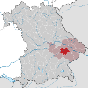
| Location of the district of Dingolfing-Landau in Bavaria | |
  |
|
The district of Dingolfing-Landau is located in the western center of the Bavarian administrative district of Lower Bavaria .
geography
location
The district of Dingolfing-Landau is crossed by the Isar from west to east . In the north of the Isar is the Aitrachtal and to the south the Vilstal . All three rivers are right tributaries of the Danube , which flow outside the district area. The landscape in the district is flat and partly hilly and reaches heights of up to 500 m in the south. The geographical center of the district was determined between the places Mamming and Bubach.
Neighboring counties
Neighboring districts are the Straubing-Bogen district in the north, the Deggendorf district in the east, the Rottal-Inn district in the south and the Landshut district in the west .
history
Regional courts
The area of today's district of Dingolfing-Landau belonged to Bavaria very early on. In 1803, the Landau an der Isar district court was established in the district , which from 1808 belonged to the Lower Danube District . The regional courts of Dingolfing and Osterhofen were established in 1838 from parts of its territory . All regional courts then belonged to the Lower Bavaria district .
District Offices
In 1862, in the course of the separation of justice and administration at the lower level, the district offices of Dingolfing and Landau were created in addition to the previous regional court districts of the same name, with the regional court of Dingolfing ceding some communities that from then on formed the judicial district of Arnstorf, which was assigned to the district office of Eggenfelden. It should be noted that "District Office" in the Bavarian administrative language corresponded to today's district office, while "District", like today's administrative district, was the middle administrative level. The Osterhofen area was part of the Vilshofen district office.
Counties
On January 1, 1939, as everywhere in the German Reich, the designation district was introduced. The district offices became the districts of Dingolfing and Landau adIsar.
Dingolfing-Landau district
As part of the regional reform in Bavaria , the new Lower Isar district was formed on July 1, 1972 . Became its constituent parts
- all municipalities of the dissolved district of Dingolfing
- all municipalities of the dissolved Landau an der Isar district with the exception of Lailling , which today belongs to the municipality of Otzing in the Deggendorf district
- the market Simbach and the communities Langgraben, Pischelsdorf and Ruhstorf of the dissolved district Eggenfelden
- the communities Martinsbuch , Mühlhausen and Süsskofen of the dissolved district of Mallersdorf
- the communities of Frontenhausen and Rampoldstetten of the dissolved district of Vilsbiburg
The new district was renamed the Dingolfing-Landau district on May 1, 1973 .
On May 1, 1978, the community of Großenpinning moved from the district of Dingolfing-Landau to the district of Straubing-Bogen and was incorporated into Oberschneiding .
Population development

From 1988 to 2008 the district of Dingolfing-Landau grew by over 15,000 inhabitants or around 20%. However, after 2004, after a provisional high of around 92,000 inhabitants, the trend was down slightly before the population increased again. In the period from 1988 to 2018 the district grew from 76,096 to 96,217 by 20121 inhabitants or by 26.4% - after the districts of Landshut and Kelheim, the district with the third highest percentage growth in the period mentioned in Lower Bavaria. In 7 of the 15 municipalities, the population increased by more than 30%.
The following figures refer to the territorial status on May 25, 1987.
| Population development | ||||||||||||||||
|---|---|---|---|---|---|---|---|---|---|---|---|---|---|---|---|---|
| year | 1840 | 1871 | 1900 | 1925 | 1939 | 1950 | 1961 | 1970 | 1987 | 1991 | 1995 | 2000 | 2005 | 2010 | 2015 | |
| Residents | 40,921 | 46,858 | 50,073 | 54,921 | 55,310 | 80,098 | 70,939 | 72,063 | 75,517 | 80,945 | 86,589 | 90,562 | 91.906 | 91.011 | 94.104 | |
politics

District Administrator
Werner Bumeder ( CSU ) has been the district administrator since May 1, 2020.
Deputy District Administrator is Dr. Franz Gassner (CSU), Mayor of Frontenhausen. Another deputy is Manuela Wällischmiller (Free Voters).
In the district election on March 15, 2020, Bumeder was elected as the successor to Heinrich Trapp ( SPD ) as district administrator with 69.1 percent of the valid votes . Trapp had been district administrator since June 22, 1991 and could no longer stand for election due to the age limit under the Bavarian electoral law.
| Surname | Political party | Year (s) |
|---|---|---|
| Fritz Ettengruber | CSU | 1972-1991 |
| Heinrich Trapp | SPD | 1991-2020 |
| Werner Bumeder | CSU | since 2020 |
District partnerships
A partnership has existed with the Łomża County in Poland since 1999 .
coat of arms
|
|
Blazon : “Split under the shield head with the Bavarian diamonds; in front in red a silver lion, which rises on a silver side four-mountain, in the back in the notch section three times divided by red and silver. " |
| Reasons for the coat of arms: The coat of arms combines elements from the coats of arms of the earlier districts of Dingolfing and Landau an der Isar. The lion on the side four-mountain stands for the Landau area. It is a talking picture from the coat of arms of the Counts of Leonberg, who had a great influence in the area between Isar and Inn. The multiple division in the notch section corresponds to the apocryphal shield image of the Counts of Frontenhausen, who ruled the Dingolfing area until their extinction around 1226. The Bavarian diamonds are reminiscent of the Wittelsbach house. |
Economy and Infrastructure
In the Future Atlas 2016 , the district of Dingolfing-Landau was ranked 42nd out of 402 districts, municipal associations and independent cities in Germany, making it one of the regions with "very high future prospects". In the 2019 edition, it was ranked 95th out of 401.
The most important company in the district is the BMW AG Dingolfing plant .
Job centers are also Landau adIsar (Einhell AG, Dräxlmaier , automotive supplier) and Marklkofen (Mann & Hummel, filter production)
traffic
Rail transport
The former district town of Landau received its first station on the Plattling - Neumarkt-St.Veit - Mühldorf route in 1875 through the AG der Bayerischen Ostbahnen . In neighboring Pilsting, the Bavarian State Railways branched off the line up the Isar to Landshut - Munich from 1880. It is part of the Landshut – Plattling railway line . The line between the Plattling and Pilsting station had already been opened on October 15, 1875, including the Landau (Isar) station ; on May 15, 1880, the section from Pilsting via Dingolfing to Landshut Central Station went into operation.
From Landau, the state local railway to Arnstorf started in 1903 with a branch line opened in 1915 to Kröhstorf . Both railways lost passenger traffic in 1962/64; likewise in 1969/70 the Pilsting - Neumarkt-St.Veit section on the Mühldorf-Pilsting railway line . The network of passenger trains has thus shrunk from 95 km to 36 km; these only stop at the three train stations in Dingolfing, Landau and Wallersdorf in the district.
Road traffic
Through the district from southwest to northeast the federal highway 92 , which leads from Munich to Deggendorf ( federal highway 3 ). The federal road 20 ( Straubing - Burghausen ) runs almost in a north-south direction through the district with a connection to the A 92 and Landau.
Communities

(Residents on December 31, 2019)
|
Other communities
|
Protected areas
There are six nature reserves , one landscape protection area , eight FFH areas and at least eleven geotopes designated by the Bavarian State Office for the Environment in the district (as of April 2016).
See also
- List of nature reserves in the district of Dingolfing-Landau
- List of landscape protection areas in the district of Dingolfing-Landau
- List of FFH areas in the Dingolfing-Landau district
- List of geotopes in the district of Dingolfing-Landau
License Plate
On May 2, 1973, the district was assigned the DGF distinguishing mark , which had been valid for the Dingolfing district since July 1, 1956 . It is still issued today. LAN (Landau ad Isar) has also been available since March 1, 2017 .
Web links
- Official website of the district
- Literature from and about the district of Dingolfing-Landau in the catalog of the German National Library
- Entry on the coat of arms of the district of Dingolfing-Landau in the database of the House of Bavarian History
Individual evidence
- ↑ "Data 2" sheet, Statistical Report A1200C 202041 Population of the municipalities, districts and administrative districts 1st quarter 2020 (population based on the 2011 census) ( help ).
- ^ Wilhelm Volkert (ed.): Handbook of Bavarian offices, communities and courts 1799–1980 . CH Beck, Munich 1983, ISBN 3-406-09669-7 , p. 97 .
- ^ Ordinance on the reorganization of Bavaria into rural districts and independent cities of December 27, 1971
- ^ Federal Statistical Office (ed.): Historical municipality directory for the Federal Republic of Germany. Name, border and key number changes in municipalities, counties and administrative districts from May 27, 1970 to December 31, 1982 . W. Kohlhammer GmbH, Stuttgart / Mainz 1983, ISBN 3-17-003263-1 , p. 632 and 633 .
- ↑ Współpraca Powiatu Łomżyńskiego z partnerami zagranicznymi (Polish)
- ↑ Entry on the coat of arms of the district of Dingolfing-Landau in the database of the House of Bavarian History , accessed on September 4, 2017 .
- ↑ Future Atlas 2016. (No longer available online.) Archived from the original on October 2, 2017 ; accessed on March 24, 2018 . Info: The archive link was inserted automatically and has not yet been checked. Please check the original and archive link according to the instructions and then remove this notice.
- ↑ PROGNOS future atlas. Handelsblatt, accessed on December 10, 2019 .
- ↑ "Data 2" sheet, Statistical Report A1200C 202041 Population of the municipalities, districts and administrative districts 1st quarter 2020 (population based on the 2011 census) ( help ).
Districts:
Aichach-Friedberg |
Altötting |
Amberg-Sulzbach |
Ansbach |
Aschaffenburg |
Augsburg |
Bad Kissingen |
Bad Toelz-Wolfratshausen |
Bamberg |
Bayreuth |
Berchtesgadener Land |
Cham |
Coburg |
Dachau |
Deggendorf |
Dillingen on the Danube |
Dingolfing-Landau |
Danube Ries |
Ebersberg |
Eichstätt |
Erding |
Erlangen-Höchstadt |
Forchheim |
Freising |
Freyung-Grafenau |
Fürstenfeldbruck |
Fürth |
Garmisch-Partenkirchen |
Gunzburg |
Hatred Mountains |
Yard |
Kelheim |
Kitzingen |
Kronach |
Kulmbach |
Landsberg am Lech |
Landshut |
Lichtenfels |
Lindau (Lake Constance) |
Main-Spessart |
Miesbach |
Miltenberg |
Mühldorf am Inn |
Munich |
Neuburg-Schrobenhausen |
Neumarkt in the Upper Palatinate |
Neustadt an der Aisch-Bad Windsheim |
Neustadt an der Waldnaab |
Neu-Ulm |
Nuremberg Country |
Oberallgäu |
Ostallgäu |
Passau |
Pfaffenhofen an der Ilm |
Rain |
Regensburg |
Rhön-Grabfeld |
Rosenheim |
Roth |
Rottal-Inn |
Schwandorf |
Schweinfurt |
Starnberg |
Straubing Arch |
Tirschenreuth |
Traunstein |
Unterallgäu |
Weilheim-Schongau |
Weißenburg-Gunzenhausen |
Wunsiedel in the Fichtel Mountains |
Wurzburg
Independent cities:
Amberg |
Ansbach |
Aschaffenburg |
Augsburg |
Bamberg |
Bayreuth |
Coburg |
Erlangen |
Fürth |
Hof (Saale) |
Ingolstadt |
Kaufbeuren |
Kempten (Allgäu) |
Landshut |
Memmingen |
Munich |
Nuremberg |
Passau |
Regensburg |
Rosenheim |
Schwabach |
Schweinfurt |
Straubing |
Willows in the Upper Palatinate |
Wurzburg
Fritz Ettengruber (1972–1991) | Heinrich Trapp (1991–2020) | Werner Bumeder (from 2020)