
District of Kronach
| coat of arms | Germany map |
|---|---|

|

Coordinates: 50 ° 20 ' N , 11 ° 22' E |
| Basic data | |
| State : | Bavaria |
| Administrative region : | Upper Franconia |
| Administrative headquarters : | Kronach |
| Area : | 651.53 km 2 |
| Residents: | 66,743 (Dec. 31, 2019) |
| Population density : | 102 inhabitants per km 2 |
| License plate : | KC, SAN |
| Circle key : | 09 4 76 |
| NUTS : | DE24A |
| Circle structure: | 18 parishes |
| Address of the district administration: |
Güterstrasse 18 96317 Kronach |
| Website : | |
| District Administrator : | Klaus Löffler ( CSU ) |
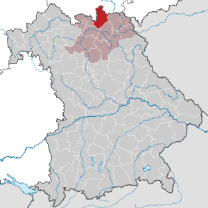
| Location of the district of Kronach in Bavaria | |
  |
|
The district of Kronach is the northernmost district of the administrative district of Upper Franconia in Bavaria . The district is a member of the Nuremberg Metropolitan Region .
geography
location
The district is mainly part of the Franconian Forest , which covers the north, east and south-east of the district with heights of up to 700 m. Tettau, Steinbach am Wald and Ludwigsstadt are on the Rennsteig . In the southwest lies the Upper Main hill country with heights between 200 and 500 m, including the district town of Kronach. It is traversed by the Rodach , also called Zahme Rodach, and its source river Wilde Rodach . The Rodach rises in the northeast of the district, then flows in a south-westerly direction and flows outside of the district into the Main . In Kronach it takes the Haßlach coming from the north .
Neighboring areas
The district borders clockwise to the west, beginning with the districts of Sonneberg , Saalfeld-Rudolstadt and Saale-Orla district (all in Thuringia ) and the districts of Hof , Kulmbach , Lichtenfels and Coburg . The closest regional centers are Hof (Saale) to the east and Coburg to the west.
history

Regional courts
Before 1800, the area of today's Kronach district belonged mainly to the Bamberg monastery . In 1802 it came to Bavaria. In 1804 the district courts of Kronach , Lauenstein and Teuschnitz were formed, which belonged to the Main District, from 1817 to the Upper Main District , from 1838 to Upper Franconia . In 1837 the seat of the Lauenstein Regional Court was relocated to Ludwigsstadt and the Teuschnitz Regional Court to Nordhalben .
District Office
In 1862 both regional courts were combined to form the Teuschnitz district office . At the same time, the Kronach District Office was created from the Kronach Regional Court.
On January 1, 1880, the Teuschnitz district office was dissolved, and its communities were incorporated into the Kronach district office. In addition, this municipality received the district office Stadtsteinach.
As early as 1888, the Teuschnitz district office was re-established because of the poor transport connections to Kronach. It was finally dissolved on June 1, 1931. With two exceptions, his communities came to the Kronach District Office.
On January 1, 1927, the Kronach district office was expanded to include the communities of Hain and Wildenberg of the Lichtenfels district office.
district
On January 1, 1939, as everywhere in the German Reich, the designation district was introduced. This is how the district office became the district of Kronach.
During the time of the division of Germany, the district was closed to the north , west and east by the border fortifications of the German Democratic Republic . Places like Welitsch , Nordhalben or Burggrub were close to the border; some of the border fortifications are still visible (especially in Welitsch near Pressig ).
During the regional reform in Bavaria , the district of Kronach was added to the communities Hofsteinach , Horb an der Steinach and Leutendorf b. Coburg of the district of Coburg enlarged. The community of Burkersdorf from the district of Lichtenfels and the market community of Seibelsdorf from the dissolved district of Stadtsteinach , which merged with four other communities to form Marktrodach, also joined the district. The district in turn gave the municipality of Unterlangenstadt to the district of Lichtenfels and the municipality of Dürrenwaid to the district of Hof, which was incorporated into Geroldsgrün there .
In March 1976, a building that last inhabited, the district Klein Lichtenhain , of the municipality of Lichtenhain bei Gräfenthal in the district Neuhaus am Rennweg , Suhl district , Democratic German Republic , was, incorporated into the community Kleintettau of the district Kronach.
On July 1, 1976, the Kulmbach district ceded the Gössersdorf community , which was incorporated into Weißenbrunn, to the Kronach district. On May 1, 1978, the Mödlitz district of the community of Weidhausen near Coburg was reclassified to the community of Schneckenlohe in the Kronach district. The district of Kronach reached its present size.
Population and religion

In the years after the Second World War , the population of the district of Kronach increased sharply (see graphic). While only 62,500 inhabitants were counted in 1939, there were around 82,000 in 1950. The population has been falling again since the 1970s. Currently (as of December 31, 2012) 69,000 people live in the district.
Around 56% of the population belong to the Catholic and 38% to the Protestant denomination. The communities of Wallenfels , Pressig and Steinbach am Wald are almost exclusively Catholic, Küps and Mitwitz Protestant. The proportion of foreigners is relatively low at 4%.
Population development
From 1988 to 2008 the district of Kronach lost over 3000 or 4% of its inhabitants.
In the period from 1988 to 2018, the population of the district fell from 74,658 to 67,135 by 7,523 or 10.1%. 16 of 18 municipalities had up to 30% fewer inhabitants in 2018 than 30 years earlier.
The following figures refer to the territorial status on May 25, 1987.
| Population development | ||||||||||||||
|---|---|---|---|---|---|---|---|---|---|---|---|---|---|---|
| year | 1840 | 1900 | 1939 | 1950 | 1961 | 1970 | 1987 | 1991 | 1995 | 2000 | 2005 | 2010 | 2015 | |
| Residents | 40,458 | 49,409 | 62,511 | 82.002 | 79.501 | 80.716 | 75,353 | 76,776 | 76,961 | 75,591 | 73,678 | 70.106 | 67,916 | |
politics
District council
Since 2002 the district council has been composed as follows:
| Party / group | Seats (plus district administrator) | |||
|---|---|---|---|---|
| 2002 | 2008 | 2014 | 2020 | |
| CSU | 29 | 26th | 21st | 19th |
| SPD | 21st | 19th | 14th | 10 |
| FW | 7th | 10 | 9 | 8th |
| JU | - | - | - | 4th |
| GREEN | 1 | 2 | 2 | 4th |
| AfD | - | - | - | 3 |
| List of women | 2 | 3 | 3 | 2 |
| FDP | - | - | 1 | - |
| total | 60 | 60 | 50 | 50 |
District Administrator
Klaus Löffler (CSU) has been the district administrator since December 2016. This was able to prevail in the district election 2016 with 62.01 percent of the vote against his opponent Norbert Gräbner (SPD).
His predecessor Oswald Marr (SPD) was in office from 1998 to 2016. He had won the district election 2010 with 66.17% of the vote against Jens Korn (CSU). The later State Minister Werner Schnappauf (CSU) was in office from 1989 to 1998 .
badges and flags
On April 11, 1957, the district of Kronach received approval from the Bavarian State Ministry of the Interior to use the coat of arms described below. The government of Upper Franconia approved the continuation of the coat of arms on June 5, 1973. In addition, the district council of the district of Kronach decided in its meeting on July 24, 1978 to use the flag described below. The approval of the government of Upper Franconia took place on November 7, 1978.
|
|
Blazon : “Split by a lowered, rising and curled blue tip, inside a golden water wheel; in front in gold a left-facing, red armored black lion covered with a silver sloping bar, behind in a golden field sprinkled with red hearts a red crowned and red armored black lion. " |
| Establishment of the coat of arms: The district of Kronach has changed only insignificantly in the course of the district reform of 1972. The district council has therefore decided to adopt the coat of arms of the old district of Kronach from 1957 unchanged. In the front half of the shield is the Bamberg lion. The land around Kronach came in 1122 as a donation to the Bamberg diocese, with which it remained until the end of the Old Kingdom in 1803. In the back half of the shield stands the lion of the Counts of Orlamünde, who are documented as rulers, especially in the northern district around Lauenstein, until their extinction in the 15th century. The water wheel represents the abundance of water and wood in the district. The colors of the tip are taken from the coat of arms of the former Langheim monastery, which until 1388 owned “Teuschnitz own”. |
- Flag description
- "The district of Kronach will in future have its own district flag, namely a stripe flag in the colors yellow and blue with the district's coat of arms."
- Even if the text here repeatedly uses the word “flag”, it is by definition a flag .
Sponsorship
- In 1961 the sponsorship for the expelled Sudeten Germans from the Podersam district was taken over.
Economy and Infrastructure
In the future atlas 2016 , the district of Kronach was ranked 359 out of 402 districts, municipal associations and independent cities in Germany, making it one of the regions with “future risks”. According to the study, it offers the worst prospects for the future of any district in Bavaria.
Established businesses
- Loewe Technologies , headquarters (entertainment and telecommunications)
- Dr. Schneider group of companies (automotive supplier)
- Carl Link Publishing House
- Confiserie Burg Lauenstein GmbH
- Lear Corporation GmbH & Co. KG (automotive supplier)
- Heinz-Glas GmbH in Kleintettau near Tettau
- Wiegand glass in Steinbach am Wald
- Julius Zöllner GmbH & Co. KG
- PPG Industries in Wallenfels
- Valeo (automotive supplier) in Neuses
traffic
railroad
The capital of the Kronach district in the Franconian Forest received its first connection to the rail network in 1861 when the Hochstadt-Stockheimer Railway branched off from the Ludwigs-Süd-Nord-Bahn in the Main Valley . The railway, which was extended to Stockheim in 1863, was continued across the Thuringian border in 1885 by the Bavarian State Railway . In Louis city was at the same time a branch line to the slate quarries of Lehesten from.


Only after the turn of the century did the following branch lines emerge:
- 1900 from Kronach in the Rodachtal up to Nordhalben ( Rodachtalbahn ),
- 1901 from Stockheim via Burggrub to Sonneberg ( Stockheim – Sonneberg line of the Prussian State Railway )
- 1903 from Pressig - Rothenkirchen to Tettau , partly in Thuringia and
- 1916 from Neuses to Weißenbrunn , initially only for freight traffic .
In Steinachtal some municipalities received following the first in 1920 by the German National Railroad completed branch line Ebersdorf - Neustadt bei Coburg .
On all branch lines (62 km), passenger traffic was gradually shut down in 1945, 1952/1954 and 1972–1976:
- 1945: Ludwigsstadt - Lehesten (4 km) and Neuhaus - Schierschnitz - Burggrub (1 km)
- 1952: Pressig - Rothenkirchen - Alexanderhütte - Tettau (13 km)
- 1954: Neuses - Weißenbrunn (5 km)
- 1972: Burggrub - Stockheim (4 km)
- 1975: Ebersdorf - Mödlitz - Hof-Steinach - Neustadt (10 km)
- 1976: Kronach - Wallenfels - Nordhalben (25 km)
This left only the smaller part of the original network of 107 kilometers in length.
Local public transport
Local public transport in the Kronach district is mainly handled by Omnibusverkehr Franken GmbH (OVF) . In the city of Kronach there is also a city bus network with 3 lines.
Transport network
Since 2018, the independent cities of Hof (Saale) and Coburg and the districts of Wunsiedel , Kulmbach , Kronach, Coburg and Hof have been planning to join the VGN .
Streets
Communities
(Residents on December 31, 2019)
Unregulated areas (20.86 km²)
|
Other communities
|
  |
Municipalities of the district before the territorial reform 1971/78
Before the regional reform , the district of Kronach had 96 municipalities (see list below). (The churches that still exist today are written in bold ):
| former parish | today's parish | today's district |
|---|---|---|
| Au | Küps | District of Kronach |
| Beikheim | Schneckenlohe | District of Kronach |
| pear tree | Stone meadows | District of Kronach |
| Brauersdorf | Pressy | District of Kronach |
| Buchbach | Steinbach am Wald | District of Kronach |
| Burggrub | Stockheim | District of Kronach |
| Burgstall | Mitwitz | District of Kronach |
| Dörfles | Kronach | District of Kronach |
| Drought woe | Geroldsgrün | Hof district |
| Ebersdorf | Ludwigsstadt | District of Kronach |
| Effelter | Wilhelmsthal | District of Kronach |
| Eibenberg | Wilhelmsthal | District of Kronach |
| Eichenbühl | Weißenbrunn | District of Kronach |
| Eila | Pressy | District of Kronach |
| Fischbach | Kronach | District of Kronach |
| Förtschendorf | Pressy | District of Kronach |
| Friedersdorf | Pressy | District of Kronach |
| Friezes | Kronach | District of Kronach |
| Gehülz | Kronach | District of Kronach |
| Geuser | Wallenfels | District of Kronach |
| Gifting | Wilhelmsthal | District of Kronach |
| Glosberg | Kronach | District of Kronach |
| Grössau | Pressy | District of Kronach |
| Großvichtach | Marktrodach | District of Kronach |
| Gundelsdorf | Kronach | District of Kronach |
| Haig | Stockheim | District of Kronach |
| grove | Küps | District of Kronach |
| Hasslach | Teuschnitz | District of Kronach |
| Haßlach near Kronach | Stockheim | District of Kronach |
| Heinersberg | Nordhalben | District of Kronach |
| Hesselbach | Wilhelmsthal | District of Kronach |
| Hirschfeld | Steinbach am Wald | District of Kronach |
| Courtly | Kronach | District of Kronach |
| Hummendorf | Weißenbrunn | District of Kronach |
| Johannisthal | Küps | District of Kronach |
| Kaltenbrunn | Mitwitz | District of Kronach |
| Kehlbach | Steinbach am Wald | District of Kronach |
| Kleintettau | Tettau | District of Kronach |
| Knellendorf | Kronach | District of Kronach |
| Kronach | Kronach | District of Kronach |
| Küps | Küps | District of Kronach |
| Lame | Wilhelmsthal | District of Kronach |
| Langenau | Tettau | District of Kronach |
| Lauenhain | Ludwigsstadt | District of Kronach |
| Lauenstein | Ludwigsstadt | District of Kronach |
| Ludwigsstadt | Ludwigsstadt | District of Kronach |
| Marienroth | Pressy | District of Kronach |
| Mitwitz | Mitwitz | District of Kronach |
| Neuengrün | Wallenfels | District of Kronach |
| New catch | Stone meadows | District of Kronach |
| Neukenroth | Stockheim | District of Kronach |
| Neundorf | Mitwitz | District of Kronach |
| News | Kronach | District of Kronach |
| Nordhalben | Nordhalben | District of Kronach |
| Only | Stone meadows | District of Kronach |
| Oberlangenstadt | Küps | District of Kronach |
| Oberrodach | Marktrodach | District of Kronach |
| Posseck in Bavaria | Pressy | District of Kronach |
| Pressy | Pressy | District of Kronach |
| Rappolten green | Teuschnitz | District of Kronach |
| Reichenbach | Reichenbach | District of Kronach |
| Reitsch | Stockheim | District of Kronach |
| Reuth | Weißenbrunn | District of Kronach |
| Rosslach | Wilhelmsthal | District of Kronach |
| Rothenkirchen | Pressy | District of Kronach |
| Schmölz | Küps | District of Kronach |
| Schnaid | Wallenfels | District of Kronach |
| Schneckenlohe | Schneckenlohe | District of Kronach |
| Schwarzdorf | Mitwitz | District of Kronach |
| Seelach | Kronach | District of Kronach |
| Steinbach an der Haide | Ludwigsstadt | District of Kronach |
| Steinbach am Wald | Steinbach am Wald | District of Kronach |
| Steinberg | Wilhelmsthal | District of Kronach |
| Stone meadows | Stone meadows | District of Kronach |
| Stockheim | Stockheim | District of Kronach |
| Tettau | Tettau | District of Kronach |
| Teuschnitz | Teuschnitz | District of Kronach |
| Theisenort | Küps | District of Kronach |
| Thonberg | Weißenbrunn | District of Kronach |
| Tschirn | Tschirn | District of Kronach |
| Tüschnitz | Küps | District of Kronach |
| Unterlangenstadt | Redwitz an der Rodach | Lichtenfels district |
| Unterrodach | Marktrodach | District of Kronach |
| Vogtendorf | Kronach | District of Kronach |
| Wallenfels | Wallenfels | District of Kronach |
| Weißenbrunn | Weißenbrunn | District of Kronach |
| Welitsch | Pressy | District of Kronach |
| Wickendorf | Teuschnitz | District of Kronach |
| Wildenberg | Weißenbrunn | District of Kronach |
| Wilhelmsthal | Wilhelmsthal | District of Kronach |
| Windheim | Steinbach am Wald | District of Kronach |
| Wötzelsdorf | Kronach | District of Kronach |
| Wolfersdorf | Stockheim | District of Kronach |
| Wolfersgrün | Wallenfels | District of Kronach |
| Zeyern | Marktrodach | District of Kronach |
| Brick earth | Kronach | District of Kronach |
Protected areas
In the district of Kronach there are 13 nature reserves , eight landscape protection areas , ten FFH areas and 50 geotopes (as of August 2016).
See also:
- List of nature reserves in the district of Kronach
- List of landscape protection areas in the district of Kronach
- List of FFH areas in the district of Kronach
- List of geotopes in the district of Kronach
License Plate
On July 1, 1956, the district was assigned the distinctive sign KC when the vehicle registration number that is still valid today was introduced . It is still issued today. Since July 10, 2013, the license plate liberalization means that the SAN ( Stadtsteinach ) distinguishing mark has also been available.
Others
The Upper Franconian dialect is predominantly spoken in the district. In the north on the border with Thuringia there are a few places where the south-east Thuringian dialect is predominant. The so-called Bamberg barrier runs along the western and southern border of the district . This language border to the Main Franconian dialects separates Upper Franconian from Itzgründischen .
The VT 612 115 of the Deutsche Bahn operates under the name of Landkreis Kronach.
literature
- Tilmann Breuer : District of Kronach (= Bavarian art monuments . Volume 19 ). Deutscher Kunstverlag, Munich 1964, DNB 450619354 .
- Helmut Demattio: Kronach - The Altlandkreis (= Historical Atlas of Bavaria, part of Franconia . I, 32). Commission for Bavarian State History, Munich 1998, ISBN 3-7696-9698-0 .
Web links
- Official website of the district
- Literature from and about the district of Kronach in the catalog of the German National Library
- Entry on the coat of arms of the district of Kronach in the database of the House of Bavarian History
Individual evidence
- ↑ "Data 2" sheet, Statistical Report A1200C 202041 Population of the municipalities, districts and administrative districts 1st quarter 2020 (population based on the 2011 census) ( help ).
- ^ Wilhelm Volkert (ed.): Handbook of Bavarian offices, communities and courts 1799–1980 . CH Beck, Munich 1983, ISBN 3-406-09669-7 , p. 500 .
- ^ Wilhelm Volkert (ed.): Handbook of Bavarian offices, communities and courts 1799–1980 . CH Beck, Munich 1983, ISBN 3-406-09669-7 , p. 97 .
- ^ Ordinance on the reorganization of Bavaria into rural districts and independent cities of December 27, 1971
- ^ Result of the district election 2014 on March 16, 2014 in the district of Kronach
- ↑ Result of the 2020 district council election on March 15, 2020 in the Kronach district
- ↑ a b c Entry on the coat of arms of the district of Kronach in the database of the House of Bavarian History , accessed on September 5, 2017 .
- ↑ a b District of Kronach: Leading a flag through the district of Kronach
- ↑ Kommunalflaggen.de: District of Kronach
- ↑ Future Atlas 2016. (No longer available online.) Archived from the original on October 2, 2017 ; accessed on March 23, 2018 . Info: The archive link was inserted automatically and has not yet been checked. Please check the original and archive link according to the instructions and then remove this notice.
- ↑ "Data 2" sheet, Statistical Report A1200C 202041 Population of the municipalities, districts and administrative districts 1st quarter 2020 (population based on the 2011 census) ( help ).
- ↑ - ( Memento of the original from June 11, 2011 in the Internet Archive ) Info: The archive link was inserted automatically and has not yet been checked. Please check the original and archive link according to the instructions and then remove this notice.

Independent cities: Amberg | Ansbach | Bamberg | Bayreuth | Coburg | Erlangen | Fürth | Yard | Nuremberg | Schwabach | Willows in the Upper Palatinate
Districts: District of Amberg-Sulzbach | District of Ansbach | Bamberg district | Bayreuth district | District of Coburg | District of Erlangen-Höchstadt | Forchheim district | Fürth district | District of Haßberge | District of Kitzingen | District of Kronach | District of Kulmbach | District of Lichtenfels | District of Neumarkt idOPf. | District Neustadt adAisch-Bad Windsheim | District Neustadt ad Waldnaab | District of Nürnberger Land | District of Roth | District of Sonneberg | District of Tirschenreuth | Weißenburg-Gunzenhausen district | District of Wunsiedel in the Fichtel Mountains
Districts:
Aichach-Friedberg |
Altötting |
Amberg-Sulzbach |
Ansbach |
Aschaffenburg |
Augsburg |
Bad Kissingen |
Bad Toelz-Wolfratshausen |
Bamberg |
Bayreuth |
Berchtesgadener Land |
Cham |
Coburg |
Dachau |
Deggendorf |
Dillingen on the Danube |
Dingolfing-Landau |
Danube Ries |
Ebersberg |
Eichstätt |
Erding |
Erlangen-Höchstadt |
Forchheim |
Freising |
Freyung-Grafenau |
Fürstenfeldbruck |
Fürth |
Garmisch-Partenkirchen |
Gunzburg |
Hatred Mountains |
Yard |
Kelheim |
Kitzingen |
Kronach |
Kulmbach |
Landsberg am Lech |
Landshut |
Lichtenfels |
Lindau (Lake Constance) |
Main-Spessart |
Miesbach |
Miltenberg |
Mühldorf am Inn |
Munich |
Neuburg-Schrobenhausen |
Neumarkt in the Upper Palatinate |
Neustadt an der Aisch-Bad Windsheim |
Neustadt an der Waldnaab |
Neu-Ulm |
Nuremberg Country |
Oberallgäu |
Ostallgäu |
Passau |
Pfaffenhofen an der Ilm |
Rain |
Regensburg |
Rhön-Grabfeld |
Rosenheim |
Roth |
Rottal-Inn |
Schwandorf |
Schweinfurt |
Starnberg |
Straubing Arch |
Tirschenreuth |
Traunstein |
Unterallgäu |
Weilheim-Schongau |
Weißenburg-Gunzenhausen |
Wunsiedel in the Fichtel Mountains |
Wurzburg
Independent cities:
Amberg |
Ansbach |
Aschaffenburg |
Augsburg |
Bamberg |
Bayreuth |
Coburg |
Erlangen |
Fürth |
Hof (Saale) |
Ingolstadt |
Kaufbeuren |
Kempten (Allgäu) |
Landshut |
Memmingen |
Munich |
Nuremberg |
Passau |
Regensburg |
Rosenheim |
Schwabach |
Schweinfurt |
Straubing |
Willows in the Upper Palatinate |
Wurzburg