
District of Erding
| coat of arms | Germany map |
|---|---|

|

Coordinates: 48 ° 18 ' N , 12 ° 0' E |
| Basic data | |
| State : | Bavaria |
| Administrative region : | Upper Bavaria |
| Administrative headquarters : | Erding |
| Area : | 870.72 km 2 |
| Residents: | 138,182 (Dec 31, 2019) |
| Population density : | 159 inhabitants per km 2 |
| License plate : | ED |
| Circle key : | 09 1 77 |
| NUTS : | DE21A |
| Circle structure: | 26 municipalities |
| Address of the district administration: |
Alois-Schießl-Platz 2 85435 Erding |
| Website : | |
| District Administrator : | Martin Bayerstorfer ( CSU ) |
| Location of the district of Erding in Bavaria | |
  |
|


The district of Erding is located in the northeastern part of the administrative district of Upper Bavaria .
geography
location
The district of Erding is located about 30 kilometers northeast of the state capital Munich . In between there is a strip of the Munich district .
Landforms
The area of the district of Erding cannot be clearly delimited in terms of landscape and geography. A distinction is made between three types of landscape: the tertiary Isar-Inn hill country in the north and east in the Erdinger Holzland , the glacial moraine area of the Gattergebirge in the south and south-east and the Erdinger Moos as a continuation of the Munich gravel plain . The Viehlaßmoos nature reserve is located here .
The district of Erding is between 430 and 650 meters above sea level. The highest point at 649 meters is located east of Lichtenweg in the municipality of Isen on the southern edge of the district.
Neighboring areas
The district borders in a clockwise direction in the northwest on the districts of Freising , Landshut , Mühldorf am Inn , Ebersberg and Munich .
history
Until 1800
From around 7000 BC First human traces are proven; approx. 2000 BC A lively settlement activity developed. The livestock predominated over the agriculture .
Around 500 BC The Celts settled in the current district. Around 15 BC BC the Romans incorporated the area.
The Romans left behind several streets, such as the one from Riegerau to Langenpreising, which is part of the long-distance route Augsburg - Regensburg , and the one from Chiemgau via Anzing, Altenerding, Langengeisling to Berglern.
In the 5th century, the Romans had to give way to the Teutons and left behind parts of the Roman road network. The long-distance connections Augsburg – Regensburg and those from Chiemgau via Anzing, Altenerding, Langengeisling to Berglern went through today's district. From the 6th century onwards, preferred settlement areas were the river valleys of Sempt and Strogen.
In order to secure the connection between the main towns of Munich and Landshut against the Hochstift Freising , the city of Erding was founded as a ducal base in 1228. When Bavaria was divided in 1255, the courts of Erding and Dorfen became part of Lower Bavaria.
In 1503 and 1504 the Landshut War of Succession devastated the country. A serious confessional crisis arose in the country in the middle of the 16th century, when the immediate imperial Count von Haag from the Fraunberg family , who had their ancestral seat in the Erdingen area, joined the Reformation . In the years after the Thirty Years' War , the Erdinger population achieved significant prosperity. The dominion of Burgrain with the Isen market belonged to the Hochstift Freising until 1803.
Regional courts
In 1803 the district court Erding was established, which during the reforms of Montgelas from 1808 belonged to the Isar district and from 1838 to the district of Upper Bavaria. Life was primarily oriented towards Munich. In 1858, the independent Dorfen regional court was established for 19 communities in the Erding regional court district.
District Office
The Erding District Office was formed in 1862 through the merger of the Erding District Court with the District Court District of Dorfen, which was newly formed in 1858 from 19 communities in the Erding District Court.
On February 1, 1927, the Erding District Office ceded the Pfrombach community to the Freising District Office.
On July 1, 1928, the district office of Erding was enlarged to include the municipality of Ottenhofen belonging to the district office of Ebersberg.
district
On January 1, 1939, as everywhere in the German Reich, the designation district was introduced. So the district office became the district of Erding.
The period after the Second World War was marked by the reconstruction and integration of around ten thousand displaced people .
During the regional reform in Bavaria , the community Schwindkirchen from the district of Mühldorf am Inn and the communities Isen , Mittbach , Sankt Wolfgang and Schiltern from the dissolved district of Wasserburg am Inn were added to the district of Erding on July 1, 1972. On May 1, 1978 the district of Goldach in the municipality of Notzing in the district of Erding was changed to Hallbergmoos in the district of Freising. With this the district of Erding reached its present size.
On May 17, 1992, the new Munich Airport was opened in Erdinger Moos . As a result, there was a noticeable increase in the population, a consistently low unemployment rate and the settlement of new businesses.
The district of Erding has a partnership with the French district of Bastia in Corsica .
On September 23, 2008 the district received the title “ Place of Diversity ” awarded by the Federal Government .
Population development
The district of Erding gained around 35,000 inhabitants or grew by around 38 percent between 1988 and 2008 - the strongest population increase in a district in Bavaria during the period mentioned. Between 1988 and 2018 the district grew from 90,944 to 137,660 by 46,716 inhabitants or 51.4%, the Bavarian peak; In the western district in particular, several formerly rural communities between Munich and Erding near the airport almost doubled their inhabitants in the period mentioned.
The following population figures refer to the area as of May 25, 1987.
| year | 1840 | 1871 | 1900 | 1925 | 1939 | 1950 | 1961 | 1970 | 1987 | 1991 | 1995 | 2000 | 2005 | 2010 | 2015 |
| population | 33,656 | 41,186 | 46,900 | 51,158 | 54,360 | 73.189 | 72,699 | 78,975 | 89,190 | 97.048 | 104.509 | 115,939 | 123.094 | 127.011 | 133,747 |
politics
District council
The district council consists of 60 members:
| Party / list | Seats |
|---|---|
| CSU | 24 |
| SPD | 5 |
| FW | 11 |
| GREEN | 10 |
| ÖDP | 3 |
| AfD | 5 |
| FDP | 1 |
| LEFT | 1 |
| total | 60 |
In March 2018, the two Republican district councilors Martin Huber and Peter Attenhauser switched to the Alternative for Germany party .
In December 2018, the ÖDP parliamentary group decided to exclude the district councilor Rainer Forster. This had shown a closeness to the AfD and to conspiracy theories .
District administrators
|
|
Martin Bayerstorfer won the district administrator's runoff election on March 29, 2020 with 53.19%. In the first ballot, he was initially unable to prevail against Hans Schreiner, who scored 45.53% as a community candidate for Free Voters, Greens and the SPD and was mayor of Bockhorn until the 2020 local elections .
Economy and Infrastructure
economy
The district of Erding still shows a predominantly rural picture in which agriculture, handicrafts and commercial medium-sized companies complement each other. In the Future Atlas 2016, the district of Erding was ranked 34th out of 402 districts, municipal associations and independent cities in Germany, making it one of the regions with "very high future prospects". In the 2019 edition, it was ranked 60th out of 401.
With the opening of the new airport in Erdinger Moos in 1992, there was a noticeable increase in the population and the settlement of new businesses.
The Erdinger Weißbräu brewery is based in the district.
Road traffic
In the northwest, the A 92 from Munich via Landshut to Deggendorf crosses part of the district and with the opening of the Forstinning - Pastetten section on August 31, 2011, the A 94 from Munich via Mühldorf to Passau , which has been controversial for many years and has been lamented to the last instance, also reached the southwest region of the county. After it was opened to traffic on October 1, 2019, it will continue in an easterly direction through the Isental valley via Lengdorf , Dorfen and Schwindkirchen to the neighboring district of Mühldorf am Inn.
Furthermore, two federal roads run through the district, the B 15 Regensburg - Haag - Rosenheim in a north-south direction and the B 388 Ismaning - Eggenfelden - Passau - Wegscheid in a west-east direction. 10 state roads and 29 district roads also serve through traffic in the district .
Rail transport
The traffic load in the city of Erding has increased massively since the airport opened. The planned S-Bahn ring closure in combination with the regional train connection should bring relief here.
Local transport
In the district of Erding, all railway lines were built by the Bavarian State Railways .
The main line from Munich to Simbach has crossed it since 1871 . The Hörlkofen , Walpertskirchen , Thann-Matzbach and Dorfen stations are located on the district area . The trains that run here allow a fast connection to Munich, but only every hour, with individual additional trains during rush hour .
The branch line to Erding branches off from this main line in Markt Schwaben in the district of Ebersberg . It was opened in 1872 and is now used by the S-Bahn line S2. The stations of Ottenhofen, St. Koloman, Aufhausen, Altenerding and Erding are in the district .
Other local railway lines were connected to the main line:
- 1898: Dorfen - Moosen - Velden
- 1900: Thann-Matzbach - Haag
Passenger traffic ceased in 1968 on both of the 31-kilometer-long railways.
badges and flags
The coat of arms of the district of Erding was established on October 9, 1953 and confirmed on October 31, 1972.
|
|
Blazon : "Under a shield head with the Bavarian rhombuses in silver a jumping, gold-armored red horse." |
|
Reasons for the coat of arms: The horse in the coat of arms has a double meaning. For a long time, the district was the horse-richest district in Bavaria. The jumping horse was also the emblem of the imperial county of Haag , which goes back to the seal of the Gurren zu Haag in the first half of the 13th century - the Fraunberg family castle of their count's successors since 1245 is in the district of Erding. The diamonds refer to the ducal court of Erding. One of its main towns was Wartenberg, which had been a castle seat of the Wittelsbach counts and later dukes before the lordly residences of Landshut and Munich were established.
In addition to the coat of arms, the district carries a flag with the colors white-red-yellow. |
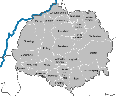
Communities
Current
(Residents on December 31, 2019)
|
Cities :
Other municipalities :
|
Markets :
  |
Municipalities of the district before the territorial reform 1971/78
Before the regional reform, the district of Erding had 47 communities (see list below). In 1900 there were one more. Pfrombach was reclassified to the Freising District Office in 1927 . The Hubenstein community was incorporated into Taufkirchen (Vils) on October 1, 1925 . The Ottenhofen community was reclassified from the Ebersberg District Office to the Erding District Office in 1928 .
In the north the district bordered on the district of Landshut , in the northeast on the district of Vilsbiburg , in the east on the district of Mühldorf am Inn , in the southeast on the district of Wasserburg am Inn , in the south on the district of Ebersberg , in the west on the district of Munich and in Northwest to the district of Freising .
The municipalities of the district of Erding before the municipality reform in 1971/78: (The municipalities that still exist today are written in bold .)


| former parish | today's parish | today's district |
|---|---|---|
| Altenerding | Erding | District of Erding |
| Auerbach | Wartenberg | District of Erding |
| Mountain learning | Mountain learning | District of Erding |
| Bockhorn | Bockhorn | District of Erding |
| Buch am Buchrain | Buch am Buchrain | District of Erding |
| Dorfen (city since 1954) | Villages | District of Erding |
| Eibach | Villages | District of Erding |
| Eitting | Eitting | District of Erding |
| Erding (city) | Erding | District of Erding |
| Eschlbach | Bockhorn | District of Erding |
| Finsing | Finsing | District of Erding |
| Forestry | Forestry | District of Erding |
| Fraunberg | Fraunberg | District of Erding |
| Gebensbach | Taufkirchen (Vils) | District of Erding |
| Grünbach | Bockhorn | District of Erding |
| Grüntegernbach | Villages | District of Erding |
| Hausmehring | Villages | District of Erding |
| Hofkirchen | Taufkirchen (Vils) | District of Erding |
| Hofstarring | Stone churches | District of Erding |
| Hohenpolding | Hohenpolding | District of Erding |
| Inning on wood | Inning on wood | District of Erding |
| Kirchberg | Kirchberg | District of Erding |
| Langengeisling | Erding | District of Erding |
| Long price | Long price | District of Erding |
| Lengdorf | Lengdorf | District of Erding |
| Matzbach | Lengdorf | District of Erding |
| Mosses (vils) | Taufkirchen (Vils) | District of Erding |
| Moosinning | Moosinning | District of Erding |
| Niederneuching | Neuching | District of Erding |
| Notzing | partly Oberding , partly Hallbergmoos |
partly district Erding, partly district Freising |
| Oberding | Oberding | District of Erding |
| Oberneuching | Neuching | District of Erding |
|
Ottenhofen (belonged to the Ebersberg district office until 1928) |
Ottenhofen | District of Erding |
| Patties | Patties | District of Erding |
| Reichenkirchen | Fraunberg | District of Erding |
| Salmannskirchen | Bockhorn | District of Erding |
| Stone churches | Stone churches | District of Erding |
| Sulding | Hohenpolding | District of Erding |
| Taufkirchen (Vils) | Taufkirchen (Vils) | District of Erding |
| Thalheim | Fraunberg | District of Erding |
| Walpert Churches | Walpert Churches | District of Erding |
| Wambach | Taufkirchen (Vils) | District of Erding |
| Wartenberg (market) | Wartenberg | District of Erding |
| Wasentegernbach | Villages | District of Erding |
| Watzling | Villages | District of Erding |
| Wörth | Wörth | District of Erding |
| Zeilhofen | Villages | District of Erding |
Protected areas
As of April 2016, there are eight nature reserves , nine landscape protection areas , seven FFH areas and at least four geotopes designated by the Bavarian State Office for the Environment in the district .
License Plate
On July 1, 1956, the district was assigned the distinguishing mark ED when the vehicle registration number that is still valid today was introduced . It is still issued today.
literature
- Bernhard Zöpf: Historical-topographical description of the k. District Court Erding . Freising 1856 ( online at Google Books ).
Web links
- District website
- Entry on the coat of arms of the district of Erding in the database of the House of Bavarian History
Individual evidence
- ↑ "Data 2" sheet, Statistical Report A1200C 202041 Population of the municipalities, districts and administrative districts 1st quarter 2020 (population based on the 2011 census) ( help ).
- ^ Wilhelm Volkert (ed.): Handbook of Bavarian offices, communities and courts 1799–1980 . CH Beck, Munich 1983, ISBN 3-406-09669-7 , p. 457 .
- ^ Wilhelm Volkert (ed.): Handbook of Bavarian offices, communities and courts 1799–1980 . CH Beck, Munich 1983, ISBN 3-406-09669-7 , p. 97 .
- ^ Ordinance on the reorganization of Bavaria into counties and urban districts. dated December 27, 1971.
- ^ Statistics for the district. Bavarian State Office for Statistics, accessed on January 21, 2011 (PDF file).
- ↑ Election of the district council of Erding district. March 15, 2020, accessed May 29, 2020 .
- ↑ Old comrades. In: Süddeutsche Zeitung. March 9, 2018, accessed July 4, 2019 .
- ^ ÖDP separates from the controversial district council. In: Süddeutsche Zeitung. December 19, 2018, accessed July 4, 2019 .
- ↑ Non- party candidate: Rainer Forster wants to become district administrator in Erding in 2020. In: Münchner Merkur. March 22, 2019, accessed July 4, 2019 .
- ^ Runoff election in the Erding district: CSU defends both offices in Erding. In: Münchner Merkur. March 29, 2020, accessed May 29, 2020 .
- ↑ The ranking for Germany's regions future atlas 2016. Prognos, accessed on March 24, 2018 .
- ↑ PROGNOS future atlas. Handelsblatt, accessed on December 10, 2019 .
- ↑ Entry on the coat of arms of the district of Erding in the database of the House of Bavarian History , accessed on September 2, 2017 .
- ↑ "Data 2" sheet, Statistical Report A1200C 202041 Population of the municipalities, districts and administrative districts 1st quarter 2020 (population based on the 2011 census) ( help ).
- ^ Michael Rademacher: German administrative history from the unification of the empire in 1871 to the reunification in 1990. Erding district. (Online material for the dissertation, Osnabrück 2006).
- ^ Bayernviewer of the Bavarian Surveying Administration.
Districts:
Aichach-Friedberg |
Altötting |
Amberg-Sulzbach |
Ansbach |
Aschaffenburg |
Augsburg |
Bad Kissingen |
Bad Toelz-Wolfratshausen |
Bamberg |
Bayreuth |
Berchtesgadener Land |
Cham |
Coburg |
Dachau |
Deggendorf |
Dillingen on the Danube |
Dingolfing-Landau |
Danube Ries |
Ebersberg |
Eichstätt |
Erding |
Erlangen-Höchstadt |
Forchheim |
Freising |
Freyung-Grafenau |
Fürstenfeldbruck |
Fürth |
Garmisch-Partenkirchen |
Gunzburg |
Hatred Mountains |
Yard |
Kelheim |
Kitzingen |
Kronach |
Kulmbach |
Landsberg am Lech |
Landshut |
Lichtenfels |
Lindau (Lake Constance) |
Main-Spessart |
Miesbach |
Miltenberg |
Mühldorf am Inn |
Munich |
Neuburg-Schrobenhausen |
Neumarkt in the Upper Palatinate |
Neustadt an der Aisch-Bad Windsheim |
Neustadt an der Waldnaab |
Neu-Ulm |
Nuremberg Country |
Oberallgäu |
Ostallgäu |
Passau |
Pfaffenhofen an der Ilm |
Rain |
Regensburg |
Rhön-Grabfeld |
Rosenheim |
Roth |
Rottal-Inn |
Schwandorf |
Schweinfurt |
Starnberg |
Straubing Arch |
Tirschenreuth |
Traunstein |
Unterallgäu |
Weilheim-Schongau |
Weißenburg-Gunzenhausen |
Wunsiedel in the Fichtel Mountains |
Wurzburg
Independent cities:
Amberg |
Ansbach |
Aschaffenburg |
Augsburg |
Bamberg |
Bayreuth |
Coburg |
Erlangen |
Fürth |
Hof (Saale) |
Ingolstadt |
Kaufbeuren |
Kempten (Allgäu) |
Landshut |
Memmingen |
Munich |
Nuremberg |
Passau |
Regensburg |
Rosenheim |
Schwabach |
Schweinfurt |
Straubing |
Willows in the Upper Palatinate |
Wurzburg