
Eitting
| coat of arms | Germany map | |
|---|---|---|

|
Coordinates: 48 ° 22 ' N , 11 ° 54' E |
|
| Basic data | ||
| State : | Bavaria | |
| Administrative region : | Upper Bavaria | |
| County : | Erding | |
| Management Community : | Oberding | |
| Height : | 449 m above sea level NHN | |
| Area : | 35.63 km 2 | |
| Residents: | 2880 (Dec. 31, 2019) | |
| Population density : | 81 inhabitants per km 2 | |
| Postal code : | 85462 | |
| Area code : | 08122 | |
| License plate : | ED | |
| Community key : | 09 1 77 116 | |
| LOCODE : | DE EIT | |
| Community structure: | 4 districts | |
| Association administration address: | Tassilostr. 17 85445 Oberding |
|
| Website : | ||
| Mayor : | Georg Wiester ( community peace voter group ) | |
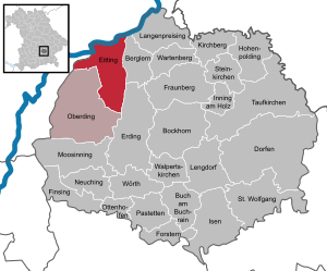
| Location of the municipality of Eitting in the district of Erding | ||
  |
||

Eitting is a municipality in the Upper Bavarian district of Erding and a member of the Oberding administrative community . The place of the same name is both the capital and the seat of the municipal administration.
geography
The community consists of the four districts Eitting, Gaden , Eittingermoos and Reisen. Eitting is located in the Erdinger Moos near Freising and not far from Munich Airport . The Middle Isar Canal flows directly on the outskirts . The Eitting hydropower plant is located there .
The Viehlaßmoos nature reserve is located south of the A92 motorway between Eitting and Gaden ; the western part of the nature reserve belongs to the municipality, the eastern part to the municipality of Berglern . To the west of Gaden is the Freisinger Buckl nature reserve .
history
Until the 19th century
Eitting was first mentioned in a document in 811 as "Utinga" and has always been owned by the Freising Monastery . Since 1284 the place had its own court, since 1434 a court mark , which existed until 1802. In the course of the administrative reforms in Bavaria, the municipality of Eitting was created with the municipal edict of 1818. The places Reisen and Gaden also belonged to it. Gaden was already recorded in the Freising documents as "Gadm" in 1232. Eittingermoos, on the other hand, was only created in 1828 as a kind of accommodation for the peat cutters .
Population development
According to the Bavarian State Office for Statistics , the population figures developed as follows on December 31 of each year:
| was standing | Residents |
|---|---|
| 1960 | 1343 |
| 1970 | 1459 |
| 1980 | 1554 |
| 1990 | 1720 |
| 1995 | 1866 |
| 2000 | 2069 |
| was standing | Residents |
|---|---|
| 2005 | 2283 |
| 2006 | 2330 |
| 2007 | 2358 |
| 2008 | 2392 |
| 2009 | 2387 |
| 2010 | 2415 |
| was standing | Residents |
|---|---|
| 2011 | 2415 |
| 2012 | 2478 |
| 2013 | 2531 |
| 2014 | 2618 |
| 2015 | 2704 |
| 2016 | 2770 |
| was standing | Residents |
|---|---|
| 2017 | 2822 |
| 2018 | 2939 |
| 2019 | 2984 |

Since 1972, the year of the municipal reform, the population has increased by 1200 people until 2015. This corresponds to a growth of 79.79 percent. In the last ten (five) years the population increased by 16.05 (11.97) percent.
politics
mayor
The first mayor has been Georg Wiester (community peace voter group) since 2008. The then mayor Mathias Kammerbauer no longer ran.
coat of arms
The coat of arms was approved on March 13, 1967 by the Bavarian Ministry of the Interior . The description of the coat of arms reads: “In a wavy cut diagonally left divided by red and gold; above the growing crook of a bishop's staff , below a black boar's head. "
The canal of the Middle Isar, whose energy is used in the Eitting power station, runs through the district. This distinctive feature of the community is represented in the coat of arms by the heraldic symbol for the watercourse, the so-called wave cut. The local history is shaped by the Hofmark Eitting of the Hochstift Freising or the cathedral chapter and by the effectiveness of the noble von Ebersbeck family in the community of Reisen. This is reminiscent of this in the coat of arms of the bishop's staff as a reference to Freising as well as the Freising colors (black, gold and red) and the emblem of the Ebersbeck, the boar head.
The coat of arms was designed by the heraldist Heinz C. Bessling from Hechendorf.
flag
The flag was approved on September 29, 1989 by the government of Upper Bavaria. The flag shows two stripes in the color sequence yellow-black with an applied coat of arms.
Attractions
- Parish church St. Georg in Eitting:
- built 1713–1719 by Anton Kogler , incorporating Gothic nave walls. Stately hall building; Rich stucco decoration in the choir by Nikolaus Liechtenfurtner around 1720.
- Filial church St. James the Elder in Gaden:
- Brick building around 1430, mesh vaults in the choir, wooden flat ceiling in the nave, tower from the end of the 15th century.
- Filial church St. Margaretha in Reisen:
- The choir with reticulated vaults from the late Gothic period is largely preserved, the nave has been given a baroque style. Upper part of the tower 1765 by Johann Baptist Lethner .
Economy and Infrastructure
A basic supply close to home is given with a baker, butcher and farm shop. The place also has its own brewery.
Agriculture and Forestry
While there were 78 farms in 1999, their number had fallen to 54 by 2010.
| Farm size in ha | Number of establishments | |
|---|---|---|
| 1999 | 2010 | |
| under 5 | 10 | - |
| 5 to under 10 | 7th | 4th |
| 10 to under 20 | 17th | 12 |
| 20 to under 50 | 35 | 25th |
| 50 or more | 9 | 13 |
| total | 78 | 54 |
traffic
The A92 runs north of the village with the Erding junction. There is a connection in the direction of Erding and beyond via the east airport tangent that begins there . The place Eitting has a bypass, the district road ED19, which keeps the traffic to the Munich airport away from the core place. Eitting is particularly affected by aircraft noise when there is an easterly wind (and the aircraft taking off in an easterly direction) . There is a public transport connection with the MVV bus line 569 Gaden-Eitting-Reisen-Niederding-Erding.
The Altenerding – Pfrombach railway line built for its construction ran along the Middle Isar Canal until 1967 .
education
In Eitting there is a children's house (crèche and kindergarten) and the primary school.
Web links
Individual evidence
- ↑ "Data 2" sheet, Statistical Report A1200C 202041 Population of the municipalities, districts and administrative districts 1st quarter 2020 (population based on the 2011 census) ( help ).
- ^ Federal Statistical Office (ed.): Historical municipality directory for the Federal Republic of Germany. Name, border and key number changes in municipalities, counties and administrative districts from May 27, 1970 to December 31, 1982 . W. Kohlhammer, Stuttgart / Mainz 1983, ISBN 3-17-003263-1 , p. 572 .
- ↑ Bavarian State Office for Statistics: 12111-101z Census and population update: municipality, population (census and current), reference dates . Online at www.statistikdaten.bayern.de. Retrieved September 6, 2016.
- ↑ Bavarian State Office for Statistics and Data Processing: Statistics communal 2015 - Eitting municipality 09 177 116 - A selection of important statistical data . PDF, online at www.statistik.bayern.de, accessed on December 31, 2016.
- ↑ Süddeutsche Zeitung of May 31, 2012: "It would be unbearable here" , accessed on December 20, 2012

Mountain learning | Bockhorn | Buch am Buchrain | Dorfen | Eitting | Erding | Finsing | Forstern | Fraunberg | Hohenpolding | Inning on wood | Isen | Kirchberg | Long price | Lengdorf | Moosinning | Neuching | Oberding | Ottenhofen | Patties | Saint Wolfgang | Stone churches | Taufkirchen (Vils) | Walpert Churches | Wartenberg | Wörth