District of Ebersberg
| coat of arms | Germany map |
|---|---|

|

Coordinates: 48 ° 5 ' N , 11 ° 58' E |
| Basic data | |
| State : | Bavaria |
| Administrative region : | Upper Bavaria |
| Administrative headquarters : | Ebersberg |
| Area : | 549.36 km 2 |
| Residents: | 143,649 (Dec. 31, 2019) |
| Population density : | 261 inhabitants per km 2 |
| License plate : | EBE |
| Circle key : | 09 1 75 |
| NUTS : | DE218 |
| Circle structure: | 21 municipalities |
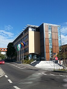
| Address of the district administration: |
Eichthalstrasse 5 85560 Ebersberg |
| Website : | |
| District Administrator : | Robert Niedergesäß ( CSU ) |
| Location of the district of Ebersberg in Bavaria | |
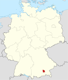
The district of Ebersberg is located east of Munich in the administrative district of Upper Bavaria . With an area of 549.36 square kilometers, it is one of the smaller districts in Germany, but with 143,700 inhabitants and 261 inhabitants per square kilometer, it has an above-average population density. The seat of the district administration is the city of Ebersberg . The district is part of the Munich region and is located in the east of the Munich metropolitan region.
geography
location
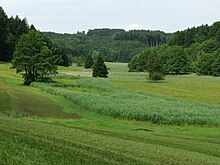
In the west, the district includes the Munich gravel plain with the Ebersberger Forest , one of the largest contiguous forest areas in southern Germany, in the north and northeast the Isen-Sempt hill country and in the south and east the Inn-Chiemsee hill country.
The district town of Ebersberg, which is one of the smaller of its kind in Germany, is located in the southeast of the district. In terms of population, it is only the fifth largest municipality in the district.
The district borders clockwise in the north, beginning with the districts of Erding , Mühldorf am Inn , Rosenheim and Munich . The northernmost point of the Ebersberg district is on the north bank of the Ismaninger reservoir . Access by land is, apart from the route over the dam, only possible via the area of the Erding district. The 2.8 hectare exclave of the Pliening community was created when the reservoir lake was flooded in 1928. It is part of a BMW test site and is not open to the public. In the west, the Ebersberg district extends over the A99 .
The highest point of the district lies in the area of the municipality of Egmating , on the border with the district of Munich and reaches 658 m above sea level. The lowest point is at 468 m on a sandbank of the Attel in Heumoos belonging to the municipality of Emmering , on the border with the district of Rosenheim.
Communities
(Residents on December 31, 2019)
- Ebersberg (12,193)
- Grafing near Munich (13,775)
- Glonn (5337)
- Kirchseeon (10,648)
- Market Swabia (13,818)
|
Other communities
|
Before the territorial reforms from 1971 to 1978, the district of Ebersberg had 29 municipalities (see list below). In 1900 there were two more. Ottenhofen was reclassified to the Erding District Office in 1928 and the municipality of Öxing was incorporated into Grafing near Munich in 1933 .
In the north the district bordered on the district of Erding , in the east on the district of Wasserburg am Inn , in the south on the district of Bad Aibling and in the west on the district of Munich .
|
The municipalities of the district of Ebersberg before the municipality reform in 1971/78 (the municipalities that still exist today are written in bold .) |
||
| former parish | today's parish | today's district |
|---|---|---|
| Anzing | Anzing | District of Ebersberg |
| Aßling | Aßling | District of Ebersberg |
| Bavaria | Bavaria | District of Ebersberg |
| Bruck | Bruck | District of Ebersberg |
| Ebersberg (town since 1954) | Ebersberg | District of Ebersberg |
| Egmating | Egmating | District of Ebersberg |
| Elkofen | Grafing near Munich | District of Ebersberg |
| Forstinning | Forstinning | District of Ebersberg |
| Frauenneuharting | Frauenneuharting | District of Ebersberg |
| Gelting | Pliening | District of Ebersberg |
| Glonn (market since 1901) | Glonn | District of Ebersberg |
|
Grafing near Munich (city since 1953; was called Markt Grafing until 1953) |
Grafing near Munich | District of Ebersberg |
| Hohenlinden | Hohenlinden | District of Ebersberg |
|
Kirchseeon (since 1959 Markt; the community was called Eglharting until 1939) |
Kirchseeon | District of Ebersberg |
| Lampferding | Tuntenhausen | Rosenheim district |
| Loitersdorf | Aßling | District of Ebersberg |
|
Markt Schwaben (market; until 1922 called Schwaben ) |
Market Swabia | District of Ebersberg |
| Moosach | Moosach | District of Ebersberg |
| Nettelkofen | Grafing near Munich | District of Ebersberg |
| Oberndorf | Ebersberg | District of Ebersberg |
| Oberpframmer | Oberpframmer | District of Ebersberg |
|
Parsdorf (the community has been called Vaterstetten since 1978) |
Vaterstetten | District of Ebersberg |
| Pliening | Pliening | District of Ebersberg |
| Poing | Poing | District of Ebersberg |
| Poering | Anger thing | District of Ebersberg |
|
Schalldorf (the community has been called Emmering since 1978) |
Emmering | District of Ebersberg |
| Steinhöring | Steinhöring | District of Ebersberg |
| Straussdorf | Grafing near Munich | District of Ebersberg |
| Anger thing | Anger thing | District of Ebersberg |
fauna and Flora
In the Atteltal there are remains of alluvial forests and largely natural side streams in which the brook mussel lives. The yellow lady's slipper can also be found here. The rare Bavarian spoonwort grows in the Kupferbachtal near Glonn, and the Siberian iris grows in the southeast of the district .
About 800 wild boars live in the Ebersberger Forst , the eponymous heraldic animal of the district. There are also deer as larger game .
There are also protected wetlands and moorland meadows in the northern, more densely populated district. White storks breed in Markt Schwaben and Forstinning .
Protected areas
In the southern district there are larger areas that are designated as Fauna-Flora-Habitat-Protected Areas (FFH). There are two nature reserves , eleven landscape protection areas , four FFH areas and at least 13 designated geotopes (as of April 2016). The bird sanctuary Eggelburger See , which is 75.6 hectares larger , was established in 1973. In 1983, the Kupferbachtal nature reserve near Unterlaus was added with 45.5 hectares.
population
Population development
| Population from 1840 to the present day | ||||
|---|---|---|---|---|
| year | Residents | |||
| 1840 | 17,863 | |||
| 1871 | 20,963 | |||
| 1900 | 24,926 | |||
| 1925 | 28,827 | |||
| 1939 | 30,805 | |||
| 1950 | 52,058 | |||
| 1961 | 55,458 | |||
| 1970 | 73,882 | |||
| 1987 | 96.283 | |||
| 2001 | 120,416 | |||
| 2005 | 123,895 | |||
| 2008 | 127.085 | |||
| 2009 | 127.907 | |||
| 2010 | 129.199 | |||
| 2011 | 1 128.870 | |||
| 2012 | 131.011 | |||
| 2013 | 133.007 | |||
| 2014 | 134,873 | |||
| 2015 | 137.421 | |||
| 2016 | 139.016 | |||
| 2017 | 140,800 | |||
From 1988 to 2008, the district of Ebersberg gained almost 29,000 inhabitants or grew by around 29%. Between 1988 and 2018, the district grew from 98,394 to 142,142 by 43,748 inhabitants or 44.5% - the third highest value of all Bavarian districts after Erding and Freising in the period mentioned.
The Federal Office for Building and Regional Planning starts from 145,000 inhabitants in 2025, according to their prognosis.
According to a study from 2015, the Ebersberg district office assumes 158,000 inhabitants in 2034. With a predicted population growth of 17.5%, the district of Ebersberg will be the fastest growing district in all of Bavaria . The original forecast predicted 143,000 residents in 2032 before increasing it to 150,000 residents for the same period in July 2014.
The regionalized population projection for Bavaria up to 2037 by the State Office for Statistics from 2018 predicts 159,100 inhabitants for 2037, which corresponds to an increase of 13.0% compared to 2017. The second highest percentage growth of all districts in Bavaria is expected for the district of Ebersberg.
foreign population
|
- ↑ The values from 2011 are still based on the value published before the 2011 census .
history
district Court
The area of today's district Ebersberg belongs to the old Bavarian areas. In 1803 the district court of Swabia (today Markt Schwaben ) was established. In 1812 the seat of the regional court was moved to Ebersberg and renamed accordingly.
District Office
The Ebersberg district office followed in 1862 the Ebersberg district court of the same area .
On July 1, 1928, the Ottenhofen community was separated from the Ebersberg district office and added to the Erding district office.
district
On January 1, 1939, the term “ Landkreis” was introduced throughout the empire , including for the Ebersberg district office.
As part of the regional reform in Bavaria , the district of Ebersberg was hardly changed on July 1, 1972, as it already had an efficient structure for the Munich region due to its residential and local recreational function. The community of Sankt Christoph from the dissolved district of Wasserburg am Inn , which was incorporated into Steinhöring , joined the district.
Again and again, the south of the district was particularly affected by flooding. In 1899, according to the chroniclers, the Kupferbach turned its surroundings into a "water desert". Further floods followed in 1937, 1946 and 1954. In August 2002, the municipalities of Glonn and Moosach were particularly hard hit. Since then, the protective measures have been intensified, so that the floods of June 2013 were comparatively mild.
badges and flags
| Blazon : "In silver on a green three-mountain, a striding, gold-armored black boar, behind which a green fir with 29 branches grows." | |
| Justification of the coat of arms: The boar and the mountain form the name "Ebersberg" (origin probably from "Burg einer Eberhart", documented mention in the 10th century as "Eberesperch"). The fir symbolizes the Ebersberg forest, the 29 branches of the fir indicate the original 29 communities in the district. |
The county flag is horizontally split in two in green and white, with the coat of arms in the center.
politics
District council
The district council elected on March 15, 2020 consists of 60 members. The CSU lost one seat and is represented with 24 seats, the biggest winner is the Greens with 15 seats (+5). The SPD lost 5 seats (now 6), the FW are also represented with six seats (−1). The AfD, FDP and BP are represented unchanged with 2 seats each, the ÖDP won one seat (now 2), the LINKE received one seat.
CSU and FDP form a common parliamentary group. The AfD lost a seat because a British candidate ran for it, who was not allowed to stand due to his lack of EU citizenship.
District Administrator
In the last regular election of the district administrator on March 15, 2020 , incumbent Robert Niedergesäß (CSU) won with 60.90% of the vote. He competed against four opponents.
| District Administrator | Term of office | |
|---|---|---|
| May 8, 1945–20. May 1945 | ||
| May 21, 1946-28. May 1952 | ||
| May 29, 1946-30. April 1952 | ||
| May 1, 1952-30. April 1978 | ||
| May 1, 1978-30. April 1994 | ||
| May 1, 1994-30. April 2002 | ||
| May 1, 2002–30. April 2013 | ||
| since May 1, 2013 | ||
economy
In the 2016 Future Atlas , the district of Ebersberg was ranked 20th out of 402 districts, municipal associations and urban districts in Germany, making it one of the regions with "very high future prospects". In the 2019 edition, it was 39th out of 401. In 2016, Ebersberg was the district with the sixth highest purchasing power per inhabitant (29,105 euros or 133% of the German average).
tourism
The district of Ebersberg is designated as an independent tourist region "Ebersberger Grünes Land" within Bavaria , which is advertised, among other things, with its own web presence.
traffic
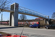
Coming from Munich, two railway lines pass through the Ebersberg district. The Munich – Rosenheim railway runs through the south and was operated by the Bavarian State Railway from 1871 onwards . Since 1899, the Grafing – Wasserburg railway , which is also known as the Filzenexpress , has branched off from this . The S 6 line of the Munich S-Bahn runs on the Munich – Grafing – Ebersberg connection . During rush hour, the S 4 line runs from Munich to Zorneding or Grafing Bahnhof . On the Munich – Grafing – Ebersberg – Wasserburg route, trains of the Südostbayernbahn usually run every hour. A second local line ran from 1894 from Grafing Bahnhof to Markt Glonn ( Grafing – Glonn line ). Passenger traffic has been idle here since 1970, the line has since been dismantled. The entire district is part of the Munich Transport and Tariff Association (MVV).
The Munich – Simbach line , which went into operation in 1871, runs through the north of the district with the Grub and Poing S-Bahn stations and the Markt Schwaben train station . A branch line to Erding has been branching here since 1872 , on which the S 2 S-Bahn line operates today. On the Munich – Simbach route, regional trains of the Südostbayernbahn run every hour from Munich to Mühldorf.
The A 99 , which forms the eastern bypass of the state capital Munich, runs along the western border of the district . The A 94 Munich – Passau runs between Ebersberger Forst and Markt Schwaben . This is where the B 12 begins at Forstinning and runs over Hohenlinden towards Haag . The airport tangent east (FTO) begins on the A 94 south-east of Poing and leads to Munich Airport in the neighboring district of Erding. Coming from Munich, the B 304 runs south of the Ebersberger Forst in the direction of Wasserburg am Inn. These long-distance roads are particularly heavily used by rush hour traffic to Munich, as they are used a lot by commuters from eastern Upper Bavaria.
License Plate
On July 1, 1956, the district was assigned the distinctive sign EBE when the vehicle registration number that is still valid today was introduced . It is still issued today.
literature
- Series of publications on districts and independent cities in Bavaria, "Our district of Ebersberg", published in cooperation with the Bavarian state institute for political education and the district of Ebersberg, 1993, ISBN 3-87052-531-2
- Yearbooks of the historical association Ebersberg
Web links
- Official website
- Historical association for the district of Ebersberg eV
- Literature from and about the district of Ebersberg in the catalog of the German National Library
- Entry on the coat of arms of the district of Ebersberg in the database of the House of Bavarian History
Individual evidence
- ↑ "Data 2" sheet, Statistical Report A1200C 202041 Population of the municipalities, districts and administrative districts 1st quarter 2020 (population based on the 2011 census) ( help ).
- ↑ Valentin Tischer: Extreme Point North: The BMW enclave behind barbed wire. In: Süddeutsche Zeitung, April 22, 2019, accessed on April 24, 2019.
- ↑ Valentin Tischer: When Napoleon fought in the Wild West of Ebersberg. In: Süddeutsche Zeitung, April 23, 2019, accessed on April 25, 2019.
- ^ Daniela Gorgs: The highest point in the district of Ebersberg. In: Süddeutsche Zeitung, April 25, 2019, accessed on April 26, 2019.
- ↑ Johanna Feckl: The lowest point in the district is on a sandbank. In: Süddeutsche Zeitung, April 29, 2019, accessed on April 30, 2019.
- ↑ "Data 2" sheet, Statistical Report A1200C 202041 Population of the municipalities, districts and administrative districts 1st quarter 2020 (population based on the 2011 census) ( help ).
- ^ Michael Rademacher: German administrative history from the unification of the empire in 1871 to the reunification in 1990. Ebersberg district. (Online material for the dissertation, Osnabrück 2006).
- ↑ BayernViewer of the Bavarian Surveying Administration
- ↑ Green List, Nature Reserves , accessed on January 1, 2015.
- ^ [1] Süddeutsche.de, September 2, 2011. Retrieved October 30, 2015.
- ↑ [2] Süddeutsche.de, December 10, 2015. Retrieved December 16, 2015.
- ↑ [3] State Office for Statistics, December 28, 2018. Accessed December 30, 2018.
- ^ Wilhelm Volkert (ed.): Handbook of Bavarian offices, communities and courts 1799–1980 . CH Beck, Munich 1983, ISBN 3-406-09669-7 , p. 453 .
- ^ Wilhelm Volkert (ed.): Handbook of Bavarian offices, communities and courts 1799–1980 . CH Beck, Munich 1983, ISBN 3-406-09669-7 , p. 97 .
- ^ Ordinance on the reorganization of Bavaria into rural districts and independent cities of December 27, 1971
- ↑ Süddeutsche Zeitung: Mauern und Mulden , Ebersberg local section, p. R7, June 4, 2013
- ^ Entry on the coat of arms of the Ebersberg district in the database of the House of Bavarian History , accessed on September 5, 2017 .
- ^ Bögel, Wieland: Ebersberg: AfD loses seat in the district council due to Brexit. Retrieved May 12, 2020 .
- ↑ Future Atlas 2016. (No longer available online.) Archived from the original on October 2, 2017 ; accessed on March 24, 2018 .
- ↑ PROGNOS future atlas. Handelsblatt, accessed on December 10, 2019 .
- ↑ GfK Purchasing Power Germany 2016. January 13, 2017, accessed on March 24, 2018 .
- ↑ Bavarian State Office for Statistics : Tourism regions in Bavaria Status: January 1, 2017, online at statistik.bayern.de
- ↑ Web presence for "Ebersberger Grünes Land" , set up by "Tourismus Oberbayern München eV" , online at oberbayern.de


