
Bad Aibling district
| coat of arms | Germany map |
|---|---|

|

Coordinates: 47 ° 52 ' N , 12 ° 1' E |
| Basic data (as of 1972) | |
| Existing period: | 1900-1972 |
| State : | Bavaria |
| Administrative region : | Upper Bavaria |
| Administrative headquarters : | Bad Aibling |
| Area : | 334.38 km 2 |
| Residents: | 50,100 (Dec. 31, 1971) |
| Population density : | 150 inhabitants per km 2 |
| License plate : | AIB |
| Circle key : | 09 1 33 |
| Circle structure: | 22 municipalities |
| Address of the district administration: |
8202 Bad Aibling |
| Location of the Bad Aibling district in Bavaria | |
  |
|

The Bad Aibling district was a district in Upper Bavaria . Most of the area today belongs to the Rosenheim district .
geography
location
The district covered most of the Mangfall valley .
Important places
The most important places were the cities of Bad Aibling and Kolbermoor , the market Bruckmühl and the communities of Bad Feilnbach , Großkarolinenfeld and Tuntenhausen .
Neighboring areas
In 1972 the district bordered clockwise in the north, beginning with the districts of Ebersberg and Rosenheim , the independent city of Rosenheim and the districts of Miesbach , Wolfratshausen and Munich .
history
district Court
The area of the former Bad Aibling district is largely identical to the Bavarian Sundergau . After centuries of existence, first as the Bailiwick of Aibling , later as the nursing court and from 1803 as the Aibling district court , the regional body was initially dissolved in 1806 and subordinated to the re-established Rosenheim district court , which in turn was dissolved in 1803 and affiliated to the Aibling district court.
District Office
On January 1, 1900, was district office trout from the 22 municipalities of the company founded in 1862 District Office Rosenheim formed the jurisdiction of the trout District Court heard.
district
On January 1, 1939, as everywhere in the German Reich, the designation district was introduced. This is how the district office became the Bad Aibling district.
On July 1, 1972, the Bad Aibling district was dissolved as part of the Bavarian regional reform. The largest part (95%) of the district area became part of the new district of Rosenheim , only the municipality of Helfendorf (today part of the municipality of Aying ) and the community-free area Hofoldinger Forst-Süd (part of the former community-free area Hofoldinger Forst ) were incorporated into the district of Munich .
Population development
| date | Pop. |
|---|---|
| Dec. 1, 1900 | 21,952 |
| Dec. 1, 1910 | 24,939 |
| 1925 | 27,397 |
| 1933 | 28,357 |
| 1939 | 29,901 |
| 1950 | 45,035 |
| 1960 | 42,600 |
| June 6, 1961 | 42,612 |
| May 27, 1970 | 48,295 |
| Dec 31, 1971 | 50,100 |
coat of arms
The coat of arms of the former Bad Aibling district shows the Bavarian diamonds in the upper part . The lower two thirds bear the sword on a red background as a symbol for the imperial possessions on the Aiblinger Hofberg, the bishop's staff, which symbolizes the Benedictine monastery Tegernsee and the Augustinian monastery Beyharting , and a moor piston to illustrate the natural features of the former, which are characterized by larger moor areas District.
Economy and Infrastructure
The cultivated area is mainly used for animal husbandry and fruit growing. Larger industrial companies are located in Kolbermoor and Bruckmühl. Large spa and rehabilitation facilities are located in Bad Aibling and Bad Feilnbach. In Bad Aibling there were also larger military facilities stationed until 2004, and secret service institutions can still be found today.
traffic
The Bad Aibling district was connected to the Mangfall Valley Railway from Holzkirchen to Rosenheim , a section of the Bavarian Maximilians Railway. Railway stations were in Westerham , Bruckmühl , Heufeld , Bad Aibling and Kolbermoor , additional stops in Heufeldmühle and Bad Aibling Kurpark.
A branch line from Westerham to Vagen and the local line Bad Aibling – Feilnbach with the stations Bad Aibling Lokalbahnhof, Dettendorf , Au bei Bad Aibling and Feilnbach and the stops Willing , Berbling and Lippertskirchen branched off the Mangfallbahn .
From 1871, part of the newly established direct connection from Munich to Rosenheim ran through the area of the district. Railway stations were in Großkarolinenfeld and Ostermünchen .
Since the 1930s, the Bad Aibling district has been crossed by the Autobahn 8 from Munich to Salzburg with junction 100 (Bad Aibling / Fischbachau / Bad Feilnbach).
Communities

Until the beginning of the Bavarian regional reform, the Bad Aibling district comprised 22 communities in the 1960s:
- Au near Bad Aibling to Bad Feilnbach
- Bad Aibling
- Bad Feilnbach
- Beyharting to Tuntenhausen
- Bruckmühl (until 1948 the municipality was called like the current district of Kirchdorf am Haunpold )
- Dettendorf to Bad Feilnbach
- Ellmosen to Bad Aibling
- Feldkirchen
- Götting zu Bruckmühl
- Großkarolinenfeld
- Helfendorf came to Aying (Munich district)
- Höhenrain to Feldkirchen-Westerham
- Holzham zu Bruckmühl
- Hohenthann to Tuntenhausen
- Kolbermoor
- Litzldorf to Bad Feilnbach
- Rent a ching to Bad Aibling
- Tattenhausen to Großkarolinenfeld
- Tuntenhausen
- Vagen to Feldkirchen-Westerham
- Wiechs to Bad Feilnbach
- Willing to Bad Aibling
After the municipal territorial reform, seven municipalities in the (then no longer existing) Altlandkreis Bad Aibling remained independent.
License Plate
On July 1, 1956, the district was assigned the AIB distinguishing mark when the vehicle registration number that is still valid today was introduced . It was issued until August 3, 1974. Since July 10, 2013 it has been available in the districts of Munich and Rosenheim due to the license plate liberalization .
See also
literature
- The Mangfallgau. Local history yearbook for the Bad Aibling district. Vol. 1, 1956 - Vol. 21, 2001, ZDB -ID 510200-5 .
- Klaus J. Schönmetzler: Mangfalltal. Bad Aibling and its landscape. Photos by Kurt Schubert and Klaus G. Förg. Edition Förg, Rosenheim 1995, ISBN 3-9803116-2-7 .

Sebastianikirche Bad Aibling

Inner Rosenheimer Strasse Bad Aibling
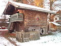
old house in Bruckmühl
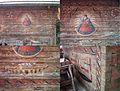
old house in Bruckmühl

Peat extraction between Bad Aibling and Bad Feilnbach


Web links
- History of the district
- Register of municipalities in the Bad Aibling district in 1945
- Directory of the administrative district of Upper Bavaria as of 1900
- Michael Rademacher: German administrative history from the unification of the empire in 1871 to the reunification in 1990. Data, statistics and election results. (Online material for the dissertation, Osnabrück 2006).
Individual evidence
- ↑ Locations directory of the Kingdom of Bavaria 1904
- ^ Wilhelm Volkert (ed.): Handbook of Bavarian offices, communities and courts 1799–1980 . CH Beck, Munich 1983, ISBN 3-406-09669-7 , p. 97 .
- ^ Federal Statistical Office (ed.): Historical municipality directory for the Federal Republic of Germany. Name, border and key number changes in municipalities, counties and administrative districts from May 27, 1970 to December 31, 1982 . W. Kohlhammer, Stuttgart / Mainz 1983, ISBN 3-17-003263-1 , p. 568 .
- ^ Official register of places for Bavaria 1964
Aichach | Alzenau i.UFr. | Amberg | Bad Aibling | Bad Neustadt adSaale | Bad Toelz | Beilngries | Berchtesgaden | Bow | Brückenau | Burglengenfeld | Dingolfing | Dinkelsbühl | Donauwörth | Ebermannstadt | Boars | Eggenfelden | Erlangen | Eschenbach idOPf. | Feuchtwangen | Friedberg | Feet | Gemünden a.Main | Gerolzhofen | Grafenau | Griesbach i.Rottal | Gunzenhausen | Hammelburg | Hassfurt | Hersbruck | Hilpoltstein | Höchstadt adAisch | Hofheim i.UFr. | Illertissen | Ingolstadt | Karlstadt | Kaufbeuren | Kemnath | Kempten (Allgäu) | Königshofen i.Grabfeld | Kötzting | Krumbach (Swabia) | Landau adIsar | Lauf adPegnitz | Running | Lohr a.Main | Mainburg | Mallersdorf | Marktheidenfeld | Marktoberdorf | Mellrichstadt | Memmingen | Mindelheim | Münchberg | Nabburg | Naila | Neuburg adDonau | Neunburg vorm Wald | Neustadt adAisch | Nordlingen | Nuremberg | Obernburg am Main | Oberviechtach | Ochsenfurt | Parsberg | Pegnitz | Parish churches | Rehau | Riedenburg | Roding | Rothenburg ob der Tauber | Rottenburg adLaaber | Scheinfeld | Schongau | Schrobenhausen | Schwabach | Schwabmünchen | Sonthofen | Stadtsteinach | Staffelstein | Straubing | Sulzbach-Rosenberg | Uffenheim | Viechtach | Vilsbiburg | Vilshofen | Vohenstrauss | Waldmünchen | Wasserburg a.Inn | Wegscheid | Weilheim i.OB | Weißenburg i.Bay. | Wertingen | Wolfratshausen | Wolfstein
1939–1945 affiliated districts: Bergreichenstein | Eisenstein market | Prachatitz