
Mainburg district
| coat of arms | Germany map | |
|---|---|---|

|
Coordinates: 48 ° 39 ' N , 11 ° 47' E |
|
| Basic data (as of 1972) | ||
| Existing period: | 1901-1972 | |
| State : | Bavaria | |
| Administrative region : | Lower Bavaria | |
| Administrative headquarters : | Mainburg | |
| Area : | 308.08 km 2 | |
| Residents: | 22,062 (May 27, 1970) | |
| Population density : | 72 inhabitants per km 2 | |
| License plate : | MAY | |
| Circle key : | 09 2 41 | |
| Circle structure: | 36 municipalities | |
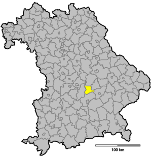
| Location of the Mainburg district in Bavaria | ||
  |
||

The district of Mainburg was part of the Bavarian administrative district of Lower Bavaria . Before the start of the Bavarian regional reform in the early 1970s, the district comprised 36 communities.
geography
Important places
The most populous places were Mainburg , Au in der Hallertau , Aiglsbach and Volkenschwand .
Neighboring areas
In 1972 the district bordered clockwise in the north, starting with the districts of Kelheim , Rottenburg an der Laaber , Landshut , Freising and Pfaffenhofen an der Ilm .
history
District Office
In 1857 the Mainburg Regional Court was formed from 17 municipalities of the Abensberg Regional Court , 15 municipalities of the Moosburg Regional Court and four municipalities of the Pfaffenhofen adIlm Regional Court , which five years later, in 1862, with the separation of the administrative and legal tasks of the Regional Courts in Bavaria, became part of the District Office Rottenburg an der Laaber was.
In 1901, the area of the former Mainburg district court became a separate district office through a spin-off from the Rottenburg an der Laaber district office .
district
On January 1, 1939, the uniform imperial designation Landkreis was introduced. The district office of Mainburg became the district office.
On July 1, 1972, the Mainburg district was dissolved as part of the regional reform in Bavaria :
- the city of Mainburg and the communities of Aiglsbach , Appersdorf , Attenhofen , Berghausen , Ebrantshausen , Großgundertshausen , Holzmannshausen, Leibersdorf , Lindkirchen , Meilenhofen , Mitterstetten, Oberempfenbach, Oberpindhart , Oberwangenbach, Pötzmes , Ratzenhofen , Sandelzhausen , Steinbach , Volkenschwand and Walkertshofen came to the Land Lower Bavaria.
- The communities of Martinszell , Obermünchen and Obersüßbach came to the Landshut district in Lower Bavaria.
- The communities Au in der Hallertau , Berg , Enzelhausen , Grafendorf , Grünberg , Günzenhausen , Haslach , Osseltshausen , Osterwaal , Rudertshausen and Tegernbach came to the Freising district in Upper Bavaria .
- The community of Larsbach came to the district of Pfaffenhofen an der Ilm in Upper Bavaria.
Population development
| year | Residents | source |
|---|---|---|
| 1910 | 17,766 | |
| 1925 | 18,088 | |
| 1939 | 18.306 | |
| 1950 | 25,852 | |
| 1960 | 20,900 | |
| 1971 | 22,300 |
Communities
Before the start of the Bavarian regional reform, the Mainburg district comprised 36 communities in the 1960s. The churches that still exist today are written in bold :
License Plate
On July 1, 1956, the district was assigned the distinctive sign MAI when the vehicle registration number that is still valid today was introduced . It was issued until April 28, 1973. Since July 10, 2013, due to the license plate liberalization , it has been available again in the Kelheim district, and since July 25, 2014 also in the Landshut district.
Individual evidence
- ^ Official register of places for Bavaria 1964
- ^ Wilhelm Volkert (ed.): Handbook of Bavarian offices, communities and courts 1799–1980 . CH Beck, Munich 1983, ISBN 3-406-09669-7 , p. 97 .
- ^ Federal Statistical Office (ed.): Historical municipality directory for the Federal Republic of Germany. Name, border and key number changes in municipalities, counties and administrative districts from May 27, 1970 to December 31, 1982 . W. Kohlhammer, Stuttgart / Mainz 1983, ISBN 3-17-003263-1 , p. 618 .
- ^ Wilhelm Volkert (ed.): Handbook of Bavarian offices, communities and courts 1799–1980 . CH Beck, Munich 1983, ISBN 3-406-09669-7 , p. 515 f .
- ↑ www.gemeindeververzeichnis.de
- ^ Localities directory for the Free State of Bavaria, based on the census of June 16, 1925
- ↑ Statistical Yearbook for the German Reich 1940
- ↑ Statistical Yearbook for the Federal Republic of Germany 1952
- ↑ Statistical Yearbook for the Federal Republic of Germany 1961
- ↑ Statistical Yearbook for the Federal Republic of Germany 1973
- ^ Official register of places for Bavaria 1964
- ↑ BayernViewer of the Bavarian Surveying Administration
Aichach | Alzenau i.UFr. | Amberg | Bad Aibling | Bad Neustadt adSaale | Bad Toelz | Beilngries | Berchtesgaden | Bow | Brückenau | Burglengenfeld | Dingolfing | Dinkelsbühl | Donauwörth | Ebermannstadt | Boars | Eggenfelden | Erlangen | Eschenbach idOPf. | Feuchtwangen | Friedberg | Feet | Gemünden a.Main | Gerolzhofen | Grafenau | Griesbach i.Rottal | Gunzenhausen | Hammelburg | Hassfurt | Hersbruck | Hilpoltstein | Höchstadt adAisch | Hofheim i.UFr. | Illertissen | Ingolstadt | Karlstadt | Kaufbeuren | Kemnath | Kempten (Allgäu) | Königshofen i.Grabfeld | Kötzting | Krumbach (Swabia) | Landau adIsar | Lauf adPegnitz | Running | Lohr a.Main | Mainburg | Mallersdorf | Marktheidenfeld | Marktoberdorf | Mellrichstadt | Memmingen | Mindelheim | Münchberg | Nabburg | Naila | Neuburg adDonau | Neunburg vorm Wald | Neustadt adAisch | Nordlingen | Nuremberg | Obernburg am Main | Oberviechtach | Ochsenfurt | Parsberg | Pegnitz | Parish churches | Rehau | Riedenburg | Roding | Rothenburg ob der Tauber | Rottenburg adLaaber | Scheinfeld | Schongau | Schrobenhausen | Schwabach | Schwabmünchen | Sonthofen | Stadtsteinach | Staffelstein | Straubing | Sulzbach-Rosenberg | Uffenheim | Viechtach | Vilsbiburg | Vilshofen | Vohenstrauss | Waldmünchen | Wasserburg a.Inn | Wegscheid | Weilheim i.OB | Weißenburg i.Bay. | Wertingen | Wolfratshausen | Wolfstein
1939–1945 affiliated districts: Bergreichenstein | Eisenstein market | Prachatitz