
Walkertshofen
| coat of arms | Germany map | |
|---|---|---|

|
Coordinates: 48 ° 14 ' N , 10 ° 35' E |
|
| Basic data | ||
| State : | Bavaria | |
| Administrative region : | Swabia | |
| County : | augsburg | |
| Management Community : | Perennials | |
| Height : | 550 m above sea level NHN | |
| Area : | 12.75 km 2 | |
| Residents: | 1092 (Dec. 31, 2019) | |
| Population density : | 86 inhabitants per km 2 | |
| Postal code : | 86877 | |
| Area code : | 08239 | |
| License plate : | A , SMÜ, WHO | |
| Community key : | 09 7 72 214 | |
| LOCODE : | DE WKH | |
| Community structure: | 5 parts of the community | |
| Address of the municipal administration: |
Hauptstrasse 28 86877 Walkertshofen |
|
| Website : | ||
| Mayoress : | Margit Jungwirth-Karl ( CSU ) | |
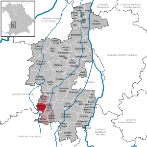
| Location of the municipality of Walkertshofen in the Augsburg district | ||
  |
||


Walkertshofen is a municipality in the Swabian district of Augsburg and a member of the Stauden administrative community based in Langenneufnach .
structure
The municipality has 5 officially named municipal parts (the type of settlement is given in brackets ):
- Gumpenweiler ( village )
- Hölden ( hamlet )
- Oberrothan (village)
- Schweizerhof ( wasteland )
- Walkertshofen ( parish village )
The wastelands of Ebrach and Reute are not officially named districts.
history
Until the church is planted
Walkertshofen was first mentioned in the year 775 - other sources speak of 784 - as part of a donation. A man named Helmker bequeathed his possessions in Singenbach , Ried near Markt Indersdorf and Walkertshofen to the church in this donation . Between 937 and 957 the revered as a saint exchanged Bishop Lampert the Freisinger owned in Walkertshofen to a noble called Papo. From 1099 a local aristocratic family "de Waltgershoven" can be traced, who had a fortified mansion in the village in the High Middle Ages , of which today only a castle stables are reminiscent. The Augsburg Cathedral Monastery acquired its first goods in the village at the end of the 14th century and had been the sole landlord since 1492. Since the Reichsdeputationshauptschluss of 1803 the place belongs to Bavaria. In the course of the administrative reforms in the Kingdom of Bavaria , today's municipality was created with the municipal edict of 1818 .
Population development
Between 1988 and 2018 the municipality grew from 868 to 1,076 by 208 inhabitants or 24%.
Incorporations
On April 1, 1971, parts of the area of the dissolved community of Habertsweiler were incorporated.
History of the parish
Ebrach
Ebrach used to be called Schlierbach. At the end of the 19th century the name Ebrach was brought into use.
Gumpenweiler
Gumpenweiler is first documented in the 12th century. The place name has its origin in the personal name Gumpo. Gumpenweiler was formerly called Günzenweiler and belonged to St. Moritz in Augsburg . According to a legend, there was a castle with jurisdiction in the village.
Hölden
The name Hölden describes a place that is located on the heap . In 1546 the place is mentioned as a dump with two houses. In 1603 he was part of Fugger's share in Langenneufnach . Around 1700 he came to Oberschönenfeld Monastery by exchange .
Oberrothan
1316 Oberrothan is mentioned as part of Seyfriedsberg . Oberrothan, Habertsweiler and the Bucherhof formed the political community of Habertsweiler until the regional reform in 1971 .
Tail
The name probably comes from clearing . In 1863 a firm butcher built the Einödhof.
Schweizerhof
Schweizerhof is first mentioned in 1481.
politics
Municipal council
Three nominations were submitted for the municipal council election on March 15, 2020. The turnout was 74.9%. The choice brought the following result:
| CSU / Free Citizens | 10 seats | (81.2%) | |
| Free voters | 2 seats | (16.2%) | |
| Independent citizens | 0 seats | (2.6%) |
Another member and chairwoman of the municipal council is the mayor. There were 2 nominations for election in March 2020. Ms. Margit Jungwirth-Karl (CSU / Free Citizens) was elected with 78.8%.
Architectural monuments

traffic
The Walkertshofen stop is on the Staudenbahn from Gessertshausen to Markt Wald, until 1983 on to Türkheim. The Deutsche Bundesbahn closed the line for passenger traffic in May 1991. The Staudenbahn is currently only operated in excursion and weekend traffic, the reactivation from Gessertshausen to Langenneufnach is in preparation. The historically valuable wooden agency building at the Walkertshof train station is still there today.
Web links
- Entry on the coat of arms of Walkertshofen in the database of the House of Bavarian History
- Walkertshofen: Official statistics of the LfStat (PDF; 1.23 MB)
Individual evidence
- ↑ "Data 2" sheet, Statistical Report A1200C 202041 Population of the municipalities, districts and administrative districts 1st quarter 2020 (population based on the 2011 census) ( help ).
- ^ Community Walkertshofen in the local database of the Bavarian State Library Online . Bavarian State Library, accessed on August 19, 2019.
- ^ Wilhelm Volkert (ed.): Handbook of Bavarian offices, communities and courts 1799–1980 . CH Beck, Munich 1983, ISBN 3-406-09669-7 , p. 569 .

Adelsried | Allmannshofen | Altenmünster | Aystetten | Biberbach | Bobingen | Bonstetten | Diedorf | Spelled shards | Ehingen | Ellgau | Emersacker | Fischach | Gablingen | Gersthofen | Gessertshausen | Dig | Großaitingen | Heretsried | Hiltenfingen | Horgau | Kleinaitingen | Klosterlechfeld | Koenigsbrunn | Kühlenthal | Kutzenhausen | Langenneufnach | Langerringen | Langweid am Lech | Meitingen | Mickhausen | Mittelneufnach | Neusäß | Nordendorf | Oberottmarshausen | Scherstetten | Schwabmünchen | Stadtbergen | Heads of animals | Untermeitingen | Ustersbach | Walkertshofen | Wehringen | Welden | Westendorf | Zusmarshausen
Unregulated areas: Schmellerforst