
Heretsried
| coat of arms | Germany map | |
|---|---|---|

|
Coordinates: 48 ° 28 ' N , 10 ° 44' E |
|
| Basic data | ||
| State : | Bavaria | |
| Administrative region : | Swabia | |
| County : | augsburg | |
| Management Community : | VG Welden | |
| Height : | 515 m above sea level NHN | |
| Area : | 17.31 km 2 | |
| Residents: | 1008 (Dec. 31, 2019) | |
| Population density : | 58 inhabitants per km 2 | |
| Postcodes : | 86465 (the same as Welden) | |
| Area code : | 08293 | |
| License plate : | A , SMÜ, WHO | |
| Community key : | 09 7 72 156 | |
| Community structure: | 3 parts of the community | |
| Address of the municipal administration: |
Rathausplatz 1 86465 (the same as Welden) Heretsried |
|
| Website : | ||
| Mayor : | Heinrich Jackle | |
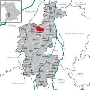
| Location of the municipality of Heretsried in the Augsburg district | ||
  |
||

Heretsried is a municipality in the Swabian district of Augsburg .
geography
location
The community is located about 15 kilometers northwest of Augsburg in the Holzwinkel of the Augsburg-Westliche Wälder Nature Park .
Parish parts
There are three officially named parts of the municipality (the type of settlement is given in brackets ):
- Heretsried ( parish village )
- Lauterbrunn ( Kirchdorf )
- Monburg ( hamlet )
history
Until the church is planted
Heretsried was first mentioned in writing in the 13th century; the community celebrated its 750th anniversary in 1992. It was owned by the Holzen Monastery for a long time and passed into secular ownership in 1600. In 1538 the first church was built in the village by order of the abbess Apollonia Wiedemann. In 1636, during the Thirty Years War , the village was burned down by the Swedes. According to one report, only six subjects were found in the village, more dead than alive. In 1722 a new church was built by the builder Hans Geörg Radmiller. Since the Reichsdeputationshauptschluss of 1803 the place belongs to Bavaria. In the course of the administrative reforms in the Kingdom of Bavaria , today's municipality was created with the municipal edict of 1818 .
Oddities
Heretsried does not have its own postcode but 86465 like Welden , as one of the few independent municipalities in Germany .
Furthermore, Heretsried does not have its own building yard , also as one of the few independent communities.
Incorporations
On May 1, 1978, the previously independent municipality of Lauterbrunn and the district of Monburg were incorporated into the dissolved municipality of Affaltern .
Population development
Between 1988 and 2018, the municipality grew from 942 to 990 by 48 inhabitants or 5.1%.
politics
The community is a member of the Welden administrative community .
Municipal council
In the local elections on March 15, 2020 , the two local groups of voters each received 50.0% of the vote. The municipal council consists of four members each from the Heretsried electoral community and the Lauterbrunn Free Voters' Association. In the 2014 to 2020 term of office, the municipal council still had twelve members due to the number of inhabitants; the two groups each provided six councilors.
mayor
Heinrich Jäckle (electoral group) has been mayor of Heretsried since 2014; he was confirmed in office for a further six years on March 15, 2020 with 92.3% of the votes. His predecessors were Josef Carteau (2008–2014) and Helmut Schuster (UWG).
coat of arms
|
|
Blazon : "In red a vertical, overturned golden sword, separated on the right by an inwardly turned silver abbess staff, on the left by an inwardly turned silver Reuthaue." |
Culture and sights
Architectural monuments

Other structures
Soil monuments
Web links
- Local government
- Heretsried: Official statistics of the LfStat (PDF; 1.2 MB)
Individual evidence
- ↑ "Data 2" sheet, Statistical Report A1200C 202041 Population of the municipalities, districts and administrative districts 1st quarter 2020 (population based on the 2011 census) ( help ).
- ↑ Municipal Council. Heretsried community, accessed on August 15, 2020 .
- ↑ Heretsried community in the local database of the Bavarian State Library Online . Bavarian State Library, accessed on August 20, 2019.
- ↑ Postcode 86465 • 2 places in the postcode area. Retrieved July 27, 2020 .
- ↑ Simone Kuchenbaur: Heretsried loses four councilors. Retrieved July 27, 2020 .
- ^ Federal Statistical Office (ed.): Historical municipality directory for the Federal Republic of Germany. Name, border and key number changes in municipalities, counties and administrative districts from May 27, 1970 to December 31, 1982 . W. Kohlhammer, Stuttgart / Mainz 1983, ISBN 3-17-003263-1 , p. 768 .
- ^ Entry on the Heretsried coat of arms in the database of the House of Bavarian History

Adelsried | Allmannshofen | Altenmünster | Aystetten | Biberbach | Bobingen | Bonstetten | Diedorf | Spelled shards | Ehingen | Ellgau | Emersacker | Fischach | Gablingen | Gersthofen | Gessertshausen | Dig | Großaitingen | Heretsried | Hiltenfingen | Horgau | Kleinaitingen | Klosterlechfeld | Koenigsbrunn | Kühlenthal | Kutzenhausen | Langenneufnach | Langerringen | Langweid am Lech | Meitingen | Mickhausen | Mittelneufnach | Neusäß | Nordendorf | Oberottmarshausen | Scherstetten | Schwabmünchen | Stadtbergen | Heads of animals | Untermeitingen | Ustersbach | Walkertshofen | Wehringen | Welden | Westendorf | Zusmarshausen
Unregulated areas: Schmellerforst