
Ehingen (Augsburg district)
| coat of arms | Germany map | |
|---|---|---|
.svg)
|
Coordinates: 48 ° 36 ' N , 10 ° 48' E |
|
| Basic data | ||
| State : | Bavaria | |
| Administrative region : | Swabia | |
| County : | augsburg | |
| Management Community : | Nordendorf | |
| Height : | 443 m above sea level NHN | |
| Area : | 9.65 km 2 | |
| Residents: | 1110 (Dec. 31, 2019) | |
| Population density : | 115 inhabitants per km 2 | |
| Postal code : | 86678 | |
| Area code : | 08273 | |
| License plate : | A , SMÜ, WHO | |
| Community key : | 09 7 72 134 | |
| Community structure: | 2 parts of the community | |
| Address of the municipal administration: |
Main street 52 86678 Ehingen, Germany |
|
| Website : | ||
| Mayor : | Franz Schlögel ( Free Voters Bavaria ) | |
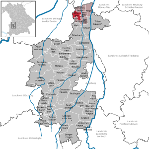
| Location of the municipality of Ehingen in the Augsburg district | ||
  |
||

Ehingen is a municipality in the Swabian district of Augsburg and a member of the Nordendorf administrative community .
geography
Geographical location
The community is located about 30 kilometers north of Augsburg in a side valley of the Schmutter , surrounded by the foothills of the Swabian-Bavarian plateau.
Parish parts
The community is composed of the main town and parish village Ehingen and the village Ortlfingen .
history
Until the church is planted
Ehingen was the seat of a local noble family, the Lords of Ehingen, who were the greatest landlords in today's municipality in the 13th and 14th centuries. In 1315, Ludwig the Bavarian gave Heinrich von Bocksberg patronage over the church. The feudal rights remained with the Wittelsbachers until they came to the Benediktbeuern monastery in 1392 . Since the Reichsdeputationshauptschluss of 1803 the place belongs to Bavaria. In the course of the administrative reforms in Bavaria , today's municipality was created with the municipal edict of 1818 . In 1972 she moved from the district of Wertingen to the district of Augsburg.
Incorporations
On May 1, 1978, the previously independent municipality of Ortlfingen was incorporated.
Population development
Between 1988 and 2018 the municipality grew from 841 to 1,068 by 227 inhabitants or by 27%.
politics
Municipal council
In the local elections on March 15, 2020 , only the impartial group of voters Ehingen-Ortlfingen submitted a list of applicants that will hold all twelve seats in the municipal council for the 2020 to 2026 term. The turnout was 63.4% (2014: 58.0%). In the previous term from 2014 to 2020, the electoral group had also received all twelve seats.
mayor
Franz Schlögel (impartial voter group Ehingen-Ortlfingen) has been mayor since May 2002; he was re-elected in 2008, 2014 and 2020 (89.5%).
badges and flags
Description of the coat of arms from 1962: "In silver a soaring blue unicorn, topped with a golden slanted left bar."
A white and blue flag with the municipality 's coat of arms is used as the unofficial municipal flag .
Architectural monuments
Web links
- Ehingen municipality
- Ehingen (Augsburg district): Official statistics of the LfStat (PDF; 1.23 MB)
Individual evidence
- ↑ "Data 2" sheet, Statistical Report A1200C 202041 Population of the municipalities, districts and administrative districts 1st quarter 2020 (population based on the 2011 census) ( help ).
- ↑ Municipal Council. Municipality of Ehingen, accessed on June 14, 2020 .
- ^ Community Ehingen in the local database of the Bayerische Landesbibliothek Online . Bavarian State Library, accessed on August 20, 2019.
- ^ Federal Statistical Office (ed.): Historical municipality directory for the Federal Republic of Germany. Name, border and key number changes in municipalities, counties and administrative districts from May 27, 1970 to December 31, 1982 . W. Kohlhammer, Stuttgart / Mainz 1983, ISBN 3-17-003263-1 , p. 767 .
- ^ Entry on the coat of arms of Ehingen (Augsburg district) in the database of the House of Bavarian History
- ↑ Entry on Ehingen on the website kommunalflaggen.eu

Adelsried | Allmannshofen | Altenmünster | Aystetten | Biberbach | Bobingen | Bonstetten | Diedorf | Spelled shards | Ehingen | Ellgau | Emersacker | Fischach | Gablingen | Gersthofen | Gessertshausen | Dig | Großaitingen | Heretsried | Hiltenfingen | Horgau | Kleinaitingen | Klosterlechfeld | Koenigsbrunn | Kühlenthal | Kutzenhausen | Langenneufnach | Langerringen | Langweid am Lech | Meitingen | Mickhausen | Mittelneufnach | Neusäß | Nordendorf | Oberottmarshausen | Scherstetten | Schwabmünchen | Stadtbergen | Heads of animals | Untermeitingen | Ustersbach | Walkertshofen | Wehringen | Welden | Westendorf | Zusmarshausen
Unregulated areas: Schmellerforst