
Klosterlechfeld
| coat of arms | Germany map | |
|---|---|---|

|
Coordinates: 48 ° 10 ′ N , 10 ° 50 ′ E |
|
| Basic data | ||
| State : | Bavaria | |
| Administrative region : | Swabia | |
| County : | augsburg | |
| Management Community : | Lechfeld | |
| Height : | 561 m above sea level NHN | |
| Area : | 2.36 km 2 | |
| Residents: | 2960 (Dec. 31, 2019) | |
| Population density : | 1254 inhabitants per km 2 | |
| Postal code : | 86836 | |
| Area code : | 08232 | |
| License plate : | A , SMÜ, WHO | |
| Community key : | 09 7 72 162 | |
| LOCODE : | DE KCF | |
| Address of the municipal administration: |
Bayernstrasse 1 86836 Klosterlechfeld |
|
| Website : | ||
| Mayor : | Rudolf Schneider (independent) | |
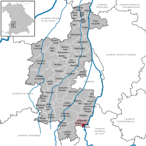
| Location of the municipality of Klosterlechfeld in the Augsburg district | ||
  |
||

Klosterlechfeld is a municipality in the Swabian district of Augsburg and a member of the Lechfeld administrative community based in Untermeitingen . The community is located in the Lechfeld south of Augsburg and north of Landsberg am Lech .
history
The present-day village of Klosterlechfeld emerged from the 17th century around the Lechfeld monastery and the associated pilgrimage church Maria Hilf . The pilgrimage goes back to a small chapel built in 1602 by Regina von Imhof , a landlady living in neighboring Untermeitingen , according to plans by the Augsburg city architect Elias Holl .
The Franciscan monastery, from 1624 hospice , from 1668 convent , initially belonged to the Strasbourg order province , from the 19th century to the Bavarian order province and accommodated up to 30 Franciscan friars. The pilgrimage church was gradually expanded and enlarged in the 17th century and essentially redesigned in the first half of the 18th century . It is still one of the most beautiful Rococo churches in the region. During the secularization of the monastery, the monastery first fell to the Teutonic Order , then in 1806 to the Kingdom of Bavaria . The Franciscan monastery remained uninterrupted, during the period of secularization as an extinction monastery , and then again as a full-fledged convent from 1830 . In 1993 the last Franciscans left the monastery, the monastery building was sold by the Free State to the Diocese of Augsburg and today houses the rooms of the parish "Maria Hilf" Klosterlechfeld, which has been independent since 1952 .
Over the years, mainly traders, shopkeepers and innkeepers settled around the pilgrimage church and the monastery to serve the needs of the pilgrims. This resulted in four annual markets during the summer, which gained national importance. The small hamlet belonged to the manorial estate of the Augsburg patrician family von Imhof, who were wealthy in Untermeitingen, and later to the rural community of Untermeitingen. On April 16, 1928, the community was Lechfeld as an independent municipality officially - to distinguish it from neighboring Lagerlechfeld in - Klosterlechfeld renamed. Since the municipal reform in 1972 , the municipality is again linked to the neighboring municipality of Untermeitingen in an administrative community.
Population development
Between 1988 and 2018 the municipality grew from 1,858 to 2,966 by 1,108 inhabitants or 59.6%.
politics
mayor
Rudolf Schneider has been mayor (independent) since 2014; he was confirmed in office on March 15, 2020 with a competitor with 70.8% of the votes.
Municipal council
The distribution of seats in the 14-member municipal council is as follows: ( 2014 local elections )
- CSU: 5 seats
- SPD: 3 seats
- VHF (Independent Klosterlechfelder Voting Association): 3 seats
- Free voters Bavaria Association: 2 seats
- GfK (jointly for Klosterlechfeld): 1 seat
Fractions in the municipal council:
- CSU - 5 seats
- SPD - 3 seats
- VHF - 3 seats
- FW / GfK - 3 seats
coat of arms
The description of the coat of arms reads: Split of red and silver, on it a split cross of St. Anthony in confused colors, accompanied by two six-pointed stars in the same colors.
Attractions
- Former Franciscan monastery with the baroque pilgrimage church Maria Hilf .

Pilgrimage Church of Maria Hilf

Interior view of the pilgrimage church Maria Hilf

Church sky of the pilgrimage church Maria Hilf

Calvary


- Kalvarienberg Klosterlechfeld : At the suggestion of Father Sebastian Höß, a calvary was built on the square opposite the pilgrimage church (since 1980 Franziskanerplatz). The builder of the complex (inauguration 1719) was August v. Voit.
- Natural monument "Alte Schachtel" south of the tennis and soccer fields. This rare heather area was declared a natural monument in May 1980. Footpaths all around open up the "Old Box" for walkers.
Architectural monuments
Soil monuments
See: List of soil monuments in Klosterlechfeld
Individual evidence
- ↑ "Data 2" sheet, Statistical Report A1200C 202041 Population of the municipalities, districts and administrative districts 1st quarter 2020 (population based on the 2011 census) ( help ).
- ^ Wilhelm Volkert (ed.): Handbook of Bavarian offices, communities and courts 1799–1980 . CH Beck, Munich 1983, ISBN 3-406-09669-7 , p. 569 .
Web links
- Entry on the coat of arms of Klosterlechfeld in the database of the House of Bavarian History
- Klosterlechfeld: Official statistics of the LfStat (PDF; 1.23 MB)

Adelsried | Allmannshofen | Altenmünster | Aystetten | Biberbach | Bobingen | Bonstetten | Diedorf | Spelled shards | Ehingen | Ellgau | Emersacker | Fischach | Gablingen | Gersthofen | Gessertshausen | Dig | Großaitingen | Heretsried | Hiltenfingen | Horgau | Kleinaitingen | Klosterlechfeld | Koenigsbrunn | Kühlenthal | Kutzenhausen | Langenneufnach | Langerringen | Langweid am Lech | Meitingen | Mickhausen | Mittelneufnach | Neusäß | Nordendorf | Oberottmarshausen | Scherstetten | Schwabmünchen | Stadtbergen | Heads of animals | Untermeitingen | Ustersbach | Walkertshofen | Wehringen | Welden | Westendorf | Zusmarshausen
Unregulated areas: Schmellerforst