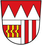
District of Karlstadt
| coat of arms | Germany map | |
|---|---|---|

|
Coordinates: 49 ° 58 ' N , 9 ° 46' E |
|
| Basic data (as of 1972) | ||
| Existing period: | 1862-1972 | |
| State : | Bavaria | |
| Administrative region : | Lower Franconia | |
| Administrative headquarters : | Karlstadt | |
| Area : | 475.81 km 2 | |
| Residents: | 41,100 (Dec. 31, 1971) | |
| Population density : | 86 inhabitants per km 2 | |
| License plate : | KAR | |
| Circle key : | 09 6 42 | |
| Circle structure: | 47 parishes | |
| Address of the district administration: |
8782 Karlstadt | |
| Location of the Karlstadt district in Bavaria | ||
The district of Karlstadt was a district in the Bavarian administrative district of Lower Franconia .
geography
Starting in 1972, the district bordered clockwise in the north on the districts of Gemünden am Main , Hammelburg , Schweinfurt , Würzburg , Marktheidenfeld and Lohr am Main .
history
District Office
The district office of Karlstadt was formed in 1862 through the merger of the regional courts of the older order Arnstein and Karlstadt .
On March 10, 1871, the Karlstadt District Office ceded the Brebersdorf community to the Schweinfurt District Office .
On January 1, 1889, the Steinbach community moved to the Lohr am Main district office .
district
On January 1, 1939, the designation district was introduced as everywhere else in the German Reich . So the district office became the district of Karlstadt. At that time the district had 31,158 inhabitants.
On September 21, 1943, the Hammelburg district was enlarged to include the Bonnland community in the Karlstadt district. This was dissolved and incorporated into the Hammelburg army estate district. On April 1, 1949, it was spun off from the disbanded Hammelburg Army District of the Hammelburg district and re-established as an independent municipality in the Karlstadt district.
In the course of the regional reform, the district of Karlstadt was dissolved on July 1, 1972:
- The Gauaschach community came to the Bad Kissingen district together with the Bonnland community , which had already been resettled .
- The communities of Burghausen , Kaisten , Mühlhausen , Rütschenhausen , Schwemmelsbach and Wülfershausen came to the district of Schweinfurt .
- The communities of Erbshausen , Gramschatz , Hausen b. Arnstein , sacrificial tree and Rieden came to the district of Würzburg .
- All other municipalities were amalgamated with parts of the districts of Gemünden am Main , Lohr am Main and Marktheidenfeld to form the district of Main-Spessart (which was known as the district of Mittelmain until May 1, 1973 ). The district town was initially Lohr am Main , and from May 1, 1973 finally Karlstadt .
Population development
| year | Residents | source |
|---|---|---|
| 1864 | 29,390 | |
| 1885 | 29,879 | |
| 1900 | 30,020 | |
| 1910 | 30,688 | |
| 1925 | 31,255 | |
| 1939 | 31,371 | |
| 1950 | 41,742 | |
| 1960 | 39,400 | |
| 1971 | 41,100 |
Communities
By 1971, the Karlstadt district comprised 48 communities, including two towns and two markets. After Gambach was incorporated into the city of Karlstadt on December 1, 1971, the district still comprised 47 communities when it was dissolved.
|
Other communities
|
License Plate
On July 1, 1956, the district was assigned the distinctive sign KAR when the vehicle registration number that is still valid today was introduced . It was issued in the Main-Spessart district until February 11, 1979.
literature
- Hans Sponholz, Reinhold Hoeppner (Ed.): District of Karlstadt am Main. 110 years. Hoeppner, Munich / Assling / Obb. 1972.
Individual evidence
- ^ Wilhelm Volkert (ed.): Handbook of Bavarian offices, communities and courts 1799–1980 . CH Beck, Munich 1983, ISBN 3-406-09669-7 , p. 434 .
- ^ Wilhelm Volkert (ed.): Handbook of Bavarian offices, communities and courts 1799–1980 . CH Beck, Munich 1983, ISBN 3-406-09669-7 , p. 97 .
- ^ Ordinance on the reorganization of Bavaria into rural districts and independent cities of December 27, 1971.
- ^ Federal Statistical Office (ed.): Historical municipality directory for the Federal Republic of Germany. Name, border and key number changes in municipalities, counties and administrative districts from May 27, 1970 to December 31, 1982 . W. Kohlhammer, Stuttgart / Mainz 1983, ISBN 3-17-003263-1 , p. 746 and 762 .
- ^ Eugen Hartmann: Statistics of the Kingdom of Bavaria . Ed .: Royal Bavarian Statistical Bureau. Munich 1866, population of the district offices 1864, p. 106 ( digitized version ).
- ↑ Royal Bavarian Statistical Bureau (ed.): Localities directory of the Kingdom of Bavaria . Munich 1888, population figures of the district offices 1885 ( digitized ).
- ↑ a b www.gemeindeververzeichnis.de: Lower Franconia.
- ↑ for the Free State of Bavaria, according to the census of June 16, 1925.
- ↑ Statistical Yearbook for the German Reich 1940.
- ↑ Statistical Yearbook for the Federal Republic of Germany 1952.
- ↑ Statistical Yearbook for the Federal Republic of Germany 1961.
- ↑ Statistical Yearbook for the Federal Republic of Germany 1973.


