
Wilhelmsthal
| coat of arms | Germany map | |
|---|---|---|

|
Coordinates: 50 ° 19 ' N , 11 ° 22' E |
|
| Basic data | ||
| State : | Bavaria | |
| Administrative region : | Upper Franconia | |
| County : | Kronach | |
| Height : | 450 m above sea level NHN | |
| Area : | 42.92 km 2 | |
| Residents: | 3620 (Dec. 31, 2019) | |
| Population density : | 84 inhabitants per km 2 | |
| Postal code : | 96352 | |
| Area code : | 09260 | |
| License plate : | KC, SAN | |
| Community key : | 09 4 76 189 | |
| LOCODE : | DE 36T | |
| Community structure: | 40 districts | |
| Address of the municipal administration: |
Wöhrleite 1 96352 Wilhelmsthal |
|
| Website : | ||
| Mayoress : | Susanne Grebner ( SPD ) | |
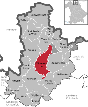
| Location of the community Wilhelmsthal in the district of Kronach | ||
  |
||


Wilhelmsthal is a municipality in the Upper Franconian district of Kronach in Bavaria .
geography
Geographical location
The community is located in the Franconian Forest Nature Park . The Grümpel and the Kremnitz flow through the municipality . When these brooks meet near the Fehnenschneidmühle (south of Wilhelmsthal), they form the Kronach River .
Parish parts
Wilhelmsthal has 40 officially named municipal parts.
|
history
Originally a medieval castle stood on a hill spur at the upper edge of the slope above the Grümpeltal. Wilhelm Gottfried von Marschall founded Wilhelmsthal in 1730, which bears his name when he sold lands on the southern slope of the Eichsberg to everyone who made an effort. In 1744 the place was parish after Lahm. In 1862 the rural community of Wilhelmsthal was incorporated into the newly created Bavarian district office of Kronach . In 1871 it had 767 inhabitants, of whom 764 were Catholics, and 92 residential buildings.
Incorporations
At the beginning of 1978 the community consisted of the parish village Wilhelmsthal and the village of Neuenbach, which was incorporated in the 1950s and previously belonged to Hesselbach. On May 1, 1978, the municipalities of Effelter, Hesselbach, Lahm and Steinberg and sheep farm were incorporated into the dissolved municipality of Neufang . Steinberg became the seat of the new municipal administration. Eibenberg on January 1, 1975, Gifting on January 1, 1977 and the village of Roßlach on January 1, 1978 were incorporated into the dissolved municipality of Steinberg.
Population development
In 1987 the community had 4,369 inhabitants. 30 years later, the number had dropped to 3,658.
politics
Municipal council
Wilhelmsthal has 16 municipal council seats, plus another one for the incumbent mayor. Susanne Grebner has been mayor since 2014. In the local elections on March 16, 2014 , the following distribution of seats resulted:
| 2014 | |
|---|---|
| CSU | 8th |
| SPD | 5 |
| UWG | 3 |
coat of arms
The coat of arms description reads: “Divided by blue and silver; above a striding golden lion, below two red sheep claws next to each other ”.
Partnerships
-
 Austria : Wilhelmsthal has a partnership with Heiligenkreuz in Burgenland .
Architectural monuments
The Catholic parish church of St. Josef was built in 1904/1905 in neo-Gothic style and consecrated on September 19, 1905. A parish was established in 1906. From 1999 to 2003 there was a general renovation and redesign of the equipment. The church is a hall building that is spanned by a gable roof, with a choir side tower and a sacristy extension. The church has a vaulted choir which , like the nave, is filled with struts all the way around. In 2004 Metzler Orgelbau from Dietikon installed a new organ with 20 registers on two manuals and a pedal .
In the list of architectural monuments in the Wilhelmsthal district , five architectural monuments are listed.
Individual evidence
- ↑ "Data 2" sheet, Statistical Report A1200C 202041 Population of the municipalities, districts and administrative districts 1st quarter 2020 (population based on the 2011 census) ( help ).
- ^ Wilhelmsthal in the local database of the Bayerische Landesbibliothek Online . Bavarian State Library
- ↑ Kgl. Statistical Bureau (ed.): Complete list of localities of the Kingdom of Bavaria. According to districts, administrative districts, court districts and municipalities, including parish, school and post office affiliation ... with an alphabetical general register containing the population according to the results of the census of December 1, 1875 . Adolf Ackermann, Munich 1877, 2nd section (population figures from 1871, cattle figures from 1873), Sp. 1065 , urn : nbn: de: bvb: 12-bsb00052489-4 ( digitized ).
- ^ Federal Statistical Office (ed.): Historical municipality directory for the Federal Republic of Germany. Name, border and key number changes in municipalities, counties and administrative districts from May 27, 1970 to December 31, 1982 . W. Kohlhammer GmbH, Stuttgart / Mainz 1983, ISBN 3-17-003263-1 , p. 690 and 691 .
- ^ Federal Statistical Office (ed.): Historical municipality directory for the Federal Republic of Germany. Name, border and key number changes in municipalities, counties and administrative districts from May 27, 1970 to December 31, 1982 . W. Kohlhammer GmbH, Stuttgart / Mainz 1983, ISBN 3-17-003263-1 , p. 689 and 690 .
- ↑ Bavarian State Office for Statistics and Data Processing (Ed.): Official local directory for Bavaria, territorial status: May 25, 1987 . Issue 450 of the articles on Bavaria's statistics. Munich November 1991, DNB 94240937X , p. 312 ( digitized version ).
- ↑ 2014 election results , wilhelmsthal.net, accessed on July 23, 2015 (PDF)
Web links
- Official website of the Wilhelmsthal community
- Entry on Wilhelmsthal's coat of arms in the database of the House of Bavarian History
- Wilhelmsthal: Official statistics of the LfStat (PDF; 1.66 MB)

Kronach | Küps | Ludwigsstadt | Marktrodach | Mitwitz | Nordhalben | Pressy | Reichenbach | Schneckenlohe | Steinbach am Wald | Stone meadows | Stockheim | Tettau | Teuschnitz | Tschirn | Wallenfels | Weißenbrunn | Wilhelmsthal
Unparished areas: Birnbaum | Langenbach Forest