Niederviehbach
| coat of arms | Germany map | |
|---|---|---|

|
Coordinates: 48 ° 37 ' N , 12 ° 23' E |
|
| Basic data | ||
| State : | Bavaria | |
| Administrative region : | Lower Bavaria | |
| County : | Dingolfing-Landau | |
| Height : | 392 m above sea level NHN | |
| Area : | 29.63 km 2 | |
| Residents: | 2642 (Dec. 31, 2019) | |
| Population density : | 89 inhabitants per km 2 | |
| Postal code : | 84183 | |
| Area code : | 08702 | |
| License plate : | DGF, LAN | |
| Community key : | 09 2 79 130 | |
| Address of the municipal administration: |
Schulstr. 1 84183 Niederviehbach |
|
| Website : | ||
| Mayor : | Johannes Birkner ( CSU ) | |
| Location of the community of Niederviehbach in the district of Dingolfing-Landau | ||
Niederviehbach is a municipality in the Lower Bavarian district of Dingolfing-Landau .
geography
location
Niederviehbach is located in the Landshut region. The area of the community of Niederviehbach essentially extends to the Viehbachtal with a portion in the Isar valley.
Community structure
Districts are the parish villages of Niederviehbach and Oberviehbach , the parish village of Süßbach , the villages of Hörglkofen , Lichtensee , Niederviehbacherau and Rothhaus , but also the hamlet with church Eschlbach , the hamlets of Gummering , Hinterkreuth , Lichtenseermoos , Schlott , Walperstetten , Wimpersing and Winterstetten as well as Wocka Castle the desert areas of Birnthal , Geltenhof , Hattenkofen , Höll , Mühlen , Reith , Schreg and Vorderkreuth .
Markings
There are two districts with Niederviehbach and Oberviehbach.
history
Until the 19th century
Niederviehbach belonged to the Niederviehbach monastery . Although the place was part of the Electorate of Bavaria , it formed a closed Hofmark , which was abolished in 1803 with the women's monastery. In the course of the administrative reforms in Bavaria , today's municipality was created with the municipal edict of 1818 . In 1847 Dominican women took over the buildings of the old monastery and built a boarding school for girls, which is now run as the St. Maria secondary school.
Incorporations
On April 1, 1971, Oberviehbach was incorporated into the community of Niederviehbach.
Administrative community
In the years 1978 and 1979 the community Niederviehbach formed together with the eastern neighboring community Loiching the administrative community Niederviehbach based in Niederviehbach. This administrative community was dissolved on January 1st, 1980 at the instigation of the Loiching community.
Population development
In the period from 1988 to 2018, the municipality grew from 1,998 to 2,611 by 613 inhabitants or by 30.7%.
- 1961: 1989 inhabitants
- 1970: 1940 inhabitants
- 1987: 1901 inhabitants
- 1991: 2012 inhabitants
- 1995: 2244 inhabitants
- 2000: 2375 inhabitants
- 2005: 2455 inhabitants
- 2010: 2499 inhabitants
- 2015: 2519 inhabitants
politics
mayor
The first mayor is Johannes Birkner (CSU), in office since March 21, 2019. His predecessor since May 1, 1990 was Josef Daffner (CSU), who died on December 6, 2018.
coat of arms
Blazon : In Green a thriving rising on silver side four mountain lion silver; behind a golden oblique wave bar emanating from the middle of the upper edge of the shield.
Explanation: In 1296, Count Berengar von Leonsberg founded an Augustinian monastery in Niederviehbach and transferred most of his property there to him. In the first half of the 14th century, the monastery acquired further property from the Lords of Eschlbach (community of Niederviehbach). Until secularization, the Klosterhofmark Niederviehbach with Eschlbach was the responsible lower court district for the area of today's municipality. Symbols from the coat of arms of the Counts of Leonberg (lion on Vierberg) and the Lords of Eschlbach (wave-diagonal bar) are particularly suitable for symbolizing local history. The latter figure also shows the place name base word “-bach”.
Culture and sights
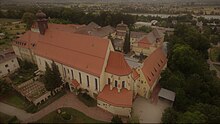
The former monastery church and current parish church of St. Maria has the consecration dates 1355 and 1388. In the years from 1670 to 1690 it was heavily modified by repairs to the nave and the expansion of the sacristy . The 38 meter long nave is divided into the lay church in the east and the sister church in the west. Several figures of saints and a stone Maria from around 1400 on the altars from 1755 and 1680 are significant from the interior , as is a late Romanesque crucifix from the second half of the 13th century.
Adjacent to the church are the medieval, Baroque-style east wing (today the parsonage) with the house chapel from 1233 and the monastery buildings built by Johann Michael Fischer from 1731 to 1733 , a long wing with three south wings. In 1785 the east wing was increased by one storey.
Architectural monuments
Economy and Infrastructure
Economy including agriculture and forestry
According to official statistics, there were four employees at the place of work in the field of agriculture and forestry, 52 in the manufacturing sector and 17 in the trade and transport sector. In other economic areas, 70 people were employed at the place of work subject to social security contributions. There were a total of 788 employees at the place of residence subject to social security contributions. There were none in the manufacturing sector and four in the construction sector. In addition, in 1999 there were 65 farms with an agricultural area of 1574 ha, of which 1375 ha were arable land.
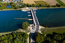
The Isar power plant of the same name is located in the Gummering district .
education
The community is well equipped with the educational facilities kindergarten (St. Georg), secondary school and the monastery secondary school St. Maria. The secondary school is run together with the Loiching community as a secondary school association. The primary school is in the neighboring municipality of Loiching and is supported as a school association by the municipalities of Loiching and Niederviehbach. In 1999 the following institutions existed:
- Kindergarten : 50 kindergarten places with 67 children
- Elementary school : one with 15 teachers and 231 students
- Realschule St. Maria of the Dominican nunnery in Niederviehbach (in the 2007/08 school year with 40 teachers and 660 students in 20 classes)
Infrastructure
The district road junction DGF 1 in east-west direction and DGF 4 in north-south direction through the middle of Niederviehbach ensure a smooth and safe flow of traffic. With the connection to the A92 Wörth / Isar in 4 km distance, a short connection to a supra-regional transport carrier is guaranteed.
Personalities
- Maria Renata Singer von Mossau (1679–1749), was a German victim of the witch hunt and nun and superior of the Unterzell monastery near Würzburg. She is considered the last Franconian victim of the witch hunt.
- Andreas Niedermayer (1835–1872), Catholic priest, historian and well-known writer.
Individual evidence
- ↑ "Data 2" sheet, Statistical Report A1200C 202041 Population of the municipalities, districts and administrative districts 1st quarter 2020 (population based on the 2011 census) ( help ).
- ^ Wilhelm Volkert (ed.): Handbook of Bavarian offices, communities and courts 1799–1980 . CH Beck, Munich 1983, ISBN 3-406-09669-7 , p. 447 .
- ↑ Werner Kohl: The development of our community 1971–1985. In: Community Loiching (Ed.): Festschrift for the 1100th anniversary of the community Loiching (885-1985). Loiching 1985, pp. 59-95.
- ↑ Mayor killed in serious accident
- ↑ a b House of Bavarian History - Bavaria's municipalities. Retrieved February 12, 2019 .
Web links
- Entry on the coat of arms of Niederviehbach in the database of the House of Bavarian History


