Viereth-Trunstadt
| coat of arms | Germany map | |
|---|---|---|

|
Coordinates: 49 ° 55 ' N , 10 ° 45' E |
|
| Basic data | ||
| State : | Bavaria | |
| Administrative region : | Upper Franconia | |
| County : | Bamberg | |
| Height : | 261 m above sea level NHN | |
| Area : | 15.83 km 2 | |
| Residents: | 3547 (Dec. 31, 2019) | |
| Population density : | 224 inhabitants per km 2 | |
| Postal code : | 96191 | |
| Area code : | 09503 | |
| License plate : | BA | |
| Community key : | 09 4 71 207 | |
| LOCODE : | DE VT9 | |
| Community structure: | 4 districts | |
| Address of the municipal administration: |
Weiherer Strasse 6 96191 Viereth-Trunstadt |
|
| Website : | ||
| Mayoress : | Regina Wohlpart (community of citizens) | |
| Location of the municipality of Viereth-Trunstadt in the Bamberg district | ||
Viereth-Trunstadt is a municipality in the Upper Franconian district of Bamberg and is located on the Main .
geography
location
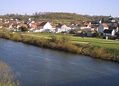
The community is located on the Main , about 10 km northwest of Bamberg . The federal highway 26 runs through the municipality in an east-west direction . In Viereth there is a junction to the north-running A 70 motorway (junction 13 Viereth-Trunstadt).
Neighboring communities
Neighboring communities are (starting from the north in a clockwise direction): Oberhaid , Bischberg , Lisberg , Priesendorf and Eltmann ( Haßberge district , Lower Franconia ).
Community structure
Viereth-Trunstadt is divided into four districts:
- Viereth (main town) with pond
- Trunstadt with Stückbrunn
Population numbers
| Part of the community | Dec 30, 2004 | June 30, 2008 | Dec 31, 2010 | Jan. 2, 2018 |
|---|---|---|---|---|
| Viereth | 1806 | 1824 | 1715 | 1764 |
| Trunstadt | 1728 | 1660 | 1583 | 1600 |
| Stückbrunn | 142 | 145 | 131 | 143 |
| Pond | 105 | 104 | 102 | 113 |
| Total community | 3781 | 3733 | 3531 | 3620 |
history
Until the church is planted
Viereth belonged to the Michelsberg Monastery of the Bamberg Monastery and thus from 1500 to the Franconian Empire . Since the Reichsdeputationshauptschluss of 1803 Viereth belongs like large parts of Franconia to Bavaria (see also history of Franconia ). Trunstadt, on the other hand, was owned by a von Rieneck family and only fell to Bavaria in 1806 with the Rhine Confederation Act . Today's community was created on May 1, 1978 when the community of Trunstadt was incorporated into the community of Viereth.
Administrative community and name change
From May 1, 1978 to January 1, 1980, the community was a member of the Bischberg administrative community. On July 1, 1980, the parish name Viereth was changed to Viereth-Trunstadt .
Population development
In the period from 1988 to 2018, the municipality grew from 2907 to 3554 by 647 inhabitants or by 22.3%.
| year | Residents | comment |
|---|---|---|
| 1961 | 1974 | As of June 6, 1961 (day of the census) |
| 1970 | 2262 | As of May 27, 1970 (Census Day) |
| 1987 | 2838 | As of May 25, 1987 (census day) |
| 1991 | 3120 | |
| 1995 | 3504 | |
| 2000 | 3613 | |
| 2005 | 3723 | As of June 30, 2005 |
| 2010 | 3531 | |
| 2015 | 3696 |
Unless otherwise stated, the reference date is December 31st.
religion
According to the census on May 9, 2011, 78.8% of the population are Roman Catholic and 9.3% Evangelical Lutheran. 11.9% have another religion or are non-denominational.
politics
mayor
Mayor has been Regina Wohlpart (Bürgergemeinschaft) since 2014, who received 58.70% of the votes in 2014 from an opposing candidate of the CSU and was re-elected in 2020 with 84.25% of the votes without opposing candidates. Her predecessor was Edwin Mahr (community of citizens / non-partisan voter community). Mahr was the successor to Johann Schmitt (Bürgergemeinschaft) in 2002 and re-elected in 2008 with 93.22% of the vote.
Municipal council
The local elections in 2002, 2008 , 2014 and 2020 led to the following allocation of seats in the local council:
| Party / group of voters | 2002 | 2008 | 2014 | 2020 |
|---|---|---|---|---|
| CSU -free voter community (2020: CSU) | 5 seats | 5 seats | 5 seats | 4 seats |
| Non-partisan voter community Viereth-Trunstadt | 4 seats | 4 seats | 4 seats | 5 seats |
| Civic community Viereth-Trunstadt | 4 seats | 3 seats | 4 seats | 3 seats |
| Independent voters Viereth-Trunstadt | 3 seats | 4 seats | 3 seats | 4 seats |
| total | 16 seats | 16 seats | 16 seats | 16 seats |
Architectural monuments
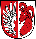
In addition to the monuments, there are smaller, privately created works of art, such as the mosaic municipal coat of arms in the Viereth roundabout. This was made by the regulars' table Viereth Hold'em for the 1100 year celebration.
Economy and Infrastructure
Economy including agriculture and forestry
The municipal tax receipts totaled 3.564 million euros in 2017, of which 1.172 million euros (net) were trade tax receipts and 2.018 million euros contribution to income tax.
In 1998, according to official statistics, there were six in the field of agriculture and forestry, 309 in the manufacturing sector and 64 in the trade and transport sector at the place of work. In other economic areas, 85 people were employed at the place of work subject to social security contributions. There were a total of 1,441 employees at the place of residence subject to social security contributions. There were ten companies in the manufacturing sector and seven in the construction sector. In addition, in 1999 there were 60 farms with an agricultural area of 736 hectares, of which 537 hectares were arable land and 194 hectares were permanent green areas.
Breweries
The Mainlust breweries in Viereth and Kundmüller in Weiher still exist in the municipality . The Berg-Bräu in Viereth existed until 1980 and the Schlossbräu in Trunstadt until 1972.
Voluntary fire brigades
There are the volunteer fire brigades Viereth, Weiher and Trunstadt-Stückbrunn.
education
In 2018 there were the following institutions:
- four day-care centers with 235 places and 212 children, 44 of them under three years of age
- an elementary school with 7 classes and 125 students
Individual evidence
- ↑ "Data 2" sheet, Statistical Report A1200C 202041 Population of the municipalities, districts and administrative districts 1st quarter 2020 (population based on the 2011 census) ( help ).
- ↑ http://www.bayerische-landesbibliothek-online.de/orte/ortssuche_action.html?val=1136&attr=590&modus=automat&tempus=20111101/234807&hodie=20111101/234807
- ↑ Johannes Neumann: The Reichsdeputationshauptschluss of 1803: Requirements and consequences (PDF file; 179 kB)
- ↑ a b Federal Statistical Office (ed.): Historical municipality register for the Federal Republic of Germany. Name, border and key number changes in municipalities, counties and administrative districts from May 27, 1970 to December 31, 1982 . W. Kohlhammer GmbH, Stuttgart / Mainz 1983, ISBN 3-17-003263-1 , p. 673 and 674 .
Web links
- Viereth-Trunstadt community
- Entry on the coat of arms of Viereth-Trunstadt in the database of the House of Bavarian History
- Viereth-Trunstadt: Official statistics of the LfStat (PDF; 1.24 MB)


