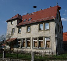
Kalteneggolsfeld
Kalteneggolsfeld (Franconian: Egelsfeld) is a village in Franconian Switzerland (district of the Markt Heiligenstadt i.OFr. ).
The place has about 141 inhabitants and belongs to the district of Bamberg . The district has an area of 418 hectares.
location
Kalteneggolsfeld is 520 meters above sea level, on the edge of the Long Mile .
history
The first documentary mention comes from the year 1276 when the widow Gertrud des Konrad von Ketschendorf donated all tithe to the cathedral monastery in the village of Egelsvelt, as well as other goods in Frankendorf and Stackendorf.
Surname
The pronunciation of the locals is simply Egelsfeld . This form also appears in the oldest documents and means field of Egil . The syllable cold , added later, expresses the harsh climate. It would be conceivable that they wanted to differentiate it from the warmer Eggolsheim in Regnitzgrund.
Modern times
The poor conditions after the First World War prompted the Bayreuth District President to visit the Jura villages of Dürrbrunn, Kalteneggolsfeld, Oberngrub, Teuchatz, etc. in May 1925. In his travelogue he stated:
“In general, the impression we got during our visits and meetings was not as unpleasant as we expected. It is undoubtedly an area in which economic operations are struggling with extremely difficult conditions; stony ground, high, rough location, far away from the train stations in the valley, no state roads at all, few district roads and poor, sometimes very steep communal and field paths, almost no opportunity to earn a living through commercial operations, factory work or daily wages; Little profitable forests, for the most part very poor water supply. What is most needed is the improvement of the paths and the improvement of the water supply. "
On May 1, 1978, the previously independent community was incorporated into the Heiligenstadt market in Upper Franconia.
Old descriptions
Geographical Lexicon (1799)
In Bundschuh's Geographical Lexicon from 1799, Kalteneggolsfeld is described as follows:
“Kaltenegelsfeld, Kalteneggolsfeld, Kaltengesfeld, Bambergisches Dorf im Amte Memmelsdorf, 2 hours from the royal seat of Bamberg, where the Amt Eggolsheim, the Count von Seinsheim and Freiherr v Stauffenberg have favorable feudal people. The centering exercises Memmelsdorf from-conclusive here on out. It parishes to Tiefenpölz, from which it is an hour away, which is why the Franciscans at Burg-dug usually administer the Sacra allda. The landscape is extremely bad and mountainous, the character of the subjects rough, the soil brittle and unproductive. "
Biedermann (1752)
In Biedermann's topographical description from 1752, Kalteneggolsfeld is described as follows:
“Kaltenegensfeld, a little village on the heights below the Memmelsdorf office, with a sheep farm, where the tenants were partly transferred to the bishopric, partly to Baron Schenk v. Stauffenberg into Grub Castle and partly to v. Step into Buttenheim Castle . The knights steer the Canton Gebürg and pastors together with the princely to the Catholic Church in Tiefenbelz. "
School job description (1914)
In a school job description by the teacher Hans Schmitt from 1914 it says:
“Kalteneggolsfeld, village with a Catholic population in a small depression on the Long Mile, 500 m above sea level, 31 houses, 32 families, 160 residents, parish Tiefenpölz, independent community, district office Bamberg 1, district court and rent office Bamberg, post office and gendarmerie posts are in Zeegendorf, train station is Heiligenstadt, doctor and pharmacy are 10 km away in Buttenheim, the ways there are sometimes very bad. The population does agriculture. The climate is very harsh, but healthy. Kalteneggolsfeld has two wells with good water. The groceries are difficult to come by because errands are rare. For unmarried teachers there is a cheap and appropriate lunch menu in the inn. "
chronology
- 1307: first documented mention
- 1978: Incorporation in Heiligenstadt
Attractions
Linden tree at the village fountain
Also called "millennial linden tree". The summer linden tree, protected as a natural monument (ND – No. 21) with a chest height circumference of 7.56 m (2017), is located in the south-western part of the village by the old village fountain, directly on the curve of the district road BA 13. The actual age of the monumental tree veteran is around 300 Years estimated.
This is next to the linden tree and the old village fountain
- Bus shelter oven
the village oven on the village square, which was transformed into a bus shelter
not far from it stands the
- Village chapel
the devotional building of the place called "Herz Maria"
Individual evidence
- ↑ a b c d Dieter Zöberlein: Community chronicle market Heiligenstadt i. OFr.
- ^ Federal Statistical Office (ed.): Historical municipality directory for the Federal Republic of Germany. Name, border and key number changes in municipalities, counties and administrative districts from May 27, 1970 to December 31, 1982 . W. Kohlhammer GmbH, Stuttgart and Mainz 1983, ISBN 3-17-003263-1 , p. 672 .
- ↑ Kalteneggolsfeld in the directory of monumental oaks . Retrieved August 12, 2020
- ↑ "Thousand-year-old linden tree in Kalteneggolsfeld" in the tree register at www.baumkunde.de
- ^ "Summer lime tree in the village on a meadow, Kalteneggolsfeld" in Monumental Trees at monumentaltrees.com
literature
- Dieter Zöberlein: Community chronicle Markt Heiligenstadt i. OFr. - Published on the occasion of the celebration of the 450th anniversary of the granting of market rights to Heiligenstadt i. OFr. - Heiligenstadt: 1995
Web links
Coordinates: 49 ° 51 ' N , 11 ° 7' E


