
Oberleinleiter

Oberleinleiter is a village in Franconian Switzerland and a district of the Markt Heiligenstadt in Upper Franconia in the Bamberg district .
geography
The predominantly Protestant village has 164 inhabitants (as of 2017) and is located on the upper reaches of the Leinleiter . The valley floor of the village is 386 meters above sea level. The landmark of the village is the 520-meter-high Kreuzstein rock, from which you have a panoramic view over the corridor to the villages of the Bamberg Jura.

View from the north
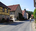
Thoroughfare

View from the south

Leinleiter near Oberleinleiter


history
Oberleinleiter was first mentioned in a document in 1343, when Dieterich Ohs (Ochs) at Obernlainlauter was selling goods in Dürrbrunn to canon Gunther von Aufseß in Bamberg.
Oberleinleiter himself was originally partially owned by the Streitbergers . About half went as a knightly fief from the Bamberg monastery to nobles and citizens. There was probably also a medieval hilltop castle in the village , on May 17, 1422, the Bishop of Bamberg awarded "1 Selde on the wall on the ditch, since the wild fire is sitting at this time" to Hiltpolt von Streitberg. The castle was already destroyed by this time, its place in the village is unknown. In addition, the early medieval ring wall Schwedenschanze is located north-north-west directly above the town . At the end of the German monarchy, the Lords of Stauffenberg were the local rulers .
On January 1, 1971, Oberleinleiter was incorporated into the Heiligenstadt market in Upper Franconia.
Old descriptions
Geographical Lexicon (1799)
In Bundschuh's Geographical Lexicon from 1799, Oberleinleiter is described as follows:
“Oberleinleiter, a village lying between two coarse hills, a quarter of an hour from Burggrub, which some time ago was completely thrown together by a downpour and drowned along with several cattle of different species 10 people.
The high jurisdiction belongs to the principality of Bamberg to the office Ebermannstadt It has different dominions. The baronial family Schenk v Stauffenberg exercised the village and community rule, however the lower jurisdiction exercised each rule on their domestic fief.
The place belongs to the Evangelical parish of Heiligenstadt and has quite a meadow ground, but mostly arable farming, although on mountainous hills, but quite good; Cattle fattening, also a sizeable sheep farm belonging to the Amt Streitberg. The religion is mixed up. The inhabitants feed themselves very well through the closure of produced grain. The shepherd's staff is between the principality of Bamberg, then the baronial Schenk v. Stauffenberg family still in dispute, but the tithe belongs to Burggrub. "
Josef Heller (1829)
The Bamberg private scholar Joseph Heller wrote in his description of the Muggendorfer Mountains in 1829:
“Oberleinleiter (Oberlahnlatter), Bambergisch, confessional mixed, is located in the valley on the Leinleiter, has 214 inhabitants; 2 mills, 2 inns, of which the upper one is highly recommended. On September 9, 1791, a downpour caused great damage there.
Nearby are strange: the origin of the linen ladder; the source, called the Tummler, and the Heroldstein mountain, on which a castle is said to have stood. "
economy

The Ott brewery with an output of around 8000 hectoliters per year is located in the village. This makes it one of the largest in the district.
literature
- Dieter Zöberlein: Community chronicle Markt Heiligenstadt i. OFr. - Published on the occasion of the celebration of the 450th anniversary of the granting of market rights to Heiligenstadt i. OFr. - Heiligenstadt: 1995.
Web links
Individual evidence
- ↑ a b c Dieter Zöberlein: Community chronicle market Heiligenstadt i. OFr.
- ↑ Dieter Zöberlein: The von Streitberg, story of a Franconian noble family , self-published, Burggrub 2018, part 2, pp. 309–321.
- ↑ Hellmut Kunstmann : The castles of north-western and northern Franconian Switzerland . Reprint of the 1972 edition. Commission publisher Degener & Co, Neustadt an der Aisch 2000, ISBN 3-7686-9265-5 , pp. 3-4.
- ^ Wilhelm Volkert (ed.): Handbook of Bavarian offices, communities and courts 1799–1980 . CH Beck, Munich 1983, ISBN 3-406-09669-7 , p. 451 .
.svg)
Brunn | Burggrub | Geisdorf | Greifenstein | Heroldsmühle | Herzogenreuth | Hohenpölz | Kalteneggolsfeld | Leidingshof | Lindach | Neudorf | Neumühle | Oberleinleiter | Oberngrub | Reckendorf | Siegritz | Stücht | Teuchatz | Tiefenpölz | Traindorf | Veilbronn | Volkmannsreuth | Zoggendorf
Coordinates: 49 ° 53 ' N , 11 ° 8' E