
Line ladder
|
Leinleiter Leinleiterbach |
||
 Run the line ladder |
||
| Data | ||
| Water code | DE : 242672 | |
| location |
Franconian Switzerland
|
|
| River system | Rhine | |
| Drain over | Wiesent → Regnitz → Main → Rhine → North Sea | |
| source | between Laibarös and Heroldsmühle , near Heiligenstadt -Oberleinleiter 49 ° 54 '18 " N , 11 ° 8' 33" O |
|
| Source height | approx. 475 m above sea level NN | |
| Spring discharge |
MQ |
20 l / s |
| muzzle | near Gasseldorf in the Wiesent coordinates: 49 ° 47 '24 " N , 11 ° 12' 3" E 49 ° 47 '24 " N , 11 ° 12' 3" E |
|
| Mouth height | 292.5 m above sea level NN | |
| Height difference | approx. 182.5 m | |
| Bottom slope | approx. 9.2 ‰ | |
| length | 19.9 km | |
| Catchment area | 97.01 km² | |
| Discharge at the level Untersteinleiter A Eo : 83.72 km² |
NNQ MNQ MQ Mq MHQ HHQ (2005) |
183 l / s 210 l / s 1.1 m³ / s 13.1 l / (s km²) 13.1 m³ / s 16 m³ / s |
| Communities | Heiligenstadt , Unterleinleiter , Ebermannstadt | |
The Leinleiter is a 20 km long river in Franconian Switzerland .
Surname
The Leinleiter gave its name to the villages of Oberleinleiter and Unterleinleiter . Both places are called Lada in the East Franconian dialect . There was also a lineage of "Leinleyter", which was probably named after one of the two localities.
The earliest mention of the name Leinleiter falls between the years 1076 and 1086. Name researchers interpret the river name Leinleiter as a clear stream , whereby the root word Lauter stands for louder (clear) water. This word also occurs in the name of the city of Kaiserslautern . The name researchers do not agree on the prefix Lein :
- Possibly it comes from the Celtic and means brook.
- Another interpretation sees flax in its meaning as flax that was grown there.
- Another possible interpretation goes back to the old Franconian word lei for rock (cf. Lorelei ).
geography
Leinleiterquelle

The continuously pouring Leinleiterquelle is north of the Heroldsmühle and southwest of the Heroldstein castle stable . It is designated as a natural monument. Karst water emerges from several individual springs along an approximately 40 m long basin. The mean flow rate is about 20 l / s. There are numerous other intermittent karst springs , so-called tumblers . After heavy rain , these springs can also flood the upper dry valley. The source of the Leinleiterquelle is limited by a concrete wall through which the source stream flows in a recess. The spring water is used at the Heroldsmühle for trout breeding.
course
The Leinleiter rises at a height of about 475 m above sea level. NHN between Laibarös and the Heroldsmühle near the village of Oberleinleiter, which belongs to the municipality of Heiligenstadt, in a glacial valley and finally flows out at an altitude of about 292.5 m above sea level. NHN near Gasseldorf from the right into the Wiesent .
Tributaries
Tributaries from the source to the mouth with length
- Feuerbach ( right ), 1.7 km
- Retschgraben ( right ), 1.2 km
- Plessenbach ( right ), 4.0 km
- Neumühlenbach ( left ), 1.6 km
- Schulmühlbach ( left ), 1.6 miles
- Mathelbach ( left ), 1.1 km
- Dürrbach ( right ), 3.0 km
Places along the Leinleiter
- Heroldsmühle
- Oberleinleiter
- Burggrub
- Zoggendorf
- Heiligenstadt i.OFr.
- Veilbronn
- Lower leash
- Gasseldorf
description
Johann Will (1692)
In an old description of the landscape Das Teutsche Paradeiß by Magister Johann Will from 1692, the area around the Leinleiter is described as follows:
- " The Leinleiter breaks out of the mountain under Hohen-Böltz so strongly that it can master the Herats and Obern-Lein people next to the two village mills, and it flows through Burggrub towards Zogendorff, Heilingstadt, Drandorf, Unterleinleuter and Geißeldorff into the Wiesent: At first she trincket a vested healing well, so that the little children should be good before the circling of the little children when they wash their diapers from its water; then a little river, like that from the village of Brunn an Reckendorff under Greiffenstein, and one like that from Obergrub Against one thing, so it falls down from Safeitz-Thal to Schulmühl towards Veilbrunn and a number of others. The landscape is still quite fertile. Otherwise there are many mountains in this area, among which the Greinen-, Eichel- and Eiferberg the others almost exaggerate. "
Gottlieb Zimmermann (1840)
In another report from the time of the discovery of Franconian Switzerland , Gottlieb Zimmermann describes a hiking route along the Leinleiter in 1840, where he first describes the path from Gügel near Scheßlitz :
- “From the Gügel we climb a forest path to the top of the mountains. The high-lying church village of Ludwag immediately catches our eye. We come to Herzogenreuth, and hike on the side road mentioned earlier, which is quite stony, over Tiefenpölz and Oberleinleither to the valley, after we have admired the Seigelstein, a grotesque rock mass, and refreshed ourselves in the latter place with a good drink at the host Hofmann . "
Zimmermann also mentions the tumblers between Laibarös and Heroldsmühle above the Leinleiterquelle:
- “We see the nearby, widely visible villages of Hohenpölz and Teuchaz. Between the first place and the Heroldsmühle are the so-called Tummler two remarkable springs, which only flow when it is raining continuously, but then burst out with tremendous noise and flood the upper part of the valley. "
- “From the mountain near Teuchaz, on which there is a chapel, you can enjoy a beautiful view of the Regnitz and Aisch valley areas. We hike in the valley of the Leinleiter surrounded by strangely shaped rocks that protrude over the deciduous wood of the mountains, to reach the mountain via Burggrub, where a Stauffenberg castle, Zoggendorf and the Neumühle near Heiligenstadt, on which the Greifenstein castle, a widely shining point in the area, rises. "
With the mention of the old name of Heiligenstadt , namely Hallstadt, Zimmermann shows that this place name has nothing to do with saints, but with the word Halde .
- "Heiligenstadt, also called the Lutheran Hallstadt, is a pretty market town in the valley, where travelers can find several and pretty good inns."
More than 150 years ago, the old lime tree avenue to Greifenstein Castle impressed visitors:
- “An avenue of lime trees, mixed with beeches, leads from the nearby Neumühle to the Greifenstein Castle, which is owned by Mr. Stauffenberg belongs to it. It lies at the height of the ridge in Franconian Switzerland, which stretches between the Leinleiter and the trout-rich Aufseeß and is called the Aufseeßer Gebirg.
- The castle is old-fashioned and offers a beautiful view from its upper windows. Its deep well is also remarkable. All around are the beautiful gardens, where the art and care of the gardener over the rough soil and the climate - because it is often quite cold here in May - won the day. Noteworthy are the greenhouses, the orangery, the summer salon, a rock corridor with the Vehmgericht, which, reminiscent of a tremendous time, should not be missing in a right knight's castle, a modern bowling alley, etc., a pleasure house on a rock that is adjacent to another connected by a chain bridge, an obelisk, and above all a Gothic chapel, which is admired for its seven stained glass windows. "
The path then continues via Veilbronn to Streitberg :
- “From Greifenstein we have two ways to get to Streitberg. Either we go, when we have descended to Heiligenstadt and have come to the beautifully situated Veilbrunn on Vicinalstrasse, from here via the Unterleinleiter through which the brook of the same name flows and which is below the long mile or we take a closer but less comfortable path, by climbing the hill to the left from Veilsbrunn and walking past the Störnhofe, in front of which there are three large cherry trees, on the mountainous area to Streitberg. "
Picture gallery

Source of Leinleiter at the Heroldsmühle

Source of Leinleiter at the Heroldsmühle

Heroldsmühle in the Leinleitertal

near Oberleinleiter
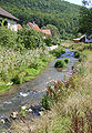
Line ladder in lower line ladder
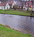
Leinleiter in Gasseldorf


See also
Web links
- Panoramic view from Kreuzstein into the Leinleitertal
- Karst phenomena and karst tectonics in the Upper Leinleitertal
Individual evidence
- ↑ a b List of brook and river areas in Bavaria - Main river area, page 56 of the Bavarian State Office for the Environment, as of 2016 (PDF; 3.3 MB)
- ↑ Bavarian flood news service (as of September 7, 2011)
- ↑ Self-measurement on the BayernAtlas
- ↑ a b Quoted from Dieter Zöberlein: Gemeindechronik Markt Heiligenstadt i. OFr. Published on the occasion of the celebration of the 450th anniversary of the granting of market rights to Heiligenstadt i. OFr. - Heiligenstadt: 1995