Brotjacklriegel
| Brotjacklriegel | ||
|---|---|---|
|
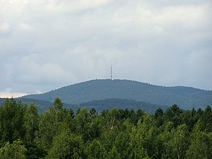
Image of the mountain from Rohrbach Reservoir from |
||
| height | 1011 m above sea level NHN | |
| location | District of Freyung-Grafenau , Bavaria ( Germany ) | |
| Mountains | Bavarian forest | |
| Dominance | 17 km | |
| Notch height | 216 m ↓ | |
| Coordinates | 48 ° 49 '1 " N , 13 ° 13' 3" E | |
|
|
||
| rock | Gneiss | |
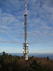
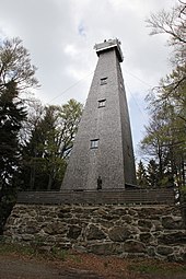
| particularities | Sender Brotjacklriegel , observation tower | |
The Brotjacklriegel is - seen from the Danube - with its 1011 m above sea level. NHN Höhe the first large mountain in the Bavarian Forest . The mountain is located in the Freyung-Grafenau district and is a landmark of the Sonnenwald region with the municipalities of Schöfweg , Zenting , Innernzell , Grattersdorf and the market Schöllnach .
There is a Brotjacklriegel on the television and radio broadcasting tower of the Bavarian Radio and a smaller observation tower of the Bavarian Forest Association .
The forecast according to the Brotjacklriegel its name to a baker, the bread-Jackl owe, located in the Thirty Years' War is said to have hidden on the mountain. The name probably came about later during surveying work by the French under Napoleon , when a misunderstanding of the Bavarian “Broada Jaga-Riegel” (broad hunter's bar) meant that Brotjacklriegel was written down.
As early as 1839 the priest and two innkeepers from Langfurth built the first observation tower there. In 1924 the current 27 m high construction was built on the mountain.
On the eastern slope of the mountain there are overgrown reading stone walls above Daxstein .
From the “Jackl” hiking car park above the village of Langfurth , the Sonnenwald adventure trail with ten stations, on which the forest and its inhabitants are depicted, leads for about two kilometers to the summit.
Individual evidence
- ↑ Dominances and celebrities according to Highrisepages.de ( Memento of the original from October 19, 2014 in the Internet Archive ) Info: The archive link was inserted automatically and has not yet been checked. Please check the original and archive link according to the instructions and then remove this notice. (here estimate)
- ↑ Federal Agency for Cartography and Geodesy , State Office for Surveying and Geoinformation Bavaria : Digital Topographic Map 1:10 000, BayernAtlas , accessed on March 23, 2014
- ↑ Nationalpark-FerienLand, Landratsamt Freyung-Grafenau on the adventure trail , accessed on June 4, 2014


