Grafling
| coat of arms | Germany map | |
|---|---|---|

|
Coordinates: 48 ° 54 ' N , 12 ° 59' E |
|
| Basic data | ||
| State : | Bavaria | |
| Administrative region : | Lower Bavaria | |
| County : | Deggendorf | |
| Height : | 433 m above sea level NHN | |
| Area : | 46.3 km 2 | |
| Residents: | 2771 (Dec. 31, 2019) | |
| Population density : | 60 inhabitants per km 2 | |
| Postal code : | 94539 | |
| Area code : | 0991 | |
| License plate : | DEG | |
| Community key : | 09 2 71 122 | |
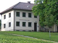
| Address of the municipal administration: |
Hauptstrasse 2 94539 Grafling |
|
| Website : | ||
| Mayor : | Anton Stettmer ( CSU ) | |
| Location of the municipality of Grafling in the district of Deggendorf | ||
Grafling is a municipality in the Deggendorf district in Lower Bavaria .
geography
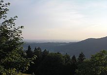
Grafling is located in the Danube Forest region . The lowest point is in Großtiefenbach at 326 m above sea level. NN. The highest elevations in the municipality are the Steinberg ( 999 m ), the Geißriegel ( 1043 m ), the Dreitannenriegel ( 1090 m ) and the Einödriegel ( 1121 m ) and close off the Graflinger Tal to the east. To the north, the valley is closed by the Hochberg ( 727 m ), to the west by the Butzen ( 775 m ) and Vogelsang ( 1022 m ) in the municipality of Bernrieds . To the south the valley opens towards Deggendorf to the Danube plain, the Gäuboden .
The geographical features include the large differences in altitude. While the main town is 546 m high, the difference in altitude in the Klein- and Großtiefenbach district is only 330 m , but the Rohrmünz district is 730 m high. Hochoberndorf is located at 775 m . This results in considerable climatic differences within the municipality: While spring has often already arrived in the lower areas, winter is still severe in the higher areas.
Community structure
There are 37 districts:
- Alberting
- Doctoring
- Bergern
- Burgholz
- Datting
- Diessenbach
- Eidsberg
- End bow
- Engelburgsried
- Giggenberg
- Grafling
- Großtiefenbach
- Grub
- Haidhof
- Hochoberndorf
- Hörpolding
- Dog jerk
- Kleintiefenbach
- Loderhart
- Mitterbühl
- Mitterhirschberg
- Mills
- Neumühlen
- Oberhirschberg
- Obersprechhausen
- Oberried
- Ottenberg
- Petraching
- Pipe coin
- Rohrmünzmühle
- Schwarzenberg
- Ulrichsberg
- Unterhirschberg
- Untersprechhausen
- Unterried
- Delusion
- Wühnried
The places Graßlingsberg , Mühlen-Siedlung and Neuwühn are not official districts.
Neighboring communities
The following municipalities border the municipality of Grafling (list from west to east):
North of the Regen district :
South of the Deggendorf district :
climate
Due to its location in Central Europe, Grafling is in the cool, temperate climate zone . The community lies in the transition area between the humid Atlantic and the dry continental climate .
Climate table
The following graphic shows the climate values of the Deggendorf district, which can only approximately apply to Grafling due to the large differences in altitude in the municipality:
|
Average temperature and precipitation values
Source: MSN Weather - Deggendorf, DEU
|
||||||||||||||||||||||||||||||||||||||||||||||||||||||||||||||||||||||||||||||||||||||||||||||||||||||||||||||||||||||||||||||||||||||||||||||||||||||
Snow chaos in winter 2005/06
The municipality of Grafling was particularly hard hit by the snow chaos in winter 2005/06, which led to the collapse of residential houses and agricultural buildings, especially in the higher parts of the village. Some isolated individual properties were no longer accessible for days. Only heavy clearing equipment from the THW and the Federal Police from Deggendorf were able to clear the snow-covered paths, since the snow masses could no longer be moved with clearing plows .
Because of this, on February 9, 2006, District Administrator Christian Bernreiter in the Deggendorf district issued the disaster alarm and only lifted it on February 14, 2006.
history
Until the church is planted
The Graflinger Valley was settled from the Metten Monastery , which was entrusted with the colonization of the Bavarian Forest in 790 AD. The Graflinger Valley was first mentioned in history in 805. In the period that followed, the Bavarian dukes opened up the valley. In 1253 the area fell under the rule of the Wittelsbach family . During the Thirty Years' War , the region and Grafling were raided and plundered several times. Numerous arson attacks took place during this time.
Grafling was part of the Straubing Rent Office and the Deggendorf Regional Court of the Electorate of Bavaria . In the course of the administrative reforms in Bavaria , the municipality was created with the municipal edict of 1818 .
Incorporations
The former municipalities of Alberting (1970: 346 inhabitants) and Hirschberg (1970: 480 inhabitants) were incorporated on January 1, 1972. Bergern (1970: 461 inhabitants) followed on May 1, 1978.
Population development
In the period from 1988 to 2018, the municipality grew from 2,582 to 2,795 by 213 inhabitants or 8.3%.
| year | 1900 | 1961 | 1970 | 1987 | 1991 | 1995 | 2000 | 2005 | 2010 | 2015 |
|---|---|---|---|---|---|---|---|---|---|---|
| Residents | 1809 | 2142 | 2413 | 2524 | 2759 | 2781 | 2790 | 2785 | 2728 | 2749 |
Population structure
In 2014 the proportion of seniors over 65 years of age was almost 17%, the proportion of minors was just over 17%. 51% of the population were female. Almost 94% of the residents were registered as having their primary residence in Grafling.
politics
Municipal council
The local elections of 2020 and earlier resulted in the following allocation of seats:
| CSU |
Free voters Grafling |
FWG Alberting |
Boy list |
FWG Bergern |
SPD | total | |
| 2020 | 5 | 4th | 3 | 2 | - | - | 14th |
| 2014 | 5 | 3 | 2 | 1 | 2 | 1 | 14th |
| 2008 | 4th | 3 | 1 | 1 | 2 | 3 | 14th |
| 2002 | 4th | 4th | 2 | - | 2 | 2 | 14th |
mayor
Anton Stettmer (CSU) has been the first mayor since May 2020. In the local elections on March 15, 2020 , he was elected with 58.34 percent in the first ballot.
Willibald Zißlsberger (CSU) held office before Stettmer. In 2002 he succeeded Hans Bügler ( FWG ), who, due to his retirement age, no longer ran for office after twelve years in office. In March 2008, Zißlsberger was re-elected without an opposing candidate, as was the case on March 16, 2014. Zißlsberger was the SPD mayor for the first eleven years of service, and in May 2013 he switched to the CSU. He did not stand for election in the 2020 local elections.
Finance 2013 and 2014
According to the plan, the administrative budget was € 3.38 million, the asset budget € 1.78 million. Debt remained constant in 2013 compared to 2012 at € 1.49 million, corresponding to € 543 per inhabitant. In 2014, the debt was reduced to € 1.12 million, corresponding to € 404 per inhabitant.
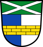
coat of arms
| Blazon : "Under the green head of the shield, inside a continuous silver St. Andrew's cross, split from blue and silver, covered with a bricked golden bar." | |
| Justification of the coat of arms: The coat of arms was approved by the government of Lower Bavaria on May 15, 1981. The Bavarian rulers and, as landowners, the Gotteszell Monastery were particularly significant for the history of the municipality. The split with the laid brick beam corresponds to the coat of arms of Gotteszell , whereby the originally red front field has been replaced by a blue field to indicate the lordly manorial rule in the municipal area administered by the Deggendorf caste office. The St. Andrew's cross in the shield head stands for the parish church of Grafling, which is dedicated to St. Andreas is consecrated. The green tinge symbolizes the geographic location of the municipality in the Bavarian Forest . |
Community partnerships
-
 : Grafling has had a partnership with the small Polish town of Pelplin since 2000 .
 -
 : Grafling entered into a partnership with the Czech municipality of Dolany in 2010.
Economy and Infrastructure
Economy including agriculture and forestry
In 1998, according to official statistics, there were no employees at the place of work in the manufacturing industry 76 and in the trade and transport sector. In other economic sectors this figure was 44 people. There were 977 employees subject to social security contributions at the place of residence. There was one in the manufacturing sector and four in the construction sector. In addition, in 1999 there were 108 farms with an agriculturally used area of 1010 ha, of which 134 ha were arable land and 875 ha were permanent green space.
On June 18, 2008, the business database of the district of Deggendorf identified 81 businesses for Grafling, most of which were active in the craft, forestry, gastronomic and hostel sectors.
traffic
Street
Grafling is crossed by Bundesstraße 11 (Europastraße 53) from Deggendorf to Bayerisch Eisenstein . For the Deggendorf-Grafling section, a 4.5 km route relocation and a three-lane expansion are planned; the traffic forecast for 2020 is 12,600 vehicles per day. Contrary to the previous intentions of the state building authority to expand the section of the B11 between the districts of Datting and Hochbühl into three lanes, this expansion is now only two lanes for nature conservation reasons.
The municipality is connected to the neighboring municipalities by bus lines from the Verkehrsgemeinschaft Landkreis Deggendorf .
rail
The Plattling – Bayerisch Eisenstein railway has crossed the municipality since 1877 . In doing so, it overcomes a double loop , the Ulrichsberger Doppelschleife, on the highest natural railway embankment in Germany and in two tunnels about 250 meters in altitude.
The municipality was originally developed through the Grafling train station. After the station lost its role as a passing point over time, the stop was abandoned in 1990 and the station building was later privatized. With the introduction of regular traffic at the end of 2003, a depot without platforms was built in the municipality, away from the settlement. Since after the abandonment of the Grafling station between the nearest stations Deggendorf Hbf and Gotteszell it was not possible to switch passengers on a 23 km route, the municipality tried for years to get a station again. It was only through the acceleration of train traffic that it became possible to set up an additional stop. On December 15, 2013, the community in the district of Arzting received a newly built stop below the B 11 road bridge over the railway line. It is accessed through a P + R car park set up by the municipality and is connected to the municipality by a footpath.
The Grafling-Arzting stop is served hourly by the Länderbahn with its Waldbahn brand .
The municipality of Grafling has particular problems due to the seven railway bridges, which passed into their possession in 1993 by law. These buildings (mostly listed and therefore without the possibility of demolition despite their lack of use) require financial expenditure in terms of renovation and maintenance that the municipality would like to use elsewhere.
education
There are the following facilities:
- Kindergarten: cath. Kindergarten St. Andreas Grafling (4 groups)
- School: one / two-class elementary school (until 2004 part of the main school)
Transmitters
Culture and sights
In addition to the Andreas chapel (built in 1475), which was integrated into the Grafling parish church, there is the St. Florian chapel in Wühn and the St. Ulrich church (built 1751) on Ulrichsberg .
The highest natural railway embankment in Germany is worth seeing for railway enthusiasts , on which the forest railway crosses the valley and connects the two loop loops. The so-called Kohlbach dam is 390 m long, 44 m high and 178 m wide. When it was built at the end of the 19th century, 524,000 m³ of mass had to be moved. The embankment is now a protected monument . Twice a year special trips are made on the route with historical steam locomotives .
Further architectural monuments and additional descriptions of the aforementioned are compiled in the list of architectural monuments in Grafling .
The many forest paths in the largely forested valley and on the slopes of the surrounding mountains allow for shady hikes even in midsummer. 14 hiking trails with a total of 100 km are currently signposted. There is an approximately two-kilometer nature trail with 15 stations between Grafling and Eidsberg.
Five mountain bike trails lead through the Graflinger area.
Soil monuments
See: List of ground monuments in Grafling
Honorary citizen
The community has appointed the following honorary citizens . They are listed chronologically according to the date of appointment:
- Josef Fischer (on April 22, 1997)
- Rudi Schaft (on March 13, 2002)
- Josef Ebner Sr. (on January 28, 2003)
- Siegfried Seitz (on February 22, 2004)
- Josef Gürster (on February 5, 2014)
- Hans Bügler (on April 15, 2014)
societies
28 clubs are registered in Grafling (as of 2015). These include four sports clubs , four rifle clubs, four church clubs and four volunteer fire brigades . The volunteer fire brigades are located in Grafling and in the districts of Alberting, Bergern and Hirschberg that were incorporated during the regional reform.
literature
- Betty Oberhofer: The Graflinger Valley in the Bavarian Forest . Landscape between Deggendorf and Vogelsang
- Albert Wilhelm: The snap taps send their regards . A history and story book from and about Grafling
- Church administration Grafling: Churches and chapels of the parish of St. Andreas Grafling
- Brigitte Spies-Kimmig: Christmas cookies from the Graflinger Valley
(All books are self-published by the Grafling municipal administration.)
Web links
Individual evidence
- ↑ "Data 2" sheet, Statistical Report A1200C 202041 Population of the municipalities, districts and administrative districts 1st quarter 2020 (population based on the 2011 census) ( help ).
- ↑ Bavarian State Library Online
- ^ Wilhelm Volkert (ed.): Handbook of Bavarian offices, communities and courts 1799–1980 . CH Beck, Munich 1983, ISBN 3-406-09669-7 , p. 444 .
- ^ Federal Statistical Office (ed.): Historical municipality directory for the Federal Republic of Germany. Name, border and key number changes in municipalities, counties and administrative districts from May 27, 1970 to December 31, 1982 . W. Kohlhammer GmbH, Stuttgart / Mainz 1983, ISBN 3-17-003263-1 , p. 605 .
- ↑ Figures and data from 2014. Grafling municipality, November 27, 2014, accessed on December 28, 2014 .
- ↑ Local council election & mayoral election in Grafling 2020 - candidates & results. In: Wahl.info. March 15, 2020, accessed May 2, 2020 .
- ^ Election result of March 15, 2020. wahl.info, March 16, 2020, accessed on March 16, 2020 .
- ↑ Deggendorfer Zeitung of May 7, 2013
- ↑ Deggendorfer Zeitung of May 4, 2013, page 31, budget without new debt
- ↑ a b c pö: Grafling lowers per capita debt to 404 euros. PNP , December 1, 2014, accessed May 10, 2020 .
- ^ Entry on the Grafling coat of arms in the database of the House of Bavarian History , accessed on September 6, 2017 .
- ^ Municipality of Grafling 2006, page 10: Description of coat of arms.
- ↑ Dolany fire service partnership. Grafling municipality, accessed on May 10, 2020 .
- ↑ Landkreis Deggendorf ( Memento of the original from January 19, 2014 in the Internet Archive ) Info: The archive link was inserted automatically and has not yet been checked. Please check the original and archive link according to the instructions and then remove this notice. Operations database.
- ↑ Project page B11 ( Memento of the original from June 16, 2009 in the Internet Archive ) Info: The archive link was inserted automatically and has not yet been checked. Please check the original and archive link according to the instructions and then remove this notice. , Retrieved May 28, 2009.
- ↑ Grafling municipality in the "Bridge Dilemma". Passauer Neue Presse , November 14, 2014, accessed on May 10, 2020 .


