Wallerfing
| coat of arms | Germany map | |
|---|---|---|

|
Coordinates: 48 ° 41 ' N , 12 ° 53' E |
|
| Basic data | ||
| State : | Bavaria | |
| Administrative region : | Lower Bavaria | |
| County : | Deggendorf | |
| Management Community : | Oberpöring | |
| Height : | 357 m above sea level NHN | |
| Area : | 20.77 km 2 | |
| Residents: | 1281 (Dec. 31, 2019) | |
| Population density : | 62 inhabitants per km 2 | |
| Postal code : | 94574 | |
| Area code : | 09936 | |
| License plate : | DEG | |
| Community key : | 09 2 71 152 | |
| LOCODE : | DE WXF | |
| Community structure: | 19 districts or districts | |
| Association administration address: | Niederpöring 23 94562 Oberpöring |
|
| Website : | ||
| Mayor : | Hans Eigner ( CSU / UBL) | |
| Location of the community Wallerfing in the district of Deggendorf | ||
Wallerfing is a municipality in the Lower Bavarian district of Deggendorf and a member of the Oberpöring administrative community .

geography
Wallerfing is located in the Danube Forest region.
The following districts exist : Neusling, Ramsdorf , Wallerfing. There are also the districts of Ammersöd, Bachling, Bamling, Einöden, Englöd, Hacklöd, Hansöd, Hasreit, Herblfing, Hirlöd, Kolling, Lain, Neubachling, Oberviehhausen and Reitberg.
history
Wallerfing belonged to the Landshut Rent Office and the Osterhofen Regional Court of the Electorate of Bavaria. Wallerfing was the seat of an executive committee . In 1818 today's political community was established. After the Vilshofen district was dissolved , it has belonged to the Deggendorf district since July 1, 1972 . The community has been a member of the Oberpöring administrative association since 1978.
Incorporations
On January 1, 1972, the previously independent community of Neusling was incorporated. Ramsdorf was added on July 1, 1972.
Population development
In the period from 1988 to 2018, the municipality grew from 1,185 to 1,303 by 118 inhabitants or 10%.
- 1961: 1112 inhabitants
- 1970: 1080 inhabitants
- 1987: 1183 inhabitants
- 1991: 1245 inhabitants
- 1995: 1397 inhabitants
- 2000: 1327 inhabitants
- 2005: 1380 inhabitants
- 2010: 1160 inhabitants
- 2015: 1314 inhabitants
politics
Municipal council
The values reflect the distribution of seats (in brackets the percentage election result):
| CSU * | FW of the non-partisan civic bloc | Independent citizen list * | total | |
|---|---|---|---|---|
| 2020 | 8 seats (64.7%) | 4 seats (35.3%) | - | 12 seats |
| 2014 | 4 seats (34.1%) | 4 seats (28.7%) | 4 seats (36.5%) | 12 seats |
| 2008 | 8 seats (67.1%) | 4 seats (32.9%) | - | 12 seats |
* : In 2020 the CSU and the Independent Citizens List started with a common list.
mayor
Hans Eigner (CSU / UBL) has been the first mayor of Wallerfing since May 2020. In the local elections on March 15, 2020 , he was elected 1st mayor in the first ballot with 58.97 percent.
In the 2014 local elections, Thomas Brunner (Free Voters / Non-partisan Citizens' Block Wallerfing) was elected mayor with 55.95 percent of the votes cast. He succeeded Ludwig Weinzierl (CSU), who had succeeded Rudolf Stockner (CSU) in 2002. In the 2008 local elections, Weinzierl was confirmed in office with 82.57% of the votes cast.
tax income
In 2011, the municipal tax revenue amounted to € 1,180 thousand, of which € 502 thousand was trade tax income (net).
coat of arms
|
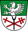
Blazon : "Divided by green and silver, at the top a growing, red armored silver griffin, at the bottom a red double cross bar crossed diagonally, covered with a vertical black scatter fork."
The coat of arms has been used since 1982. |
|
Architectural monuments
Economy and Infrastructure
economy
According to official statistics, there were 96 employees at the place of work in the manufacturing sector and 32 in trade and transport. In other economic sectors 74 people were employed at the place of work subject to social security contributions. There were a total of 519 employees at the place of residence subject to social security contributions. There were none in manufacturing and four in construction. In 2010 there were also 47 farms with a total of 1859 hectares of agricultural land, 1836 hectares of which were arable land.
education
The following facilities exist:
- Kindergarten St. Michael sponsored by the Ramsdorf-Wallerfing Catholic Parish Association with 56 places. Seven teachers look after and support 47 children (2012).
- Wallerfing middle school and elementary school in Oberpöring with a total of 11 classes and 231 students (school year 2013/2014)
Individual evidence
- ↑ "Data 2" sheet, Statistical Report A1200C 202041 Population of the municipalities, districts and administrative districts 1st quarter 2020 (population based on the 2011 census) ( help ).
- ^ Wallerfing in the local database of the Bayerische Landesbibliothek Online . Bayerische Staatsbibliothek, accessed on June 6, 2020.
- ^ Wilhelm Volkert (ed.): Handbook of Bavarian offices, communities and courts 1799–1980 . CH Beck, Munich 1983, ISBN 3-406-09669-7 , p. 585 .
- ↑ City council election & mayoral election in Wallerfing 2020 - candidates & results. In: Wahl.info. March 15, 2020, accessed May 3, 2020 .
- ↑ Wahl.info
- ^ Election result of March 15, 2020. wahl.info, March 16, 2020, accessed on March 16, 2020 .
- ↑ Entry on Wallerfing's coat of arms in the database of the House of Bavarian History , accessed on August 26, 2020 .
- ^ Wallerfing Middle School website
Web links
- Entry on Wallerfing's coat of arms in the database of the House of Bavarian History


