
Administrative community Tiefenbach
| coat of arms | Germany map | |
|---|---|---|

|
Coordinates: 49 ° 26 ' N , 12 ° 35' E |
|
| Basic data | ||
| State : | Bavaria | |
| Administrative region : | Upper Palatinate | |
| County : | Cham | |
| Area : | 66.67 km 2 | |
| Residents: | 2865 (Dec. 31, 2019) | |
| Population density : | 43 inhabitants per km 2 | |
| License plate : | CHA, KÖZ, ROD , WÜM | |
| Association key : | 09 3 72 5308 | |
| Association structure: | 2 municipalities | |
| Association administration address : |
Main street 33 93464 Tiefenbach |
|
| Website : | ||
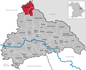
| Location of the administrative community Tiefenbach in the district of Cham | ||
  |
||

The administrative community Tiefenbach is located in the Upper Palatinate district of Cham and is formed by the following communities:
- Tiefenbach , 1923 inhabitants, 45.8 km²
- Treffelstein , 942 inhabitants, 20.87 km²
The administrative association is based in Tiefenbach.
Individual evidence
- ↑ "Data 2" sheet, Statistical Report A1200C 202041 Population of the municipalities, districts and administrative districts 1st quarter 2020 (population based on the 2011 census) ( help ).
Administrative communities in the Cham district
Falkenstein | Stamsried | Tiefenbach | Forest | Walderbach | Weiding
Dissolved: Chamerau | Grafenwiesen | Lam | Miltach | Rötz | Traitsching | Willmering