Grafenau (Lower Bavaria)
| coat of arms | Germany map | |
|---|---|---|

|
Coordinates: 48 ° 51 ' N , 13 ° 24' E |
|
| Basic data | ||
| State : | Bavaria | |
| Administrative region : | Lower Bavaria | |
| County : | Freyung-Grafenau | |
| Height : | 609 m above sea level NHN | |
| Area : | 63.79 km 2 | |
| Residents: | 8247 (Dec. 31, 2019) | |
| Population density : | 129 inhabitants per km 2 | |
| Postcodes : | 94481, 94568 | |
| Area code : | 08552 | |
| License plate : | FRG, GRA, WOS | |
| Community key : | 09 2 72 120 | |
| City structure: | 52 districts | |
City administration address : |
Rathausgasse 1 94481 Grafenau |
|
| Website : | ||
| Mayor : | Alexander Mayer (UW Grafenau) | |
| Location of the city of Grafenau in the Freyung-Grafenau district | ||
The Bavarian city of Grafenau is located in the district of Freyung-Grafenau in the administrative district of Lower Bavaria . The state-approved climatic health resort in the Bavarian Forest is located on the Goldenen Steig , gained city rights in 1376 and is therefore the oldest city in the Bavarian Forest.
geography
Geographical location
The city is located in the low mountain range of the Bavarian Forest at an altitude between 600 and 700 meters above sea level, right next to the Bavarian Forest National Park. The Kleine Ohe (Grafenauer Ohe) , a source river of the Ilz, flows along the eastern and southern outskirts of the city . It feeds an artificial lake in 1976 (see photo) in the city's sports and recreation park.
Grafenau is located in the Moldanubian region of the crystalline basement in the landscape of the rear Bavarian Forest . The northeast Bavarian basement mentioned here is the western part of the Bohemian Massif . These include the landscapes of the Bavarian Forest, the Upper Palatinate Forest , the Fichtelgebirge and the Franconian Forest . The unit of the Bohemian mass forms the eastern part of the European Variscan orogen . The Variscan (also Varistic or Variscan) mountain formation took place mainly in the periods of the Devonian and Carboniferous in the geological age of the Paleozoic . The predominant rocks are gneisses penetrated by massive granite bodies .
The assignment of Grafenau to the rear Bavarian Forest is regulated by its location (immediately) east of the fault zone of the Great Stake .
climate
The mean annual temperature is 7–8 ° C. Grafenau has been fulfilling the bioclimatic and air hygiene requirements for the health resort rating since 1965 - as evidenced by constantly updated and controlled reports by the German Weather Service .
The following weather stations are accessed by the DWD in the vicinity :
- Sankt Oswald-Riedlhütte (ID 4392)
- Saldenburg-Entschenreuth (ID 4354)
- Waldhäuser (Nat.Park) (ID 5306)
- Mauth-Finsterau (ID 3211)
- Spiegelau-Klingenbrunn (ID 4778)
The four-digit numbers in brackets are the corresponding identification numbers of the specified stations.
history
Until the 19th century
The first written evidence about Grafenau comes from the year 1255. In 1376, Emperor Charles IV made it the first town in the Bavarian Forest , as this gave the town the right to build a city wall and thus secure the salt trade with Bohemia . Grafenau was on the Goldener Steig which represented a trade connection between Austria, Bavaria and Bohemia. Shortly before, in 1375, the area around Grafenau, administered by Bärnstein Castle , fell to Landgrave Johann I von Leuchtenberg after the Count of Hals died out . In 1417 it came to Count Etzel von Ortenburg and in 1438 to the Wittelsbach family .
In 1450, 1468 and 1504 Grafenau was invaded by Bohemia and the Gulden Strass made impassable. The salt trade declined in the 16th century and Grafenau lost its economic importance. Today reminded the annual Säumer , the 1976 600th anniversary of the city was first organized, the Säumer salt merchant named.
In 1521 Grafenau received its first town hall . Already in 1523 Grauenaw was shown in the first map of Bavaria drawn up by Johannes Aventinus .
In 1634 the plague was rampant as a result of the billeting of foreign troops in the Thirty Years War and in 1742 the Pandurs (Hungarian hussars ) plundered Grafenau. In the years 1504, around 1545, between 1550 and 1572, 1639, 1832, 1844 and 1850, city fires raged. Nevertheless, the city was always rebuilt. The Guldenstrasse was repeatedly repaired until 1772. In 1845/46 the striking old town hall with its graceful turret was built on the town square on the site of earlier town halls.
20th century
In World War II Grafenau remained undamaged. In contrast to the neighboring community of Schönberg, there were no acts of war in Grafenau when the Americans marched in, as the parish priest Rankl and his niece approached the troops with a white flag and offered them the surrender of the city of Grafenau.
On February 3, 1946, the first municipal elections after the Second World War took place. Grafenau has been a state-approved climatic health resort since 1965 . Not least because of the integration of numerous refugees and displaced persons, there was intensive housing construction in the post-war years. The number of buildings increased from 186 in 1945 to 562 on December 31, 1978 (excluding incorporations).
On September 6, 1967, the official inaugural meeting of the association for the promotion of the Bavarian Forest National Park project took place in the city .
Grafenau was a district town until 1972. In the course of the district reform , the city lost this status. By merging the two old districts Grafenau and Wolfstein , the district of Freyung was created, from May 1, 1973, the district of Freyung-Grafenau , with the administrative headquarters in Freyung .
The Bogenstätter Brazilian tobacco factory was operated in Grafenau until 1974 . Initially in Perlesreut , not far from Grafenau, the tobacco factory was operated with a diesel engine system until the beginning of the First World War , which also supplied the town with electricity. With the shortage of crude oil during the war years, the plant was relocated to Grafenau in the former Mittermühle am Venusberg in autumn 1915 in order to maintain production there - from today's perspective ahead of its time - until the factory was shut down using water power . The snuff company Alois Pöschl bought the company and with it the recipes. Even today, the Schmalzler Perlesreuter Waldler Fresko by the Bogenstätter company is produced and sold by the Pöschl company with the same recipe.
Incorporations
On April 1, 1971, the previously independent community of Rosenau was incorporated. On January 1, 1972, a large arm strike was added. Neudorf followed on January 1, 1974. The municipality of Schlag and parts of the dissolved municipality of Haus im Wald were added on January 1, 1978. 52 districts belong to Grafenau:
Population development
Between 1988 and 2018 the city grew from 8,163 to 8,256 by 93 inhabitants or 1.1%. On December 31, 1999 Grafenau had 9,176 inhabitants.
religion
The history of Catholic pastoral care in Grafenau is closely linked to the neighboring Sankt Oswald-Riedlhütte . The church in St. Oswald was consecrated on June 14, 1389 . Seven years later, on August 5, 1396, the founding of the Pauline Monastery of St. Oswald was recorded. Both the church and the monastery are foundations of Landgrave Johann I von Leuchtenberg . Nothing is known about the time of the construction of the parish church and the parish in Grafenau. Grafenau was initially looked after as a secular parish by the St. Oswald Monastery. In the deed of foundation of the monastery one can read of the "Kürchen and Pfarr our dear Mrs. Marie of God's mother in the Grafenau, who is our right heir ..." . At the end of the 16th century, the St. Oswald Monastery was taken over as the provost's office by the Niederalteich Abbey (near Deggendorf ) due to its high debt . From 1604 the pastoral care of Grafenaus was entrusted to a vicar belonging to the St. Oswald monastery . During the secularization , the St. Oswald Provostry was dissolved. In 1806 Grafenau was again city parish. Grafenau belongs to the diocese of Passau . The Catholic pastor of Grafenau is Dean Kajetan Steinbeißer, his Protestant colleague is Pastor Sonja Schuster. The history of evangelical pastoral care in Grafenau and the surrounding area begins with the privatization of the glassworks and the industrialization of wood production. Franconian and Saxon entrepreneurs largely took over these branches of industry and brought evangelical skilled workers from their homeland. In 1901 the Martin Luther Church was consecrated and in 1934 the Grafenau wooden church. After the war, many Protestant refugees came and in 1969 the significantly larger Christ Church and the Dietrich-Bonhoefferkirche Schönberg were consecrated. The Protestant community of Grafenau has been an independent community since 1948. Spiegelau, Schönberg, Klingenbrunn, Innernzell and the surrounding area belong to it. The community is part of the Passau deanery.
Church building in the city:
- Chapel in Waldhäuser (looks after the parish of Grafenau)
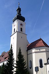
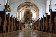
- Catholic parish church of the Assumption . The neo-baroque building was built between 1905 and 1907 according to plans by architect Michael Kurz . The altars date from around 1730, numerous figures from the Gothic and Baroque periods.
- Catholic branch church Herz Jesu (Neudorf)
- Catholic branch church of the Immaculate Conception ( Großarmschlag )
- Catholic parish church Hl. Herz Jesu ( house in the forest )
- Hospital Church of the Holy Trinity (1759)
- Evangelical Christ Church (1969)
- Evangelical Martin Luther Church (1901) (Spiegelau)
- Protestant Dietrich Bonhoefferkirche (1968) (Schönberg)
- Chapel in Rosenau
- Brudersbrunn pilgrimage church (1842), next to it a memorial chapel, which Paula Holzhäuer from the Elsenthal district had built in 1952 for her father who was murdered in the concentration camp
politics
mayor
The first mayor is Alexander Mayer (independent voter Grafenau). Mayer received 57.9% of the votes cast in the runoff election in March 2020. The turnout in the first ballot was 68.1%, in the runoff election 78.6%.
City council
The city council has 20 seats. After the 2020 local elections, these will be broken down as follows:
coat of arms
| Blazon : "A red-tongued, black bear growing under the shield head with the Bavarian diamonds in gold over a descending silver battlement wall." | |
The black bear between battlements symbolizes Bärnstein Castle. The defensive ability should be represented by the battlements. The city archive has the original certificate for the award of the city coat of arms from 1508.
Town twinning
-
 Austria : Schärding (since 1976)
 -
 Czech Republic : Kašperské Hory (German: Bergreichenstein ; since 1991).
Culture and sights
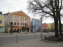
The town square rises sharply to the north. Here is the neo-Gothic, former town hall from 1845 with a stepped gable, now the national park administration. At the top is the parish church of the Assumption of Mary.
Grafenau is showing publicly displayed bronze sculptures by the artist Heinz Theuerjahr at two locations : the capercaillie can be seen at the town's high school and the great bear in the Grafenau spa gardens .
Architectural monuments
Parks
Museums
The city museum informs the visitor about the history of Grafenau and also includes the representation of the former city pharmacy. Furthermore, historical handicraft traditions are presented.
The farmer's furniture museum (consisting of two farmhouses, a carriage shed and a grain box ) is located at the west entrance of the spa park and exhibits the painting art of peasant furniture from the 18th and 19th centuries in the Bavarian Forest. Furthermore, numerous contemporary objects testify to rural life.
The snuff museum is the only one in the world on this topic and provides information about the history, manufacture and distribution of snuff . There is also the largest snuff glass in the world, weighing over 30 kilograms.
Regular events
- The traditional folk festival begins on the 1st Friday in July (since 1950)
- The Säumerfest takes place on the 1st Saturday in August . (Since 1976)
- Rock Festival Lichteneck (1995-2014, 2018-)
- Advent season: Christmas market on the town square
Trivia
- The shooting of the film Arabian Nights took place under the direction of Klaus Lemke in Grafenau and the surrounding area . The film premiered in 1979.
Economy and Infrastructure
tourism
The official opening of the Berlin holiday village on the Grafenauer Schwaimberg by Wilhelmine Lübke , wife of the then Federal President Heinrich Lübke, took place on May 24, 1964 . At that time it was the largest and most modern holiday village in Europe with 125 bungalows. The system was financed by the Aid Foundation Berlin in cooperation with the ARD television lottery Ein Platz an der Sonne . The holiday village was last operated by the Dutch Roompot Holiday Group . It is currently closed. The holiday village has meanwhile been acquired by the city of Grafenau in order to sell it to an investor.
There is a heated wave pool and a spa park.
The closest campsite, Camping am National Park, is in the neighboring town of Spiegelau . It is open all year round and has a capacity of 100 places (including mobile homes).
On the southern edge of the city to the neighboring district of Schlag there is a lift with two tow lifts . This is converted into a bobsleigh run (rail-guided) in the snowless months. The total length of the track is over 1000 meters. The difference in altitude is just over 100 meters.
Asphalt curling lanes are available on the eastern edge of the spa park in summer. In winter the facility is used as an ice rink (ice skating and curling).
For hang-glider pilots there is a launch pad near Grafenau am Berg Büchelstein .
In August 2005 the golf club at the Bavarian Forest National Park was opened, in which Grafenau is involved. The facility covers 90 hectares with 18 playable holes .
At the Grafenau cross-country skiing center in Rosenau there is the possibility to access the Bayerwaldloipe .
traffic
Street
The only federal road that runs through the city is the B 533 . This branches off from the B 85 Passau - Cham near Elsenthal and connects Freyung with the motorway connection to the A 3 ( European road E56) near Hengersberg. is the closest federal motorway to Grafenau. In addition, State Road 2132 connects Grafenau with Spiegelau and Zwiesel .
Train connection
With the opening of the Zwiesel – Grafenau railway on September 1, 1890, Grafenau was connected to the railway network.
Since 2003, the Waldbahn trains have been running every two hours on this route with a connection in Zwiesel to Plattling, Bay. Eisenstein and Bodenmais. Since then, the railway line has been integrated into the Bavarian Forest national park traffic concept. By December 2018, the route is to be expanded every hour.
In the course of modernizing the station area in 2008, the station was reduced to one track.
Local public transport
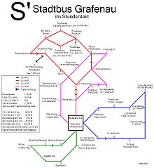
The Grafenau bus station is served by the RBO and other private bus companies. These connect Grafenau with destinations in the region. There is also a city bus from the Sieghart Reisen company , which runs on four routes every hour between 7 a.m. and 6 p.m. on weekdays. This will be supplemented by a daily night line network on two lines during the festival. Grafenau is connected to the hedgehog buses of the Bavarian Forest National Park.
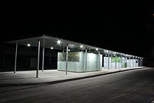
The bus station is in the immediate vicinity of the city's train station. In the course of a conversion costing 1.3 million euros, the entire station area was rebuilt by 2009 and a new bus station was built. By November 2007, two roundabouts, a bus stop and a parking lot were newly created.
In the urban area, the Bayerwald ticket is valid on regional bus routes operated by the RBO. Since May 1, 2010, the city and other Bavarian Forest communities have been involved in the GUTi - Guest Service Environment Ticket , which offers its guests free transport on all rail and bus connections in the Bayerwald Ticket tariff area. This also applies to the Grafenau city bus.
air traffic
In about 4.5 km away ( straight line ) to the city center at the junction B 85 / B 533 southwest of the city lies the special airfield airfield Elsenthal-Grafenau . This was built in 1963 by a local shipping company and was later taken over by the Grafenau aviation club. It has a 500 m long natural runway.
economy
In the central local hierarchy , the city ranks as the middle center. As part of regional development, the Grafenau medium-sized center is part of the Danube Forest planning region .
Established businesses
- AMF (mineral fibers)
- AVS Ing.JC Römer GmbH (valves, fittings)
- Bucher Bräu GmbH & Co. KG (drinks)
- BWmedien GmbH (Internet services)
- elumeg GmbH (electrical cable manufacture)
- Ludwig Baierer e. K. (mineral oils, fuels, petrol station)
- Sedlbauer AG (electronics)
- SLE (microelectronics)
- Zambelli (roof systems)
media
- Grafenauer Anzeiger (local editorial office of the PNP )
Public facilities
schools
The city's first school building is located on Scharrerstrasse (No. 35). The provision of the building to the establishment of a school was notarized on June 27, 1610 by the provost of St. Oswald, P. Laurentius Seyberer.
With the Easter vacation in 1945, all teaching activities of the community school in National Socialism initially end. School lessons in Grafenau will not be continued until September 19, 1945, in accordance with the instructions and specifications of the military governor.
On October 1, 1950, a three-class state secondary school for boys is opened as a forerunner of today's secondary school .
On September 7, 1965, the grammar school was founded as a communal school. The school was nationalized on August 1, 1967. In 1993 it was given the name Landgraf-Leuchtenberg-Gymnasium , which is still valid today .
In addition to the school types mentioned, Grafenau is the location for middle schools (Propst-Seyberer-Schule), special needs (Don-Bosco-Schule), elementary , vocational , vocational , music and adult education centers with an average of 2300 students.
Administrations
Since 1976, the city has housed the administration of the Bavarian Forest National Park in the former town hall .
Healthcare
The clinics AM GOLDENEN STEIG in the district of Freyung Grafenau GmbH operates a hospital in a central location that is equipped with a helicopter landing pad .
Personalities
- Karl Alexander von Reichlin-Meldegg (born February 22, 1801 in Grafenau, † February 16, 1877 in Heidelberg ), philosopher, theologian and university professor.
- Alfred Edel (born March 12, 1932 in Abensberg ; † June 17, 1993 in Frankfurt am Main ), actor; was buried in Grafenau.
- Theo Elm (born July 11, 1944 in Grafenau), German specialist in German
- Fredl Fesl , (born July 7, 1947, Grafenau), songwriter and cabaret artist
- Stephan Haering , (born September 15, 1959, Grafenau), Roman Catholic theologian, a. a. Judge at the Archbishop's Consistory and Metropolitan Court in Munich.
- Alfons Fürst (born November 11, 1961), Roman Catholic theologian
literature
- District assembly of the district Grafenau (Hrsg.) The image of an old Bavarian district - Grafenau . Morsak publishing house, Grafenau, 1972.
- Hermann Neumann: 600 years of the city of Grafenau 1376–1976 . Morsak Verlag, Grafenau, 1976, ISBN 3-87553-063-2
Web links
Individual evidence
- ↑ "Data 2" sheet, Statistical Report A1200C 202041 Population of the municipalities, districts and administrative districts 1st quarter 2020 (population based on the 2011 census) ( help ).
- ↑ See Hanno Trurnit: Glasherrn, Brauer, Tabakreiber. Family story from the Bavarian Forest. Morsak Verlag Grafenau. 2010. p. 28ff. ISBN 978-3-86512-021-2
- ^ Wilhelm Volkert (ed.): Handbook of Bavarian offices, communities and courts 1799–1980 . CH Beck, Munich 1983, ISBN 3-406-09669-7 , p. 473 .
- ^ Federal Statistical Office (ed.): Historical municipality directory for the Federal Republic of Germany. Name, border and key number changes for municipalities, counties and administrative districts from May 27, 1970 to December 31, 1982 . W. Kohlhammer GmbH, Stuttgart / Mainz 1983, ISBN 3-17-003263-1 , p. 627 .
- ^ City of Grafenau in the local database of the Bavarian State Library Online . Bayerische Staatsbibliothek, accessed on August 20, 2018.
- ↑ Main State Archives Munich GU Bärnstein 74
- ↑ Timeline of the history of the Grafenau parish ( Memento of the original from June 12, 2010 in the Internet Archive ) Info: The archive link was inserted automatically and has not yet been checked. Please check the original and archive link according to the instructions and then remove this notice. . Retrieved August 5, 2010.
- ↑ Memorial sites for the victims of National Socialism. A documentation, volume 1. Federal Agency for Civic Education, Bonn 1995, ISBN 3-89331-208-0 , p. 143
- ↑ Greetings. Grafenau community, accessed on August 2, 2020 .
- ↑ wahl.info: City council election & mayoral election in Grafenau 2020 - candidates & results. Accessed March 31, 2020 .
- ^ Passauer Neue Presse of March 29, 2020 - Mayer is Grafenau's first postal mayor
- ↑ Entry on the coat of arms of Grafenau (Lower Bavaria) in the database of the House of Bavarian History
- ↑ List of sculptures exhibited by Heinz Theuerjahr ( memento of the original from April 6, 2014 in the Internet Archive ) Info: The archive link has been inserted automatically and has not yet been checked. Please check the original and archive link according to the instructions and then remove this notice.
- ↑ Grafenau airfield website
- ^ Bavarian State Chancellery - Central Places (municipalities according to the respective territorial status) . Retrieved April 7, 2020.
- ^ Homepage of the regional planning association Danube Forest . Retrieved August 12, 2010.
- ↑ See time table for the history of the Grafenau parish ( memento of the original from June 12, 2010 in the Internet Archive ) Info: The archive link has been inserted automatically and has not yet been checked. Please check the original and archive link according to the instructions and then remove this notice. . Retrieved August 5, 2010.
- ↑ Bayer. Main State Archives Munich, No. 1646. Cf. Hermann Neumann: Vom Schulwesen bis 1945 in: 600 Jahre Stadt Grafenau 1376–1976 Grafenau, 1976, p. 240.
- ↑ See Hermann Neumann: Vom Schulwesen bis 1945 in: 600 Jahre Stadt Grafenau 1376–1976 Grafenau, 1976, p. 245.


