
Haidmühle
| coat of arms | Germany map | |
|---|---|---|

|
Coordinates: 48 ° 50 ' N , 13 ° 47' E |
|
| Basic data | ||
| State : | Bavaria | |
| Administrative region : | Lower Bavaria | |
| County : | Freyung-Grafenau | |
| Height : | 831 m above sea level NHN | |
| Area : | 21.03 km 2 | |
| Residents: | 1319 (Dec. 31, 2019) | |
| Population density : | 63 inhabitants per km 2 | |
| Postal code : | 94145 | |
| Area code : | 08556 | |
| License plate : | FRG, GRA, WOS | |
| Community key : | 09 2 72 122 | |
| Community structure: | 13 districts | |
| Address of the municipal administration: |
Dreisesselstrasse 12 94145 Haidmühle |
|
| Website : | ||
| Mayor : | Heinz Scheibenzuber | |
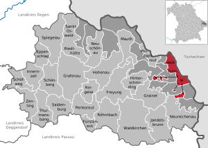
| Location of the community of Haidmühle in the Freyung-Grafenau district | ||
  |
||

Haidmühle is a municipality in the Lower Bavarian district of Freyung-Grafenau and a state-approved resort .
geography

Geographical location
The municipality is located in the Danube Forest region on the Cold Vltava River in the Bavarian Forest , right on the border with the Czech Republic on Glasstrasse . Haidmühle is 25 km from Freyung , 24 km from Waldkirchen and 20 km from the border with Austria .
Community structure
The municipality has 13 parts:
The following districts exist : Bischofsreut , Philippsreut, Frauenberg.
history
Until the church is planted
The district of Haidmühle, which gives it its name today, was founded in 1770 and is therefore one of the youngest settlements in the Freyung-Grafenau district - a result of the construction of a mill. As early as the 15th century, a path, the so-called Haidweg, led from Fürholz to the “great Haid” and further through the valley of the Cold Vltava to Wallern and Krummau in Bohemia. The Frauenberg district is a scattered settlement close to the Dreisessel mountain and was created as early as 1724. The small village belonged to the Austrian rule of Rannariedl until 1765 and was then bought back by the Passau prince-bishop Firmian with the seven villages of Art. The old trading route Goldener Steig leads through the oldest district of Bischofreut, founded in 1705 to secure the border .
Haidmühle, in the former Bishopric of Passau located, was in 1803 with the majority of the high pin and the territory in favor of Ferdinand of Tuscany secularized and fell until 1805 with the Treaties of Brno and Bratislava to Bavaria. In the course of the administrative reforms in Bavaria , today's municipality was created with the municipal edict of 1818 .
19th and 20th centuries
The construction of an iron hammer works in 1840 and the opening of the Waldkirchen - Frauenberg - Haidmühle - Prachatitz railway line in 1910 led to an economic boom.
Tourism began around 1912, making Haidmühle one of the oldest tourist locations in the Lower Bavarian Forest. Since 1946, the former Schwarzenthal glassworks settlement has belonged to the Bischofsreut community, which joined Haidmühle in 1978.
On April 27, 1951, the community name Frauenberg was officially changed to Haidmühle .
Incorporations
On May 1, 1978, the previously independent community of Bischofsreut (from April 27, 1951, previously Leopoldsreut ) was incorporated.
Population development
Between 1988 and 2018, the population fell from 1,511 to 1,324 by 187 inhabitants or by 12.4% - together with the neighboring municipality of Philippsreuth, the clearest decrease in population in the district in the period mentioned.
|
|
politics

Municipal council
Since the local elections on March 15, 2020, the municipal council has been composed as follows:
- CSU - FWG : 7 seats
- WG Bischofsreut-Haidmühle-Frauenberg : 4 seats
- Young list - Bischofsreut / Haidmühle : 1 seats
mayor
Heinz Scheibenzuber (CSU / Free Voting Association) has been the honorary first mayor since May 1, 2020.
coat of arms
|
|
Blazon : “By a narrow silver wavy bar divided by red and blue; above a golden mill wheel above, below growing out of the edge of the shield, a golden iron hammer and a golden mallet crossed at an angle. " |
ILE compartment
The community is a member of the working group “Integrated Rural Development Abteiland” (ILE Abteiland) founded by 11 communities in April 2011, the aim of which is to preserve and design the natural, cultural and economic area of Abteiland as a home worth living in.
Culture and sights

Museums
- The KulturLandschaftsMuseum offers visitors the opportunity to experience relics of the cultural landscape that are typical of the Bavarian and Bohemian Forest. In addition, the culturally and historically remarkable elements such as Wässerwiesen, Allmendeweiden, Steinäcker and much more are presented in their original place in the landscape and connected via a variety of structured museum paths.
Buildings
- Parish Church of St. Maximilian in Haidmühle, built between 1926 and 1929 by Michael Kurz , Munich; Interior painting by Paul Thalheimer .
- Parish church of St. Valentin in Bischofsreut , built from 1870 to 1872 according to plans by Leonhard Schmidtner .
Regular events
- International dog sled races take place every year in Haidmühle , including the 2019 World Sled Dog Championship.
- In the Bischofsreut district, the historical Leopoldsreut festival takes place every 2-3 years.
- In the summer months, the tourist information organizes a hike every two weeks. More information at www.haidmuehle.de/veranstaltungen
Economy and Infrastructure
Economy including agriculture and forestry
In 1998 there were no employees in the field of agriculture and forestry, 67 in the manufacturing industry and no employees in the field of trade and transport at the place of work. In other economic sectors 83 people were employed at the place of work subject to social security contributions. There were a total of 449 employees at the place of residence subject to social insurance contributions. There were two companies in the manufacturing sector and no companies in the main construction sector. In addition, in 1999 there were 74 farms with an agriculturally used area of 522 ha. Of this, 3 ha were arable land and 520 ha were permanent green areas.

traffic
Before the First World War , the Haidmühle train station was connected to the railway from Passau to Budweis (Austria-Hungary). The Royal Bavarian State Railway ran from Passau via Waldkirchen to Haidmühle ( Passau – Freyung and Waldkirchen – Haidmühle line ); From Haidmühle, the Imperial-Royal Austrian State Railways continued via Neuthal and Wallern towards Budweis ( Číčenice – Haidmühle railway ). In 1945 cross-border traffic ended. Passenger trains still ran to Waldkirchen until 1963; freight traffic was finally shut down in 1975 above Jandelsbrunn . Today the route is dismantled. The Haidmühle sewage treatment plant is located on part of the route. A few meters from the village is the border crossing Nové Údolí (Neuthal) to Stožec (Tusset) , which is open to pedestrians and cyclists. This is where the Passau – Prachatice (Prachatitz) railway ends, right at the border crossing on the Czech side , which is now used by regional trains to Volary (Wallern) . Part of the route is in operation as a museum railway ( Pošumavská jižní dráha ).
education
The following institutions exist (as of 2012):
- Kindergarten: 50 kindergarten places with 32 supervised children, 2 of them under three years of age
- Primary school: 4 teachers and 57 students in 3 classes
media
The news, culture and communication portal www.haibischl.de has existed since July 2014 and is operated on a voluntary basis.
International measuring stations
On Sulzberg , northwest of Haidmühle, there are two measuring stations of the IMS ( International Monitoring System ) for monitoring the nuclear test ban agreement . This is the GERES primary seismic station (PS19). It is used to measure seismic waves that are caused by earthquakes and explosions and that propagate inside the earth.
The I26DE (IS26) measuring station is used to measure pressure waves below the audible frequency range ( infrasound ), which are caused by explosions or other artificial or natural processes in the atmosphere and then spread over great distances.
Web links
- Haidmühle community
- Cultural Landscape Museum Border Experience , the first cultural landscape museum in the German-speaking area
- The Bischofsreuter Waldhufen , an exemplary nature conservation project
- Haidmühle: Official statistics of the LfStat
Individual evidence
- ↑ "Data 2" sheet, Statistical Report A1200C 202041 Population of the municipalities, districts and administrative districts 1st quarter 2020 (population based on the 2011 census) ( help ).
- ^ Community Haidmühle in the local database of the Bavarian State Library Online . Bayerische Staatsbibliothek, accessed on August 12, 2020.
- ↑ Tourist Info Haidmuehle: Haidmühle. In: www.haidmuehle.eu. Retrieved October 7, 2016 .
- ↑ ibid.
- ↑ Tourist Info Haidmuehle: Haidmühle. In: www.haidmuehle.eu. Retrieved October 7, 2016 .
- ^ Wilhelm Volkert (ed.): Handbook of Bavarian offices, communities and courts 1799–1980 . CH Beck, Munich 1983, ISBN 3-406-09669-7 , p. 596 .
- ^ Federal Statistical Office (ed.): Historical municipality directory for the Federal Republic of Germany. Name, border and key number changes in municipalities, counties and administrative districts from May 27, 1970 to December 31, 1982 . W. Kohlhammer GmbH, Stuttgart / Mainz 1983, ISBN 3-17-003263-1 , p. 628 .
- ↑ City Hall. Haidmühle community, accessed on August 12, 2020 .
- ↑ Mayor / Lord Mayor in municipalities belonging to the district (as of May 1st, 2020). (xlsx) Bavarian State Office for Statistics, accessed on June 12, 2020 .
- ^ Entry on the coat of arms of Haidmühle in the database of the House of Bavarian History
- ^ Origin of ILE Abteiland , accessed on April 25, 2020.
- ^ Bay. State Office for Statistics and Data Processing: Statistics Municipal 2012
- ^ German IMS station: GERES primary seismic station (PS19) . In: bgr.bund.de . Retrieved November 3, 2019.
- ^ German IMS station: infrasound station I26DE (IS26) . In: bgr.bund.de . Retrieved November 3, 2019.

Cities:
Freyung |
Grafenau |
Waldkirchen
Markets:
Perlesreut |
Röhrnbach |
Schönberg
municipalities:
Eppenschlag |
Fürsteneck |
Grainet |
Haidmühle |
Hinterschmiding |
Hohenau |
Innernzell |
Jandelsbrunn |
Mauth |
Neureichenau |
Neuschönau |
Philippsreut |
Ringelai |
Saldenburg |
Sankt Oswald-Riedlhütte |
Schöfweg |
Spiegelau |
Thurmansbang |
Zenting
municipality-free areas:
Annathaler Wald |
Frauenberger and Duschlberger Forest |
Grained forest |
Leopoldsreuter Forest |
Mauther Forest |
Philippsreuter Forest |
Pleckenstein Forest |
Saint Oswald |
Schlichtenberg Forest |
Schönbrunn Forest |
Waldhäuserwald