Cold Vltava
|
Cold Vltava Studená Vltava, oxbow lake |
||
|
Upper reaches of the Cold Vltava |
||
| Data | ||
| Water code | DE : 5214, CZ : 1-06-01-044 | |
| location | Bohemian forest | |
| River system | Elbe | |
| Drain over | Vltava → Elbe → North Sea | |
| origin | The confluence of the left Weberaubach and the right Rothbach west of Haidmühle 48 ° 49 ′ 14 ″ N , 13 ° 43 ′ 44 ″ E |
|
| Source height | 855 m | |
| confluence | with the Warm Vltava to the Vltava on Mrtvý luh near Chlum Coordinates: 48 ° 51 '33 " N , 13 ° 53' 35" E 48 ° 51 '33 " N , 13 ° 53' 35" E |
|
| Mouth height | 734 m nm | |
| Height difference | 121 m | |
| Bottom slope | 5 ‰ | |
| length | 24 km | |
| Catchment area | 121.6 km² | |
| Drain |
MQ |
2.04 m³ / s |
| Communities | Haidmühle , Stožec , Volary | |
|
Stone at the beginning of the Cold Vltava |
||
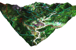
The Cold Vltava , also backwaters ( Studená Vltava in Czech ) is the right source river of the Vltava in Bavaria and the Czech Republic .
course
The Cold Vltava arises in the Bavarian Forest north of the Bramandlberg (991 m) and the Hirschberg (881 m) through the confluence of the left Weberaubach and right Rothbach. The stream later leads past Haidmühle and the Na Spálenci ( Brand ) desert in an easterly direction; between the confluences of the Moorbach and the Ruttenbach, it marks the German-Czech border for about two kilometers. The Cold Vltava then flows into Czech territory, where it takes a north-easterly direction at Nové Údolí ( Neuthal ). The mountain moor meadows behind the border have been under protection since 1985 on an area of 101 hectares as the Spálený luh natural monument. The further course leads past the Lorenz Mountains and Stožec ( Tussetberg , 1065 m nm) and the Pasta desert through Stožec ( Tusset ) and Černý Kříž ( Black Cross ). The lower course of the Cold Vltava leads through the natural monument Vltavský luh ( Moldau floodplains ). At Chlum ( Humwald ), a district of the town of Volary ( Wallern ), it joins the Teplá Vltava / Warm Moldau to the Vltava / Moldau after 24 kilometers in the Mrtvý luh ( Dead Au ) bog .
The lower 16 kilometers of the Cold Vltava flows through Czech territory. It is navigable over a length of twelve kilometers when the water level is elevated. The Číčenice – Haidmühle railway runs through the valley of the stream between Smolná Pec and the state border .
history
After the Iron Curtain was erected, the Cold Vltava valley between Stožec and the German border became a restricted area. The places Pasta, Na Spálenci and Nové Údolí were relocated and demolished during this time. The railway line was preserved due to the fact that wood exports from Czechoslovakia to Bavaria were handled via the Haidmühle border crossing in the small border traffic . The restricted area was lifted in 1990.
Tributaries
- Mirasalbach (r), near Haidmühle
- Kreuzbach (r), near Haidmühle
- Moorbach / Hraniční potok (l), near Na Spálenci
- Ruttenbach / Údolský potok (r), near Nové Údolí
- Spálený potok ( Brandbächel ) (l), below Nové Údolí
- Světlá ( light water ) (r), below Nové Údolí
- Jelení potok ( tailor's brook ) (r), above Stožec
- Mlýnský potok ( Mühlaubach ) (l), in Stožec
- Hučinka ( Little Hutschenbach ) (r), above Černý Kříž
- Hučina ( Großer Hutschenbach ) (r), below Černý Kříž
Web links
- Description on kct-tabor.cz (Czech)
Individual evidence
- ↑ a b c Vltava a její přítoky - Studená Vltava at kct-tabor.cz

