Hohenfurch
| coat of arms | Germany map | |
|---|---|---|

|
Coordinates: 47 ° 51 ' N , 10 ° 54' E |
|
| Basic data | ||
| State : | Bavaria | |
| Administrative region : | Upper Bavaria | |
| County : | Weilheim-Schongau | |
| Management Community : | Altenstadt (Upper Bavaria) | |
| Height : | 699 m above sea level NHN | |
| Area : | 12.4 km 2 | |
| Residents: | 1682 (Dec. 31, 2019) | |
| Population density : | 136 inhabitants per km 2 | |
| Postal code : | 86978 | |
| Primaries : | 08861 and 08869 | |
| License plate : | WM, SOG | |
| Community key : | 09 1 90 129 | |
| LOCODE : | DE HC4 | |
| Community structure: | 2 parts of the community | |
| Address of the municipal administration: |
Hauptplatz 7 86978 Hohenfurch |
|
| Website : | ||
| Mayor : | Guntram Vogelsgesang ( CSU ) | |
| Location of the community Hohenfurch in the district of Weilheim-Schongau | ||
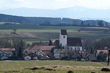
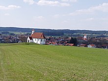
Hohenfurch is a municipality in the Weilheim-Schongau district in Upper Bavaria . The place of the same name is both the capital and the seat of the municipal administration.
geography
The municipality is located in the Oberland region in Pfaffenwinkel . There are two officially named parts of the municipality (the type of settlement is given in brackets ):
- Ditch ( wasteland )
- Hohenfurch ( parish village )
There is only the Hohenfurch district .
Hohenfurch is a place in the foothills of the Alps immediately south of the terminal moraine of the Lech glacier.
history
Until the church is planted
In Roman times, the Via Claudia Augusta led across the Hohenfurch area.
Until 1785 the upper village belonged to the bishopric of Augsburg and the lower village to the St. Mang monastery in Füssen. After that, the entire place was exchanged for the Steingaden Monastery and thus became part of the Electorate of Bavaria . Steingaden Monastery had Hohenfurch as a closed Hofmark until 1802 .
In 1818 the political community was established , which belonged to the district court of Schongau .
Population development
Between 1988 and 2018 the municipality grew from 1,293 to 1,643 by 350 inhabitants or 27.1%.
| year | 1840 | 1871 | 1900 | 1925 | 1939 | 1950 | 1961 | 1970 | 1987 | 1991 | 1995 | 2000 | 2005 | 2010 | 2015 | 2019 |
| Residents | 537 | 550 | 683 | 725 | 695 | 1107 | 987 | 1092 | 1274 | 1312 | 1274 | 1423 | 1479 | 1501 | 1547 | 1682 |
politics
The community is a member of the Altenstadt administrative community . The first mayor is Guntram Vogelsgesang (CSU) (since the local elections in 2008). Josef Epple (FWV) was elected by the municipal council as the second mayor in 2008 and 2014. In 2020 Peter Schratt (FWV) became 2nd Mayor.
| Party / list | 2020 election | Election 2014 | 2008 election |
|---|---|---|---|
| CSU | 5 | 4th | 5 |
| SPD | 3 | 4th | 3 |
| Voting group / FWV | 4th | 4th | 4th |
| total | 12 | 12 | 12 |
coat of arms
| Blazon : “Split by silver and green; in front a black bull with red horns growing out of the front edge of the shield, behind a golden dragon. " | |
Architectural monuments
Soil monuments
Economy and Infrastructure
Economy including agriculture and forestry
In 1998 a total of 771 people were employed at the place of residence subject to social security contributions. There were two companies in the manufacturing sector and ten in the construction sector. In addition, there were 62 farms in 1999 with an agricultural area of 1806 ha. Of this, 1433 ha were arable land and 369 ha were permanent green areas.
traffic
The village of Hohenfurch is located directly on federal road 17 and on district road WM 6 . Until the cessation of passenger traffic in 1984, there was a stop on the Fuchstalbahn , which is still in operation today as a freight line between Schongau and Augsburg .
education
In 1999 the following institutions existed:
- Kindergartens: 50 kindergarten places with 49 children
- an elementary school with five teachers and 118 students
In 2020 there were the following institutions:
- Kindergartens: 50 kindergarten places and 12 crèche places
- a primary school with 86 students
Sons and daughters of the church
- Martin Erhard (1938–2013), ice hockey player and referee
Others
Hohenfurch is a member of the following tourist associations:
- romantic street
- Via Claudia
- Pfaffenwinkel tourism association
- Auerbergland
- Lechtal habitat
The municipality is also a member of the AL-P Local Action Group for the implementation of the regional development concept .
literature
- Josef Strobel: Chronicle of the community Hohenfurch: published on the occasion of the 800th anniversary of the community in 1989 . Hohenfurch, municipality of Hohenfurch 1989.
Web links
- Local government
- Hohenfurch: Official statistics of the LfStat (PDF; 1.24 MB)
Individual evidence
- ↑ "Data 2" sheet, Statistical Report A1200C 202041 Population of the municipalities, districts and administrative districts 1st quarter 2020 (population based on the 2011 census) ( help ).
- ^ Community Hohenfurch in the local database of the Bavarian State Library Online . Bayerische Staatsbibliothek, accessed on September 5, 2019.
- ↑ Hohenfurch municipal statistics , accessed on November 6, 2010
- ↑ Greetings from the mayor. Hohenfurch community, accessed on August 20, 2020 .
- ^ Result of the 2014 local elections , accessed on March 18, 2014
- ↑ Weilheimer Tagblatt of March 18, 2014, local section p. 8
- ^ Entry on the Hohenfurch coat of arms in the database of the House of Bavarian History


