
Habach
| coat of arms | Germany map | |
|---|---|---|

|
Coordinates: 47 ° 44 ' N , 11 ° 17' E |
|
| Basic data | ||
| State : | Bavaria | |
| Administrative region : | Upper Bavaria | |
| County : | Weilheim-Schongau | |
| Management Community : | Habach | |
| Height : | 652 m above sea level NHN | |
| Area : | 12.16 km 2 | |
| Residents: | 1161 (Dec. 31, 2019) | |
| Population density : | 95 inhabitants per km 2 | |
| Postal code : | 82392 | |
| Area code : | 08847 | |
| License plate : | WM, SOG | |
| Community key : | 09 1 90 126 | |
| Community structure: | 8 parts of the community | |
| Address of the municipal administration: |
Hofmark 1 82392 Habach |
|
| Website : | ||
| Mayor : | Michael Strobl jun. ( UWG ) | |
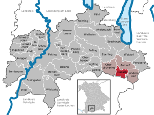
| Location of the community of Habach in the Weilheim-Schongau district | ||
  |
||


Habach is a municipality in the Upper Bavarian district of Weilheim-Schongau and the seat of the Habach administrative community .
geography
location
The municipality is located in the Bavarian Oberland region in the foothills of the Alps on a line between Murnau and Penzberg . The distance to the state capital Munich in the northeast is about 50 kilometers, to Garmisch-Partenkirchen and the Zugspitze in the south-southwest about 30 kilometers.
Neighboring communities
The municipality is largely bounded by fields and forests. Short border stretches are given by the Grenzbach in the southeast, a nameless stream in the southwest and the Steinbach in the northwest.
The neighboring communities (starting clockwise in the north) are: Antdorf , Sindelsdorf , Großweil , Riegsee and Obersöchering .
Distances from town center to town center
|
Antdorf 3 km |
||
|
Obersöchering 4.5 km |
.svg)
|
Sindelsdorf 4 km |
|
Riegsee 5 km |
Großweil 6 km |
Community structure
The municipality has eight officially named municipality parts :
|
|
There is only the Habach district .
history
Until the church is planted
Habach was first mentioned in the biography of St. Ulrich around 983. A monastery consecrated to St. Ulrich was founded by Count Norbert von Hohenwart in the 11th century as a canon monastery . On April 23, 1330, Emperor Ludwig the Bavarian granted Habach and 16 other Upper Bavarian monasteries and monasteries the right to court marches . Habach belonged to the Rentamt München and to the District Court of Weilheim of the Electorate of Bavaria . The monastery Habach and its open Hofmark were 1,802 secularized . Habach and Dürnhausen with the surrounding wastelands formed the community of Habach, which was founded in 1818 and belonged to the Weilheim district court .
From the 20th century
The district of Weilheim , to which the municipality belonged, was dissolved in 1972 as part of the municipal reform, Habach came to the district of Weilheim-Schongau. In 1978 the Habach administrative community was set up together with the communities of Antdorf , Sindelsdorf and Obersöchering .
etymology
The first mention of Habach in 983 in the biography of St. Ulrich as the Hewibahc monastery was followed by another in 1073 as "Hegibach [...] ad fontem ubi Maior Hegibach oritur" ( German "Hegibach near the source, where the greater Hegibach rises" ) . This is followed by evidence of Habach as Heibach (1083), Hegibach (1085), Hegebach (1173–1175), Heibach (1190–1192), Haibach (approx. 1260), Hevbach (1312), Haebach (1335) and finally in 1399 as Habach .
The defining word of the original name of the water was probably * hegi , Old High German for hedge ; so Habach means Heckenbach .
Population development
Between 1988 and 2018 the municipality grew from 739 to 1,168 inhabitants or by 58.1% - the highest percentage increase in the district in the period mentioned.
| year | Residents |
|---|---|
| 1840 | 428 |
| 1871 | 379 |
| 1900 | 409 |
| 1925 | 510 |
| 1939 | 480 |
| 1950 | 788 |
| 1961 | 640 |
| 1970 | 567 |
| 1987 | 723 |
| 1991 | 792 |
| 1995 | 812 |
| 2000 | 934 |
| 2005 | 1052 |
| 2010 | 1196 |
| 2015 | 1151 |
politics
Municipal council
| Party / list | Election 2014 | 2008 election | Election 2002 | |||
|---|---|---|---|---|---|---|
| Share of votes | Seats | Share of votes | Seats | Share of votes | Seats | |
| CSU / non-party | 22.5% (+22.5) | 3 (+3) | ||||
| UWG 1 | 58.5% (−40.4) | 7 (−5) | 98.9% (−0.2) | 12 (± 0) | 100.0% | 12 |
| Dürnhausen list | 19.0% (+19.5) | 2 (+2) | ||||
| without nomination | 1.1% (+1.1) | 0 | ||||
| total | 100% | 12 | 100% | 12 | 100% | 12 |
| voter turnout | 67.8% (-1.9) | 69.7% (-2.5) | 72.2% | |||
mayor
During the time of the Habach Monastery (1073–1802), the respective provost practically held political leadership. From 1802 to 1818 this lay with the mayor, until 1871 with the mayor and then with the mayor.
The following persons held the offices:
| Term of office | Surname | Political party | job | annotation |
|---|---|---|---|---|
| 1802-1805 | Andrä Karl | Farmer | Reindlbauer | |
| 1805-1814 | Nikolaus Neuner | Farmer | Lenzschuster | |
| 1815-1823 | Adam Neuner | Farmer | Lenzschuster | |
| 1824-1827 | Josef Schwab | Farmer | Chandler | |
| 1828-1833 | Kaspar Mayr | Farmer | Weber | |
| 1833-1848 | Josef Kirnberger | |||
| 1848-1851 | Josef Schwab | Farmer | Chandler | |
| 1851-1854 | Felix Kirchmayer | Farmer | Bricklayer | |
| 1854-1860 | Andreas Reßler | Farmer | Zucker | |
| 1860-1869 | Johann Promberger | Farmer | wagner | |
| 1870-1882 | Johann Jakob Schöttl | Farmer | Kailer | |
| 1882-1888 | Ignaz Freisl | Farmer | Jaudenmühler, honorary citizen | |
| 1888-1894 | Ignaz Koelbl | Farmer | Baur | |
| 1894-1900 | Emmerich Schwaiger | |||
| 1900-1919 | Franz Promberger | Farmer | wagner | |
| 1919-1934 | Johann Freisl | Farmer | baker | |
| 1934-1945 | Peter Führmann | |||
| 1945–1972 | Ulrich Sonner | Farmer | Greinwald, honorary citizen | |
| 1972-1990 | Josef Plinganser | |||
| 1990-2000 | Albert Metzler | CSU / FW | ||
| 2000-2008 | Josef Neuner | without nomination | ||
| since 2008 | Michael Strobl jun. | UWG 1 |
Community finances
The municipal tax revenue amounted to € 1,376,000 in 2017, of which € 367,000 (net) was accounted for by trade tax .
coat of arms
Blazon : "In blue a silver rainbow , above a silver Ulrich cross , on the right with a golden ear , on the left with a vertical golden oak leaf , underneath a golden mill wheel ." The municipality has had the coat of arms since June 19, 1987.
Architectural monuments
Soil monuments
Economy and Infrastructure
Economy including agriculture and forestry
In 2017 there were 477 employees subject to social security contributions at the place of residence and 187 at the place of work. There were no companies with 20 or more employees in the manufacturing sector, and four in the construction sector. In addition, there were 22 agricultural holdings in 2016 with a total of 410 hectares used for agriculture. 323 hectares of which were meadows and pastures.
traffic
The federal road 472 leads south past Habach, which meets the A95 approx. 3.5 km east of the town . The state road 2038 branches off from the federal road to Antdorf. The place can also be reached with two RVO bus lines .
Village shop
Since May 2012 there has been a village shop in Habach that sells groceries and other goods. Around 200 families in the village are involved in the company.
education
In 2018 there were the following institutions:
- Kindergartens: 74 kindergarten places with 49 children
- Primary school: Branch of the Iffeldorf primary school
Personalities
Habach's sons and daughters
- Hans Denck (1495–1527), German theologian and Baptist
People who worked in Habach
- Wolfgang van Elst (* 1962), sculptor. Has had his studio in the Jaudenmühle since 1992.
Honorary citizen
Honorary citizenship has been awarded to the following people:
| Surname | Life dates | annotation |
|---|---|---|
| Ignaz Freisl | 1867-1952 | Mill owner, Jaudenmühle, mayor from 1882 to 1888 |
| Josef Hammerl | 1868-1948 | Pastor from 1898 to 1948 |
| Ulrich Sonner | 1870-1962 | Economic Council |
| Eugene Job | 1898-1984 | Pastor from 1948 to 1984 |
| Ulrich Sonner | 1901-1976 | Mayor from 1945 to 1972 |
Web links
- Official website
- Entry on the coat of arms of Habach in the database of the House of Bavarian History
- Habach: Official statistics of the LfStat (PDF; 1.24 MB)
Individual evidence
- ↑ "Data 2" sheet, Statistical Report A1200C 202041 Population of the municipalities, districts and administrative districts 1st quarter 2020 (population based on the 2011 census) ( help ).
- ↑ Habach in the BayernAtlas , accessed on May 13, 2016
- ^ Community Habach in the local database of the Bavarian State Library Online . Bayerische Staatsbibliothek, accessed on September 5, 2019.
- ↑ Joseph Freisl: history. In: habach.de. Retrieved February 25, 2020 .
- ↑ Wolf-Armin Frhr. von Reitzenstein : Lexicon of Bavarian place names. Origin and meaning . 2nd, improved and enlarged edition. Verlag C. H. Beck, Munich 1991, ISBN 3-406-35330-4 , p. 169
- ↑ a b c d Habach municipal statistics , accessed on February 25, 2020.
- ↑ Local elections in Bavaria on March 16, 2014 , accessed on May 13, 2016
- ^ Result of the election of the municipal councils in the municipalities in Bavaria in 2008 - Antdorf , accessed on May 15, 2016
- ↑ Local elections in Bavaria 2002 - Antdorf , accessed on May 13, 2016
- ↑ Joseph Freisl: The History of the political leadership in Habach. In: habach.de. Retrieved February 25, 2020 .
- ↑ Municipal Council. Habach community, accessed on August 11, 2020 .
- ↑ Emma Mages: Coat of Arms / History / Geography - Habach community. In: hdbg.eu. House of Bavarian History, accessed on May 15, 2013 .
- ↑ Regional traffic Upper Bavaria: Route network map West branch . Retrieved December 5, 2016 (PDF file; 3.19 MB)
- ^ Chronology of Habacher Dorfladen ( Memento from April 29, 2016 in the Internet Archive )
- ↑ Sarah Kanning: The long way to local supply . In Süddeutsche Zeitung , May 5, 2014, accessed on May 28, 2016
- ↑ Habach Schoolhouse. In: grundschule-iffeldorf.de. Retrieved February 25, 2020 .
- ↑ Honorary citizen of the community of Habach. In: habach.de. Retrieved February 25, 2020 .

Cities: Penzberg | Schongau | Weilheim in Upper Bavaria
Markets: Peißenberg | Peiting
Other municipalities: Altenstadt (Upper Bavaria) | Antdorf | Bernbeuren | Bernried am Starnberger See | Böbing | Burggen | Eberfing | Eglfing | Habach | Hohenfurch | Hohenpeissenberg | Huglfing | Iffeldorf | Ingenried | Oberhausen (near Peißenberg) | Obersöchering | Pähl | Polling (near Weilheim) | Prem | Raisting | Rottenbuch | Schwabbruck | Schwabsoien | Seeshaupt | Sindelsdorf | Steingaden | Wessobrunn | Wielenbach | Wildsteig