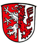
Schwabbruck
| coat of arms | Germany map | |
|---|---|---|

|
Coordinates: 47 ° 50 ' N , 10 ° 50' E |
|
| Basic data | ||
| State : | Bavaria | |
| Administrative region : | Upper Bavaria | |
| County : | Weilheim-Schongau | |
| Management Community : | Altenstadt (Upper Bavaria) | |
| Height : | 733 m above sea level NHN | |
| Area : | 7.33 km 2 | |
| Residents: | 964 (Dec. 31, 2019) | |
| Population density : | 131 inhabitants per km 2 | |
| Postal code : | 86986 | |
| Area code : | 08868 | |
| License plate : | WM, SOG | |
| Community key : | 09 1 90 149 | |
| Association administration address: | Marienplatz 2 86972 Altenstadt |
|
| Website : | ||
| Mayor : | Norbert Essich ( Free Voting Group ) | |
| Location of the municipality of Schwabbruck in the Weilheim-Schongau district | ||
Schwabbruck is a municipality in the Upper Bavarian district of Weilheim-Schongau and a member of the Altenstadt administrative community .
geography
Schwabbruck is located in the Oberland region west of the city of Schongau on the border between Swabia and Old Bavaria in the young moraine area north of the Allgäu Alps . To the north of the municipality, the Sachsenrieder Forest and the Denklingen Forest form one of the largest contiguous forest areas in Upper Bavaria.
Only the Schwabbruck district exists .
history
Until the church is planted
In the 8th / 9th In the 17th century, the imperial monastery of St. Mang in Füssen was equipped with royal fiscal property east of Sachsenried . From around 1070 the bailiwick of the monastery was owned by the Guelphs , who were able to establish a closed territory on the Lechrain .
The place name first became tangible in 1126 through the mention of a Guelph family of servants "von Brugge". The residence of this family was in the "Brucksteller" corridor (von Burgstall ) northwest of the village. The castle was built around 1100 to protect a bridge built at that time over the Schönach, after which the moated castle and the village were named. The water crossing was created as part of the expansion of the important military road between Augsburg and Verona . This road connection probably goes back to ancient, pre-Roman road connections.
Until 1716 the village in the foreland of the Allgäu Alps was only called Brugg, Bruck, Prugk or similar. The current name "Schwabbruck" has only been in common use since 1802. The population mostly calls their hometown "Brugg" up to the present day.
Schwabbruck belonged to the secularization of the Bishopric of Augsburg , which had in 1313 acquired the bailiwick of the monastery St. Mang. In 1785 , the bishopric of the Electorate of Bavaria was swapped for high jurisdiction . Since the Reichsdeputationshauptschluss and the secularization of 1803 the place belongs to Bavaria. Today's community was created with the community edict of 1818 .
Population development
- 1961: 553 inhabitants
- 1970: 635 inhabitants
- 1987: 714 inhabitants
- 1991: 772 inhabitants
- 1995: 811 inhabitants
- 2000: 829 inhabitants
- 2005: 911 inhabitants
- 2010: 936 inhabitants
- 2015: 948 inhabitants
The population figures refer to today's municipality.
Schwabbruck grew by 234 inhabitants or approx. 32% from 1988 to 2008. Between 1988 and 2018 the community grew from 725 to 963 by 238 inhabitants or 32.8%.
mayor
Norbert Essich (Free Voters' Group) has been the mayor since May 2014.
Auerbergland
Schwabbruck is a member municipality of the inter-municipal alliance " Auerbergland ", which crosses the borders of the administrative districts of Swabia and Upper Bavaria .
Architectural monuments
Soil monuments
education
In 1999 the following institutions existed:
- Kindergarten: 50 kindergarten places with 38 children
literature
- Pankraz Fried : Regional court, high court and district of Schongau (Historical Atlas of Bavaria, part of Old Bavaria, double volume 22/23). Munich 1971
- Josef Mayrock, Peter Socher (ed.): Chronicle of the parish and community Schwabbruck - based on the work of the same name by Pastor Ostheimer, edited and continued by Josef Mayrock and Peter Socher . Schwabbruck 1993
- Max Ostheimer: Chronicle of the parish and community Schwabbruck . Manuscript, Schwabbruck 1940
Web links
- Entry on the coat of arms of Schwabbruck in the database of the House of Bavarian History
- Schwabbruck: Official statistics of the LfStat (PDF; 1.24 MB)
Individual evidence
- ↑ "Data 2" sheet, Statistical Report A1200C 202041 Population of the municipalities, districts and administrative districts 1st quarter 2020 (population based on the 2011 census) ( help ).
- ↑ http://www.wahlen.bayern.de/kommunalwahlen/


