Rottbach (Lech)
| Rottbach | ||
|
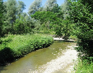
The Rottbach just before it flows into the Lech |
||
| Data | ||
| Water code | DE : 12592 | |
| location |
Bavaria
|
|
| River system | Lech | |
| Drain over | Lech → Danube → Black Sea | |
| source | about 50 m to the west of Puitl 47 ° 51 '10 " N , 11 ° 0' 25" O |
|
| Source height | 745 m above sea level NHN | |
| muzzle | north of Rauhenlechsberg from the right in the Lech coordinates: 47 ° 54 ′ 15 ″ N , 10 ° 55 ′ 58 ″ E 47 ° 54 ′ 15 ″ N , 10 ° 55 ′ 58 ″ E |
|
| Mouth height | 635 m above sea level NHN | |
| Height difference | 110 m | |
| Bottom slope | 6.8 ‰ | |
| length | 16.1 km | |
| Catchment area | 28.57 km² | |
| Reservoirs flowed through | Engelsried lake | |
| Navigable | on the Engelsrieder See | |
The Rottbach is an approximately 16 km long right tributary of the Lech in the districts of Landsberg am Lech and Weilheim-Schongau in Upper Bavaria .
Upper course
The Rottbach rises in a hilly moraine landscape near Puitl at an altitude of 745 m above sea level. NHN .
course
The Rottbach initially runs south past Streberg and then briefly forms the border between the districts of Landsberg am Lech and Weilheim-Schongau in the area of the Breiten Moos , before it completely enters the area of the Landsberg am Lech district.
A little later the Rottbach takes on the Lüßgraben from the left before it is dammed up to Lake Engelsrieder . This was created in 1510 at the instigation of the Wessobrunn abbot Kaspar Götz for fish farming , after a dam breach in 1905 the weir was rebuilt in 1921. There is a lido by the lake.
Shortly after leaving the Engelsrieder See, the Geiselmoosbach flows from the right, followed by the Kalterbach a little later.
After a bend to the northwest, the Rottbach passes the southern part of the village of Rott , before it increasingly cuts into a deep valley by a meandering river bed at Grubmühle . Finally, the Rottbach flows south of Apfeldorfhausen through a gorge that is about 70 m deep just before the confluence north of Rauhenlechsberg in the Lech.
Finally the Rottbach flows from the right into the Lech below the Lech barrage 9 - Apfeldorf at 635 m above sea level. NHN .
The 16.1 km long Rottbach flows about 110 meters below its origin and thus has an average bed gradient of almost 7 ‰.
Tributaries
- Lüßgraben (GKZ: 12592-2), from the left and west to about 697 m above sea level. NHN in a marshland west of Engelsrieder See , 1.47 km long and 4.33 km² catchment area. Arises at about 707 m above sea level. NHN south of the Riedhof .
- Hostage Moosbach (TVC: 12592-4), from the right and southeast at about 690 m above sea level. NHN after the runoff from the Engelsrieder See near Seehäusl , 2.13 km long and 2.92 km² catchment area. Arises at about 715 m above sea level. NHN west-northwest of Wessobrunn .
- Kalterbach (GKZ: 12592-6), from the right and east to about 686 m above sea level. NHN in the Kalterbacher Filz south of Rott, 2.61 km long and 3.56 km² catchment area. Arises at about 722 m above sea level. NHN west of Schellschwang .
Further data
The mean annual precipitation is around 1,300 mm.
Individual evidence
- ^ BayernAtlas. Accessed January 30, 2019 .
- ↑ Water directory Bavaria. Retrieved February 1, 2019 .
- ^ Environment Atlas Bavaria. Retrieved February 1, 2019 .
