Streberg
|
Streberg
municipality Wessobrunn
Coordinates: 47 ° 51 ′ 41 ″ N , 11 ° 0 ′ 24 ″ E
|
|
|---|---|
| Height : | 746 m above sea level NHN |
| Residents : | 6 (May 25 1987) |
| Postal code : | 82405 |
| Area code : | 08809 |
|
NSG Rohrmoos near Streberg
|
|
Streberg is a district of the municipality of Wessobrunn in the Upper Bavarian district of Weilheim-Schongau .
geography
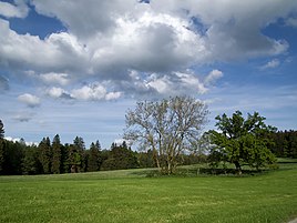
The wasteland is about two kilometers southwest of Wessobrunn in a young moraine landscape , but is separated from the main town by the Schlittgraben. The Rohrmoos nature reserve is located about 500 m to the north , and the Rottbach flows past to the south .
history
Streberg belonged to the Forst riedership of the Klosterhofmark Wessobrunn . In 1761 an eighth yard is mentioned; it was built for the Wessobrunn monastery. The high jurisdiction lay with the Landsberg district court .
After secularization , the wasteland became part of the newly formed community of Forst in the Weilheim district court in Upper Bavaria in the course of the municipal edicts of 1818 .
With this Streberg was incorporated into Wessobrunn in the course of the regional reform in Bavaria on May 1, 1978.
literature
- Pankraz Fried, Sebastian Hiereth: Altbayern Row I, Issue 22-23: Landsberg Regional Court and Rauhenlechsberg Nursing Court . In: Historical Atlas of Bavaria . Komm. Für Bayerische Landesgeschichte, Munich 1971 (327 pages).
Web links
- Streberg in the location database of the Bayerische Landesbibliothek Online . Bavarian State Library
Individual evidence
- ^ BayernAtlas. Retrieved May 2, 2019 .

