
Litnisschrofen
| Litnisschrofen | ||
|---|---|---|
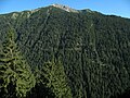
 Litnisschrofen from the northeast |
||
| height | 2068 m above sea level A. | |
| location | Tyrol , Austria | |
| Mountains | Vilsalpseeberge , Allgäu Alps | |
| Dominance | 2.1 km → Sulzspitze | |
| Notch height | 198 m ↓ Strindenscharte | |
| Coordinates | 47 ° 27 '59 " N , 10 ° 33' 47" E | |
|
||
| rock | Main dolomite | |
| Normal way | Nesselwängle - Gräner Ödenalpe - southern flank | |

The Litnisschrofen (also Tennenbergkopf according to historical sources ) is a 2068 meter high mountain in the Allgäu Alps that rises in Austria .
Location and surroundings
The Litnisschrofen is located in the Austrian state of Tyrol . The border between the municipalities of Grän in the northwest and Nesselwängle in the southeast runs over almost the entire mountain .
The summit of the Litnisschrofen towers between the Strindenbachtal in the northeast and the Weißenbachtal in the south. In these valleys, the flanks drop down to 700 meters and 900 meters respectively. Beyond the valleys are the Vogelhörnle (1882 m) and the Leilachspitze (2274 m). To the west a long west ridge runs into the Strindenscharte (1870 m), from where the flanks of the Sulzspitze (2084 m) rise. Scharte and Berg are the reference points for Schartenhöhe and Dominanz , which are 198 meters and 2.1 kilometers, respectively. In the northeast of the Litnisschrofens, its flanks gathers above the Gräner Ödenalpe (1736 m) to the Krinnenspitze (2000 m).
geology
The litnis cup is made of brittle main dolomite .
Origin of name
In 1774 Peter Anich recorded a Litten Spitz in his Atlas Tyrolensis . In Schmitt's map of southwest Germany from 1797, a Liehnes mountain is recorded. A possible origin of the name could come from the dialect word "Verlitt", which means something like hardship or plague. This could mean the arduous ascent through the mountain pine thicket from the Strindenscharte. The ending of the name refers to the shape of the rock as a crag .
In addition to the name used today and its history, there is a second type of naming: Tennenbergkopf . It is used for the first time in 1810 in a tax register : Thennenbergkopf and Wald am Thennenberg . On the basis of the border description there, only the litniscroft can be clearly meant as "head above the fir-covered mountain". This would especially suit the appearance of the southern flank.
Ascent
With a marked and developed path, the summit of the Litnisschrofens can only be reached via the southern flank. This branches off from the road at the Gräner Ödenalpe. There are several ways to get there. This is relatively easy to do from Nesselwängle from the beginning of the driveway or from the top station of the chairlift . This is also possible from Haldensee through the Strindental or from Rauth over the Enziansteig . From the junction, the path crosses the southern flank under the summit structure and leads into a very crumbly and steep gully. This is insured with iron chains and requires surefootedness . At its end is the west ridge towards the summit. The last part of the way requires a head for heights .
A more challenging route to the summit is the ascent of the west ridge from the Strindenscharte. The difficulties here have the 1st degree and require "alpine experience". Climbing over the northeast ridge is rated IV.
photos

Summit cross

Key point normal route
South flank


Web links
Individual evidence
- ↑ a b Compass hiking, bike and ski tour map: Sheet 04 Tannheimer Tal (1: 35,000). ISBN 978-3-85491-644-4 (as of February 2007).
- ↑ Federal Office for Metrology and Surveying Austria: Austrian Map online . Retrieved May 8, 2010.
- ^ A b Ernst Zettler, Heinz Groth: Alpine Club Guide - Allgäu Alps . 12th, completely revised edition. Bergverlag Rudolf Rother , Munich 1985, ISBN 3-7633-1111-4 (p. 465f).
- ^ Thaddäus Steiner : Allgäu mountain names . 2nd Edition. Kunstverlag Josef Fink, Lindenberg 2008, ISBN 978-3-8987-0389-5 (p. 138).
- ^ Thaddäus Steiner: Allgäu mountain names . 2nd Edition. Kunstverlag Josef Fink, Lindenberg 2008, (p. 206).
- ↑ Dieter Seibert: Alpine Club Guide alpine - Allgäu Alps and Ammergau Alps . 17th edition. Bergverlag Rother, Munich 2008, ISBN 978-3-7633-1126-2 (p. 272ff).