
Warth (Vorarlberg)
|
Warth
|
||
|---|---|---|
| coat of arms | Austria map | |
 |
|
|
| Basic data | ||
| Country: | Austria | |
| State : | Vorarlberg | |
| Political District : | Bregenz | |
| License plate : | B. | |
| Surface: | 19.31 km² | |
| Coordinates : | 47 ° 16 ' N , 10 ° 11' E | |
| Height : | 1495 m above sea level A. | |
| Residents : | 166 (January 1, 2020) | |
| Population density : | 8.6 inhabitants per km² | |
| Postal code : | 6767 | |
| Area code : | 05583 | |
| Community code : | 8 02 39 | |
| NUTS region | AT341 | |
| Address of the municipal administration: |
Hno. 32 6767 Warth |
|
| Website: | ||
| politics | ||
| Mayor : | Stefan Strolz | |
|
Local council : ( 2015 ) (9 members) |
||
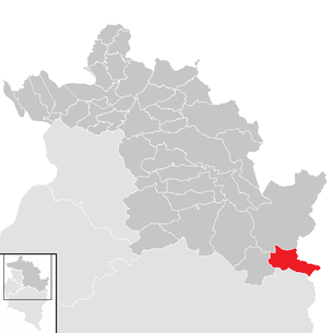
| Location of Warth in the Bregenz district | ||
  |
||
 Warth in summer |
||
| Source: Municipal data from Statistics Austria | ||


Warth is the second smallest municipality in terms of population in Vorarlberg , the westernmost Austrian state, with 166 inhabitants (as of January 1, 2020). The community is of particular importance as a winter sports resort, connected to the Arlberg ski area , the largest contiguous ski area in Austria, and as a connection point between the Bregenz Forest and the neighboring Tyrolean Lech Valley (via the Hochtannberg pass ).
geography
Warth is located in the Bregenz district about 42 km southeast of Lake Constance at an altitude of 1,495 m on the Tannberg . There the village is just a little south of the Haldenwanger Eck . With the official altitude of 1495 m above sea level. A. Warth is the highest municipality in Vorarlberg. Warth is the easternmost municipality that is still geographically and historically part of the Bregenzerwald region, but for tourism it is part of the Arlberg region and is geographically already in the Lech Valley . All other Bregenzerwald communities, however, are located in the valley of the Bregenzer Ach or one of the side valleys of the Bregenzer Ach.
With a municipal area of 19.34 km², the municipality of Warth has an area corresponding to the Vorarlberg average, but at the same time is one of the smaller municipalities in this region compared to other municipalities in the Bregenzerwald. 19.8% of the community area is forested, 62% is in the mountains of the Alps. The districts of the community are the Hochkrumbach hillside settlement and the actual settlement of Warth.
Community structure
The municipality includes the following two localities (population in brackets as of January 1, 2020):
- Hochkrumbach (23)
- Warth (143)
The community consists of the cadastral district of Warth.
Neighboring communities
The municipality of Warth shares its municipal boundary with five other municipalities. These are the German market in Oberstdorf in the Bavarian district of Oberallgäu , the municipality of Steeg in the Reutte district in the neighboring state of Tyrol , the municipality of Lech in the Vorarlberg district of Bludenz and the communities of Schröcken and Mittelberg in the Bregenz district. Despite the geographical proximity, there is no transport option to reach Mittelberg in Kleinwalsertal or Oberstdorf in Germany directly from Warth.
climate
|
Monthly mean values for Warth
Source: GMA Climate Data Germany
|
||||||||||||||||||||||||||||||||||||||||||||||||||||||||||||
history
Middle Ages and Walser settlement
The area of the municipality of Warth was mentioned for the first time in a deed of donation in 1059. With this diploma , King Heinrich IV transferred the wild ban over the forest between Lech, Wertach and Iller and the sole hunting rights for the Great Widderstein to the bishop of Augsburg, Heinrich II. , In whose ecclesiastical territory the area was still located until 1816. Around the years 1280-1300, the Walsers who emigrated from the Swiss Wallis settled on the Tannberg. These were given to the land as a fiefdom from the Swabian landlords of Rotenberg in exchange for low interest in kind. In addition, the Walsers were given extensive rights, such as self-administration and the exercise of lower jurisdiction . The Tannberg Walser Court subsequently included the communities of Lech , Warth, Hochkrumbach , Schröcken and Mittelberg .
Modern times
In 1451 titular Archduke Sigismund of Austria conquered the Walser holdings on the Tannberg by force and dissolved the far-reaching Walser rights. From then on, the Walsers were subordinate to the Austrian rule of Bregenz . Only after the Appenzell Wars at the beginning of the 16th century did the Walsers regain their original rights. In 1602, Warth became its own parish for the first time, after a parish church had been created by enlarging the existing chapel. Warth had previously belonged to the parish of Lech. From 1805 to 1814 the place belonged to Bavaria , then again to Austria . Warth has been part of the Austrian state of Vorarlberg since it was founded in 1861. In 1885, Warth was merged with the previously independent municipality of Hochkrumbach to form the new municipality of Warth-Hochkrumbach .
20th and 21st centuries
It was not until 1924 that the municipality changed its name back to Warth, with Hochkrumbach becoming part of the municipality. From 1945 to 1955, like all of Vorarlberg, the community was part of the French occupation zone in Austria.
On December 31, 2002, the community had 261 inhabitants (including second homes). The proportion of foreigners in 2002 was 19.5%. After a general construction ban was imposed for the entire municipality in 2008 due to an acute water shortage in the municipality, the hotel was subsequently closed. Subsequently, the municipal administration of Warth and the neighboring town of Lech agreed that a water pipe should be laid from the neighboring municipality to Warth in order to be able to guarantee the drinking water supply . After this water pipe was completed in autumn 2011, the construction ban was subsequently lifted by the municipality.
Population development

The decline in the population from 2001 to 2011 is caused by a slightly negative birth balance and a more negative migration balance .
politics
The Warth community council consists of nine members. After Mayor Gebhard Fritz and the entire municipal council had declared their resignation as a result of threats on February 8, 2012, the council had to be re-elected on June 17, 2012.
In the municipal council election on June 17, 2012, the "procedure for election to the municipal council in the absence of nominations" was used after no lists could be drawn up for election. The 9 elected members of the municipal council subsequently elected Stefan Strolz as mayor , who was able to unite the highest number of votes with 63 votes in the municipal council election. Markus Strolz was elected Vice Mayor. In the context of the ordinary municipal council and mayoral elections in 2015 , the majority vote procedure was used again in Warth.
According to the municipal financial report 2010, Warth was the municipality with the third highest per capita debt in Austria. For every Warther there was the equivalent of 16,285 euros in municipal debts. At the same time, however, Warth was Austria's municipality with the highest reserves per capita (7,450 euros) and the second highest financial strength per inhabitant (5,923 euros). These relatively high numbers can be attributed to the low population in the municipality of Warth.
Parish council
The parish council is faced with the mayor as chairman, but is not itself a member of the municipal executive board. Markus Strolz was elected as the first community board member and vice mayor in the current legislative period, Christoph Weißenbach as the second community board member and Oswald Jäger as the third community board member by the community council.
coat of arms
The coat of arms of the municipality of Warth shows a connection with the Walser past of the settlement as well as with the Bregenzerwald region. The coat of arms shows two silver Walser stars in a split shield in the right red field and in the left silver field on a green three-mountain a green forest fir with ascending branches. The municipal coat of arms was awarded on July 21, 1970 by the Vorarlberg state government .
Culture and sights
- Catholic parish church Warth am Arlberg hl. Sebastian
- Simmel Chapel in Hochkrumbach
Economy and Infrastructure
According to a survey by the Austrian Chamber of Commerce , there were a total of 198 (dependent) employees in 23 business enterprises on average in 2014. In addition to three companies in the commercial sector, two craft companies, one company in the banking and insurance sector and two transport companies, the remaining 15 companies came from commercial tourism, with 145 and thus the majority of the employees.
In order to maintain local supplies in the community, the local grocer, a SPAR store, is financially supported by both the community and the state of Vorarlberg. The regional funding concept of the state of Vorarlberg expressly provides for this funding of small regional local suppliers.
tourism

The tourism and tourism industries are of particular importance for the economy of the municipality of Warth. Winter ski tourism in particular is economically important, as the slopes around Warth and Schröcken are considered to be very snow-reliable ski areas. In the winter season 2014/15 there were a total of 119,748 overnight stays with 24,311 guests in Warth, of which almost 70% were in local hotels , inns and guesthouses , i.e. business tourism facilities. The Ski Arlberg ski area is located on the southwestern mountain slopes of Warth . Since the 2013/14 winter season, the Auenfeldjet gondola lift has been connecting the previously neighboring but separate ski areas of Ski Arlberg West and Snowworld-Warth-Schröcken. The last gap in the area will be closed for the 2016/17 winter season with the construction of the Flexenbahn between Stuben and Zürs . The resulting common ski area is currently the largest in Austria with a total of 88 lifts and 304 kilometers of slopes. Furthermore, tickets can only be purchased for the respective partial ski areas Snowworld-Warth-Schröcken , Ski Arlberg East and West ; the use of the entire ski area requires the purchase of the Ski Arlberg ski pass .
Overall, summer tourism enjoys a less prominent position in Vorarlberg, but the state has been increasingly marketed as a hiking and recreational holiday destination since the early 1990s. In the 2014 summer season (May to October), Warth recorded a total of 32,174 overnight stays with 11,267 registered guests. Warth benefits in particular from its ideal starting point for hikers and mountaineers who undertake tours in the area of the Lechquellen Mountains and the rear Bregenzerwald Mountains .
List of systems in Warth
| Surname | Construction year | system | Height above sea level
Valley station [meters] |
Height above sea level
Mountain station [meters] |
Stretch-
length [meters] |
Promotional
capacity [pers./hour] |
business
winter |
business
summer |
|---|---|---|---|---|---|---|---|---|
|
Warth village railway |
2017 | 8-MGD | 1,499 | 1,575 | 422 | 850 | W. | S. |
| Hochalpbahn
|
2003 | 4-CLF | 1.914 | 2,042 | 770 | 2,380 | W. | 0 |
| Jägeralp Express
|
2003 | 6- CLD / B | 1,580 | 2,040 | 1,466 | 2,357 | W. | 0 |
| Karhornbahn
|
1993 | 2-CLF | 1.929 | 2,055 | 578 | 1,435 | W. | 0 |
| Tickle lift
|
1977 | Knitting lift | - | - | 100 | 500 | W. | 0 |
| Steffisalp Express
|
1990 | 4-CLD / B | 1,518 | 1,887 | 1,402 | 2,380 | W. | S. |
| Wannenkopfbahn
|
1996 | 4-CLF | 1,517 | 1,599 | 369 | 1,674 | W. | 0 |
| Wartherhorn Express
|
1997 | 6-CLD / B | 1,762 | 2,046 | 1,028 | 2,880 | W. | 0 |
The abbreviations in the "System" column are explained under aerial cableway .
Last 2 columns:
W = winter operation / S = summer operation; each highlighted in green
0 = no summer operation, highlighted in red
traffic

In the area of the Hochkrumbach hillside settlement belonging to Warth, the Bregenzerwaldstraße (L 200) connects the valley of the Bregenzer Ach with the upper Lech valley in the course of the Hochtannbergpass . The Hochtannbergpass is an important connecting road between the municipality of Schröcken in the Bregenz Forest and the municipality of Warth in the Lech Valley. From the Hochkrumbach district of Warth, the wooden floor tunnel with a length of 168 m and an associated gallery of 1153 m leads along Bregenzerwaldstraße to the center of Warth. In addition, the Lechtalstraße (L 198), which is usually only passable in summer, leads from the neighboring town of Lech via Warth into the Tyrolean Lech Valley. The two state roads meet in the center of Warth, which enables a continuous connection from the Bregenzerwald into the Tyrolean Lech Valley or via Lech and the Flexenpass into the Klostertal or into the Tyrolean Stanzer Valley .
As part of public transport, Warth is connected to the city of Dornbirn in the Vorarlberg Rhine Valley with line 40 of the Bregenzerwald regional bus via the rear and central Bregenzerwald (with stops in Bezau and Egg, among others ) . While this connection continues to Lech in the summer, line 40 ends at the Warth Dorfplatz stop in the winter months.
Public facilities
In addition to a municipal office, there is a multi-purpose building in Warth, which is used by the volunteer fire brigade as well as the mountain rescue and waste management of the municipality. In addition, due to its exposed location, Warth has its own small wastewater treatment plant . The Warth police station is located directly on the village square and is not manned all year round and is run as a branch of the Au police station. The closest local office of the Austrian Red Cross with an ambulance vehicle responsible for Warth is in Au. The quickest public hospital to be reached by rescue helicopter is the Dornbirn hospital in the city of the same name in the Rhine Valley. In the municipality of Warth, the Warth transmitter is also an ORS transmitter, which broadcasts public radio.
education
Up until the 2010/11 school year, the Warth community had both an elementary school (including upper level) and a kindergarten. After the number of pupils had dropped massively, the elementary school in Warth was closed in 2011. Since the 2011/12 school year, the Warth elementary school students have been attending the elementary school in Schröcken, while the secondary school students are taught in Au. The closest grammar school is in Egg, other higher schools, such as a commercial academy or a tourism school, are in the main town of the Bregenzerwald, in Bezau .
Personalities
Sons and daughters of the church
- Werner Grabher (* 1948), author and head of the Vorarlberg cultural office
- Luise Jaretz (* 1931), ski racer
- Hubert Strolz (* 1962), 1988 Olympic champion in alpine combined
- Johannes Strolz (* 1992), ski racer
People associated with the place
- Wiltrud Drexel (* 1950), Olympic third in giant slalom 1972 and Downhill World Cup winner 1969
Web links
- Homepage of the community of Warth
- Website of the Warth-Schröcken ski area
- 80239 - Warth (Vorarlberg). Community data, Statistics Austria .

Individual evidence
- ↑ Statistics Austria - Population at the beginning of 2002–2020 by municipalities (area status 01/01/2020)
- ↑ Statistics Austria: Population on January 1st, 2020 by locality (area status on January 1st, 2020) , ( CSV )
- ↑ Martin Bitschnau , Hannes Obermair : Tiroler Urkundenbuch, II. Department: The documents on the history of the Inn, Eisack and Pustertal valleys. Volume 1: By the year 1140 . Universitätsverlag Wagner, Innsbruck 2009, ISBN 978-3-7030-0469-8 , p. 206, no. 228 .
- ↑ A brief historical overview of Warth ( memento from August 8, 2014 in the Internet Archive ) on the Warth community website.
- ↑ Ulrich Nachbaur : Vorarlberg municipalities 1849 to 2008 (PDF; 182 kB). In: 200 years of community organization - Almanac for the Vorarlberg community year 2008 . Bregenz, 2009. ISBN 978-3-902622-10-5
- ^ ORF Vorarlberg: Warth is hoping for drinking water from Lech . Article of February 11, 2009.
- ^ ORF Vorarlberg: water pipe for Warth before completion . Article dated August 13, 2011.
- ^ Statistics Austria, A look at the community of Warth, population development. Retrieved March 24, 2019 .
- ^ ORF Vorarlberg: Warth: threatening letters as a reason for resignations . Article dated February 10, 2012.
- ^ ORF Vorarlberg: New elections in Warth on June 17th . Article of February 27, 2012.
- ^ A b ORF Vorarlberg: Warth: Stefan Strolz is mayor . Article of June 26, 2012.
- ^ ORF Vorarlberg: Community debt: Ländle in third place . Article of December 20, 2010.
- ↑ Cornelia Albertani, Ulrich Nachbaur: Vorarlberg municipal coat of arms registry . Ed .: Vorarlberger Landesarchiv. 3. Edition. Bregenz 2011, ISBN 978-3-902622-17-4 , pp. 49 ( vorarlberg.at [PDF]).
- ^ Vorarlberg Chamber of Commerce : Employment Statistics ( Memento from November 17, 2015 in the Internet Archive ) . Edition 2015. p. 18.
- ^ Office of the Vorarlberg State Government, State Office for Statistics: Tourism Winter Season 2014/15 ( Memento from October 16, 2015 in the Internet Archive ) (PDF; 123 kB). Preliminary figures. P. 3 and 5.
- ↑ Successful world premiere of the Auenfeldjet . Article on Vorarlberg Online (VOL.at) from March 27, 2014.
- ↑ Flexenbahn. Retrieved August 31, 2017 .
- ↑ Austria: largest ski areas - largest ski area in Austria. Retrieved August 31, 2017 .
- ↑ The Auenfeldjet connects the Lech Zürs and Warth-Schröcken ski areas ( memento from January 3, 2016 in the Internet Archive ) . Article on the website of Vorarlberg Tourismus .
- ^ Office of the Vorarlberg State Government, State Office for Statistics: Tourism Summer 2014 (PDF; 1.42 MB). P. 32 and 34.
- ^ ORF Vorarlberg: Elementary school in Warth will be closed . Article dated September 1, 2011.

Alberschwende | Andelsbuch | Au | Bezau | Bildstein | Bizau | Bregenz | Book | Damüls | Doren | Egg | Eichenberg | Fußach | Gaissau | Hard | Hittisau | Highest | Hohenweiler | Hörbranz | Kennelbach | Krumbach | Langen near Bregenz | Langenegg | Lauterach | Lingenau | Lochau | Mellau | Mittelberg | Möggers | Reuthe | Riefensberg | Schnepfau | Schoppernau | Schröcken | Schwarzach | Schwarzenberg | Sibratsgfall | Sulzberg | Warth | Wolfurt