
Schröcken
|
Schröcken
|
||
|---|---|---|
| coat of arms | Austria map | |
 |
|
|
| Basic data | ||
| Country: | Austria | |
| State : | Vorarlberg | |
| Political District : | Bregenz | |
| License plate : | B. | |
| Surface: | 23.43 km² | |
| Coordinates : | 47 ° 15 ' N , 10 ° 6' E | |
| Height : | 1269 m above sea level A. | |
| Residents : | 211 (January 1, 2020) | |
| Population density : | 9 inhabitants per km² | |
| Postal code : | 6888 | |
| Area code : | 05519 | |
| Community code : | 8 02 34 | |
| NUTS region | AT341 | |
| Address of the municipal administration: |
Heimboden 2 6888 Schröcken |
|
| Website: | ||
| politics | ||
| Mayor : | Herbert Schwarzmann | |
|
Local council : (2015) (9 members) |
||
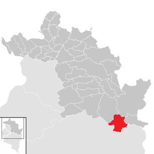
| Location of Schröcken in the Bregenz district | ||
  |
||
 Schröcken before Juppenspitze (2412 m) and Mohnenfluh (2542 m) |
||
| Source: Municipal data from Statistics Austria | ||

Schröcken is a municipality in the Austrian state of Vorarlberg with 211 inhabitants (as of January 1, 2020). The municipality is located in the Bregenz am Tannberg district and, together with the neighboring municipality of Warth, forms an important ski region which has been connected to the Arlberg ski area since 2013 .
geography
The municipality of Schröcken is located in the westernmost state of Austria, Vorarlberg, in the Bregenz district south-east of Lake Constance at an altitude of 1269 m . Geographically belongs Schröcken due to its location in the farthest part of the valley of Bregenzerach the Bregenz Forest , historically the Tannberg , Schröcken touristy but still the Arlberg region counted.
The Neßlegg parcel, located a little above the center of the village, is part of the community of Schröcken . This high settlement is at the foot of the Hochtannberg Pass . From Schröcken in the rearmost Bregenz Forest, the Hochtannbergstrasse leads via Hochkrumbach , a district of the neighboring municipality of Warth, into the Lech Valley .
12.4% of the total of 23.43 square kilometers of the municipal area are forested, 39.4% of the area of the Alps.
Neighboring communities
Schröcken borders a total of five other Vorarlberg communities. Of these, three, namely the communities of Schoppernau , Mittelberg and Warth, are also in the Bregenz district and the other two ( Lech and Sonntag ) in the Bludenz district . (The municipalities are given clockwise, starting in the north.)
climate
|
Average monthly temperatures and precipitation for Schröcken
|
|||||||||||||||||||||||||||||||||||||||||||||||||||||||||||||||||||||||||||||||||||||||||||||||||||||||||||||||||||||||||||||||||||||||||||||||||||||||||||||||||||||||||
history
The area around Schröcken was first settled by Walsers around 1300, came to Austria in 1453 and was subordinate to the Bregenz Bailiwick. The place was incorporated into the Tannberg court until 1806.
The Habsburgs ruled the places in Vorarlberg alternately from Tyrol and Upper Austria (Freiburg im Breisgau). From 1805 to 1814 the place belonged to Bavaria , then again to Austria . Schröcken has belonged to the Austrian state of Vorarlberg since it was founded in 1861 . In 1863 the church and surrounding buildings burned down completely in the course of a major fire in the village.
The place was part of the French occupation zone in Austria from 1945 to 1955 .
Population development

The proportion of foreigners at the end of 2002 was 10.5 percent. The decrease in the number of inhabitants from 1991 to 2011 occurred despite a positive birth balance due to a more negative migration balance .

etymology
The place was originally called "Girsboden". The name "Schröcken" first appeared at the beginning of the 17th century.
politics

The Schröcken municipal council consists of 9 members; in the 2015 municipal council election she was not elected via party lists, but by majority vote. Mayor of the community is Herbert Schwarzmann.
Schröcken belongs to the political district of Bregenz and the judicial district of Bezau .
Culture and sights

Parish Church of Our Lady of the Assumption
The first church in Schröcken was consecrated in 1639 - Schröcken was a branch of Lech until 1640. This church was enlarged from 1726 to 1732, destroyed by fire in 1863, rebuilt from 1864 to 1867 and consecrated in 1867.
The parish church is surrounded by a walled cemetery, has a neo-Romanesque nave and in the north a tower with a pointed helmet. The high altar has a neo-Romanesque canopy and figures by Fidelis Rudhart (1876).
The altarpiece “Assumption of Mary” is by Melchior Paul von Deschwanden (1876).
Chapel of the Annunciation (in the sub-floor)
This chapel with its neo-Gothic altar was built in 1778 instead of a chapel that had previously been demolished in 1774 and consecrated in 1779.
Economy and Infrastructure
Tourism and leisure industry
In 2003 there were 16 commercial enterprises with 141 employees and 2 apprentices on site. There were 97 employees subject to wage tax. In the 2001/2002 tourism year there were a total of 70,292 overnight stays.
Schröcken is located on the edge of the Ski Arlberg ski area , but the village center is only connected to the ski area by a ski bus connection. The construction of a village railway was approved in 2012, but there is currently a lack of funds and beds in the community.
List of plants in Schröcken
| Surname | Construction year | system | Height above sea level
Valley station [meters] |
Height above sea level
Mountain station [meters] |
Stretch-
length [meters] |
Promotional
capacity [pers./hour] |
business
winter |
business
summer |
|---|---|---|---|---|---|---|---|---|
| Auenfeldjet
|
2013 | 10- MGD | 1,719 | 1,786 | 2,072 | 1,490 | W. | 0 |
| Basket lift
|
1995 | 1-SL | 1,658 | 1,680 | 206 | 791 | W. | 0 |
| Kuchlbahn
|
1993 | 2-CLF | 1,649 | 1,720 | 307 | 1,430 | W. | 0 |
| Märchenlandlift
|
- | Knitting lift | - | - | 100 | 500 | W. | 0 |
| Saloberjet
|
2003 | 6-CLD / B | 1,659 | 2,044 | 1,192 | 3,005 | W. | 0 |
|
Falken I ski swing
|
1997 | 2-CLF | 1,678 | 1,811 | 1.310 | 1,435 | W. | 0 |
| Falken II ski swing
|
1997 | 2-CLF | 1,696 | 1,811 | 585 | 1,433 | W. | 0 |
| Sonnencruiser-Auenfeld
|
2003 | 4-CLF | 1,718 | 1,992 | 1.108 | 1,900 | W. | 0 |
| Sonnenjet Auenfeld
|
2003 | 6-CLD / B | 1,651 | 2,041 | 1,454 | 2,900 | W. | 0 |
The abbreviations in the "System" column are explained under aerial cableway .
Last 2 columns:
W = winter operation / S = summer operation; each highlighted in green
0 = no summer operation, highlighted in red

traffic
The traffic is served by the Wälderbus 40 or 42 between Schoppernau and Warth / Lech am Arlberg. The stepped Bregenzerwald federal highway 200 is winding and (still) quite narrow.
Avalanche barriers
Because of a landslide from the Saloberkopf in 2002, the route above the pass road on the Schröcken - Warth side has been secured with avalanche fences. The road has meanwhile been straightened and further supported. The result of the rock fall was a tidal wave that rolled down the Lech, damaging several bridges and buildings. That is why the L 200 had to be successively renovated.
education
There are (as of September 2010) 8 students on site. In Schröcken there is also a kindergarten, which 8 children are currently attending.
Personalities
- Pastor Bickel , pastor of Schröcken, climbed the Großer Widderstein on July 25, 1669, according to other sources, in 1664
Web links
Individual evidence
- ↑ Statistics Austria - Population at the beginning of 2002–2020 by municipalities (area status 01/01/2020)
- ^ Statistics Austria, A look at the community of Schröcken, population development. (PDF) Retrieved March 24, 2019 .
- ↑ Dorfbahn stands or falls with beds . In: Vorarlberger Nachrichten | VN.AT . ( vn.at [accessed on August 25, 2017]).
- ↑ uni-karlsruhe.de ( page no longer available , search in web archives ) Info: The link was automatically marked as defective. Please check the link according to the instructions and then remove this notice.

Alberschwende | Andelsbuch | Au | Bezau | Bildstein | Bizau | Bregenz | Book | Damüls | Doren | Egg | Eichenberg | Fußach | Gaissau | Hard | Hittisau | Highest | Hohenweiler | Hörbranz | Kennelbach | Krumbach | Langen near Bregenz | Langenegg | Lauterach | Lingenau | Lochau | Mellau | Mittelberg | Möggers | Reuthe | Riefensberg | Schnepfau | Schoppernau | Schröcken | Schwarzach | Schwarzenberg | Sibratsgfall | Sulzberg | Warth | Wolfurt