
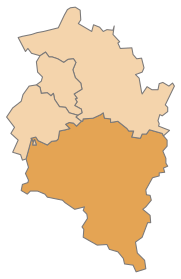
District Bludenz
| location | |
|---|---|
  |
|
| Basic data | |
| state | Vorarlberg |
| NUTS III region | AT-341 |
| Administrative headquarters | Bludenz |
| surface | 1286 km² |
| Residents | 64,107 (January 1, 2020) |
| Population density | 50 inhabitants / km² |
| License Plate | BZ |
| District Commission | |
| District Captain | Harald Dreher |
| website | Website of the BH Bludenz |
| map | |
  |
|
The Bludenz district is an administrative district in the Austrian state of Vorarlberg .
Administrative division
The Bludenz district covers an area of 1,285.64 km² and covers the entire southern half (49.4%) of Vorarlberg and is divided into 29 municipalities , including one municipality ( Bludenz ) and two market municipalities ( Nenzing , Schruns ).
The population figures are from January 1st, 2020:

| local community | location | Ew | km² | Ew / km² | Judicial district | region | Type
|
photo | Metadata |
|---|---|---|---|---|---|---|---|---|---|
Bartholomäberg
|

|
2,359 | 27.19 | 87 | Bludenz | Montafon | local community
|

|
According to code: 80101 |
Blons
|

|
330 | 14.89 | 22nd | Bludenz | Great Walsertal | local community
|

|
According to code: 80102 |
Bludenz
|

|
14,845 | 29.94 | 496 | Bludenz | Walgau | urban community
|

|
According to code: 80103 |
Bludesch
|

|
2,384 | 7.59 | 314 | Bludenz | Walgau | local community
|

|
According to code: 80104 |
fire
|

|
729 | 40.29 | 18th | Bludenz | Brandnertal | local community
|

|
According to code: 80105 |
Bürs
|

|
3,362 | 24.61 | 137 | Bludenz | Walgau | local community
|

|
According to code: 80106 |
Bürserberg
|

|
550 | 13.73 | 40 | Bludenz | Brandnertal | local community
|

|
Acc. To code: 80107 |
Dalaas
|

|
1,600 | 94.24 | 17th | Bludenz | Klostertal | local community
|

|
According to code: 80108 |
Fontanella
|

|
463 | 31.17 | 15th | Bludenz | Great Walsertal | local community
|

|
According to code: 80109 |
Gaschurn
|

|
1,454 | 175.28 | 8.3 | Bludenz | Montafon | local community
|

|
According to code: 80110 |
Innerbraz
|

|
997 | 19.92 | 50 | Bludenz | Klostertal | local community
|

|
According to code: 80111 |
Kloesterle
|

|
677 | 62.24 | 11 | Bludenz | Klostertal | local community
|

|
According to code: 80112 |
Lech
|

|
1,607 | 89.97 | 18th | Bludenz | Arlberg | local community
|

|
According to code: 80113 |
Lorüns
|

|
296 | 8.35 | 35 | Bludenz | Montafon | local community
|

|
Acc. To code: 80114 |
Ludesch
|

|
3,608 | 11.26 | 320 | Bludenz | Walgau | local community
|

|
Acc. To code: 80115 |
Nenzing
|

|
6,200 | 110.09 | 56 | Bludenz | Walgau | market community
|

|
According to code: 80116 |
Nüziders
|

|
4,992 | 22.07 | 226 | Bludenz | Walgau | local community
|

|
Acc. To code: 80117 |
Raggal
|

|
868 | 41.57 | 21st | Bludenz | Great Walsertal | local community
|

|
Acc. To code: 80118 |
St. Anton in the Montafon
|

|
699 | 3.39 | 206 | Bludenz | Montafon | local community
|

|
According to code: 80119 |
St. Gallenkirch
|

|
2.213 | 127.99 | 17th | Bludenz | Montafon | local community
|

|
According to code: 80120 |
St. Gerold
|

|
400 | 12.57 | 32 | Bludenz | Great Walsertal | local community
|

|
According to code: 80121 |
Schruns
|

|
3,896 | 18.06 | 216 | Bludenz | Montafon | market community
|

|
According to code: 80122 |
Silbertal
|

|
842 | 88.65 | 9.5 | Bludenz | Montafon | local community
|
.jpg)
|
According to code: 80123 |
Sunday
|

|
640 | 81.59 | 7.8 | Bludenz | Great Walsertal | local community
|

|
According to code: 80124 |
Stallhr
|

|
275 | 1.64 | 168 | Bludenz | Montafon | local community
|

|
According to code: 80125 |
Thuringia
|

|
2.214 | 5.67 | 390 | Bludenz | Walgau | local community
|

|
According to code: 80126 |
Thuringian Mountain
|

|
719 | 10.4 | 69 | Bludenz | Great Walsertal | local community
|

|
According to code: 80127 |
Tschagguns
|

|
2,195 | 57.56 | 38 | Bludenz | Montafon | local community
|

|
According to code: 80128 |
Vandans
|

|
2,693 | 53.75 | 50 | Bludenz | Montafon | local community
|

|
According to code: 80129 |
Population development

Web links
Commons : District Bludenz - Collection of images, videos and audio files
Individual evidence
- ↑ Statistics Austria - Population at the beginning of 2002–2020 by municipalities (area status 01/01/2020)
Coordinates: 47 ° 9 ' N , 9 ° 49' E