Feldkirch district
| location | |
|---|---|
| Basic data | |
| state | Vorarlberg |
| NUTS III region | AT-342 |
| Administrative headquarters | Feldkirch |
| surface | 278 km² |
| Residents | 108,133 (January 1, 2020) |
| Population density | 389 inhabitants / km² |
| License Plate | FK |
| District Commission | |
| District Captain | Herbert Burtscher |
| website | Website of the BH Feldkirch |
| map | |
The Feldkirch district is an administrative district in the Austrian state of Vorarlberg .
In the west, the district borders on the Principality of Liechtenstein and in the northwest on the Swiss canton of St. Gallen . The neighboring Austrian districts are Dornbirn in the north, Bregenz in the east and Bludenz in the south. Feldkirch is the westernmost district in Austria.
The area of the Feldkirch district has changed massively over time. In some cases municipalities were added, on the other hand, until 1969, today's Dornbirn district also belonged to the Feldkirch district. The split was due not least to the fact that in 1968 Feldkirch was the district with the most inhabitants in Austria (around 130,000).
The administrative district today has an area of 277.89 km² and is congruent with the judicial district of Feldkirch .
Municipalities in the district
The Feldkirch district is divided into 24 communities , including one town and three market communities .
| local community | location | Ew | km² | Ew / km² | Judicial district | region | Type
|
photo | Metadata |
|---|---|---|---|---|---|---|---|---|---|
Altach
|

|
6,769 | 5.36 | 1263 | Feldkirch | Rhine Valley | local community
|

|
According to code: 80401 |
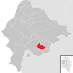
Thin
|
|
407 | 3.45 | 118 | Feldkirch | Walgau | local community
|

|
According to code: 80402 |
Dünserberg
|

|
143 | 5.56 | 26th | Feldkirch | Walgau | local community
|

|
Acc. To code: 80403 |
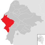
Feldkirch
|
|
34.210 | 34.33 | 997 | Feldkirch | Rhine Valley | urban community
|

|
Acc. To code: 80404 |
Frastanz
|

|
6,503 | 32.26 | 202 | Feldkirch | Walgau | market community
|

|
Acc. To code: 80405 |
Fraxern
|

|
714 | 8.86 | 81 | Feldkirch | Walgau | local community
|

|
According to code: 80406 |
Göfis
|

|
3,324 | 9.05 | 367 | Feldkirch | Walgau | local community
|

|
According to code: 80407 |
Götzis
|

|
11,765 | 14.62 | 805 | Feldkirch | Rhine Valley | market community
|

|
Acc. To code: 80408 |
Klaus
|

|
3,100 | 5.24 | 592 | Feldkirch | Rhine Valley | local community
|

|
Acc. To code: 80409 |
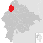
Koblach
|
|
4,718 | 10.24 | 461 | Feldkirch | Rhine Valley | local community
|

|
According to code: 80410 |
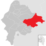
Lanterns
|
|
666 | 43.75 | 15th | Feldkirch | Laternsertal | local community
|

|
According to code: 80411 |
Mäder
|

|
4.102 | 3.23 | 1270 | Feldkirch | Rhine Valley | local community
|

|
According to code: 80412 |
Meiningen
|
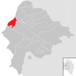
|
2,312 | 5.36 | 431 | Feldkirch | Rhine Valley | local community
|

|
According to code: 80413 |
Rankweil
|

|
11,928 | 21.85 | 546 | Feldkirch | Rhine Valley | market community
|

|
According to code: 80414 |
Röns
|
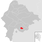
|
338 | 1.45 | 233 | Feldkirch | Walgau | local community
|
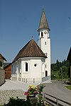
|
Acc. To code: 80415 |
Röthis
|

|
2.110 | 2.73 | 773 | Feldkirch | Rhine Valley | local community
|

|
According to code: 80416 |
Satteins
|

|
2,727 | 12.69 | 215 | Feldkirch | Walgau | local community
|

|
According to code: 80417 |
Schlins
|

|
2,481 | 6.03 | 411 | Feldkirch | Walgau | local community
|
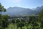
|
According to code: 80418 |
Schnifis
|

|
800 | 4.87 | 164 | Feldkirch | Walgau | local community
|

|
According to code: 80419 |
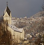
Sulz
|

|
2,591 | 3.01 | 861 | Feldkirch | Rhine Valley | local community
|
|
According to code: 80420 |
Oversaxing
|

|
621 | 5.76 | 108 | Feldkirch | Rhine Valley | local community
|

|
According to code: 80421 |
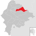
Viktorsberg
|
|
415 | 12.49 | 33 | Feldkirch | Rhine Valley | local community
|

|
According to code: 80422 |
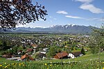
hamlet
|

|
2.133 | 3.08 | 693 | Feldkirch | Rhine Valley | local community
|
|
According to code: 80423 |
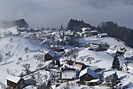
Between water
|

|
3,256 | 22.61 | 144 | Feldkirch | Rhine Valley | local community
|
|
Acc. To code: 80424 |
Population development
The population figures refer to the district within the current limits.

Web links
Coordinates: 47 ° 14 ' N , 9 ° 36' E


