
Meiningen (Vorarlberg)
|
Meiningen
|
||
|---|---|---|
| coat of arms | Austria map | |
 |
|
|
| Basic data | ||
| Country: | Austria | |
| State : | Vorarlberg | |
| Political District : | Feldkirch | |
| License plate : | FK | |
| Surface: | 5.36 km² | |
| Coordinates : | 47 ° 18 ' N , 9 ° 35' E | |
| Height : | 425 m above sea level A. | |
| Residents : | 2,312 (January 1, 2020) | |
| Population density : | 431 inhabitants per km² | |
| Postal code : | 6812 | |
| Area code : | 05522 | |
| Community code : | 8 04 13 | |
| NUTS region | AT342 | |
| Address of the municipal administration: |
Schweizerstrasse 58 6812 Meiningen |
|
| Website: | ||
| politics | ||
| Mayor : | Thomas Pinter ( ÖVP ) | |
|
Local council : (2015) (21 members) |
||
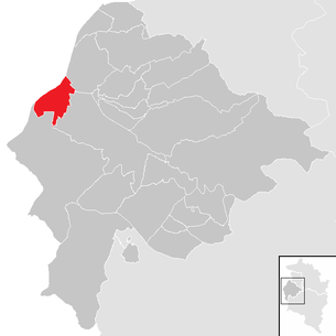
| Location of Meiningen in the Feldkirch district | ||
  |
||
 High, fresh view from Meiningen |
||
| Source: Municipal data from Statistics Austria | ||

Meiningen is a municipality in the Austrian state of Vorarlberg with 2312 inhabitants (as of January 1, 2020). The community lies on the Rhine , which is the border river to Switzerland at this point.
geography
Meiningen is located in the westernmost state of Austria, Vorarlberg, in the Feldkirch district at 425 m above sea level. A. Height. 17.5% of the area is forested. Meiningen borders directly on the Swiss border with Oberriet in the canton of St. Gallen . There are no other cadastral communities in Meiningen.
history
Meiningen came to Austria in 1390 with the Feldkirch rule. Originally based on the parishes of “ Our Lady ” and “St. Peter ” parish in Rankweil became independent in 1610 as a separate parish , since 1609 there has been a parish order . The Habsburgs ruled the places in Vorarlberg alternately from Tyrol and Upper Austria (Freiburg im Breisgau). From 1805 to 1814 the place belonged to Bavaria, then again to Austria. For Austrian province of Vorarlberg belongs Meiningen since its founding in 1861. The place was 1945-1955 part of the French zone of occupation in Austria.
Population development

Although there has been a slightly positive balance of migration in the last few decades , the strong growth was due to the strongly positive birth balance .
Culture and sights

- Baroque parish church of Saint Agatha
- The Siebers Hus is a farmhouse at Hadeldorfstrasse 5 and used to be a horse changing station. The Rheintalhaus was built in the 17th century and rebuilt in the 18th century. The interiors are shaped by the time around 1900.
Economy and Infrastructure
In 2010 there were 13 agricultural and forestry businesses in Meiningen, 7 of which were full-time businesses. In 2011, 191 people worked in 24 companies in the secondary economic sector , mainly in the manufacture of goods. The tertiary sector employed 356 people in 96 companies.
There is a kindergarten and a primary school in the community of Meiningen.
There is also a general practitioner and a house for assisted living in the village. In 2014 Margrit Koch bequeathed her fortune to the community in order to build a house for assisted living. The house, which opened in 2015, was named Margrits Hus in her honor .
politics
The community council of Meiningen consists of 21 members. In the municipal council and mayoral elections in 2015 , the list “Open Voting Community - People's Party Meiningen” received 14 seats and the “Meininger Freedom Party - FPÖ and party-free citizens” seven seats.
mayor
- until 2005 Karlheinz Koch (ÖVP)
- since 2005 Thomas Pinter (ÖVP)
coat of arms
Blazon : split between blue and red. In the blue field a silver cattail with two leaves, in the red field a silver iris.
Community partnerships
- Since May 4, 2012 there has been a town partnership with the German town of Meiningen in southern Thuringia.
Web links
- 80413 - Meiningen (Vorarlberg). Community data, Statistics Austria .
Individual evidence
- ^ Statistics Austria, A look at the community of Meiningen, population development. Retrieved March 29, 2019 .
- ^ Statistics Austria, A look at the community of Meiningen, agricultural and forestry operations. Retrieved March 29, 2019 .
- ^ Statistics Austria, A look at the community of Meiningen, workplaces. Retrieved March 29, 2019 .
- ^ Statistics Austria, A look at the community of Meiningen, employees. Retrieved March 29, 2019 .
- ^ Community of Meiningen, Social Affairs, Education. Retrieved March 29, 2019 .
- ^ Community of Meiningen, Social Affairs, Assisted Living. Retrieved March 29, 2019 .
- ↑ ORF, "Margrit Hus" opened in Meiningen. September 20, 2015, accessed March 29, 2019 .
- ↑ Cornelia Albertani, Ulrich Nachbaur: Vorarlberg municipal coat of arms registry . Ed .: Vorarlberger Landesarchiv. 3. Edition. Bregenz 2011, ISBN 978-3-902622-17-4 , pp. 36 ( vorarlberg.at [PDF]).
