
Gaschurn
|
Gaschurn
|
||
|---|---|---|
| coat of arms | Austria map | |
 |
|
|
| Basic data | ||
| Country: | Austria | |
| State : | Vorarlberg | |
| Political District : | Bludenz | |
| License plate : | BZ | |
| Surface: | 175.28 km² | |
| Coordinates : | 46 ° 59 ' N , 10 ° 2' E | |
| Height : | 979 m above sea level A. | |
| Residents : | 1,454 (January 1, 2020) | |
| Population density : | 8.3 inhabitants per km² | |
| Postal code : | 6793 | |
| Area code : | 05558 | |
| Community code : | 8 01 10 | |
| NUTS region | AT341 | |
| Address of the municipal administration: |
Dorfstrasse 2 6793 Gaschurn |
|
| Website: | ||
| politics | ||
| Mayor : | Martin Netzer ( ÖVP ) | |
|
Local council : (2015) (18 members) |
||
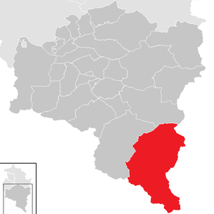
| Location of Gaschurn in the Bludenz district | ||
  |
||
 Gaschurn (view from Rifa) |
||
| Source: Municipal data from Statistics Austria | ||

Gaschurn ( ) is the southernmost and, with a municipal area of 176.7 km², the largest municipality in the Austrian state of Vorarlberg . It is located in the Bludenz district and has 1,454 inhabitants (as of January 1, 2020).
geography
The center of Gaschurn is 979 m above sea level. A. in the Montafon between Gortipohl and the town of Partenen , which belongs to the municipality of Gaschurn, the altitude range being up to 3312 m above sea level. A. ( Piz Buin ) extends. The largest place in the municipality is Gaschurn Dorf . 12.7 percent of the municipal area is forested, 51.7 percent determine the Alps .
The municipality is traversed by the Ill , to the right of which is the Verwall and to the left the Silvretta .
Community structure
The municipality includes the following two localities (population in brackets as of January 1, 2020):
- Gaschurn (1074)
- Partenen (380)
The community consists of the cadastral community Gaschurn.
history
The Rhaeto-Romanic place names are already mentioned in documents of the 15th century (1423 "Gaschurra", 1499 "Parthenna"), some Alps even earlier (for example 1089 "alpem in Signes" = Zeinisalpe). Favored by the warmer climate in the Middle Ages, but also until the 18th century, the high alpine Vermunt was used by farmers from Ardez and Guarda in the Lower Engadin (cattle drive over the Vermunt Pass).
The community was repeatedly affected by avalanches (most severe in 1689), damage from floods and mudslides (e.g. 1762, 1770, 1910) as well as by major fires (1800 village fire in Partenen). In the meantime, the natural hazards have been considerably reduced by extensive avalanche and torrent barriers.
The Habsburgs ruled the places in Vorarlberg alternately from Tyrol and Upper Austria ( Freiburg im Breisgau ). From 1805 to 1814 the place belonged to Bavaria , then again to Austria . Gaschurn has been part of the Austrian state of Vorarlberg since the state was founded in 1861.
Summer tourism emerged from the middle of the 19th century. In 1885 a beautification association was founded. Several Alpine Club huts were opened: 1885 Madlenerhaus , 1896 Wiesbadener Hut , 1908 Tübinger Hut , 1910 Saarbrücker Hut , 1927 Heilbronner Hut . Road construction from Schruns to Partenen began around 1910 .
After the First World War , the Vorarlberger Illwerke , founded in 1922, began to use hydropower for energy supply. From 1925 to 1930 the Vermuntsee and the Vermuntwerk in the Partenen district were built with the Rhineland line as the first high-voltage transmission line in Central Europe; The Schruns – Partenen narrow-gauge railway and the Partenen – Trominier inclined elevator were installed as access to the construction sites . This was followed by significant expansions in the use of hydropower: 1938 to 1952 Silvretta reservoir and Obervermuntwerk , 1959 to 1970 Kops reservoir and Kops cavern power station with various streams and Rifawerk with compensation basin.
The place was part of the French occupation zone in Austria from 1945 to 1951.
The former auxiliary construction path to Bielerhöhe ( 2071 m above sea level ) was opened to tourist traffic in 1954 as the Silvretta High Alpine Road and expanded further from 1961. Since 1963, Gaschurn has had a bypass road on the route of the narrow-gauge railway that was closed in 1954.
In the 1960s, extensive development for winter sports began: since 1967 Versettlabahn , from 1972 connection of the Versettla and Garfrescha ski areas to the greater Silvretta Nova area , now known as Silvretta Montafon, with around 30 lifts. At the same time, the appearance of the settlement is changing due to the construction of hotels, inns, pensions and other tourist facilities.


Population development

The proportion of foreigners in 2002 was 10.9 percent.
The population decrease in the last few decades has taken place despite the positive birth balance , as the migration balance is very negative.
religion
In Gaschurn there was a St. Michael chapel as early as the 15th century; its own parish was formed in 1587. A branch church of Gaschurn was built in Partenen in 1729.
politics
Mayor of the community of Gaschurn is Martin Netzer from the People's Party Citizens List Gaschurn-Partenen . He was elected in the last direct mayor election in 2015 with 65.07% of the vote. The municipal council has 18 members, who after the municipal council elections in 2015 consisted of 10 mandatars from the People's Party Citizens List Gaschurn-Partenen and 8 mandatars from the list Together for Gaschurn and Partenen .
coat of arms
The municipal coat of arms was created in 1966 based on a design by the Schruns artist and heraldist Konrad Honold . In addition to the crossed papal keys, it shows a water wheel and a halberd. This refers to the local hero Lukas Tschofen , who was associated with all kinds of benefits.
Culture and sights


- The Gaschurn Tourism Museum was opened in Gaschurn in 1992 as the first tourism museum in Austria.
- A 300-year-old Montafon parlor - the so-called Lucas Tschofen parlor - has been set up in the new community center of the village, which was completed in 1986 .
- The parish church of Gaschurn as a neo-Romanesque church was inaugurated in 1869 by Linz bishop Franz Josef Rudigier, who was born in Partenen. The altar and ceiling paintings were made by the Schruns brothers Franz and Jakob Bertle in the late Nazarene style.
- Maria Schnee chapel : According to the inscription, the construction of the chapel dates back to 1637. Lukas Tschofen , a legendary and legendary figure in the Montafon valley,is considered the founder and builder. The chapel houses a Maria-Hilf-Bild (copy after a miraculous image by Lucas Cranach the Elder ) and has become a popular place of pilgrimage to Mary. The chapel is located on a small hill in the village center of Gaschurn.
freetime and sports
As the largest municipality in Vorarlberg, there is a large network of hiking trails (266.8 km) and numerous mountain bike trails (71.9 km in total - both as of autumn 2013). From Partenen via Gaschurn to St. Gallenkirch there is a 12 km long cycling, walking and winter hiking route. The running and Nordic walking scene in Montafon was created based on a sports science concept developed by the University of Innsbruck . 13 selected routes were designated and signposted for the first time in Vorarlberg. Signposted snowshoe trails in Gaschurn-Partenen allow hiking in the vicinity of the village even without a guide.
The Bielerhöhe lies in the middle of the Silvretta; in summer you can reach this place via the Silvretta-Hochalpenstraße, in winter there is access with the Vermuntbahn (Partenen) and the tunnel taxi. The highest boat trip in the Alps is located there. The British national rowing team trains on the lake as preparation for their competitions. The offer includes skiing, ski tours, winter and snowshoeing and cross-country skiing on the frozen Silvretta reservoir. The 9-hole golf course of the Silvretta Golf Club is the highest golf course in Vorarlberg.
There are four Alpine Club huts in the municipality of Gaschurn: the Neue Heilbronner Hütte of the DAV section Heilbronn and the Wiesbadener hut of the DAV section Wiesbaden , the Saarbrücker hut of the DAV section Saarbrücken and the Tübinger hut of the DAV section Tübingen .
economy

Already in the 18th century (e.g. 1754: 1010 inhabitants) a strong increase in the population led to a high population density in relation to the livelihoods. One consequence of this was the expansion of mountain farming to the limit of what was possible. Around 1800 there were around 1000 cattle, 1500 sheep and 750 goats in Gaschurn (for comparison in 1990: 430 cattle). Up until the turn of the century, the necessary additional income was found partly through seasonal hikes (e.g. building craftsmen as "French walkers"), at times also through mule traffic over the Zeinisjoch (a tavern can be found on Zeinis as early as the 16th century) and finally through the advent of alpinism . The first support for tourists in the 19th century was mainly provided by Gasthaus Rößle . From 1925 there was a rapid increase in earning opportunities through the construction and operation of the Illwerke (the most important employer in Partenen) and through the upward trend in tourism. Since the 1960s, with the Silvretta Nova ski area and the tourist expansion of the Silvretta-Hochalpenstrasse , the Vermuntbahn and the Bieler Höhe, there has been a sharp increase in overnight stays. Between 1960/61 and 1991/92 the number of overnight stays increased from 109,000 to around 430,000 with an expansion of the accommodation offer from 1,800 to 3,700 beds. Since 1974, more and more overnight stays have been recorded in winter than in summer.
In 2003 there were 66 commercial enterprises with 360 employees and 25 apprentices on site. There were 818 employees subject to wage tax.
tourism

In the tourism year 2001/2002 there were a total of 428,119 overnight stays in Gaschurn.

The bank for Tyrol and Vorarlberg has been the main shareholder of the previous Silvretta Nova Bergbahnen AG since 2007, which has been called Silvretta Montafon since then .
energy
The community operates the WINKEL drinking water power plant and supplies the electricity generated to VKW Ökostrom. All three machines of the 450 MW Kops 2 power plant have been on the grid since November 2008.
The Gaschurn biomass heating plant was the first communal biomass heating plant in the Montafon. It has been in operation since 2000. In May 2008, two buffer storage tanks with 43 m³ were installed to smooth out the peaks. This means that it has been possible to dispense with any heating oil for the entire summer of 2008.
The Gaschurn municipality's latest project in 2013 is the use of waste heat from the Kopswerk I and Kopswerk II power plants and the Vermuntwerk. The Gaschurn biomass heating plant would then also be supplied with part of the waste heat. Approx. 60 percent of the heat required could be provided by the new waste heat project.
Since autumn 2008 the municipality of Gaschurn has been the only municipality in the Montafon in the program of the e5 municipalities (energy-efficient municipality). In 2013 the e5 community Gaschurn was recertified and achieved the third "e".
media
The GaPa-Zitig or the GaPa-Blitz are the community news published by the community of Gaschurn.
traffic
Gaschurn can be reached from Bludenz via the L 188 Montafoner Straße (formerly Silvrettastraße ) in about 25 minutes by car. Gaschurn can also be reached with the Montafonerbahn , which runs from Bludenz to Schruns , and from there with the public bus service of the MBS bus. In the summer months, Gaschurn can be reached by car from Landeck via Galtür and the Silvretta High Alpine Road in around an hour and a half.

education
There are (as of January 2003) 71 students on site.
There is an elementary school and a kindergarten that can be attended by all children from the age of three. Since 2008, younger children can also attend kindergarten.
There is also a primary school and a kindergarten in Partenen. The special thing about the kindergarten facilities is that there are no districts within the community in the kindergarten area. The parents and children can choose their own kindergarten. Since summer 2006, the community has been offering summer childcare in one of the kindergartens. Every Wednesday Gaschurn offers children up to 10 years of age the opportunity to take part in an extracurricular, playful English course.
Personalities
- Peter Rudigier (1882–1963), farmer and member of the state parliament
- Martin Marinac (* 1979), ski racer and trainer
Web links
- Homepage
- 80110 - Gaschurn. Community data, Statistics Austria .
Individual evidence
- ^ Municipality of Gaschurn: Mayor. Retrieved April 2, 2020 .
- ↑ Statistics Austria: Population on January 1st, 2020 by locality (area status on January 1st, 2020) , ( CSV )
- ↑ The Bündner Urkundenbuch documents the Alps on Zeinis, in the Verbellatal , on Vallüla and in Vermunt as early as 1089 . See also: Alp Strategy Vorarlberg, Sömmerung and Habitat Diversity, study carried out on behalf of the Vorarlberg Nature Conservation Council, October 2013, p. 45: Online .
- ^ Statistics Austria, A look at the community of Gaschurn, population development. Accessed March 31, 2019 .
- ↑ Cornelia Albertani, Ulrich Nachbaur: Vorarlberg municipal coat of arms registry . Ed .: Vorarlberger Landesarchiv. 3. Edition. Bregenz 2011, ISBN 978-3-902622-17-4 , pp. 27 ( vorarlberg.at [PDF]).

Bartholomäberg | Blons | Bludenz | Bludesch | Fire | Bürs | Bürserberg | Dalaas | Fontanella | Gaschurn | Innerbraz | Klösterle | Lech | Lorüns | Ludesch | Nenzing | Nüziders | Raggal | St. Anton im Montafon | St. Gallenkirch | St. Gerold | Schruns | Silbertal | Sunday | Stallhr | Thuringia | Thuringian Mountain | Tschagguns | Vandans
Cadastral communities: Gaschurn • Localities and counting districts: Gaschurn | Partenen
Villages:
Gaschurn •
Rotten:
Auserbach |
Outside sofa |
Aussergosta |
Bielerhöhe |
Gufelgut |
Gundalatscherberg |
Inner bofa |
Innergosta |
Hole |
Motta |
Partenen |
Catches |
Pfolla |
Rifa |
Trantrauas |
Vand |
Angle |
Zeinisjoch •
Other settlements:
Heilbronner Hütte |
Klostertaler Hut |
Madlenerhaus |
Rifawerk |
Saarbrücker Hut |
Tübinger Hut |
Alpe Valschaviel |
Wiesbadener Hut |
Zeinisjochhaus