
Bürserberg
|
Bürserberg
|
||
|---|---|---|
| coat of arms | Austria map | |
 |
|
|
| Basic data | ||
| Country: | Austria | |
| State : | Vorarlberg | |
| Political District : | Bludenz | |
| License plate : | BZ | |
| Surface: | 13.73 km² | |
| Coordinates : | 47 ° 9 ' N , 9 ° 47' E | |
| Height : | 871 m above sea level A. | |
| Residents : | 550 (January 1, 2020) | |
| Population density : | 40 inhabitants per km² | |
| Postal code : | 6707 | |
| Area code : | 05552 | |
| Community code : | 8 01 07 | |
| NUTS region | AT341 | |
| Address of the municipal administration: |
Boden 1 6707 Bürserberg |
|
| Website: | ||
| politics | ||
| Mayor : | Fridolin Plaickner | |
|
Local council : (2010) (12 members) |
||
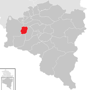
| Location of Bürserberg in the Bludenz district | ||
  |
||
 Bürserberg (down in the valley with a view of Bludenz ) |
||
| Source: Municipal data from Statistics Austria | ||


Bürserberg is a municipality in Austria in Vorarlberg in the Bludenz district with 550 inhabitants (as of January 1, 2020).
geography
The mountain community of Bürserberg is located in the westernmost state of Austria , Vorarlberg , in the Bludenz district at an altitude of 871 meters. It is located at the entrance of the Brandnertal - around 5 km from Bludenz and is a hillside settlement divided into several terraces.
A total of 57.0% of the total area is forested and 18.5% of the area is alpine or mountain pastures. There are no other cadastral communities in Bürserberg.
Well known is the Schesatobel , one of the largest mudslides in Europe.
history
In 1347 the "Vallavier" valley was awarded to 12 Walser families. Probably at the same time Walser settled in the upper area of Bürserberg.
In 1730 the parish church was consecrated to St. Joseph. From 1805 to 1814 the place belonged to Bavaria , then again to Austria . From 1830 a first street was built under Alois Negrelli . Bürserberg has belonged to the Austrian state of Vorarlberg since the Vorarlberg Parliament was founded in 1861.
From 1945 to 1955 the place was part of the French occupation zone in the Republic of Austria, which was restored after the Second World War .
Population development

The proportion of foreigners at the end of 2002 was 9.3 percent.
From 1981 to 1991, both the birth balance and the migration balance were positive. In the years up to 2011, emigration increased and the birth rate decreased.
politics
The community council consists of twelve members. The election was not made by lists, but by majority vote. The current mayor is Fridolin Plaickner.
In 2001, the municipal income from taxes and other charges was 668,364 €, the municipal expenditure was 1,466,009 €. The debt level in 2001 was € 2,448,603.
coat of arms

The community - coat of arms was created in 1969 with a design by Schrunser artist and heraldist Konrad Honold .
Description: In blue a silver ibex head over a black three-mountain .
Town twinning
Durbach , Ortenaukreis , Baden-Württemberg , Germany
Culture and sights
Stone circles
The stone circles on the Bürserberg are in the district of Tschengla . They are supposedly "Neolithic", but were probably only erected there a few years ago.
Economy and Infrastructure
In 2003 there were 11 commercial enterprises with 144 employees and 3 apprentices on site. There were 265 employees subject to wage tax. Tourism and tourism play an important role for the municipality. In the 2001/2002 tourism year, the municipality counted a total of 68,456 overnight stays. Since the 1960s, the district of "Tschengla" has been accessed by several ski lifts .
education
In Bürserberg there is a kindergarten and (as of January 2003) 26 students.
Individual evidence
- ^ Statistics Austria, A look at the community of Bürserberg, population development. Accessed March 31, 2019 .
- ↑ Cornelia Albertani, Ulrich Nachbaur: Vorarlberg municipal coat of arms registry . Ed .: Vorarlberger Landesarchiv. 3. Edition. Bregenz 2011, ISBN 978-3-902622-17-4 , pp. 22 ( vorarlberg.at [PDF]).
- ^ Stone circles on the Bürserberg
- ↑ Archive link ( Memento of the original from January 25, 2014 in the Internet Archive ) Info: The archive link was inserted automatically and not yet checked. Please check the original and archive link according to the instructions and then remove this notice.
Web links
- 80107 - Bürserberg. Community data, Statistics Austria .
- Josef "Don Camillo" Wehinger speaks to Gerhard Pirchl and Prof. Walter Bartel about the stone circles in the Bürserberg community

Bartholomäberg | Blons | Bludenz | Bludesch | Fire | Bürs | Bürserberg | Dalaas | Fontanella | Gaschurn | Innerbraz | Klösterle | Lech | Lorüns | Ludesch | Nenzing | Nüziders | Raggal | St. Anton im Montafon | St. Gallenkirch | St. Gerold | Schruns | Silbertal | Sunday | Stallhr | Thuringia | Thuringian Mountain | Tschagguns | Vandans