
Schnepfau
|
Schnepfau
|
||
|---|---|---|
| coat of arms | Austria map | |
 |
|
|
| Basic data | ||
| Country: | Austria | |
| State : | Vorarlberg | |
| Political District : | Bregenz | |
| License plate : | B. | |
| Surface: | 16.52 km² | |
| Coordinates : | 47 ° 21 ' N , 9 ° 57' E | |
| Height : | 734 m above sea level A. | |
| Residents : | 453 (January 1, 2020) | |
| Population density : | 27 inhabitants per km² | |
| Postal code : | 6882 | |
| Area code : | 05518 | |
| Community code : | 8 02 32 | |
| NUTS region | AT341 | |
| Address of the municipal administration: |
No. 38 6882 Schnepfau |
|
| Website: | ||
| politics | ||
| Mayor : | Robert Meusburger | |
|
Local council : (2015) (9 members) |
||
| Location of Schnepfau in the Bregenz district | ||
  |
||
 Schnepfau community |
||
| Source: Municipal data from Statistics Austria | ||

Schnepfau is a municipality in the Austrian state of Vorarlberg with 453 inhabitants (as of January 1, 2020).
geography
Schnepfau is located in the rear Bregenzerwald in the westernmost state of Austria, Vorarlberg, in the Bregenz district southeast of Lake Constance at an altitude of 734 meters.
47.5% of the area is forested, 15.4% of the area of the Alps.
Community structure
The municipality includes the following two localities (population in brackets as of January 1, 2020):
- Hirschau (180)
- Schnepfau (273)
The community consists of the cadastral community Schnepfau. The three districts of this community on the right bank of the Bregenzer Ach are: Hirschau, Schnepfau, and Schnepfegg.
Neighboring communities
The municipality of Schnepfau borders on four other Vorarlberg municipalities, which, like Schnepfau, are all in the political district of Bregenz. The municipalities of Bizau , Au , Mellau and Reuthe are located clockwise, starting in the north .
history
Schnepfau was first mentioned in 1280 as "Hirzowe et Snephowe".
The Habsburgs ruled the places in Vorarlberg alternately from Tyrol and Upper Austria (Freiburg im Breisgau). From 1805 to 1814 the place belonged to Bavaria, then again to Austria. For Austrian province of Vorarlberg Schnepfau heard since its founding 1861 . The place was part of the French occupation zone in Austria from 1945 to 1955 .
Population development

Since 2001 the population has been falling despite a positive birth balance due to a negative migration balance .
politics
The community council of Schnepfau consists of 9 members.
- mayor
- 1980–2005 Elmar Schuster
- 2005–2015 Josef Moosbrugger
- since 2015 Robert Meusburger
Culture and sights
- Parish Church Schnepfau
- The chapel of St. Martin was built in Hirschau in 1671.
- The Lourdes Chapel was built by Kaspar Held as a simple frame structure in Hirschau between 1888 and 1890.
- The chapel of St. Wendelin is on Schnepfegg
- Bergkapelle Wirmboden in Vorsäß Wirmboden

Lourdes Chapel
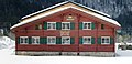
Bregenzerwälder Einhof bez. 1628

Parish church and on the left the main house of the cheese count Jöckles Galle

in the district of Hirschau


Economy and Infrastructure
In 2015 there were 257 employees at the place of residence; as of December 31, 2017, eight apprentices were in Schnepfau.
In the 2016/17 tourism year, 24,038 overnight stays were counted, 11,419 of them in winter and 12,619 in summer.
education
There were ten students in the elementary school in Schnepfau in the 2016/17 school year. Eleven children attended the local kindergarten, which corresponds to a care rate of 84.6% of 3-6 year olds.
Personalities
- John Michael Kohler (* 1844 in Schnepfau, † 1900 in Sheboygan , Wisconsin ; Americanized John Michael Kohler , also John M. Kohler ) from the Kohler family was a successful industrialist and mayor of Sheboygan (Wisconsin). Kohler founded what would later become known as the Kohler Company , a manufacturer of bathroom and kitchen furnishings.
Web links
- 80232 - Schnepfau. Community data, Statistics Austria .
Individual evidence
- ↑ Statistics Austria: Population on January 1st, 2020 by locality (area status on January 1st, 2020) , ( CSV )
- ^ Statistics Austria, A look at the community of Schnepfau, population development. Retrieved March 24, 2019 .
- ↑ a b Office of the Vorarlberg state government, portrayal of the municipalities. Retrieved March 24, 2019 .

Alberschwende | Andelsbuch | Au | Bezau | Bildstein | Bizau | Bregenz | Book | Damüls | Doren | Egg | Eichenberg | Fußach | Gaissau | Hard | Hittisau | Highest | Hohenweiler | Hörbranz | Kennelbach | Krumbach | Langen near Bregenz | Langenegg | Lauterach | Lingenau | Lochau | Mellau | Mittelberg | Möggers | Reuthe | Riefensberg | Schnepfau | Schoppernau | Schröcken | Schwarzach | Schwarzenberg | Sibratsgfall | Sulzberg | Warth | Wolfurt