Neßlegg
| Neßlegg ( village ) | ||
|---|---|---|
|
|
||
| Basic data | ||
| Pole. District , state | Bregenz (B), Vorarlberg | |
| Judicial district | Bregenz | |
| Pole. local community | Schröcken | |
| Coordinates | 47 ° 15 '44 " N , 10 ° 6' 14" E | |
| height | 1500 m above sea level A. | |
| Post Code | 6888 Schröcken | |
| prefix | + 43/5519 ( Schröcken ) | |
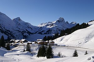
 View from the east of Neßlegg in winter |
||
| Source: STAT : index of places ; BEV : GEONAM ; VoGIS | ||
Neßlegg (sometimes also spelled Nesslegg ) is a district of the municipality of Schröcken in the Austrian state of Vorarlberg . The district is with an average location at 1500 m above sea level. A. the highest permanently inhabited part of Schröckens and lies at the foot of the Hochtannberg just in the valley of the Bregenzer Ach and thus in the Bregenzerwald . Historically, the district belongs to the Tannberg as well as Schröcken itself and the Hochkrumbach settlement, which is only a few kilometers away from the neighboring municipality of Warth . Today Neßlegg is located directly on the state road Bregenzerwaldstraße (L 200) in the direction of the Hochtannbergpass and Warth, west of the center of Schröcken.
Neßlegg , which was settled by the Walsers , was mentioned for the first time in 1489 in the year book of the parish of Lech as nesselögke . This old field name is derived from the large number of nettles and the shape of the elevation on which the district is located. For the year 1666, 3–12 residents are given for the Urhof ( Berghof , today Neßlegg 35). In 1991 the number of inhabitants of the handful of houses in Neßlegg was documented as 12 to 46.
Today, the small district is mainly touristy, with winter tourism in connection with the adjacent Lech / Warth / Schröcken ski area making up the majority of arrivals and overnight stays in Neßlegg. A public toboggan run also starts in Neßlegg and leads down the old main road to the center of Schröcken.
Web links
Individual evidence
- ↑ 39 Nesslegg. In: Tannberg.info. Lech / Zürs Tourismus and Warth / Schröcken Tourismus, accessed on March 4, 2019 .
- ^ Kurt Klein (edit.): Historical local dictionary . Statistical documentation on population and settlement history. Ed .: Vienna Institute of Demography [VID] d. Austrian Academy of Sciences . Vorarlberg , Schröcken , p. 52 ( online document , explanations . Suppl . ; both PDF - oD [updated]).

