Höhenbach (Lech)
| Höhenbach | ||
|
Höhenbach |
||
| Data | ||
| Water code | AT : 2-4-33 | |
| location | Ausserfern , Tyrol , Austria | |
| River system | Danube | |
| Drain over | Lech → Danube → Black Sea | |
| origin | Confluence of Rossgumpenbach and Schochenalpbach in the Allgäu Alps 47 ° 17 ′ 19 ″ N , 10 ° 20 ′ 9 ″ E |
|
| Source height | 1325 m above sea level A. | |
| muzzle | near Holzgau in the Lech coordinates: 47 ° 15 ′ 18 ″ N , 10 ° 20 ′ 41 ″ E 47 ° 15 ′ 18 ″ N , 10 ° 20 ′ 41 ″ E |
|
| Mouth height | 1083 m above sea level A. | |
| Height difference | 242 m | |
| Bottom slope | 55 ‰ | |
| length | 4.4 km | |
| Catchment area | 22.3 km² | |
| Communities | Holzgau | |
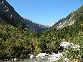
The Höhenbach is a 4.4 km long left tributary of the Lech in the Allgäu Alps in Tyrol .
It arises from the union of Rossgumpenbach and Schochenalpbach near the Untere Roßgumpenalpe. The 2.9 km long Rossgumpenbach, sometimes seen as the upper reaches of the Höhenbach, is formed from three source streams below the Krottenkopf at 1970 m above sea level. A. ( ⊙ ) and runs south. The Schochalpenbach rises at 2067 m above sea level. A. in Schönanger ( ⊙ ) below the Hohe Licht and flows in a north-easterly to easterly direction. The Höhenbach runs in a straight line to the south, falls over the Simms waterfall, flows through Holzgau , which lies on its alluvial cone , and flows south of it into the Lech.
The catchment area of the Höhenbach measures around 22 km² and extends from 1083 m above sea level. A. at the mouth up to 2656 m above sea level. A. (Krottenkopf).
The source streams and most of the Höhenbach stream are relatively natural. The ecological condition of the Höhenbach is classified as very good until shortly before Holzgau, there as moderate to unsatisfactory. Except for a short section in the local area of Holzgau, the river bed is unobstructed, the banks above Holzgau are built in sections from the beginning of the village to the mouth. Three smaller hydropower plants use the water from the Höhenbach to generate energy.
