
Lej da Gravacha
| Lej da Gravacha | ||
|---|---|---|

|
||
| At the Lej da Gravatscha | ||
| Geographical location | Upper Engadine | |
| Data | ||
| Coordinates | 788 777 / 157 942 | |
|
||
| Altitude above sea level | 1698 m above sea level M. | |


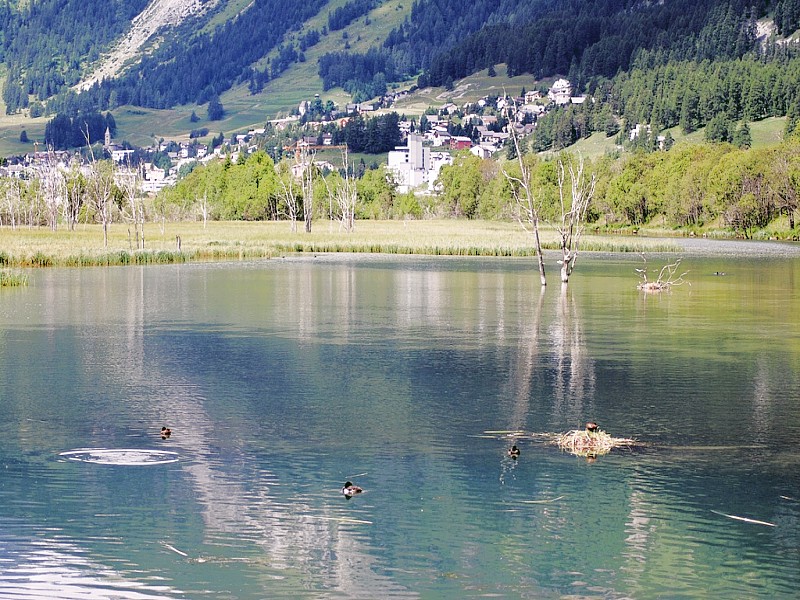
The Lej da Gravatscha ( , Rhaeto-Romanic in the dialect Puter for “lake of the large river bed”) is an artificially created small lake and - especially in the upper part - a swamp area in the Engadin in the Swiss canton of Graubünden . It is located at an altitude of 1698 meters, right next to the Inn, southeast of Bever .
Above ground, the Lej da Gravatscha is not fed by the Inn, which flows a few meters next door, but by two streams that spring in the area northeast of the Muottas Muragl : the Ova Müsella ( ) and the Ova da Val Champagna ( ). A canal a few meters long connects the lake with the Inn at the lowest point.
The Lake Gravatscha and its smaller side lakes are the remnants of an excavated lake and a Altarms of the Inn, which was removed during the Innkorrektur from the Inn. The Ova da Val Champagna was also diverted into the lake.
The Lej da Gravatscha is now an important breeding and resting place for birds with great biodiversity. It has the highest brood density in Switzerland. Numerous amphibians and fish species live in the lake. This has also made the area a popular destination. With the exception of a barbecue area and footpaths, there are no tourist infrastructures so that the area is largely natural.
Web links
- Photo of the lake
- Lej da Gravatscha on schweizersee.ch
Individual evidence
- ↑ Lej da Gravatscha on flyfisherbeat.com