
Emsland district
| coat of arms | Germany map |
|---|---|

|

Coordinates: 52 ° 44 ' N , 7 ° 24' E |
| Basic data | |
| Existing period: | 1977– |
| State : | Lower Saxony |
| Administrative headquarters : | Meppen |
| Area : | 2,882.07 km 2 |
| Residents: | 326,954 (Dec. 31, 2019) |
| Population density : | 113 inhabitants per km 2 |
| License plate : | Tbsp |
| Circle key : | 03 4 54 |
| NUTS : | DE949 |
| Circle structure: | 60 parishes |
| Address of the district administration: |
Ordeniederung 1 49716 Meppen |
| Website : | |
| District Administrator : | Marc-André Burgdorf ( CDU ) |
| Location of the district of Emsland in Lower Saxony | |
  |
|
The district of Emsland is a district in Lower Saxony in northwest Germany . It is named after the river Ems that crosses it and the Emsland as a cultural and historical region and territory.
geography
location
The district of Emsland is located in western Lower Saxony. It covers large parts of the cultural and historical region of Emsland . The rivers Ems and Hase with their tributaries, the extensive moor areas of the Bourtanger Moor and the coastal canal moor , as well as the geest areas of the Hümmlings and the Lingener Höhe are characteristic of the district .
The district has a maximum north-south extension of 93 km and an east-west extension of 56 km. Mostly it is flat land between 20 and 35 m above sea level. There are larger elevations only in the northeast and southeast: the Nattenberg at 72 m above sea level. NN near Emsbüren , the Windmühlenberg on the border of Langen and Thuine with 93 m above sea level. NN and the Windberg with 72.7 m above sea level. NN at Werpeloh in Hümmling.
Cities
Cities are Haren (Ems) , Haselünne , Freren , Lingen (Ems) , Meppen (district town), Papenburg and Werlte (since March 22, 2017).
Area record
From its founding until December 5, 1993, the district was the largest district in Germany in terms of area . He was replaced by the then newly created Brandenburg district of Uckermark , which in turn was replaced by the Mecklenburg Lake District on September 4, 2011 .
Neighboring areas
The district borders clockwise to the north, starting with the districts of Leer , Cloppenburg and Osnabrück (all in Lower Saxony), the district of Steinfurt (in North Rhine-Westphalia ) and the district of Grafschaft Bentheim (again in Lower Saxony). In the west it borders on the Dutch provinces of Drente and Groningen .
Nature reserves
There are 76 nature reserves in the Emsland district . The largest ( Tinner Dose-Sprakeler Heide ) has an area of around 3,500 hectares , the smallest ( Zitteriche ) an area of 2.9 hectares. The formerly smallest nature reserve in the district, the 2.6 hectare nature reserve " Hasealtarm bei Wester ", went into 2017 in the nature reserve " Natura 2000 nature reserve in the lower Haseniederung ".
See also:
- List of nature reserves in the Emsland district
- List of landscape protection areas in the Emsland district
- List of natural monuments in the Emsland district
- List of protected landscape components in the district of Emsland
population
In the district of Emsland, the local population still speaks the Lower Saxon language (colloquially Flat German or Flat / Low German) in many places - especially in rural areas . With a population density of 150 inhabitants per square kilometer (2017), the district is one of the most sparsely populated regions in Germany. The district is dominated by Catholicism. The proportion of Catholics in the total population was estimated in the 2011 census at 68.4%. The district of Emsland has a high birth rate .
history
Before founding


Early history
After the last Ice Age, when hunters and gatherers lived here, the region was founded around 4000 BC. Was included by the funnel cup culture in the arable farming sector of north-central Europe. From 3500 BC In the Emsland over 60 megalithic systems and barrows were built primarily between Meppen and Lastrup and between Lingen and Freren . Other finds from the Neolithic period come from areas along the Ems, the Hase and the triangle Freren, Lengerich and Fürstenau . In the Emsland, between the rivers Ems and Hunte , was the area of distribution of the so-called Ems-Hunte group in the Younger Bronze Age (approx. 1100 to 800 BC) . Finds from Nattenberg near Emsbüren show mythological depictions of ships from this culture. Another splendid find comes from the Heiligenberg near Gleesen near Bramsche . The 16-meter-long and 216-post avenue of this culture, consisting of six double rows of posts on the Hörtel ridge near Leschede, is considered a cult facility. This avenue came to light on a burial ground between two burial mounds from the transition period from the Younger Bronze Age to the Early Iron Age. Numerous relics have also come down from the Iron Age.
A Germanic settlement of the Emsland is to be assumed before the turn of the ages, whereby the Germanic people lived in relatively small settlements. The suffix "-ing" is a reference to the possession of areas by the Germanic peoples. This is especially true for places south of Lingen. Places with the suffix "-ing" are: Lingen, Messingen , Völleringhook , Sommeringen , Estringen , Münnigbüren , Mehringen , Imming , Schardingen , Rupingberg and the places Raming , Teglingen and Wippingen , north of Lingen.
The topography also shows, however, that these places were already settled before the Germanic occupation: For example, there are tombs from the Neolithic in Mehringen and Teglingen . The area of the former Hümmling district also shows continuous settlement since that time, due to more or less well-preserved barrows . This area is also called Sögeler Geest . Furthermore, numerous finds also prove that the place Estringen near Bramsche must have been of great importance as early as the Stone Age. The origin of this place name is derived from the terms Esch and Ting . Ting places were sacred religious places for the Germanic tribes, in addition these places served as court and assembly places. Meppen was probably an important Germanic trading place at that time. From the Osnabrücker Land , a region with significant iron ore deposits, iron could be shipped via the Hase and Ems to East Friesland and Groningen in exchange for Frisian salt.
The Germanic peoples knew no administrative state system in today's sense. The Germanic tribes were organized in a similar way to union states. The members of a tribe swore allegiance to their ruler. The “state” was not defined by a spatial extent, but by its people and their position in relation to the ruler. Therefore, the empires were strongly connected to the respective ruler, and the death of a ruler often also meant the fall of the empire. According to the Roman historian Tacitus , the Germanic tribe of the Ampsivarians (Germanic "Ems men") settled in northern Emsland, the Germanic tribe of Chasuarians on the Hase and the Brukterer tribe in southern Emsland. It is also known that the Imperial Roman Army used the Ems as a transport route several times and also built camps on its banks, such as the Bentumersiel camp . Roman finds, such as in Lengerich , in Gersten , in Geeste , north of Meppen, as well as various sites in the area of the confluence of the Great Aa with the Ems in Gleesen near Bramsche also show the connection with the Roman actions in the late Augustan-early Iberian period. In 2007, a Germanic settlement from the Roman Empire was discovered in Hesselte , which was presumably located on the route of the Roman troops. Roman finds on the Ems are particularly interesting because they can be evidence of the actions of Germanicus in AD 15-16.
middle Ages

From the 5th century the Emsland was under the influence of the Frankish Empire and the tribal duchy of Saxony . Lingen belonged to Venkigau and Meppen to Hasegau . The counts of Hasegau were related to the Widukind family. In the middle of the 10th century, Heinrich was named as the first Count of Hasegau , who had his residence at the permanent Arkenau Castle (Arkenowa) in Brokstreek near Essen / Oldenburg , as well as his son Gottschalk . From the 9th century, the Christianization of the Emsland resulted in the first documented mentions of localities in the Emsland. In the year 834 Meppen was mentioned in a deed of donation Vita secunda S. Liudgeri from Emperor Ludwig the Pious , in which the Meppen mission cell was transferred to the Benedictine Abbey of Corvey Monastery in Höxter . In lifting register the Benedictine Abbey from the monastery are on the watch 836 brasses and Thuine , 891 Freren and 975 Lingen mentioned as associated to Venkigau place.

In January 1180 Friedrich Barbarossa withdrew the imperial fiefs from the Saxon Duke Heinrich the Lion , so that the Upper Monastery of Münster and the County of Tecklenburg emerged on the territory of today's Emsland . For example, Hümmlingen lost its territorial independence in 1394 when Cloppenburg was conquered by Bishop Otto IV von Hoya von Münster . In the certificate of the free farmer's certificate , the separation of Lahn near Sögel from the territory of the Counts of Tecklenburg to the Oberstift Münster is announced. After the division of the Holy Roman Empire into ten imperial circles, the Emsland belonged to the Lower Rhine-Westphalian Empire from the 16th century . Due to the large proportion of moors and poorly productive geest soils , this region had very little cultivated land that could be cultivated. Therefore there was a lot of poverty in the Emsland.
Early modern age


.svg)
The north (the former district of Aschendorf-Hümmling) and the middle (the former district of Meppen) of today's district as well as a narrow corridor between the counties of Bentheim and Lingen with the towns of Lohne , Emsbüren and Salzbergen belonged to the monastery of Münster . The county of Bentheim and the United Netherlands bordered the monastery of Münster west of the Ems. To the north, the bishopric bordered the counties of East Friesland and Oldenburg . The county of Lingen was completely surrounded by the monasteries Osnabrück and Münster. Coming from Jutland , the Flämische Strasse crossed the Emsland in an east-west direction and in a north-south direction the Friesische Strasse , which, following the Ems, connected Westphalia to the North Sea coast. The Bourtanger Moor stretched along the Ems in the western Emsland .
- County of Lingen (southern Emsland)
In the southern Emsland, the county of Lingen was created in 1493 when the county of Tecklenburg was divided . Count Nikolaus IV resided at Lingen Castle until 1541. In 1541 Konrad von Tecklenburg-Schwerin inherited the county. He introduced the Reformation in 1543. After the defeat of the Schmalkaldic League , he had to cede Lingen to Emperor Charles V in 1548 . Lingen was recatholicized after the loss of Konrad's reign . The fiefdom was given to his sister Maria of Hungary , the governor of the Netherlands , in 1550. Afterwards, the son of Charles V, Philip II , King of Spain and the Netherlands, took up his feudal tenure in Lingen. Lingen, which was in Spanish hands, was conquered by Prince Moritz of Orange in his campaign of 1597 during the Eighty Years' War . August 19, 1597/12. November 1597, after several days of siege, the fortress fell . Due to its location on the Flämische Strasse from Zwolle to Hamburg and the Friesische Strasse from Münster to Emden, Lingen was of great military importance in this war. The county of Lingen became Calvinist . In 1605 Lingen was recaptured and re-Catholicized by the Spanish general Ambrosio Spinola . During this time there was only the possibility of advancing into the province of Groningen over the Dieler Schanze , which was very strongly fortified. During the Thirty Years' War, the Lingen garrison advanced on February 11, 1624 over the frozen moorland in Hesepe and Haren under the command of Lucas Kairos against Ter Apel in the province of Groningen. After fierce fighting, the Spaniards were pushed back as far as Groß Fullen near Meppen. Due to the loss of the fortresses Oldenzaal and Wesel , the Spaniards withdrew from Lingen and from all German positions north of the Rhine in 1630. After the Lingen fortress was handed over to the imperial family, it was razed in 1632. At the beginning of 1633 Lingen again became the property of the Orange and became Calvinist again. In the neighboring county of Bentheim, the war raged from 1618 to 1648 during the Thirty Years' War. The county of Bentheim was a neutral country, but the population still suffered greatly. Munster, Lüneburg, Hessian and Swedish troops took up quarters here and extorted food and their last possessions.
- Monastery of Münster and Osnabrück (Northern Emsland)
In the northern Emsland, during the reign of Prince-Bishop Franz von Waldeck , the Reformation gained momentum from 1543. As Prince-Bishop, Franz von Waldeck supported the Reformation in his diocese. For example, in 1543 he passed the Osnabrück Church Ordinance, a Protestant church ordinance for the rural churches of the Osnabrück Monastery . Franz von Waldeck also provided military support to the Protestants against the still Catholic Duke Heinrich von Braunschweig-Wolfenbüttel . Waldeck even sought admission to the Schmalkaldic League . However, this was unsuccessful because the federal government made the final implementation of the Reformation a condition. After the battle of Mühlberg and the defeat of the Schmalkaldic League, Waldeck was forced to give up his plans for the Reformation. In the monastery of Münster and Osnabrück, however, the Reformation had progressed so far that attempts at recatholization were doomed to failure. In September 1587, during the Eighty Years' War between the Union of Utrecht and the Spanish line of the Habsburgs , the Dutch penetrated from Zwolle across the Ems to occupy the Niederstift Münster and the Meppen fortress. Meppen fell into the hands of the United Netherlands on September 11, 1587 . In October of the same year Meppen was recaptured by Spanish troops for the bishopric of Münster , as was Lengerich in the southern Emsland. Due to the fact that both warring parties could hardly find any food in the bled-out Netherlands, the war finally spread to the neighboring Emsland. The Emsland was particularly heavily looted during battles in 1591 and 1592. In 1605, the Orange also tried to get the Emsland under their control by blocking the Ems above Meppen, but this failed.
When Ferdinand von Bayern took up the office of Bishop of Münsters in 1612, he initiated the counter-reform in the Monastery of Münster. In 1614 he enacted a religious order that provided civil rights and public offices only for Catholics. He promoted the Jesuits , Capuchins and other new orders. During the Thirty Years' War from 1618 to 1648, the fortress of Meppen was captured by the Protestant Mansfeld troops on November 8, 1622 by the Count of Guthrum without a blow of a sword. The Meppen Fortress was well protected by its natural location and was of great strategic importance for the warring parties. After Christian's defeat in the Battle of Stadtlohn on August 6, 1623, the imperial rulers under Count Tilly , accompanied by Count von Anholt, moved towards Meppen to displace the Mansfelder from the Ems and from the borders of East Frisia. The Mansfelder then vacated Meppen on August 12, 1624 and went to Greetsiel . After the capture, the reformer Melchior Balthasar was executed in Meppen on September 28, 1624.
After the withdrawal of the Tillic troops from the northern Emsland, the episcopal freischar took over the Meppen fortress. In 1626 the Hümmling was set on fire by the Protestant military leader Bernhard von Sachsen-Weimar , who was in Danish service, until he could be rejected by the Count von Anholt. Under the command of Knaphausen, the northern Emsland and the Meppen fortress were captured by Swedish troops after the Battle of Lützen on November 6, 1632. The northern Emsland became Protestant again . In October 1635 imperial troops invaded the Emsland and captured the town of Haselünne on October 10, 1635 . Eighteen days later, Cloppenburg fell into the hands of the imperial, as well as Fürstenau , Quakenbrück , Vechta , Wildeshausen and Friesoythe . After this the imperial family moved towards the Ems . They tried to take Nienhaus Castle near Aschendorf in order to gain control of the Ems, which failed. In January 1636 Haselünne could be recaptured. On August 12, 1637, French and Hessian troops crossed the Ems at Rhede and Aschendorf and took the Dieler Schanze held by the imperial family . At that time it was the only way to get from Emsland to East Frisia. In accordance with the provisions of the Westphalian Peace Treaty and the resolutions passed at the Reichstag in Nuremberg in 1650, the people of the Osnabrück Monastery were guaranteed the freedom to practice their religion with the perpetual surrender (Capitulatio perpetua osnabrugensis) . In 1651 , Prince Bishop Christoph Bernhard von Galen recruited soldiers from the imperial army of the Thirty Years' War in Westphalia in order to assert himself against the Protestant neighbors. Especially the expanding Dutch were a thorn in Galen's side. During this time, the fortification of the city of Meppen was further strengthened.
Development after the Thirty Years War


The county of Lingen remained until the death of Wilhelm III. Part of the Netherlands . On March 25, 1702, Prussia took over Lingen in a bloodless coup. The privy councilor Thomas Ernst Danckelman , in consultation with King Friedrich I, had royal Prussian emblems attached and the officials sworn in to the new ruling house.
In addition, the Treaty of Lunéville resulted in the territorial reorganization of the Monastery of Münster . After the Reichsdeputationshauptschluss the secular rule of the Bishop of Münster over large parts of the Emsland finally ended. The Emsland was secularized in 1802 through the occupation of the bishopric of Münster by Prussian troops . After secularization, the southern Emsland belonged to the hereditary principality of Münster and the northern Emsland to the Duchy of Arenberg-Meppen .
After the Peace of Tilsit in 1807, the Hereditary Principality of Münster was occupied by the French and in 1808 the Emsland became part of the Grand Duchy of Berg . With the annexation of north-west German areas on January 1, 1811 by the Napoleonic Empire, the Emsland became part of the French Empire . It belonged to the Département de l'Ems-Supérieur (Department Ober-Ems) and Département de la Lippe (Department Lippe). The Napoleonic Empire brought the achievements of the French Revolution to the Emsland, liberalism : legal equality , freedom of travel , freedom of trade , the separation of church and state , the protection of private property and the civil code (“Code Napoléon”).
In November 1813, French rule over the Emsland ended. In 1814 the County of Lingen fell back to Prussia, but when Prussia renounced the Lower County of Lingen, Lingen became part of the Kingdom of Hanover founded at the Congress of Vienna .
Newer modern times

.svg)
The Emsland has belonged to the Kingdom of Hanover since 1814 . With this it fell to Prussia in 1866 .
1933 to 1945
In the predominantly Catholic Emsland, the NSDAP was an outsider party until the " seizure of power " in 1933. They had to make do with a few bases, and when there were NSDAP events, the speakers and chairpersons mostly did not come from the region. The first NSDAP bases were founded or supported by the county of Bentheim, East Friesland and the Osnabrück region. Due to the struggle of the central press, the Catholic Church and other parties against them, the NSDAP was only able to gain a foothold before 1933 in a few places in which there were pronounced local conflicts, such as Aschendorf and Haselünne, as well as in the cities, but without theirs to be able to build on nationwide results.
Before the Second World War , the Reich Labor Service was used for various activities in the Emsland. An important focus was the - albeit not very effective - use to reclaim the huge moorland and heather area (Emsland cultivation), on which new farms were to be built as part of the self-sufficiency policy . As part of the Emsland cultivation, several camps were also set up in the Emsland. The first three camps were the Neusustrum concentration camp , the Börgermoor concentration camp and the Esterwegen concentration camp . They were erected in 1933 for political “prisoners in protection” . One of the best known prisoners in the Esterwegen concentration camp was the Nobel Peace Prize laureate Carl von Ossietzky . Another focus was the construction of the Gleesen-Papenburg canal .
Time from 1945

From 1945 the Netherlands planned to annex large areas along the German-Dutch border. This was considered as a way of war reparation alongside cash payments and the hiring out of labor. The areas that should have been annexed according to the Bakker-Schuts-Plan had encompassed the entire district of Emsland. The Emsland was part of the British occupation zone after the Second World War . The exception was Haren in the center of the Emsland between Meppen and Papenburg , which was under Polish occupation from 1945 to 1948 . On September 10, 1948, the last Poles left Haren.
The current district has belonged to the federal state of Lower Saxony since 1946.
In Emsland was the commissioning nuclear power plant Lingen the nuclear age started. The nuclear power plant was one of the first commercial nuclear power plants in Germany. As early as 1977, the nuclear part of the power plant was shut down after damage to the steam converter system. A large anti-nuclear demonstration took place on November 29, 1976 in Wippingen near Dörpen against the construction of a repository and a reprocessing plant (WAA) for radioactive waste . This was the climax of the region's resistance to the plans of Lower Saxony's Prime Minister Ernst Albrecht . In 1988, the Emsland nuclear power plant (KKE), the second youngest German nuclear power plant, was put into operation.
Since its founding
Today's district was formed by the district reform on August 1, 1977 from the Aschendorf-Hümmling , Meppen and parts of the Lingen district. This division into Emsland-Nord, Emsland-Mitte and Emsland-Süd is reflected in many of the district's statistics.
In September 2018 , the district was in the media nationwide as a result of a moor fire . The fires, some of which were underground, were ignited by a rocket fired from a helicopter as part of a test by the German armed forces on September 3, 2018 .
Population development

|
|
|
The population figures before 1977 refer to the area of the former districts of Aschendorf-Hümmling, Meppen and Lingen.
Religions
The district of Emsland, like the district of Vechta , the district of Cloppenburg, the former Osnabrück and Hildesheim monasteries and the Untereichsfeld, is one of the regions in Lower Saxony that are traditionally shaped by the Catholic Church. According to the 2011 census , the proportion of Catholics is 68.4 percent, the proportion of Protestants 17.3 percent.
politics
District Administrator
The former First District Councilor Reinhard Winter (CDU) was elected as the successor to the first full-time District Administrator Hermann Bröring (CDU) . He received 68.02% of the vote in the local election on September 11, 2011. In the district election on May 26, 2019, Marc-André Burgdorf (CDU) was elected Winter's successor with 59.44 percent of the valid votes. The district administrator automatically also belongs to the district council.
District administrators
honorary district administrators
- Klaus Stricker (CDU), 1977–1981
- Josef Meiners (CDU), 1981-2001
full-time district administrators
- Hermann Bröring (CDU), 2001–2011
- Reinhard Winter (CDU), 2011–2019
- Marc-André Burgdorf (CDU), since 2019
Upper District Directors
- Karl-Heinz Brümmer, 1977–1991
- Hermann Bröring, 1991–2001
District council
The district council has 66 elected members. In addition, there is the directly elected full-time district administrator . Since the local elections on September 11, 2011, six parties or voter communities have belonged to it:
| Parties and constituencies |
% 2016 |
Seats 2016 |
% 2011 |
Seats 2011 |
% 2006 |
Seats 2006 |
% 2001 |
Seats 2001 |
|
| CDU | Christian Democratic Union of Germany | 59.30 | 39 | 63.04 | 41 | 67.0 | 44 | 66.5 | 46 |
| SPD | Social Democratic Party of Germany | 19.03 | 13 | 19.21 | 13 | 18.6 | 12 | 19.5 | 13 |
| Green | Alliance 90 / The Greens | 5.87 | 4th | 7.17 | 5 | 3.3 | 2 | 2.9 | 1 |
| AfD | Alternative for Germany | 5.56 | 4th | - | - | - | - | - | - |
| FDP | Free Democratic Party | 3.62 | 2 | 2.91 | 2 | 5.4 | 4th | 3.9 | 2 |
| UWG | Independent voting community Emsland | 4.98 | 3 | 5.64 | 4th | - | - | - | - |
| left | The left | 0.93 | 1 | 0.81 | - | 0.2 | - | - | - |
| UBF | Independent citizens' forum | 0.71 | 0 | 0.97 | 1 | - | - | - | - |
| Fiber optic | Lahner voter list | - | - | - | - | 0.2 | - | - | - |
| Flat share | Other groups of voters | - | - | - | - | 5.2 | 4th | 7.3 | 4th |
| EB | Individual nominations | - | - | 0.24 | - | - | - | - | - |
| total | 100 | 66 | 100 | 66 | 100 | 66 | 100 | 66 | |
| Voter turnout in% | 57.11 | 55.07 | 56.2 | 61.3 | |||||
- since the electoral communities for 2001 and 2006 cannot be broken down, the results are listed separately.
- In addition to the elected members of the district council, the district administrator belongs to the district council.
coat of arms
_Bernd_Busemann,_Pr%C3%A4sident_Nieders%C3%A4chsischer_Landtag,_in_seinem_B%C3%BCro_mit_der_Emsland-Fahne.JPG)
The coat of arms of the district is divided into three parts. In the upper third there is a gray barrow on a red background, it stands for the northern part of the district and refers to the coat of arms of the former district of Aschendorf-Hümmling. In the middle are three red medlar flowers on a golden background, they represent the merger of the three former circles and go back to the coat of arms of the former district of Meppen. A wave cut between the middle and the lower area of the coat of arms stands for the Ems. The medlar flowers go back to the coat of arms of the Dukes of Arenberg , who in 1803 became sovereigns of the Meppen office, which previously belonged to the Duchy of Münster. The golden anchor on a blue background in the lower third of the Emsland coat of arms goes back to the coat of arms of the former Lingen district.
District partnership
Since 2004, a partnership has been connecting the Emsland district with the Polish district ( Powiat ) Lidzbarski (German Heilsberg in East Prussia ) in the Warmia-Masurian Voivodeship . This partnership ties in with the sponsorship that the Aschendorf-Hümmling district took on for the Heilsberg district in 1954. The home parlor of the Heilsberg district community was set up in Werlte.
Culture and sights


Emsland landscape
The Emsland landscape was founded as a registered association to maintain cultural institutions .
Museums
- Exhibition center for the archeology of the Emsland in Meppen
- Distillery museum in Haselünne
- Documentation and Information Center (DIZ) Emslandlager in Papenburg
- Emslandmuseum Schloss Clemenswerth in Sögel
- Fire Brigade Museum in Salzbergen
- Emsland Moor Museum in Geeste -Groß Hesepe -Moormitte
- Petroleum and Natural Gas Museum in Twist
- Open-air shipping museum in Papenburg
- Time storage in Papenburg
- Maritime Museum in Haren
- Mill museum in Haren (Ems)
- Prussian Cultural Heritage Foundation at Altenkamp Castle in the Aschendorf district of Papenburg
- Art gallery in Lingen
- Paper museum in Dörpen
architecture
- Dankern Castle in Haren
- Westerholtscher Burgmannshof in Haselünne
- Railway repair shop in Lingen
- historic town hall in Meppen
- largest covered dry dock in the world at the Meyer shipyard in Papenburg
- Baroque palace complex Clemenswerth in Sögel
- historic town hall in Lingen
- Neo-Baroque St. Martinus Church in Haren ("Emslanddom")
- Convent of the Franciscan Sisters of St. Martyr Georg in Thuine
Technical monuments and attractions
- Hüvener Mühle in Hüven and numerous other wind and water mills
- Museum train rides of the Hasetal Railway Friends and the Hümmlinger Kreisbahn museum train
- Transrapid test facility Emsland in Lathen
- Automotive Testing Papenburg one of the largest automotive test tracks in Europe in Papenburg
- Emsflower in Emsbüren
- Aselager mill (Herzlake)
- Holiday and leisure park Schloss Dankern near Haren
Jewish cemeteries
There are nine Jewish cemeteries in the Emsland district : in Freren , Haren , Haselünne , Herzlake , Lathen , Lingen , Meppen , Papenburg and Sögel . They are protected cultural monuments - stone witnesses to formerly existing Jewish communities and a lively Jewish community life up to the 1930s. The cemeteries are often difficult to find, especially since they are often on the outskirts of the communities.
Emsland Medal
Since 1987, the district of Emsland has been awarding the Emsland Medal to people who have rendered outstanding services to the district of Emsland and its residents. The number of living medalists was limited to 20. New medals can only be awarded if a previous award winner has passed away.
- 1987: Karl-Heinz Brümmer († 1991); Klaus Stricker († 2009); Josef Meiners
- 1989: Bernd Keizer († 2006)
- 1991: Karl Küpker († 1998)
- 1992: Jutta Giersch († 1992)
- 1993: Walter Hensen († 1997); Sister Helgard Brunen († 2008); Josef connector († 2008)
- 1994: Margret Rieskamp
- 1995: Veijo Valve († 2007)
- 1997: Paul Hendrys; Norbert Rademacher
- 1999: Gerhard Hugenberg; Hermann Proske († 2007); Heinrich Hövelmann
- 2001: Ingrid Höppener
- 2002: Alexander Wisniewsky († 2012); Rudolf Seiters
- 2006: Willi Wolf († 2007); Hans-Gerd Strube ; Hans Brauer
- 2007: Hermann Bröring
- 2009: Manfred von Landsberg-Velen († 2010)
- 2010: Gerd Hoffschroer; Erhard Mielenhausen
- 2011: Bernard Krone; Ursula Mersmann
- 2012: Erna de Vries
- 2014: Hans-Gert Pöttering ; Hermann Kues
- 2015: Sister M. Jacintha Altenburg
- 2019: Thekla Brinker and Richard Schimmöller
education
There are a total of 12 grammar schools in the district, these are in Handrup, Haren, Haselünne, Lingen, Meppen, Dörpen, Papenburg, Sögel and Werlte.
From 1988 the Emsland University of Cooperative Education existed in Lingen . It was the oldest vocational academy in Lower Saxony and offered three courses (business administration, business informatics and industrial engineering). The Emsland Vocational Academy was integrated into the Osnabrück University of Applied Sciences in 2011.
In 2000, a branch of the University of Applied Sciences Osnabrück was founded in Lingen, which includes the Faculty of Management, Culture and Technology with the Institutes of Management and Technology, dual courses, communication management and theater education on the Lingen campus .
Economy and Infrastructure


economy
In the future atlas 2016 , the district of Emsland was ranked 142nd out of 402 districts, municipal associations and independent cities in Germany, making it one of the regions with “future opportunities”.
Originally the district was shaped by agriculture and peat extraction. Today, in machine, engine and vehicle construction, paper production ( UPM Nordland Paper in Dörpen ), the wood-based materials industry ( Glunz AG in Meppen ), shipbuilding ( Meyer shipyard in Papenburg), the oil and natural gas industry ( GDF Suez in Lingen ), the food industry, and construction employ a large workforce. The largest private forest management in Lower Saxony ( Arenberg-Meppen GmbH in Meppen) manages its forests here. In addition to these industries, tourism (for example, the Dankern Castle holiday center in Haren) is becoming increasingly important.
labour market
Employees subject to social insurance:
| 1980 | 1985 | 1990 | 1995 | 2000 | 2003 | 2004 | 2005 | 2006 | 2007 | 2008 | 2009 | 2010 |
|---|---|---|---|---|---|---|---|---|---|---|---|---|
| 65,157 | 64,777 | 74,482 | 84,691 | 90.007 | 90,722 | 89,460 | 89,365 | 92.169 | 96,981 | 101.045 | 102,098 | 103.313 |
Unemployed (June 2019):
| Unemployed | Unemployment rate | Vacancies |
|---|---|---|
| 3,984 | 2.1% | 4,853 |
traffic
The main traffic route has always been the so-called Emsachse, which crosses the district from north to south.
Road traffic

Federal motorway 31, completed in 2004, runs parallel to the west of this axis and federal road 70 to the east of the Ems .
To the west to the Netherlands there was no convenient traffic connection for a long time, as the Bourtanger Moor represented a natural border that could hardly be overcome. Today there is a west-east connection from the German-Dutch border at Twist -Hebelermeer to the federal highway 1 near Cloppenburg through the federal roads 402 , 213 and 72 , which as E 233 today is the shortest connection between the Amsterdam area and the Hamburg area for represents car traffic. In 2005, it was decided to upgrade to four lanes, and construction work between the A 31 and the Dutch border has been completed (as of 2008). The south of the district is connected to the federal motorway 30 (continuously accessible since 1991). The B 401 runs parallel to the coastal canal from the A 31 at Heede / Dörpen to Oldenburg, the B 408 from the B 70 past Haren to the Dutch border. In Salzbergen, at the southern tip of the district, the B 65 ran , which was downgraded to the state road with the completion of the A 30. Another hub is in Lingen; This is where the federal highways B 70, B 213 and B 214 meet. The B 214 connects Lingen and the southern Emsland with the Hanover / Braunschweig region.
Rail transport
The main axis of the rail network is the Emsland line Leer (Ostfriesland) –Papenburg – Meppen – Lingen – Rheine, which was opened in 1856 by the Royal Hanover State Railways . Since 1865 the Almelo – Salzbergen railway has been flowing into Salzbergen . In 1879, the Rheinische Eisenbahn-Gesellschaft ran its Rheine – Freren – Quakenbrück route through the southeastern tip of the district.
The district operates the Emsländische Eisenbahn GmbH under its own management , which arose from the districts of the Hümmling and Meppen districts: the Meppen-Haselünner Railway , which opened in 1894, was extended to Herzlake in 1902 and to the Oldenburg State Railway in Lewinghausen in 1907. In 1979 the former federal railway line to Essen / Oldenburg was also taken over. The Hümmlinger Kreisbahn from Lathen to Werlte was built in 1898 as a narrow-gauge railway and also touched the then district town of Sögel. It was converted to standard gauge in 1957.
The narrow-gauge railway Lingen-mountain Quakenbrück presented in 1904 a further ( narrow gauge ) cross-connection from the Ems towards Oldenburgisches Münsterland ago.
In view of the large area of the district, the rail density was rather low at 209 km. Nevertheless, almost half of the network (around 100 km) was shut down, at least for passenger traffic:
- 1952: Lingen – Berge – Quakenbrück 26 km 1 (gauge 750 mm, freight traffic also shut down and dismantled)
- 1966: Herzlake – Lewinghausen – Essen approx. 9 km 1
- 1969: Rheine – Spelle – Freren – Quakenbrück approx. 15 km 1
- 1970: Lathen – Sögel – Werlte 25 km and Meppen – Haselünne – Herzlake 25 km
1 : The portion of the route length in the Emsland district is given.
Scheduled passenger traffic only takes place on the Emsland route (course book route 395 of Deutsche Bahn) and the connection from Salzbergen to Bad Bentheim (part of the course book route 375). Intercity trains run every two hours on the connections (Norddeich Mole–) Papenburg – Meppen – Lingen (–Koblenz) and Amsterdam – Berlin, but the latter does not stop in the district. In regional traffic there are hourly connections Münster – Salzbergen – Papenburg –Emden (RE 15 “Emsland-Express”) and Hengelo– Salzbergen –Bielefeld (RB 61 “Wiehengebirgs-Bahn”), each with stops at all stations in between.
The routes from Meppen to Essen / Oldenburg and from Lathen to Werlte will be regularly used by museum trains from the Hasetal Railway Friends Association and the Hümmlinger Kreisbahn museum trains after the shutdown of scheduled passenger traffic, and goods traffic from the Emsland Railway still takes place there.
The route from Rheine via Spelle and Freren to Quakenbrück was also shut down north of Spelle in 1996 for freight traffic, until Spelle freight trains of the Münsterland regional transport are still running .
In addition, the only Transrapid test track in Europe is located in Lathen . Here, speeds of over 500 km / h were achieved in test operation. In 2006 the first accident to date with a Transrapid occurred there. The fully occupied car drove into a workshop car at about 150 km / h. 23 people died, only a few of the passengers survived.
(see: Lathen Transrapid accident )
Shipping
The only seaport in the district is in the city of Papenburg, the Ems is designated as a sea waterway from Papenburg to the mouth. The canalised Ems and from Meppen the Dortmund-Ems Canal connect the Ruhr area with the North Sea. Upstream from Meppen, the Ems is only used for recreational traffic. Freight traffic has been circumnavigating the numerous meanders of the Ems between Lingen and Meppen on the former Ems-Hase Canal , which has mainly been included in the Dortmund-Ems Canal since 1899, since 1829 . At Dörpen the coastal channel branches off the Ems and connects it with the Weser . The Ems-Vechte Canal connects the Ems with the Vechte , but this is only approved for pleasure craft up to a length of 12 meters. There is also the Haren-Rütenbrock Canal .
Between Haren and Meppen , the Emsland Eurohafen was built as a port. The first companies have already settled there.
The left-Emsian canal network built between 1870 and 1904 was of central importance for the development of the Bourtanger Moor . In addition to transporting goods, it was primarily used for drainage.
Air traffic
The district of Emsland is a co-partner of the regional airports Klausheide (Grafschaft Bentheim) and Leer (East Friesland), as well as the airport Münster / Osnabrück .
The nearest international airports are Münster / Osnabrück Airport in Greven , Bremen Airport and, in the Netherlands, Eelde Airport in Groningen .
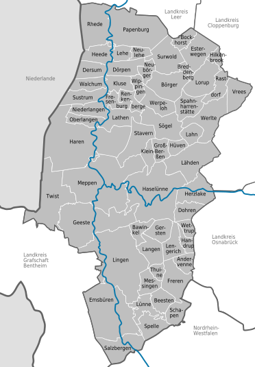
Communities

The number of inhabitants on December 31, 2019 in brackets.
- Emsbüren (10,199)
- Geeste (11,365)
- Haren (Ems) , City (23,881)
- Haselünne , City (13,029)
- Lingen (Ems) , large independent town (54,708)
- Meppen , district town , independent municipality (35,313)
- Papenburg , city, independent municipality (37,766)
- Roadstead (Ems) (4292)
- Salzbergen (7839)
- Twist (9605)
Member municipalities of the integrated municipalities
* Seat of the joint municipality administration
|
1. Samtgemeinde Dörpen (16,937)
2. Freren municipality (10,416)
3. Samtgemeinde Herzlake (10,399)
|
4. Lathen municipality (11,916)
5. Lengerich municipality (9229) 6. Nordhümmling municipality (12,226)
|
7. Sögel municipality (16,902)
8. Samtgemeinde Spelle (13,890) 9. Integrated municipality Werlte (17,042) |
License Plate
After the formation of the Emsland district on August 1, 1977, the license plates of the old districts continued to be issued: ASD (for Aschendorf-Hümmling), LIN (for Lingen) and MEP (for Meppen). On April 5, 1978, the district was then assigned the vehicle identification number EL ; it is still issued today. Until the 1990s , the license plates were allocated in the individual registration offices according to the following scheme :
| area | Letters | numbers |
|---|---|---|
| Meppen | A – Z | 1-9999 |
| AA-ZZ | 1-99 | |
| Papenburg | AA-NZ | 100-999 |
| Lingen | PA-ZZ |
See also
literature
- Hermann Abels: The place names of the Emsland in their linguistic and cultural-historical meaning. Ferdinand Schöningh Verlag, Paderborn 1929.
- Werner Franke, Josef Grave, Heiner Schüpp, Gerd Steinwascher (eds.): The district of Emsland. Geography, history, present. A circle description. Meppen 2002, ISBN 3-930365-13-8 .
- Richard Heskamp, Andreas Eiynck : Emsland. A little closer to nature. Edition Rasch & Röhring, Steinfurt 2009, ISBN 978-3-939172-51-2 .
- Christof Haverkamp: The Emsland. An illustrated travel guide. 5th edition. Bremen 2008, ISBN 978-3-86108-473-0 .
- Werner Kaemling: Atlas on the history of Lower Saxony. Gerd J. Holtzmeyer Verlag, Braunschweig 1987, ISBN 3-923722-44-3 .
- Helmut Lensing: The "National Socialist German Workers' Party" (NSDAP) in Emsland from its beginnings to the beginning of the Nazi dictatorship, in: Study Society for Emsländische Regionalgeschichte (publisher): Emsländische Geschichte 20, Haselünne 2013, pp. 258–481.
- Karl-Eberhard Nauhaus: The Emsland in the course of history. Sögel 1984, ISBN 3-925034-00-5 .
Web links
- Homepage of the district of Emsland
- Literature from and about the Emsland district in the catalog of the German National Library
Individual evidence
- ↑ State Office for Statistics Lower Saxony, LSN-Online regional database, Table 12411: Update of the population, as of December 31, 2019 ( help ).
- ↑ Neue Osnabrücker Zeitung of January 14, 2017: Minister presents certificate. Werlte can call itself a city from March 22nd . Retrieved February 8, 2017.
- ↑ Landkreis Emsland - List of nature reserves , Lower Saxony State Agency for Water Management, Coastal and Nature Conservation.
- ↑ City of Lingen - List of nature reserves , Lower Saxony State Office for Water Management, Coastal and Nature Conservation.
- ↑ "Tinner and Staverner Dose" nature reserve , registration number: NSG WE 177.
- ↑ "Zitterteiche" nature reserve , registration number: NSG WE 020 .
- ↑ Data from the 2011 census
- ↑ [1] (PDF; 3.4 MB) First evidence of production sites of the funnel cup culture by C. Diedrich, Fig. 13
- ↑ Archived copy ( memento of the original from December 21, 2011 in the Internet Archive ) Info: The archive link was inserted automatically and has not yet been checked. Please check the original and archive link according to the instructions and then remove this notice. Megaliths in the Emsland
- ↑ [2] The Ems-Hunte culture
- ^ [3] Bronze Age and Pre-Roman Iron Age in Westphalia
- ↑ [4] In the time of the Thirty Years' War this type of salt production ended in northern Germany
- ↑ [5] Localization of the Varus Battle by Cornelius Tacitus
- ↑ - ( Memento of the original from September 24, 2015 in the Internet Archive ) Info: The archive link was inserted automatically and has not yet been checked. Please check the original and archive link according to the instructions and then remove this notice. (PDF; 393 kB) The Romans in East Friesland by Norbert Fiks
- ↑ Rome an der Ems - a desideratum of research ( Memento of the original from May 16, 2016 in the Internet Archive ) Info: The archive link was inserted automatically and has not yet been checked. Please check the original and archive link according to the instructions and then remove this notice. (PDF; 522 kB) Tribal history of the Rom on the Ems
- ^ History of the former Münster office of Meppen, p. 122
- ↑ - ( Memento of the original from December 18, 2014 in the Internet Archive ) Info: The archive link was inserted automatically and has not yet been checked. Please check the original and archive link according to the instructions and then remove this notice. The landscape of the Emsland around 1870
- ↑ [6] History of the district of Lingen: The general story R von Acken, p. 211
- ↑ [7] (PDF; 65 kB) Reformed Confessionalization in Germany and Upper Germany by Georg Plasger
- ↑ The general story. In: History of the Lingen district. P. 285.
- ^ The Spaniards in Emsland. In: JB Diepenbrock: History of the former Munster office of Meppen.
- ↑ [8] History of the former Munster office of Meppen by JB Diepenbrock, p. 417
- ↑ - ( Memento of the original from March 18, 2013 in the Internet Archive ) Info: The archive link was inserted automatically and has not yet been checked. Please check the original and archive link according to the instructions and then remove this notice. Camp in Emsland
- ↑ [9] A terrifying undertaking
- ↑ Archived copy ( Memento of the original from December 18, 2014 in the Internet Archive ) Info: The archive link was inserted automatically and has not yet been checked. Please check the original and archive link according to the instructions and then remove this notice. Demonstration against nuclear energy in Wippingen on November 29, 1976
- ↑ Moorbrand: "Countless underground embers". ndr.de , September 24, 2018, accessed on September 24, 2018 .
- ↑ https://results.zensus2011.de/#StaticContent:03454,BEK_1_1_5,m,table
- ↑ a b Election results of the district assembly 2017 on wahlen-im-emsland.de , accessed on April 24, 2017
- ↑ a b Election result of the district election 2016 on wahlen-im-emsland.de , accessed on April 24, 2017
- ↑ [10] Result of the local election 2006
- ↑ Lower Saxony Ministry of the Interior and Sport (ed.): Documentation of the home collections of refugees, displaced persons and resettlers in Lower Saxony . Isensee, Oldenburg 2012, p. 157.
- ^ Federal Institute for Culture and History of Germans in Eastern Europe : Heimatstube der Kreisgemeinschaft Heilsberg , accessed on February 22, 2014.
- ^ Heidelberg University: Chapter Emsland district . In: Jewish cemeteries according to the current administrative structure - Lower Saxony ; in: Overview of all projects for the documentation of Jewish grave inscriptions in the area of the Federal Republic of Germany
- ↑ - ( Memento of the original from December 12, 2016 in the Internet Archive ) Info: The archive link has been inserted automatically and has not yet been checked. Please check the original and archive link according to the instructions and then remove this notice.
- ↑ Future Atlas 2016. (No longer available online.) Archived from the original on October 2, 2017 ; accessed on March 23, 2018 . Info: The archive link was inserted automatically and has not yet been checked. Please check the original and archive link according to the instructions and then remove this notice.
- ↑ State Office for Statistics Lower Saxony, LSN-Online regional database, Table 12411: Update of the population, as of December 31, 2019 ( help ).
Counties : Ammerland | Aurich | Celle | Cloppenburg | Cuxhaven | Diepholz | Emsland | Friesland | Gifhorn | Goslar | Göttingen | County of Bentheim | Hameln-Pyrmont | Harburg | Heidekreis | Helmstedt | Hildesheim | Holzminden | Empty | Lüchow-Dannenberg | Lüneburg | Nienburg / Weser | Northeim | Oldenburg | Osnabrück | Osterholz | Peine | Rotenburg (Wümme) | Schaumburg | Stade | Uelzen | Vechta | Verden | Wesermarsch | Wittmund | Wolfenbüttel
Region : Hanover
Independent cities : Braunschweig | Delmenhorst | Emden | Oldenburg (Oldb) | Osnabrück | Salzgitter | Wilhelmshaven | Wolfsburg