Big Aa
| Big Aa | ||
|
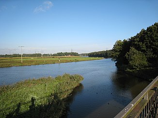
The confluence of the Große Aa in the Ems |
||
| Data | ||
| Water code | DE : 34 (with Deeper Aa) | |
| location | In Germany , Lower Saxony | |
| River system | Ems | |
| Drain over | Ems → North Sea | |
| source | the Deeper Aa near Fürstenau 52 ° 31 '33 " N , 7 ° 38' 48" E |
|
| Source height | Deeper Aa 50 m above sea level NHN Ahe 82 m above sea level NN , confluence 33 m above sea level. NN , |
|
| muzzle | south of Lingen Coordinates: 52 ° 27 '37 " N , 7 ° 19' 29" E 52 ° 27 '37 " N , 7 ° 19' 29" E |
|
| Mouth height | 22 m above sea level NN | |
| Height difference | 28 m | |
| Bottom slope | 0.8 ‰ | |
| length | 34.9 km | |
| Catchment area | 922 km² | |
| Left tributaries | Schaler Aa , Bardelgraben , Moosbeeke , Giegel Aa , Lünner Graben, Speller Aa | |
| Right tributaries | Reitbach, Schinkenkanal, Südbach, Thuiner Mühlenbach | |
| Medium-sized cities | Lingen | |
| Small towns | Freren | |
| Communities | Beesten , Lünne , Emsbüren | |
The Große Aa is an eastern and therefore right tributary of the Ems in Lower Saxony . According to its name, it is 15 miles long, hydrographically including its stronger headwaters, the Deeper Aa, 21 miles. The second source river is the shorter and less water-rich Ahe . The tributaries of this lowland river have flow paths of up to about 56 km from their sources to the confluence of the Great Aa in the Ems. Most of them come from the southeast, several from North Rhine-Westphalia and some from the Teutoburg Forest . The catchment area of the Große Aa is bounded to the north by the Lingener Höhe , to the northeast by the Ankumer Höhe .
The Deeper Aa rises northwest of Fürstenau . Even before it joins the Ahe, it receives two longer tributaries from the left, the Fürstenauer Mühlenbach and the Reetbach. The Ahe comes from the foothills of the Ankumer Höhe.
One kilometer after the Ahe comes - also from the left - the significantly larger Schaler Aa . Shortly after Beesten , the Giegel Aa flows from the south , which branches off to the right in North Rhine-Westphalia from the Hopstener Aa, which also flows into the Große Aa and receives 2/3 to 3/4 of the water.
The Hopstener Aa unites at Spelle with the Dreierwalder Aa mentioned above Ibbenbürener Aa to form the Speller Aa , which the Große Aa only reaches 7.25 km before it flows into the Ems.
Speller Aa and lower Große Aa flow parallel to the Dortmund-Ems Canal to the north and flow a few meters north of the canal ( Schleuse Gleesen ) into the river, 6 km south of Lingen .
See also
Individual evidence
- ↑ a b Lower Saxony environmental maps
- ↑ www.umwelt.niedersachsen.de: Area codes and sizes of the catchment areas in the Ems river system (PDF for download; 221 kB)
