Coastal channel
| Coastal channel | |
|---|---|
|
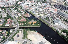
Easternmost section of the coastal canal in Oldenburg. In front: Amalienbrücke , behind: Cecilia Bridge |
|
| abbreviation | KüK |
| location | Germany: Lower Saxony |
| length | 69.56 km |
| Built | 1921 to 1935 |
| class | IV |
| Beginning | in the Hunte 140 m below the Amalienbrücke in Oldenburg ⊙ |
| The End | Confluence with the DEK (Ems) at km 202.55 ⊙ |
| Descent structures | Oldenburg , Dörpen |
| Junctions, crossings | Elisabethfehnkanal |
| Kilometrage | Ascending towards DEK, km 0 to km 69.63 |
| Downhill | Direction Oldenburg |
The coastal canal is an approximately 70-kilometer-long federal waterway that connects the Hunte near Oldenburg with the Ems near Dörpen , which has been expanded into the Dortmund-Ems Canal . The Dörpen branch canal also belongs to the coastal canal, an 890 m long bed of the partially finished Gleesen-Papenburg side canal , also belonging to waterway class IV.
Course of the coastal channel
The coastal canal branches off the Hunte in Oldenburg in a westerly direction. After about 13 km it pierces the watershed between the Ems and Weser catchment areas at the "Mosleshöhe" in the village of Friedrichsfehn . From here the canal runs in the south of the Ammerland , cuts through the district of Cloppenburg north of Friesoythe and the north of the district of Emsland and meets the Dortmund-Ems Canal (Ems) near Dörpen (south of Papenburg ). Almost along its entire length, the canal is accompanied by the coastal canal road, federal road 401 .
Structural development and use
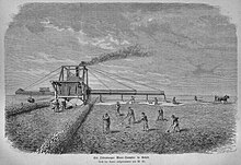
In the eastern part, from Oldenburg to the Kampe district of Friesoyther , the coastal canal was created from 1922 onwards through the expansion of the Hunte-Ems canal , which was completed in 1893 , originally a drainage canal for the Oldenburg moors. This canal still exists in its northwestern part from Kampe as the Elisabethfehn Canal . After Oldenburg had extended the canal from Kampe to the state border in 1924, Prussia began the connection between the Ems and the state border in 1927. The coastal canal was put into operation on September 28, 1935.
The coastal channel was dimensioned for the 600/750 t ship (length: 67.00 m; width: 8.20 m; draft: 1.75 / 2.00 m). The 1000 t ship (length: 80.00 m; width: 9.00 m; draft: 2.00 m) was also approved for single-aisle.
The apex position of the canal is completed in the east by the Oldenburg lock and in the west by the Dörpen lock. The fall height in Oldenburg is up to 5.40 m depending on the tidal water level of the Hunte and in Dörpen 1.20 m descent to the Bollinger ferry dam on the Ems. Conversely, the Dörpen lock can block the coastal canal against extreme Ems floods. The Oldenburg lock was opened in 1927 and the Dörpen lock in 1935. After the war damage had been repaired, the Oldenburg route was improved in 1948–1951 by means of dredging, a canal profile extended to the south and bank reinforcements. 1965–1985 the expansion for the 1000 t ship (single-aisle for the Europaschiff , 1350 t) was carried out.
Even today, the coastal canal is still the main receiving water with a catchment area of 1045 km² south of the canal for drainage and flood relief for the areas Ems - Hunte, Leda / Jümme . Of the entire catchment area, 237 km² drain completely into the canal to feed the 63 km long apex section, plus water from the Hunte, if necessary. Flood peaks from the rivers Sagter Ems , Soeste and Vehne are diverted into the canal and quickly and safely discharged in roughly equal parts to the Ems (via the Ems-Altarm Goldfischdever) and to the Hunte. In order to ensure the water level for shipping and to minimize fluctuations in the water level, the inflows and outflows are controlled according to an operating plan in which federal and state agencies as well as associations are involved.
In the beginning, the main transport goods were peat, animal feed and building materials. Bulky goods (stone and earth, food and feed) continue to have the largest share of traffic. Container traffic was added at the beginning of the 21st century. The tonnage sluiced between 2002 and 2009 at the Dörpen lock was between 3.3 and 4 million tons for over 6,000 commercial vessels. The freight transport center (GVZ) Emsland in Dörpen, which has been in existence since 1996, has a positive effect on shipping, a hub for the road, rail and waterway modes of transport, where 36% of the transport volume is taken from road to waterway.
However, representatives of the economy criticize that there is no plan in the Federal Ministry of Transport to make the canal navigable for large motor cargo ships.
Coastal Canal data
- Length 69.6 km
- Water depth 3.50 m
- 14 culverts (river crossings)
- Clear passage height under bridges 4.50 m
- Bridges over the canal: 31
- Locks: length 105 m, width 12 m
- Hundsmühlen security gate at km 5.17
- Sedelsberg security gate at km 41.06
See also
- c-Port , a special purpose association and commercial area on the coastal canal
- Lahe-Ableiter , the 4.5 km long connecting channel from the Lahe to the coastal channel
- Fighting on the coastal canal in 1945: Edewechterdamm , sea lion position
Individual evidence
- ↑ a b c Lengths (in km) of the main shipping routes (main routes and certain secondary routes) of the federal inland waterways ( memento of the original from January 21, 2016 in the Internet Archive ) Info: The archive link was automatically inserted and not yet checked. Please check the original and archive link according to the instructions and then remove this notice. , Federal Waterways and Shipping Administration
- ↑ a b Directory E, serial no. 25 der Chronik ( Memento of the original from July 22, 2016 in the Internet Archive ) Info: The archive link was inserted automatically and has not yet been checked. Please check the original and archive link according to the instructions and then remove this notice. , Federal Waterways and Shipping Administration
- ^ Coastal Canal, Route and Structural Development ( Memento from August 17, 2010 in the Internet Archive ) , Meppen Waterways and Shipping Office
- ↑ a b Journal Binnenschifffahrt, Supplement October 2010: 75 Years of the Coastal Canal
- ↑ Expansion of the coastal canal is a matter close to my heart . New Osnabrück newspaper . September 24, 2010
literature
- Georg Limann: The coastal channel . In: Oldenburger Jahrbuch des Oldenburger Landesverein für Geschichte, Natur und Heimatkunde , vol. 55 (1955), part II, pp. 1–82 ( online )
- Christof Haverkamp: The development of the Emsland as an example of state regional economic development (Emsland / Bentheim - Contributions to History , Volume 7), Sögel 1991, pp. 35–41.
- M. Eckoldt (Hrsg.): Rivers and canals, The history of the German waterways , DSV-Verlag 1998
Web links
- General Directorate for Waterways and Shipping - West Branch
- Meppen Waterways and Shipping Office
- Waterways and Shipping Office Bremen
- The coastal canal project at the Friedrichsfehn primary school
- Torsten Stengel: The construction history of the coastal canal (PDF; 543 kB)
- The coastal canal fishing association for the district of the Friesoyther Wasseracht eV, Lower Saxony, Friesoythe.


