List of natural monuments in the Emsland district
The list of natural monuments in the Emsland district contains the natural monuments in the Emsland district in Lower Saxony .
On December 31, 2016, according to the overview of the Lower Saxony State Office for Water Management, Coastal Protection and Nature Conservation, 13 natural monuments were prescribed in the city of Lingen (Ems) and 64 in the rest of the Emsland district. The Lower Nature Conservation Authority responsible for natural monuments can be found in the town of Lingen (Ems) and for the other municipalities in the district of Emsland.
Emsbüren
| number | designation | Place, location | description | Protective reason | image |
|---|---|---|---|---|---|
| ND EL 00063 | Ilex hedge |
Emsbueren in Ellbergen ( 52 ° 27 '19.9 " N , 7 ° 18' 34" O ) |
OJ the Prussian. Government in Osnabrück No. 41 BC October 14, 1933 p. 131. |
||
| ND EL 00076 | Hünenburg |
Emsbüren ( 52 ° 23 ′ 21.3 ″ N , 7 ° 16 ′ 9.2 ″ E ) |
OJ the government in Osnabrück No. 9 v. 2.05.1956 p. 32. |
Geeste
| number | designation | Place, location | description | Protective reason | image |
|---|---|---|---|---|---|
| ND EL 00022 | Ilex hedge |
Geeste Lingener Straße 9 ( 52 ° 35 ′ 17.2 ″ N , 7 ° 13 ′ 54.3 ″ E ) |
OJ for the administrative district of Osnabrück No. 8 v. April 30, 1967 p. 63. |
Haren (Ems)
| number | designation | Place, location | description | Protective reason | image |
|---|---|---|---|---|---|
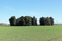
| ND EL 00089 | Ilexhecke near Haren |
Haren Geeststrasse ( 52 ° 46 ′ 5.6 ″ N , 7 ° 13 ′ 10.7 ″ E ) |
OJ for the administrative region Weser-Ems No. 38 v. 09/24/1982 p. 905. |
 more pictures |
Haselünne
| number | designation | Place, location | description | Protective reason | image |
|---|---|---|---|---|---|
| ND EL 00001 | Juniper grove cheese forth |
Haselünne ( 52 ° 41 ′ 6.4 ″ N , 7 ° 32 ′ 25.6 ″ E ) |
OJ the Prussian. Government in Osnabrück No. 45 BC November 7, 1936 p. 132. |
||
| ND EL 00002 | Transitional moor Bruns Torffehn |
Haselünne ( 52 ° 39 ′ 12.6 ″ N , 7 ° 24 ′ 4.7 ″ E ) |
OJ the Prussian. Government in Osnabrück No. 45 BC November 7, 1936 p. 132. |
||
| ND EL 00003 | Transitional moor Münster-Mörchen |
Haselünne Zum Mühlenbusch 10 ( 52 ° 37 ′ 52.4 ″ N , 7 ° 29 ′ 5.1 ″ E ) |
OJ the Prussian. Government in Osnabrück No. 45 BC November 7, 1936 p. 132. |
||
| ND EL 00004 | Heidekolk Cordes Pool |
Haselünne ( 52 ° 38 ′ 15.1 ″ N , 7 ° 30 ′ 50.9 ″ E ) |
OJ the Prussian. Government in Osnabrück No. 10 BC March 6, 1937 p. 22. |
||
| ND EL 00005 | Stone grave |
HASELUNNE southeast to Herthum / Herthumstraße ( 52 ° 44 '54.2 " N , 7 ° 30' 30.2" O ) |
OJ the Prussian. Government in Osnabrück No. 10 BC March 12, 1938 p. 32. |
||
| ND EL 00006 | Stone grave |
Haselünne south of Westerloher Strasse ( 52 ° 44 ′ 23.1 ″ N , 7 ° 30 ′ 51.6 ″ E ) |
OJ the Prussian. Government in Osnabrück No. 10 BC March 12, 1938 p. 32. |
||
| ND EL 00007 | Stone grave |
Haselünne Zum Herthum 15A ( 52 ° 44 ′ 54 ″ N , 7 ° 30 ′ 26 ″ E ) |
OJ the Prussian. Government in Osnabrück No. 10 BC March 12, 1938 p. 32. |
||
| ND EL 00021 | Lotten House |
Haselünne Im Kathen 1 ( 52 ° 38 ′ 29.8 ″ N , 7 ° 29 ′ 13.2 ″ E ) |
OJ for the administrative district of Osnabrück No. 8 v. April 30, 1967 p. 62. |
||
| ND EL 00023 | Naked Poel |
Haselünne ( 52 ° 37 ′ 33.4 ″ N , 7 ° 26 ′ 37.4 ″ E ) |
OJ for the administrative region Weser-Ems No. 29 v. 09/28/1979 p. 1191. |
||
| ND EL 00093 | Gray heron colony Gut Eickhof |
Haselünne Käseforth 2 ( 52 ° 40 ′ 4 ″ N , 7 ° 31 ′ 54.5 ″ E ) |
OJ for the administrative region Weser-Ems No. 14 v. 04/04/1985 p. 372. |
||
| ND EL 00094 | Radde-Altarm Lohe |
Lohe In Raddegrund ( 52 ° 42 '32.8 " N , 7 ° 25' 45.4" O ) |
OJ for the administrative region Weser-Ems No. 33 v. 08/16/1985 p. 887. |
||
| ND EL 00095 | Flahsdiek |
Westerloh ( 52 ° 44 ′ 8.8 ″ N , 7 ° 28 ′ 0.3 ″ E ) |
OJ for the administrative region Weser-Ems No. 33 v. 08/16/1985 p. 887. |
||
| ND EL 00096 | Rook colony Haselünne |
Haselünne Neuer Grund 24 ( 52 ° 39 ′ 58.6 ″ N , 7 ° 29 ′ 13.4 ″ E ) |
OJ for the administrative region Weser-Ems No. 21 v. May 22, 1987 p. 446. |
||
| ND EL 00101 | Pollard willows |
Lohe In Raddegrund ( 52 ° 42 '17.8 " N , 7 ° 24' 21.3" O ) |
OJ for the administrative region Weser-Ems No. 12 v. March 25, 1988 p. 339. |
Lingen (Ems)
Meppen
| number | designation | Place, location | description | Protective reason | image |
|---|---|---|---|---|---|
| ND EL 00017 | Stone grave: the stone key |
Meppen Apeldorner Hauptstrasse 8 ( 52 ° 44 ′ 4.2 ″ N , 7 ° 23 ′ 40.5 ″ E ) |
OJ of the government in Osnabrück St. 22 BC 1.12.1957 p. 108. |
 more pictures |
|
| ND EL 00019 | Boulder |
Meppen Süd-Nord-Straße 11 ( 52 ° 43 ′ 29.3 ″ N , 7 ° 10 ′ 36.7 ″ E ) |
OJ of the government in Osnabrück St. 22 BC 1.12.1957 p. 108. |
 more pictures |
|
| ND EL 00087 | Ilexhecke in verse |
Verses Spiekweg ( 52 ° 43 '0.3 " N , 7 ° 15' 5" O ) |
OJ for the administrative region Weser-Ems No. 34 v. August 27, 1982 p. 827. |
 more pictures |
|
| ND EL 00088 | Oak |
Meppen Am Nachtigallenwäldchen ( 52 ° 41 ′ 24.8 ″ N , 7 ° 17 ′ 50.1 ″ E ) |
OJ for the administrative region Weser-Ems No. 34 v. August 27, 1982 p. 827. |
||
| ND EL 00090 | Helter dune |
Meppen Osterbergstrasse ( 52 ° 40 ′ 46.9 ″ N , 7 ° 21 ′ 21.2 ″ E ) |
OJ for the administrative region Weser-Ems No. 42 v. 22.10.1982 p. 1004. |
||
| ND EL 00092 | Lily pond |
Meppen ( 52 ° 42 ′ 50.7 ″ N , 7 ° 19 ′ 37.9 ″ E ) |
OJ for the administrative region Weser-Ems No. 46 v. 11/18/1983 p. 1057. |
Papenburg
No natural monuments are prescribed in the city of Papenburg .
Roadstead (Ems)
| number | designation | Place, location | description | Protective reason | image |
|---|---|---|---|---|---|
| ND EL 00108 | Borsumer Spiek |
Rhede (Ems) ( 53 ° 1 ′ 43 ″ N , 7 ° 17 ′ 46.7 ″ E ) |
OJ of the government in Osnabrück No. 22 BC May 29, 1992 p. 657. |
Mountains of salt
| number | designation | Place, location | description | Protective reason | image |
|---|---|---|---|---|---|
| ND EL 00085 | beech |
Pre-text Espel 3 ( 52 ° 20 ′ 0.3 ″ N , 7 ° 22 ′ 48.8 ″ O ) |
OJ for the administrative region Weser-Ems No. 34 v. August 27, 1982 p. 827. |
twist
No natural monuments are prescribed in the Twist municipality .
Integrated municipality Dörpen
| number | designation | Place, location | description | Protective reason | image |
|---|---|---|---|---|---|
| ND EL 00024 | Heeder Linde |
Heede ( 52 ° 59 ′ 35.2 ″ N , 7 ° 17 ′ 45.4 ″ E ) |
OJ the Prussian. Government in Osnabrück No. 15 BC April 9, 1932 p. 47. |
 more pictures |
Joint municipality of Freren
| number | designation | Place, location | description | Protective reason | image |
|---|---|---|---|---|---|
| ND EL 00071 | Stone grave: Large stone grave in the Kunkenvenne |
Thuine ( 52 ° 30 ′ 21.3 ″ N , 7 ° 30 ′ 22.8 ″ E ) |
OJ the government in Osnabrück No. 9 v. 2.05.1956 p. 32. |
 more pictures |
Herzlake municipality
| number | designation | Place, location | description | Protective reason | image |
|---|---|---|---|---|---|
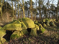
| ND EL 00013 | Stone grave |
Lähden ( 52 ° 45 ′ 53.6 ″ N , 7 ° 34 ′ 16.1 ″ E ) |
OJ the Prussian. Government in Osnabrück No. 10 BC March 12, 1938 p. 32. |
|
|
| ND EL 00014 | Stone grave |
Lähden ( 52 ° 45 ′ 5 ″ N , 7 ° 37 ′ 27.8 ″ E ) |
OJ the Prussian. Government in Osnabrück No. 10 BC March 12, 1938 p. 32. |
Lathen municipality
| number | designation | Place, location | description | Protective reason | image |
|---|---|---|---|---|---|
| ND EL 00102 | 3 Schlatts northeast of Lathen |
Lathen ( 52 ° 52 ′ 0.1 ″ N , 7 ° 20 ′ 31.7 ″ E ) |
OJ for the administrative region Weser-Ems No. 27 v. 07/07/1989 p. 653. |
Joint municipality of Lengerich
| number | designation | Place, location | description | Protective reason | image |
|---|---|---|---|---|---|
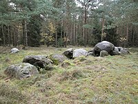
| ND EL 00072 | Stone grave |
Langen am Radberg ( 52 ° 30 ′ 57.9 ″ N , 7 ° 27 ′ 41.8 ″ E ) |
OJ the government in Osnabrück No. 9 v. 2.05.1956 p. 32. |
|
|
| ND EL 00073 | Stone grave |
Langen zu den Hünensteinen 11 ( 52 ° 30 ′ 14.2 ″ N , 7 ° 33 ′ 5.4 ″ E ) |
OJ the government in Osnabrück No. 9 v. 2.05.1956 p. 32. |

|
|
| ND EL 00075 | Spring moor |
Langen am Radberg ( 52 ° 30 ′ 54.6 ″ N , 7 ° 27 ′ 58.7 ″ E ) |
OJ the government in Osnabrück No. 9 v. 2.05.1956 p. 32. |
||
| ND EL 00106 | Little Wittefehn |
Langen Brookstrasse ( 52 ° 34 ′ 18.1 ″ N , 7 ° 26 ′ 34.1 ″ E ) |
OJ of the government in Osnabrück No. 31 BC 2.08.1991 p. 880. |
||
| ND EL 00100 | Faller Moor |
Lengerich ( 52 ° 33 ′ 5.2 ″ N , 7 ° 30 ′ 6.2 ″ E ) |
OJ for the administrative region Weser-Ems No. 1 v. January 6, 1989 p. 14. |
||
| ND EL 00078 | Ilexhain |
Race ( 52 ° 36 ′ 35.1 ″ N , 7 ° 33 ′ 25.9 ″ E ) |
OJ the government in Osnabrück No. 9 v. 2.05.1956 p. 32. |
Joint municipality of Nordhümmling
| number | designation | Place, location | description | Protective reason | image |
|---|---|---|---|---|---|
| ND EL 00041 | 2 barrows "Auf dem Wohlde" |
Surwold south of Börgerwald ( 52 ° 57 ′ 55.4 ″ N , 7 ° 31 ′ 10.1 ″ E ) |
OJ the government in Osnabrück No. 10 v. Chr. 1.06.1957 p. 50. |
Sögel municipality
| number | designation | Place, location | description | Protective reason | image |
|---|---|---|---|---|---|
| ND EL 00038 | Hill with beech and stone grave:
"Vaogelbarg" with large stone grave Börger III |
Börger Bergstrasse 5 ( 52 ° 54 ′ 44.7 ″ N , 7 ° 31 ′ 39 ″ E ) |
OJ the government in Osnabrück No. 10 v. Chr. 1.06.1957 p. 50. |
 more pictures |
|
| ND EL 00039 | Boulder "sacrificial stone" |
Börger Bergstrasse 11 ( 52 ° 54 ′ 44.4 ″ N , 7 ° 31 ′ 32.6 ″ E ) |
OJ the government in Osnabrück No. 10 v. Chr. 1.06.1957 p. 50. |
 more pictures |
|
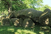
| ND EL 00040 | "Steenhus in Börger" barrow |
Börger Am Hünenstein 16 ( 52 ° 54 ′ 52.9 ″ N , 7 ° 31 ′ 41.5 ″ E ) |
OJ the government in Osnabrück No. 10 v. Chr. 1.06.1957 p. 50. |
 more pictures |
|
| ND EL 00042 | Easter brink |
Börger Up'n Riegen ( 52 ° 54 ′ 34.6 ″ N , 7 ° 32 ′ 22.4 ″ E ) |
OJ for the administrative region of Osnabrück No. 24 v. December 31, 1965 p. 206. |
||
| ND EL 00011 | Stone grave |
Groß Berßen near Hüvener Straße 3 ( 52 ° 46 ′ 52.2 ″ N , 7 ° 30 ′ 12.4 ″ E ) |
OJ the Prussian. Government in Osnabrück No. 10 BC March 12, 1938 p. 32. |
||
| ND EL 00012 | Stone grave |
Groß Berßen ( 52 ° 46 ′ 51.9 ″ N , 7 ° 30 ′ 25.2 ″ E ) |
OJ the Prussian. Government in Osnabrück No. 10 BC March 12, 1938 p. 32. |
||
| ND EL 00020 | 8 barrows |
Sögel Staverner Strasse ( 52 ° 48 ′ 48.3 ″ N , 7 ° 28 ′ 28.9 ″ E ) |
OJ of the government in Osnabrück No. 11 BC June 15, 1963 p. 61. |
||
| ND EL 00025 | Great stone grave: Great stone grave Püttkesberge |
Sögel ( 52 ° 49 ′ 48.8 ″ N , 7 ° 30 ′ 38.1 ″ E ) |
OJ the Prussian. Government in Osnabrück No. 51 BC December 18, 1936 p. 162. |
||
| ND EL 00026 | 2 barrows |
Spahnharrenstätte ( 52 ° 52 ′ 25.3 ″ N , 7 ° 35 ′ 36.2 ″ E ) |
OJ the Prussian. Government in Osnabrück No. 19 BC May 8, 1937 p. 44. |
||
| ND EL 00028 | Barrows |
Spahn ( 52 ° 52 ′ 7.6 ″ N , 7 ° 33 ′ 32.1 ″ E ) |
OJ the Prussian. Government in Osnabrück No. 19 BC May 8, 1937 p. 44. |
||
| ND EL 00029 | Steenberg stone grave |
Spahnharrenstätte ( 52 ° 52 ′ 38.8 ″ N , 7 ° 35 ′ 17.7 ″ E ) |
OJ the Prussian. Government in Osnabrück No. 19 BC May 8, 1937 p. 44. |
||
| ND EL 00008 | Stone tomb Bruneforth:
Large stone grave on Bruneforth's Esch |
Stavern ( 52 ° 46 ′ 58.3 ″ N , 7 ° 26 ′ 13.9 ″ E ) |
OJ the Prussian. Government in Osnabrück No. 10 BC March 12, 1938 p. 32. |
 more pictures |
|
| ND EL 00009 | Barrows: Barrows field in the dune firs |
Stavern ( 52 ° 46 ′ 37.9 ″ N , 7 ° 25 ′ 45.8 ″ E ) |
OJ the Prussian. Government in Osnabrück No. 10 BC March 12, 1938 p. 32. |
 more pictures |
|
| ND EL 00010 | Stone graves: Great stone graves Deymanns Mühle I-IV |
Stavern ( 52 ° 46 ′ 23.9 ″ N , 7 ° 25 ′ 49.9 ″ E ) |
OJ the Prussian. Government in Osnabrück No. 10 BC March 12, 1938 p. 32. |
 more pictures |
|
| ND EL 00018 | Stone grave: Great stone grave at the Osteresch |
Stavern Am Steinberg 2 ( 52 ° 46 ′ 23.9 ″ N , 7 ° 25 ′ 49.9 ″ E ) |
OJ of the government in Osnabrück No. 6 v. March 14, 1953 p. 18. |
 more pictures |
|
| ND EL 00098 | Heidekolk on Schlagbrücker Weg |
Stavern Schlagbrückener Weg ( 52 ° 45 ′ 27.3 ″ N , 7 ° 22 ′ 7.1 ″ E ) |
OJ for the administrative region Weser-Ems No. 1 v. January 6, 1989 p. 14. |
||
| ND EL 00099 | Madillenteich |
Stavern ( 52 ° 45 ′ 47.4 ″ N , 7 ° 22 ′ 18.9 ″ E ) |
OJ for the administrative region Weser-Ems No. 1 v. January 6, 1989 p. 14. |
||
| ND EL 00030 | Barrows field: Barrows field on the Windberg |
Werpeloh ( 52 ° 52 ′ 42.8 ″ N , 7 ° 31 ′ 36 ″ E ) |
OJ the Prussian. Government in Osnabrück No. 19 BC May 8, 1937 p. 44. |
 more pictures |
|
| ND EL 00031 | 2 stone graves: large stone graves on the Buschhöhe,
Great stone grave Werpeloh IV and V |
Werpeloh ( 52 ° 52 ′ 21.9 ″ N , 7 ° 31 ′ 30.6 ″ E ) |
OJ the Prussian. Government in Osnabrück No. 19 BC May 8, 1937 p. 44. |
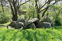 more pictures |
|
| ND EL 00032 | Stone grave: Great stone grave Werpeloh III |
Werpeloh ( 52 ° 52 ′ 44.9 ″ N , 7 ° 31 ′ 27.9 ″ E ) |
OJ the Prussian. Government in Osnabrück No. 19 BC May 8, 1937 p. 44. |
 more pictures |
|
| ND EL 00036 | Steenhus in the Klöbertannen |
Werpeloh Klöbertannen ( 52 ° 53 ′ 13.2 ″ N , 7 ° 29 ′ 25.8 ″ E ) |
OJ the government in Osnabrück No. 10 v. Chr. 1.06.1957 p. 50. |
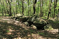 more pictures |
Joint municipality of Spelle
No natural monuments are prescribed in the joint municipality of Spelle .
Integrated municipality Werlte
| number | designation | Place, location | description | Protective reason | image |
|---|---|---|---|---|---|
| ND EL 00027 | Stone grave: Great stone grave Ostenwalde II |
Ostenwalde Ostenwalder Straße 36 ( 52 ° 50 ′ 17 ″ N , 7 ° 35 ′ 16.4 ″ E ) |
OJ the Prussian. Government in Osnabrück No. 19 BC May 8, 1937 p. 44. |
 more pictures |
|
| ND EL 00035 | Large stone grave: At the giant stones |
Ostenwalde Emslandstrasse 4 ( 52 ° 50 ′ 13.8 ″ N , 7 ° 35 ′ 22.7 ″ E ) |
OJ the government in Osnabrück No. 10 v. Chr. 1.06.1957 p. 50. |
 more pictures |
See also
- List of nature reserves in the Emsland district
- List of landscape protection areas in the Emsland district
- List of protected landscape components in the district of Emsland
- List of geotopes in the Emsland district
Web links
- Lower Saxony Ministry for the Environment, Energy and Climate Protection: The nature reserves of Lower Saxony on the interactive environmental map
Individual evidence
- ↑ Number of natural monuments in the area of responsibility of the Lower Nature Conservation Authority ( status: December 31 , 2016) on nlwkn.niedersachsen.de (accessed on November 5, 2017)
- ↑ 3 of which counted for both. Reason: decreed in the district, later incorporated into Lingen
