List of geotopes in the Emsland district
The list of geotopes in the Emsland district names the geotopes in the Emsland district in Lower Saxony . Some of these geotopes are also protected as natural monuments (ND), landscape protection areas (LSG), nature reserves (NSG) or part of these.
| Geotope no. | designation | place | comment | Coordinates | image |
|---|---|---|---|---|---|
| 2909/01 | Dune exposure with iron humus podsoles | 1.5 km west of Borsum in Borsumer mountains. | Geotope type: directional profile. Length 100 m, height 5 m. Stratigraphy: Quaternary Holocene. Petrography: north edge steep slope with a slipped base, three iron podsoles are exposed, e.g. T. in discordant storage. |
53 ° 2 '8.9 " N , 7 ° 16' 0.1" E | |
| 2909/02 | Dune areas | 1.5 km N Aschendorf 300–400 m E road to Tunxdorf. | Geotope type: dune area. 2 areas, mostly flat dunes, the NE area has some Schlatts. Height 5 m. Stratigraphy: Quaternary Holocene. Petrography: north edge steep slope with a slipped base, three iron podsoles are exposed, e.g. T. in discordant storage. Nature reserve NSG-OS 1 |
53 ° 3 '43.2 " N , 7 ° 19' 48" E | |
| 3210/01 | NSG " Auf Troendoj ". Schlatt, Hochmoor to Zwischenmoor | approx. 1.5 km southwest of Westerloh . | Geotope types: Moorschlatt, Hochmoor. Size 4.6 ha. Nature reserve NSG WE 151 "Auf Troendoj" |
52 ° 43 '33.2 " N , 7 ° 28' 18.1" E | |
| 3210/02 | NSG " Hare-Insel und Hase-Altarm " | approx. 2.5 km ONO Bokeloh . | Geotope types: oxbow lake, floodplain. Size 13.6 ha. Nature reserve NSG WE 036 "Hase-Insel und Hase-Altarm" |
52 ° 41 ′ 56 " N , 7 ° 22 ′ 52.7" E | |
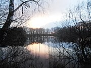
| 3310/04 | lake | approx. 7 km SSE Haselünne . | Geotope type: lake. Length 200 m, round shape. Size 50,000 m². Petrography: dead ice formation. Nature reserve NSG WE 055 "Lechtegoor" |
52 ° 36 ′ 40 " N , 7 ° 29 ′ 56" E |
 more pictures |
| 3410/01 | Boulder | 1 km south of Lingen , Staatsforst Laxter Sand, Jg. 183. | Geotope type: boulder. Length 2.2 m, width 1.8 m, height 1.1 m. Stratigraphy: Quaternary Pleistocene, Saale Glaciation. Petrography: granite, reddish, round edges. Natural monument ND LIN-S 7. |
52 ° 30 '4.3 " N , 7 ° 20' 20.4" E | |
| 2909/02 | Dune areas | 5 km west of Lünne between Ems-Niederung and Dortmund-Emskanal. | Geotope type: dune area. Dune area with strong relief energy in places, dunes up to 8 m high, different directions. Diameter approx. 3000 m. Stratigraphy: Quaternary Holocene. In the landscape protection area LSG EL 23. |
52 ° 25 ′ 19.2 " N , 7 ° 20 ′ 42" E |
See also
- List of nature reserves in the Emsland district
- List of landscape protection areas in the Emsland district
- List of natural monuments in the Emsland district
- List of protected landscape components in the district of Emsland
Web links
Commons : Geotopes in the Emsland district - collection of images, videos and audio files