List of geotopes in the Schaumburg district
The list of geotopes in the district of Schaumburg contains the geotopes in the district of Schaumburg in Lower Saxony . Some of these geotopes are also protected as natural monuments (ND), landscape protection areas (LSG), nature reserves (NSG) or part of these.
| Geotope no. | designation | place | comment | Coordinates | image |
|---|---|---|---|---|---|
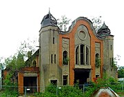
| 3621/02 | Building of the main mine complex Georgschacht of the former hard coal mining in Obernkirchener Revier | 2 km southwest of Stadthagen | geoscientific, (cultural) historical objects. Stratigraphy: Lower Cretaceous, Bückeberger Formation. Petrography: Georgschacht: colliery house, machine house. |
52 ° 18 '44.6 " N , 9 ° 10' 55.9" E |
 more pictures |
| 3720/02 | Court meadow ponds | approx. 1 km SSW Bückeburg | Sulfur source. Extensive fish pond area, in the east there is a sulfur spring. In the landscape protection area LSG SHG 8 Bückeberge |
52 ° 15 '7.6 " N , 9 ° 2' 29.4" E | |
| 3720/03 | Devil bath | approx. 1 km east of Bad Eilsen | Source. Size 60.0 ha of petrography: headwaters. Mostly congruent with the 63 hectare nature reserve NSG-HA 041 "Teufelsbad" |
52 ° 14 '32.3 " N , 9 ° 7' 34.3" E | |
| 3720/07 | Rock cliffs | Weser Mountains, NE Rinteln | Directional profile. Length 500 m Stratigraphy: Upper Jurassic, Lower Coral Oolite, Oxford. Petrography: limestone, gray, thick beneath, oolithic; Limestone and marl stone, quartz sand, yellow-gray; Limestone, gray, rich in shell debris. In the landscape protection area LSG-SHG 13 |
52 ° 12 '42.5 " N , 9 ° 5' 43.1" E | |
| 3720/08 | Clay pit of the former Röserheide brickworks | 1.5 km NE Obernkirchen | Directional profile. Length 400 m, height 6 m. Stratigraphy: Lower Cretaceous, Bückeberger Formation. Petrography: Obernkirchen sandstone, coal of the main seam, claystone, partly with layers of mussel shells. |
52 ° 16 '27.5 " N , 9 ° 8' 59.3" E | |
| 3720/11 | Former gravel pit "Im Teufelsbad" | 1.5 km south of Kleinenbremen, Buckeburg | Former gravel pit. Length 100 m, height 15 m. Stratigraphy: Quaternary Pleistocene, Saale Glaciation. Petrography: block packings and layered coarse gravel in transitions. |
52 ° 13 '30.4 " N , 9 ° 2' 20.8" E | |
| 3720/12 | Quarry | Am Papenbrink, 1.5 km south of Kleinenbremen, Bückeburg | Directional profile. Length 500 m, height 50 m. Stratigraphy: Upper Jurassic, Heersumer Strata and Korallenoolith, Oxford. Petrography: limestone, iron ore seams, marl limestone, remnants of mussels, arm pods, snails, corals. |
52 ° 13 '26.8 " N , 9 ° 2' 35.5" E | |
| 3720/13 | Quarry | near Arensburg Castle, Bad Eilsen | Directional profile. Length 600 m. Stratigraphy: Upper Jurassic, Korallenoolith, Oxford. Petrography: several stages of mining, limestone, predominantly oolithic with iron ore seams. In the landscape protection area LSG-SHG 13, Weser Mountains. |
52 ° 13 ′ 1.9 ″ N , 9 ° 7 ′ 16 ″ E | |
| 3721/02 | Quarries | 2.5 km N Kathrinhagen, Nienstädt | Directional profile. Stratigraphy: Lower Cretaceous, Bückeberger Formation. Petrography: Obernkirchen sandstone in the historical mining area. |
52 ° 15 '47.2 " N , 9 ° 12' 6.8" E | |
| 3721/05 | "Old quarries near Oberkirchen" (row of stone quarries and heaps) | Bückeberg 2–3 km NE Kathrinhagen, Obernkirchen | Directional profile. Stratigraphy: Lower Cretaceous, Bückeberger Formation. Petrography: Oberkirchen sandstone. In the landscape protection area LSG-SHG 008 "Bückeberge". |
52 ° 15 '25.2 " N , 9 ° 12' 15.1" E | |
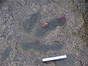
| 3721 / xx | Dinosaur tracks from Obernkirchen | Bückeberg, Obernkirchen | Fossils. In the Oberkirchen sandstone quarry. |
52 ° 15 ′ 51.8 " N , 9 ° 12 ′ 23" E |

|
| 3722/02 | Southwest slope of the middle Deister | approx. 2 km NNW Nienstedt . In the area of Lauenau . | Form of erosion. Size: 40,000 m². In the landscape protection area LSG-SHG 17, South Deister. |
52 ° 16 ′ 19.9 " N , 9 ° 26 ′ 26" E |
 more pictures |
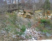
| 3722/06 | Former quarry Deister | 3.5 km NE Lauenau | Directional profile. Size 60 × 40 m. Stratigraphy: Lower Cretaceous, Bückeberger Formation. Petrography: sandstone and mudstone, thin layers alternating with mussel pavement. Sandstone, thick banked, with partly large plant remains. In the landscape protection area LSG-SHG 17, South Deister. |
52 ° 17 '27.2 " N , 9 ° 24' 38.9" E |

|
| 3820/01 | Kames landscape | at Krankenhagen SE Mollenbeck, Rinteln | glacial erosion. Stratigraphy: Quaternary - Pleistocene, Saale glaciation. In the landscape protection area LSG-SHG 12 "Lipper Bergland". |
52 ° 9 '14 " N , 9 ° 2' 29" E | |
| 3820/03 | NSG "On the Knickbrink" | S by Rinteln | Area: 5.5 ha. Stratigraphy: Quaternary Pleistocene. Petrography: meltwater deposition. In the landscape protection area LSG-SHG 12 "Lipper Bergland". |
52 ° 9 '26.3 " N , 9 ° 4' 20.6" E | |
| 3820/07 | Gravel sand pit | S Möllenbeck, Rinteln | Gravel pit. Length 1000 m, width 300 m. Stratigraphy: Quaternary Pleistocene, Saale Glaciation. Petrography: Sand and gravel of the ridge of Möllenbeck-Krankenhagen, which was heaped up by meltwater on the edge of a glacier. In the landscape protection area LSG-SHG 12 "Lipper Bergland". |
52 ° 9 '49 " N , 9 ° 2' 12.1" E |
See also
- List of nature reserves in the Schaumburg district
- List of landscape protection areas in the district of Schaumburg
- List of natural monuments in the Schaumburg district
- List of protected landscape components in the district of Schaumburg
Web links
Commons : Geotopes in the district of Schaumburg - collection of images, videos and audio files
Individual evidence
- ↑ "Teufelsbad" nature reserve. NLWKN , accessed April 26, 2019 .
- ↑ Old stone quarries near Oberkirchen , (pdf; 225 kB)
- ↑ Annette Richter, Uwe Stratmann: Obernkirchen sandstone quarries on the Bückeberg. Natural stone and fossils from the Lower Cretaceous Period , (pdf; 303 kB)
- ↑ Coal seam near "Alte Taufe" near Nienstedt im Deister , (pdf; 242 kB)
- ↑ The Kames von Krankenhagen , (pdf; 198 kB)