List of geotopes in the Hildesheim district
The list of geotopes in the Hildesheim district contains the geotopes in the Hildesheim district in Lower Saxony . Some of these geotopes are also protected as natural monuments (ND), landscape protection areas (LSG), nature reserves (NSG) or part of these.
| Geotope no. | designation | place | comment | Coordinates | image |
|---|---|---|---|---|---|
| 3725/13 | Black earth profile in the clay pit | Asel | Directional profile. Stratigraphy: Lower Cretaceous to Quaternary - Pleistocene, Vistula Glaciation. Petrography: Loess from the Vistula Ice Age lies as a silt-rich, calcareous wind sediment over clay and marl stone of the Lower Cretaceous. Natural monument ND Hi 329. |
52 ° 12 '4 " N , 9 ° 57' 57.2" E |
 more pictures |
| 3823/02 | Abandoned quarry with dinosaur tracks | Osterwald, 2 km E Sennhütte. West of Mehle | Sedimentary structures. Diameter 150 m on bottom; Diameter 250 m from the edge. Rich abundance of tracks and tracks (dinosaurs) and various sedimentation marks. Stratigraphy: Lower Cretaceous, Bückeberger Formation (Wealden main sandstone). Landscape protection area LSG Hi 55. |
52 ° 7 '35.8 " N , 9 ° 39' 22.7" E | |
| 3824/01 | Former Gravel pit | approx. 500 m SSW Burgstemmen , Elze | Gravel pit. Length 150 m, height 8 m. Stratigraphy: Quaternary Pleistocene. Petrography: Loess from the Vistula glacial period, boulder clay, meltwater gravel, basin sand, gravel from the Saale glacial period. |
52 ° 8 '10.7 " N , 9 ° 46' 7.7" E | |
| 3824/04 | Gravel pit in the NSG "Leineaue unter dem Rammelsberg" | 2 km northwest of Betheln | Gravel pit. Length 100 m, width 250 m. Stratigraphy: Quaternary Pleistocene, Saale Glaciation. Petrography: Meltwater gravel and blocks in an inclined layer, e.g. Sometimes with storage disorders, terminal moraine. In the nature reserve NSG HA 129 "Leineaue unter dem Rammelsberg" |
52 ° 7 '0.8 " N , 9 ° 46" 0.1 " E | |
| 3825/08 | Layer cuts | at the foot of the slope above the street "Zurschefen Ecke" NW Itzum , Hildesheim | Fossil deposits. Length 300 m. Stratigraphy: Lower Jurassic, Lower Toaricium. Petrography: Clay marlstone with limestone layers and geogens, e.g. Some with mussel shells, rarely with ammonites. In the nature reserve NSG-HA 109 "Am Roten Steine". |
52 ° 7 '8 " N , 9 ° 58' 51.6" E | |
| 3826/01 | Quarry in Heersum layers | approx. 1 km SSE Wendhausen , Schellerten | Rock outcrop. Length 50 m, 15 m, height 6 m, size 100 m². Stratigraphy: Jura, Heersumer layers (Oxfordium; Malm, Weißjura). |
52 ° 7 '18.1 " N , 10 ° 4' 18.1" E | |
| 3923/10 | Sand pit | 1.5 km SW Weenzen, 2 km SE Thüste. Duingen | Sand pit. Length 250 m, width 400 m. Stratigraphy: Tertiary Pliocene and Miocene, e.g. T. older. Petrography: sand, e.g. T. white ("glass sand") and brown coal; Deposits on the edge of a leaching depression above the Weenzen salt dome. |
52 ° 0 ′ 38.9 " N , 9 ° 39 ′ 27.7" E | |
| 3924/01 | Trochitenkalk, former quarry | in Külf NO Lütgenholzen , Alfeld (Leine) | Directional profile. Length 40 m, width 40 m, height 10 m. Stratigraphy: Triassic Upper Muschelkalk 1, Trochitenkalk. Petrography: clay plates, Upper Schill Limestone, Flaser Limestone, Lower Schill Limestone, Yellow Base Layers, Middle Muschelkalk. Natural monument ND HI 330 Lütgenholzen quarry. |
52 ° 0 ′ 31 " N , 9 ° 46 ′ 16.7" E | |
| 3924/08 | Former Quarry | Holzer Schlie E Brüggen | Directional profile. Stratigraphy: Upper Cretaceous, Middle Cenoman. Petrography: limestone marl, with inoceramen (mussels) and ammonites. In the landscape protection area LSG-HI 59 "Seven Mountains and Foothills". |
52 ° 2 ′ 13.9 " N , 9 ° 48 ′ 22" E | |
| 3924/11 | Former Quarry | Foot of the Seven Mountains E Eimsen , Alfeld (Leine) | Directional profile. Diameter 20 m. Stratigraphy: Upper Cretaceous, Lower Turon. Petrography: red marl limestone. In the landscape protection area LSG-HI 59 "Seven Mountains and Foothills". |
52 ° 0 ′ 33.5 " N , 9 ° 49 ′ 37.6" E | |
| 3926/01 | Former Quarry | in the new development area of Wesseln , Bad Salzdetfurth | Rock outcrop. Length 140 m, width 60 m, height 8 m. Stratigraphy: Triassic Upper Muschelkalk 1 and 2. Petrography: 1 bottom gray marlstone layers and equally thick, gray, hard, e.g. Partly shimmering limestone bench. |
52 ° 5 '1 " N , 10 ° 1' 39.2" E | |
| 3926/02 | Source pond | approx. 1.5 km ESE Wehrstedt , Bad Salzdetfurth | Source. Length 15 m, width 35 m. Petrography: large spring pond. |
52 ° 2 '22.6 " N , 10 ° 2' 9.2" E | |
| 3926/06 | Former Quarry in the NSG "Steinberg bei Wesseln" | Steinberg west of Wesseln , Bad Salzdetfurth | Directional profile. Length 20 m, width 50 m, area 10.3 ha. Stratigraphy: Triassic Upper Muschelkalk, Trochitic limestone and Ceratite layers. Petrography: limestones, e.g. T. with trochites. |
52 ° 4 '53.8 " N , 10 ° 1' 11.6" E |
 more pictures |
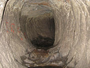
| 4024/08 | Lippoldshöhle | west of Alfeld (Leine) | Cave. Stratigraphy: Jura, Malm. Natural monument ND-HI 232. |
51 ° 58 ′ 59.5 " N , 9 ° 45 ′ 22.7" E |
 more pictures |
| 4025/03 | Gravel pit / sand pit | 1 km northwest Freden , Bockenem | Terminal moraine. Length 800 m, width 500 m, height 50 m. Stratigraphy: Quaternary Pleistocene, Saale Glaciation. Petrography: meltwater sand, poured diagonally at the edge of the ice; southernmost occurrence of the Saale Ice Age in the Leinetal. |
51 ° 56 '7.1 " N , 9 ° 52' 8.4" E | |
| 4025/05 | Ridge of the Selter with limestone cliffs | W Freden to E Naensen , Bockenem | Rock tower, cliff. Height 50 m. Stratigraphy: Jura, Malm, Lower to Upper Kimmeridge. Petrography: coral oolite, dolomite, Lower Kimmeridge (15 m), Middle Kimmeridge (25–30 m), Upper Kimmeridge (50 m). |
51 ° 54 '25.6 " N , 9 ° 53' 46.7" E | |
| 4025/10 | Former Quarry | SW Irmenseul , Lamspringe | Outcrop, rocks. Stratigraphy: Upper Cretaceous, Higher Upper Turon 1. Petrography: Marl limestone with a 3 cm layer of yellowish, greasy tuffite (volcanic ash). In the landscape protection area LSG-HI 62 "Sackwald". |
51 ° 58 '46.2 " N , 9 ° 55' 21.7" E | |
| 4025/11 | source | 1 km N Winzenburg, Freden (Leine) | Karst spring. Stratigraphy: Quaternary Holocene. Petrography: karst spring of the Apen ponds in clay u. Limestone marl of the middle marl (Alb, Lower Cretaceous), forming spring limestone. In the landscape protection area LSG-HI 62 "Sackwald". |
51 ° 56 ′ 40.2 " N , 9 ° 56 ′ 28.3" E |
 more pictures |
| 4026/01 | Boulder (gneiss granite) | in the Lamspringe monastery park | Boulder. Length 1.5 m, width 1.2 m, height 0.9 m. Stratigraphy: Quaternary Pleistocene. Petrography: fine-grained gneiss granite with flaking bark; low biotite content. Site: north of Gehrenrode ; Home area cannot be determined. |
51 ° 57 ′ 47.9 " N , 10 ° 0 ′ 58" E |

|
See also
- List of nature reserves in the Hildesheim district
- List of landscape protection areas in the Hildesheim district
- List of natural monuments in the Hildesheim district
- List of protected landscape components in the Hildesheim district
Web links
Commons : Geotopes in the district of Hildesheim - collection of images
Individual evidence
- ↑ Asel black earth profile , (pdf; 225 kB)
- ↑ Regulation text ( page no longer available , search in web archives ) Info: The link was automatically marked as defective. Please check the link according to the instructions and then remove this notice.
- ↑ Posidonia slate , (pdf; 273 kB)
- ↑ showcaves.com: Lippoldshöhle
